
Super User
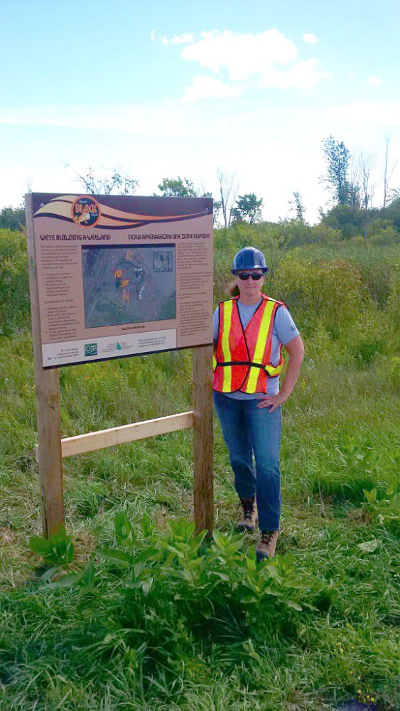
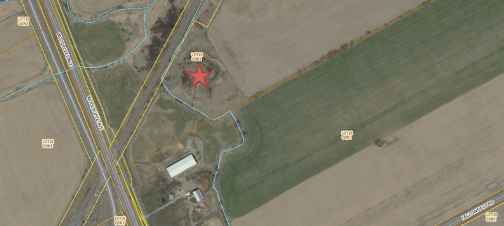
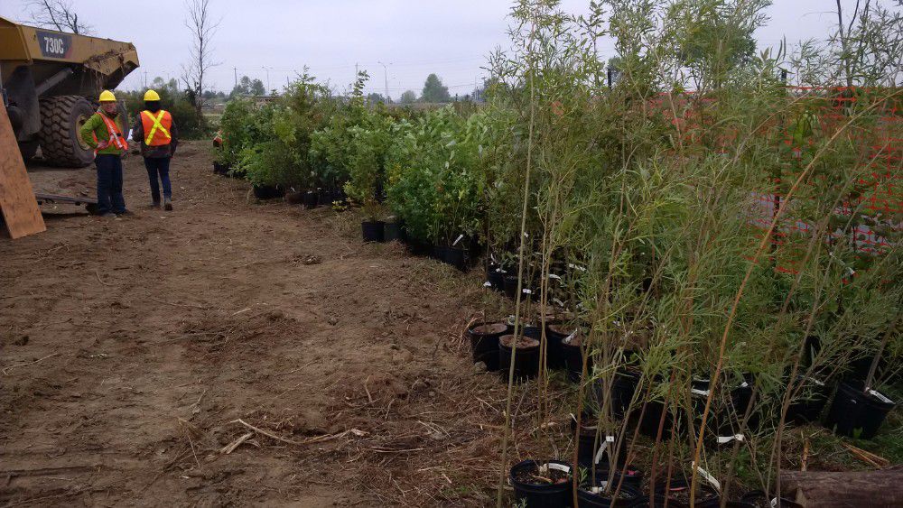
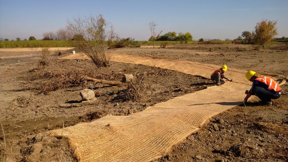
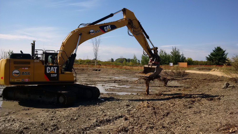
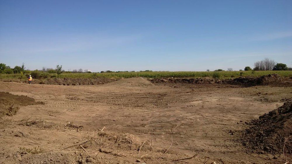
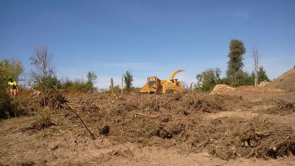
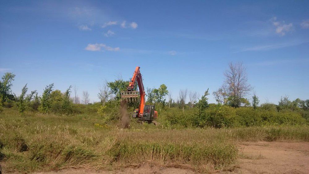
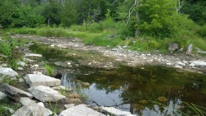
Black Rapids Wetland Restoration Project
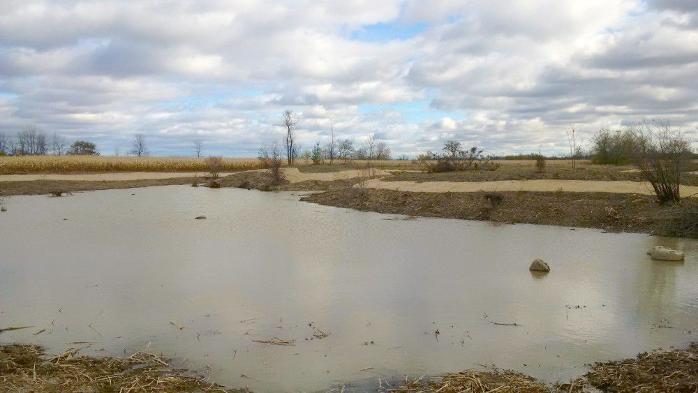
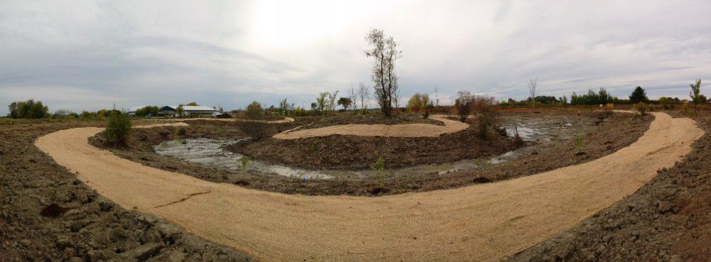
The Rideau Valley Conservation Authority in collaboration with NCC and the Great Lakes Guardian Community Fund have designed and enlarged the Black Creek wetland located in Ottawa’s Greenbelt. This enhanced wetland improves water quality, increases biodiversity and provides important wetland habitat in the headwaters of Black Rapids Creek.
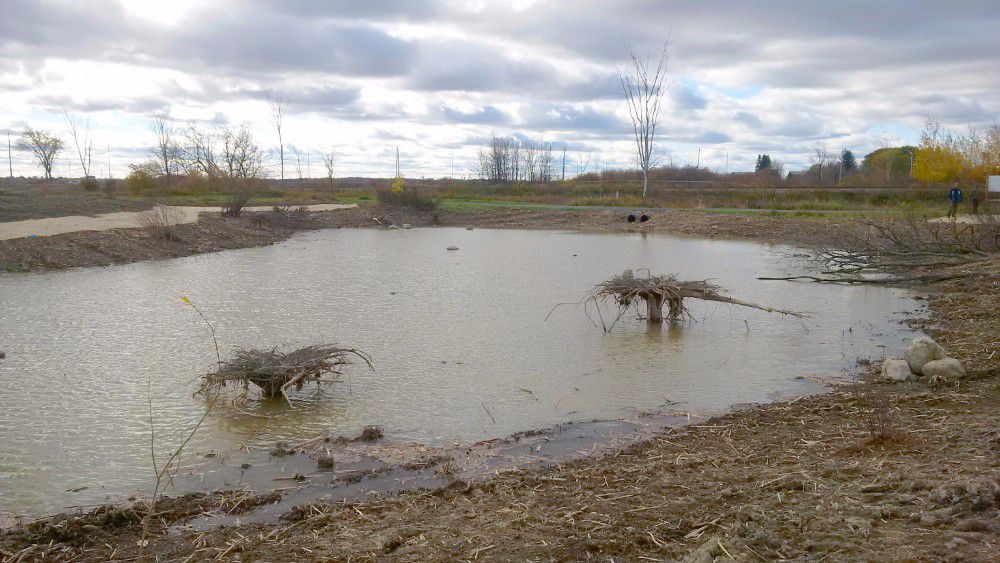
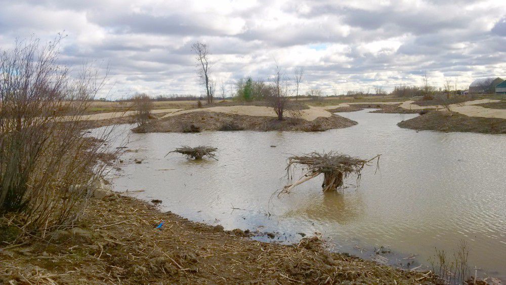
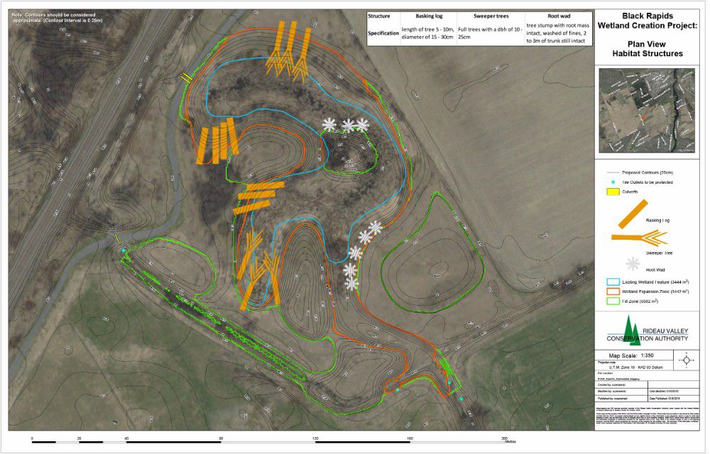
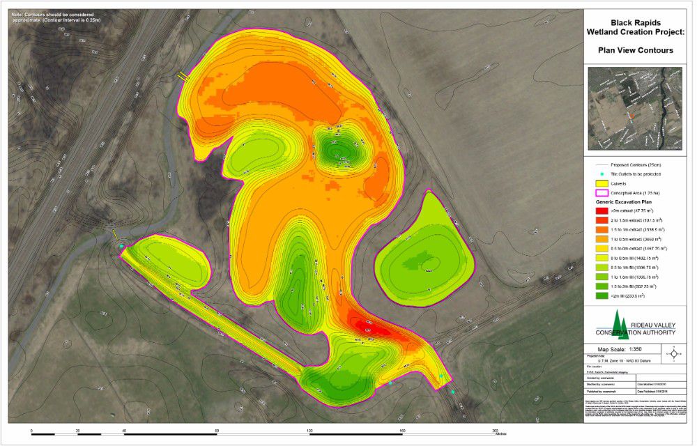
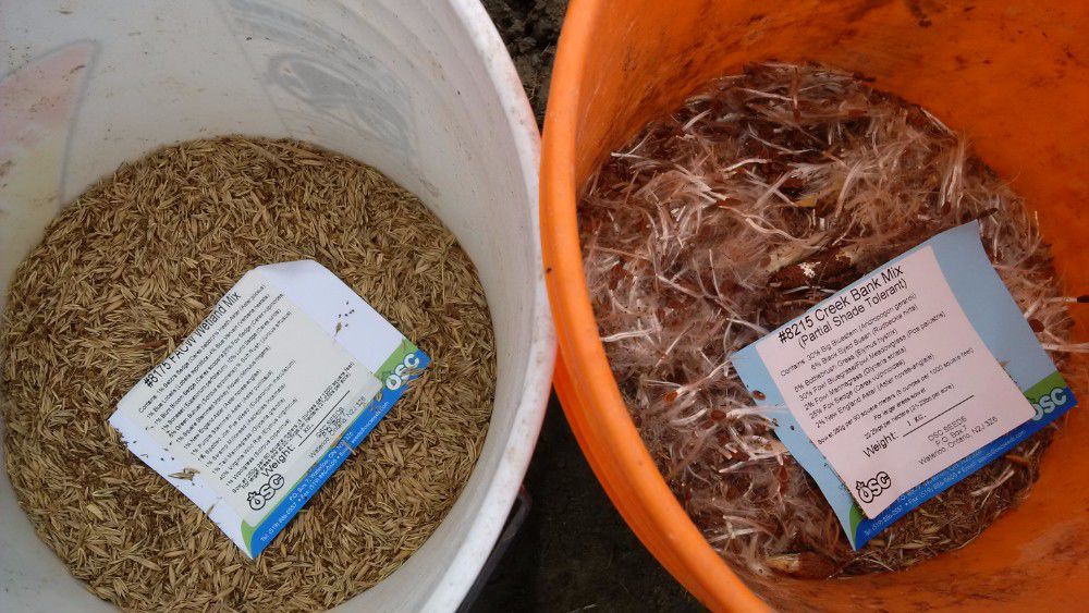
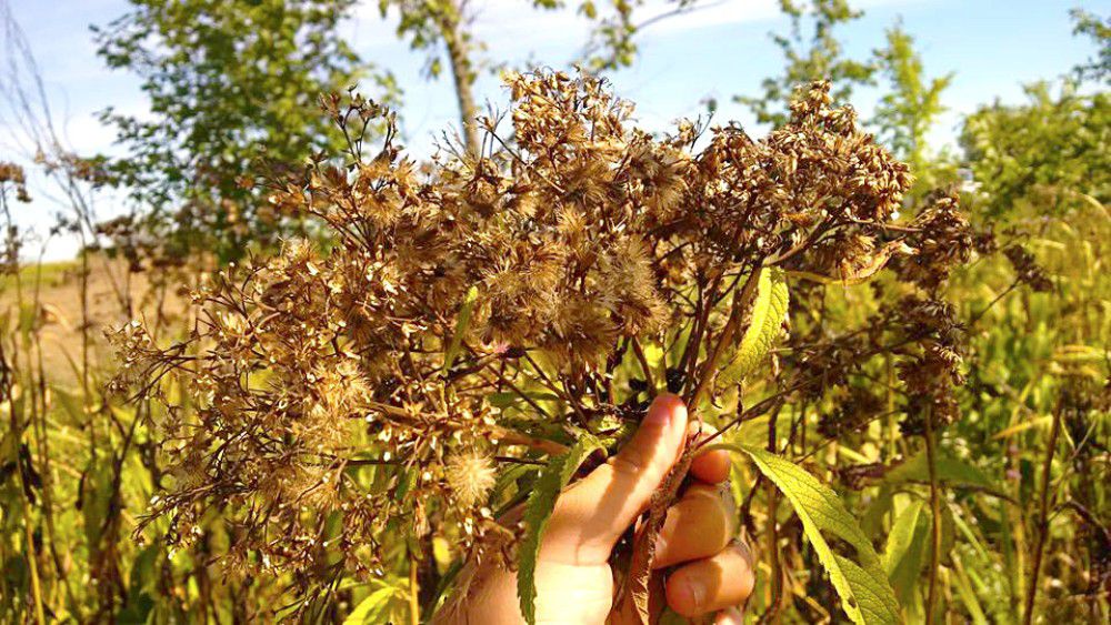
The wetland has doubled in size from 3,444 square metres to almost 7,000 square metres. A tributary that had previously bypassed the wetland now flows into it providing a larger aquatic feature that supports amphibian breeding, fish habitat, bird foraging, and acts as a water supply for wildlife. The wetland now boasts a variety of side slopes, woody debris (i.e. root wads, basking logs and sweeper trees) and re-planting of native trees, shrubs and wetland vegetation. The project was completed in September 2016.
Staff returned to monitor the wetland in 2017 and 2019, and will return again in 2021.
BLOG: Restored Black Rapids wetland keeping Rideau River clean
Benefits of the project:
- Improves water quality for Black Rapids Creek and the Rideau River
- Increases biodiversity of aquatic/terrestrial plants and fish and wildlife
- Provides winter and summer refuge areas for wetland wildlife, including nursery area for waterfowl and area for shorebirds to feed
- Includes functional spawning, nursery, rearing and food supply habitat for fish allowing for wetland and
- Presents a unique habitat feature along the National Capital Commission Greenbelt Pathway allowing for wetland and habitat restoration activities
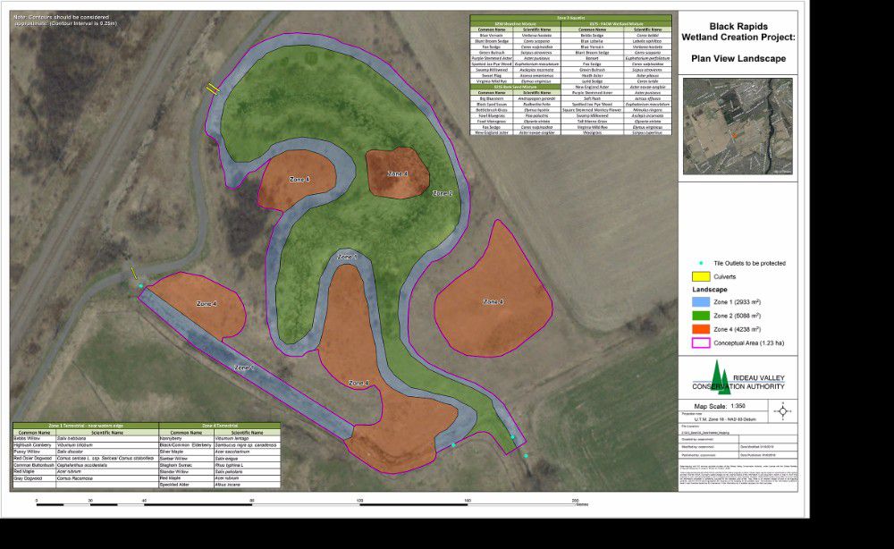
Construction Plans:
Project Partners:
Information:
Ottawa Septic System Office
The Ottawa Septic System Office (OSSO) is a partnership of the Mississippi Valley Conservation Authority, South Nation Conservation and the RVCA. The OSSO administers Part 8 (sewage systems) of the Ontario Building Code on behalf of the City of Ottawa.
The OSSO is responsible for reviewing septic designs and plans, issuing Building Permits for new and replacement sewage systems and inspections for installations to ensure compliance with approvals. Before building or renovating your home or cottage, contact the OSSO for application information.
For more information, visit the Ottawa Septic System Office www.ottawasepticsystemoffice.ca
Contact information:
phone: 613-692-3571 or 1-800-267-3504
fax: 613-692-0831
Where to find us:
The Ottawa Septic System Office is located at the RVCA's Conservation Centre
Box 599, 3889 Rideau Valley Drive
(at the corner of Rideau Valley Drive and Prince of Wales Drive)
Manotick ON K4M 1A5
Hours:
8:30 AM to 4:30 PM, Monday to Friday
Municipal Planning
The Conservation Authorities Act enables Conservation Authorities to undertake programs to further the conservation, restoration, development and management of natural resources throughout the watershed. A significant component of this work is the protection of public health and safety and minimizing property damage from risk associated with natural hazards.
Conservation Ontario, on behalf of Ontario’s 36 Conservation Authorities, has a memorandum of understanding with the Ministries of Natural Resources and Forestry and Municipal Affairs and Housing whereby Conservation Authorities have delegated responsibilities for the management of natural hazards (floodplains, hazardous slopes, unstable soils and erosion). In keeping with this responsibility, RVCA provides comments to our municipalities on Planning Act applications and other development related applications from several perspectives; watershed based resource management, planning advisory service, technical advisory service and regulatory responsibilities. RVCA provides planning and technical advice to assist our municipalities in fulfilling their responsibilities as defined in their official plans and the Provincial Policy Statement with respect to water resources, natural hazards and, where requested to do so, natural heritage features. We also assist our municipalities and landowners with the coordination of planning and regulatory requirements under the “Development, Interference with Wetlands and Alterations to Shorelines and Watercourses Regulation (O.Reg 41/24).
Planning applications circulated to the RVCA typically include:
- Official plans and official plan amendments
- Zoning by-laws and zoning by-law amendments
- Plans of subdivision and condominium
- Site plan control
- Applications for consent (severances and lot line adjustments)
- Minor variances
- Lifting of reserves
- Part lot control
Development related reviews undertaken by the RVCA also includes proposals under the:
- Environmental Assessment Act and equivalent process under the Planning Act
- Aggregate Resources Act
- Ontario Water Resources Act
The planning services RVCA provides are defined in memorandums of agreement with the City of Ottawa and our upper tier counties (County of Lanark, United Counties of Leeds and Grenville). The agreements are joint agreements between RVCA, the Mississippi Valley Conservation Authority, South Nation Conservation Authority and the Cataraqui Region Conservation Authority where a municipality’s boundary includes more than one Conservation Authority’s watershed. There have been changes to related legislation and other memorandums with senior levels of government since these agreements were formalized and some sections are no longer applicable. In particular, memorandums of agreement between the Department of Fisheries and Oceans and RVCA are no longer in place.
Memorandums of agreement:
Property File Search
A property inquiry/file search provides a written response to current property owners, potential buyers, lawyers, real estate professionals, etc with information including:
- Information and mapping on natural hazards and features such as floodplains, unstable slopes, shorelines, wetlands, etc.
- RVCA regulations and policies that apply to the property
- Information on previous approvals, outstanding orders and/or violations on the property
This file search response provides a formal record of the inquiry and offers valuable information to the client when making decisions to purchase, build on, re-grade or alter natural features on the site. In other cases, the file search response serves as official confirmation that the property is not affected by Authority policies and regulations, and provides the client with added peace of mind. RVCA staff cannot advise you on whether or not to purchase a property; we provide the facts to help you make an educated decision.
How to apply?
To apply for this service, please complete our Property File Search Form. A fee is charged to cover the cost of reviewing each individual site and a formal, written response is issued. Staff require at least two weeks to reply.
Services and Fees
| Property Inquiry File Search — Compliance Letter | $280 |
| Property Inquiry File Search — Compliance Letter with site inspection | $475 |
| Property Inquiry File Search — Compliance Letter — Expedited Service (within five business days) | $545 |
| Property Inquiry File Search — Compliance Letter — Expedited Service (within five business days) with site inspection | $740 |
For more details, contact us:
RVCA Resources Specialist
phone: 613.692.3571 or 1.800.267.3504
fax: 613.692.0831
Surface Water Quantity
Current Water Conditions Statements
(flooding or drought conditions)
Water plays a central role in all activities within a watershed. The rain that falls on the ground flows to the river and sustains all forms of life. All physical and biological activities within a watershed are intimately connected to water. Therefore, the knowledge of its occurrence, distribution, movement and functions is indispensable in understanding a watershed and all the living beings therein.
Within the Rideau Valley, water levels and stream flow, precipitation and snowpack have been systematically recorded for many years.This information can be analyzed to understand various aspects of the water cycle (or hydrologic cycle) and their impacts on the watershed. Monitoring streamflow and precipitation allows water managers to identify risk-prone areas and better respond to drought or flood conditions.
Surface Water Quality
The RVCA has gathered information on surface water quality since the early 1970s. Today, the RVCA collects data four water quality monitoring programs:
- Provincial Water Quality Monitoring Network (Water Chemistry)
- RVCA Baseline Monitoring Program (Water Chemistry)
- Watershed Watch (Water Chemistry)
- Benthic Invertebrate Sampling (Water Biology)
Results from these monitoring programs are reviewed and reported on through our catchment and subwatershed reports.
Water Biology
Benthic invertebrates include:
- aquatic insects (e.g. stoneflies, mayflies, caddisflies, beetles, true bugs, true flies)
- crustaceans (e.g. isopods, amphipods, crayfishes)
- molluscs (e.g. snails, clams, mussels)
- annelids (e.g. leeches, oligochaete)
- and a few other groups (e.g. proboscis worms, flatworms)

The Rideau Valley Conservation Authority has sampled benthic invertebrates since 1997 at various sites throughout the watershed. These efforts compliment the RVCA's extensive water chemistry sampling program. Benthic invertebrates are great barometers of pollution. Some can tolerate pollution while others are very sensitive to instream pollution. By sampling stream-bottom invertebrates the program can determine changes in stream water conditions and levels of pollution over time.
As part of the Ontario Benthos Biomonitoring Network (OBBN), RVCA staff follow a provincial protocol for sampling in streams, lakes, and wetlands. A total of three replicates of samples are collected at each of the site locations and are brought back to the RVCA lab for identification. Once identified the samples are run through various indices, which are then analyzed and observations can be made. Overtime trends and patterns of the data can be studied and water quality issues can be addressed by using best management practices in areas of concern.
Results from our water biology sampling can be seen in catchment and subwatershed reports.
VIDEO: Benthic invertebrate sampling in the Jock subwatershed
Groundwater
Groundwater has only recently been recognized as a vital natural resource. Ground water is an important source of drinking water for many in the Rideau watershed. Contamination of local groundwater is a growing concern and groundwater flow in bedrock aquifers has only recently started to be characterized (theory, methods, tools and models specific to fractured rock aquifers). Groundwater as a “science” is still young.
Since 2005, RVCA has been coordinating the Source Protection Program for the Mississippi-Rideau Source Protection Region (MRSPR). This work has involved undertaking a number of technical studies and the development of source protection plan policies for the MRSPR to protect shared municipal drinking water sources within our watersheds. Additional information about the local source protection program is available here: mrsourcewater.ca
Currently, the groundwater program at RVCA is small and primarily focuses on being a source of expertise for municipal planning services related to rural drinking water. The program also provides support to development applications near wetlands and groundwater recharge and discharge areas.
RVCA looks to learn more about our groundwater resources and their specific roles in the local hydrological cycle. We monitor and gather information at 16 wells at 13 locations in the Rideau Valley as part of the Ministry of the Environment and Climate Change’s (MOECC) Provincial Groundwater Monitoring Network (PGMN). The main goal of the PGMN program is to undertake long-term regional groundwater monitoring in order to be able to identify potential changes in groundwater quality or levels. RVCA also partners with provincial agencies, local municipalities and academia for special projects related to groundwater information management, subwatershed studies and groundwater surface water interactions.
Biology and Ecology
The streams and rivers in the Rideau Valley watershed are home to a variety of plants and animals.
RVCA staff collect information on the physical conditions of the watershed — vegetation, wetlands, shorelines, land uses. We also look at fish communities and benthic invertebrates. We look see how aquatic and terrestrial creatures interact with their environment. All this information is used to create a picture of the conditions of our streams, lakes, rivers and overall watershed. In turn, this information will set the management direction for the future.
Information is compiled and summarized in RVCA catchment reports and subwatershed reports.
Erratic Rains means “Severe” Drought Condition Continues
The drought status in the Rideau River watershed remains at “Severe” because sustained flows in the streams and rivers have not been restored.
As has been the case all summer, rainfall has been very erratic with significant amounts recorded at some monitoring stations and very little at others. There has been enough rain in the last two weeks to make many watershed residents forget that there is still a drought. Lawns are green. Farm crops are close to being ready for harvest.