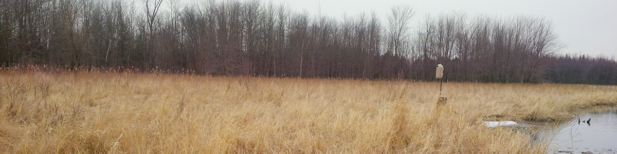
The Jebbs Creek Wetland Embayment Creation Project converted a small area of existing meadow habitat in the Rideau Valley Conservation Authority’s Perth Wildlife Reserve Conservation Area to a series of small riverine wetland embayments along the shoreline of Jebbs Creek within Tay Valley Township in Eastern Ontario.
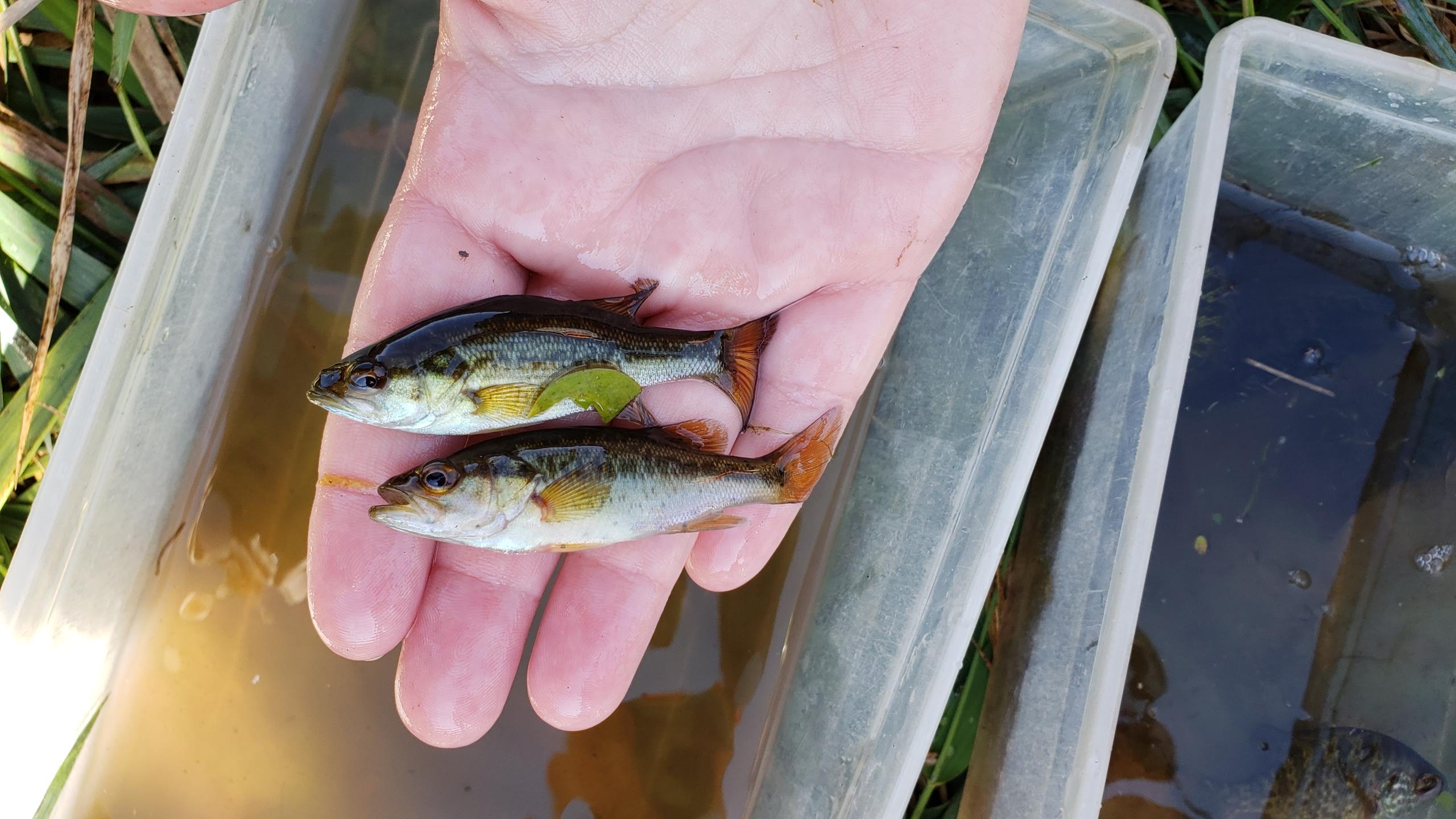
Jebbs Creek is a tributary in the Tay River watershed, which supports a warm/cool water fishery. The purpose of the Jebbs Creek Wetland Embayment Creation Project was to create 1,600 m² of new spawning, nursery, rearing, and feeding habitat for the 20 species of fish that reside in Jebbs Creek.
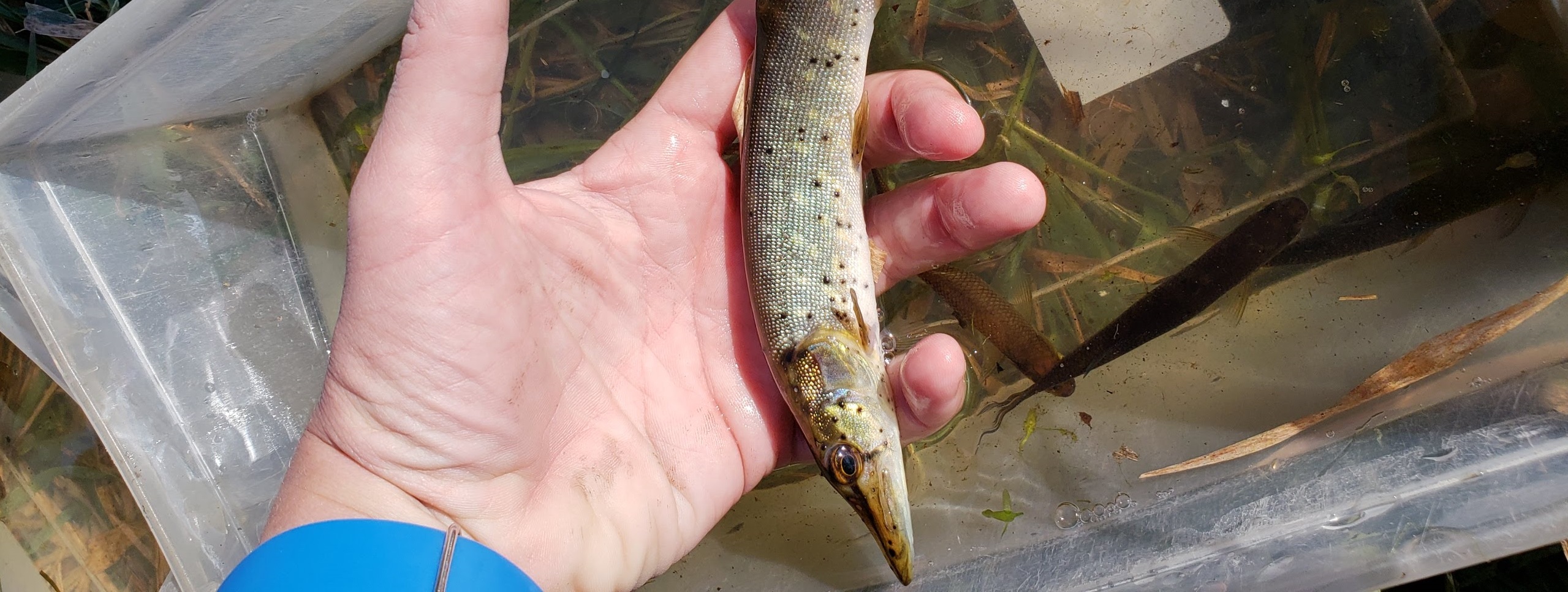
The Kemptville District of the Ministry of Natural Resources and Forests manages the Tay River watershed for an extremely diverse fishery which includes northern pike (Esox Lucius), smallmouth bass (Micropterus dolomieu), largemouth bass (Micropterus salmoides) and walleye (Sander vitreus).
Northern pike is a local sport fish, well known for its large size and predatory nature. Despite its reputation as a top predator, northern pike are particularly sensitive during spawning and are often subject to high egg mortality; therefore, it is crucial to ensure that suitable spawning habitat exists to support this species. Through a multi-tier approach, the goal was to create and maintain a suitable spawning and nursery site for northern pike along Jebbs Creek, while helping to improve shoreline stability, riparian habitat and water quality. The feature also provides a small riverine wetland embayment along Jebbs Creek which will provide important habitat for breeding birds, amphibians, turtles nesting habitat with a goal to increase overall biodiversity.
2018 Construction highlights:
- 5 days of construction
- 1600 m² of fish habitat created
- 5.5 kg of shoreline and wetland seed mixes were installed around the wetland feature
- 5.0 kg of meadow seed mix installed in the fill deposition area for pollinator habitat
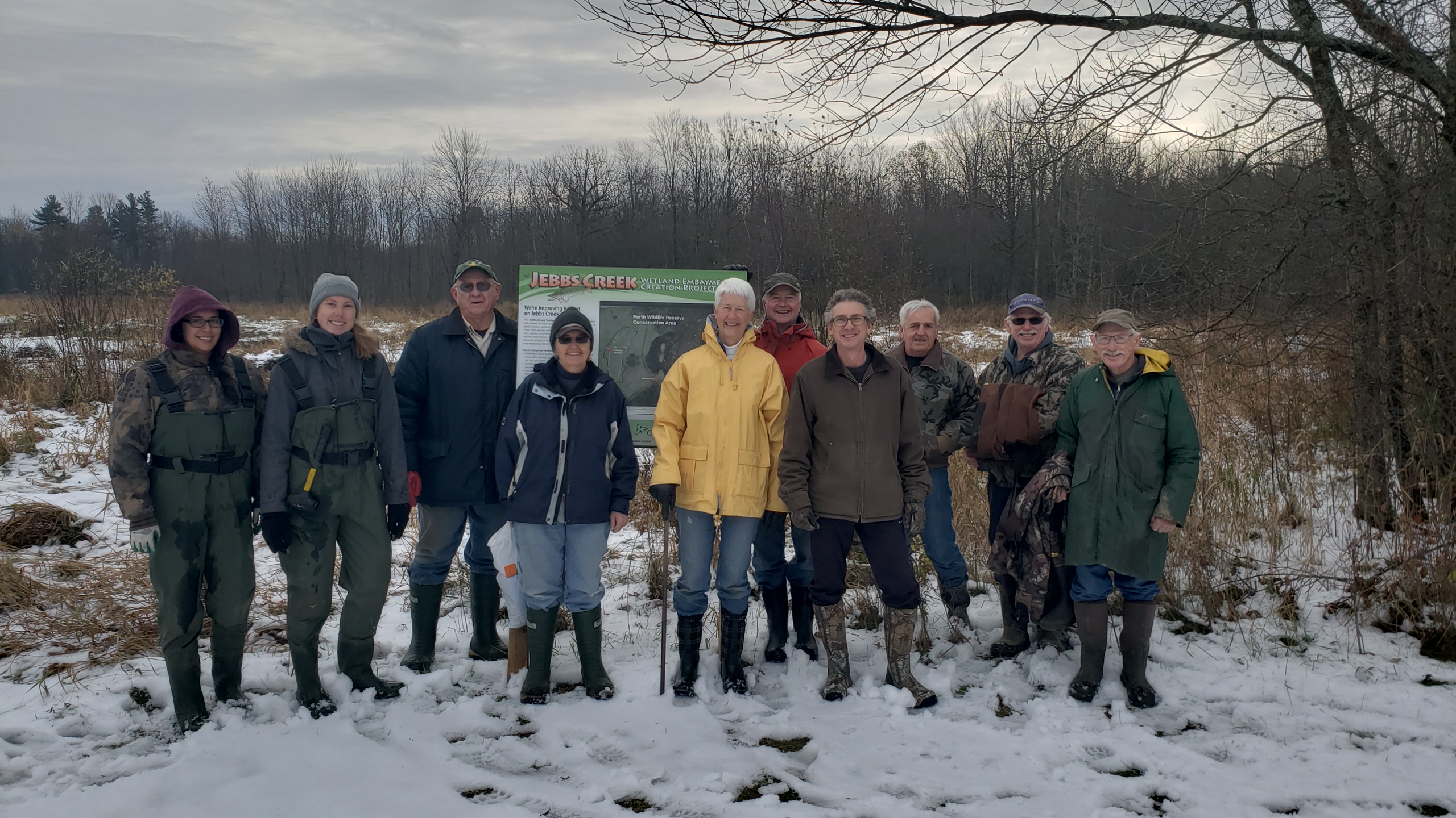
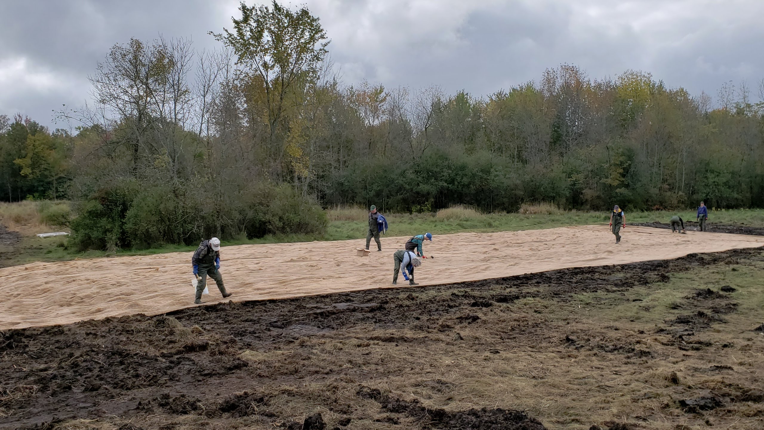
- 15 volunteers participated in the planting day for a total of 75 volunteer hours
- 125 native shrubs and trees planted around the new wetland feature
Jebb's Creek Plan View Habitat Structure (PDF)
Jebb's Creek Plan View Contours (PDF)
Post Construction Phase monitoring is scheduled for the spring/summer in 2019, 2020, 2022 and 2024.
Thank you to our Otty Lake Association volunteers!
Project Objectives
- Enhance fish habitat by creating new spawning, nursery, rearing and feeding habitat for the fish community of Jebbs Creek (target species northern pike)
- Improve food supply for aquatic and terrestrial species through increasing overhanging vegetation along the shoreline.
- Improving the function of adjacent wetland habitats for aquatic species
- Create a quiet backwater area adjacent to the main current of Jebbs Creek.
- Provide winter and summer refuge areas for fish.
- Protect water quality and enhance wildlife habitat by establishing a naturalized buffer with native species of trees and shrubs
- Altering elevations to create conditions more suitable for more diverse submergent and emergent aquatic vegetation
- Enhance recreational and educational opportunities at the site by installing educational signage
- Engage and educate community members by involving volunteers in the process and providing a demonstration site that shows a variety of cost-effective methods to protect and enhance shorelines and wildlife habitats.
- Partnership opportunities with various groups and the Conservation Authority.
Project Description
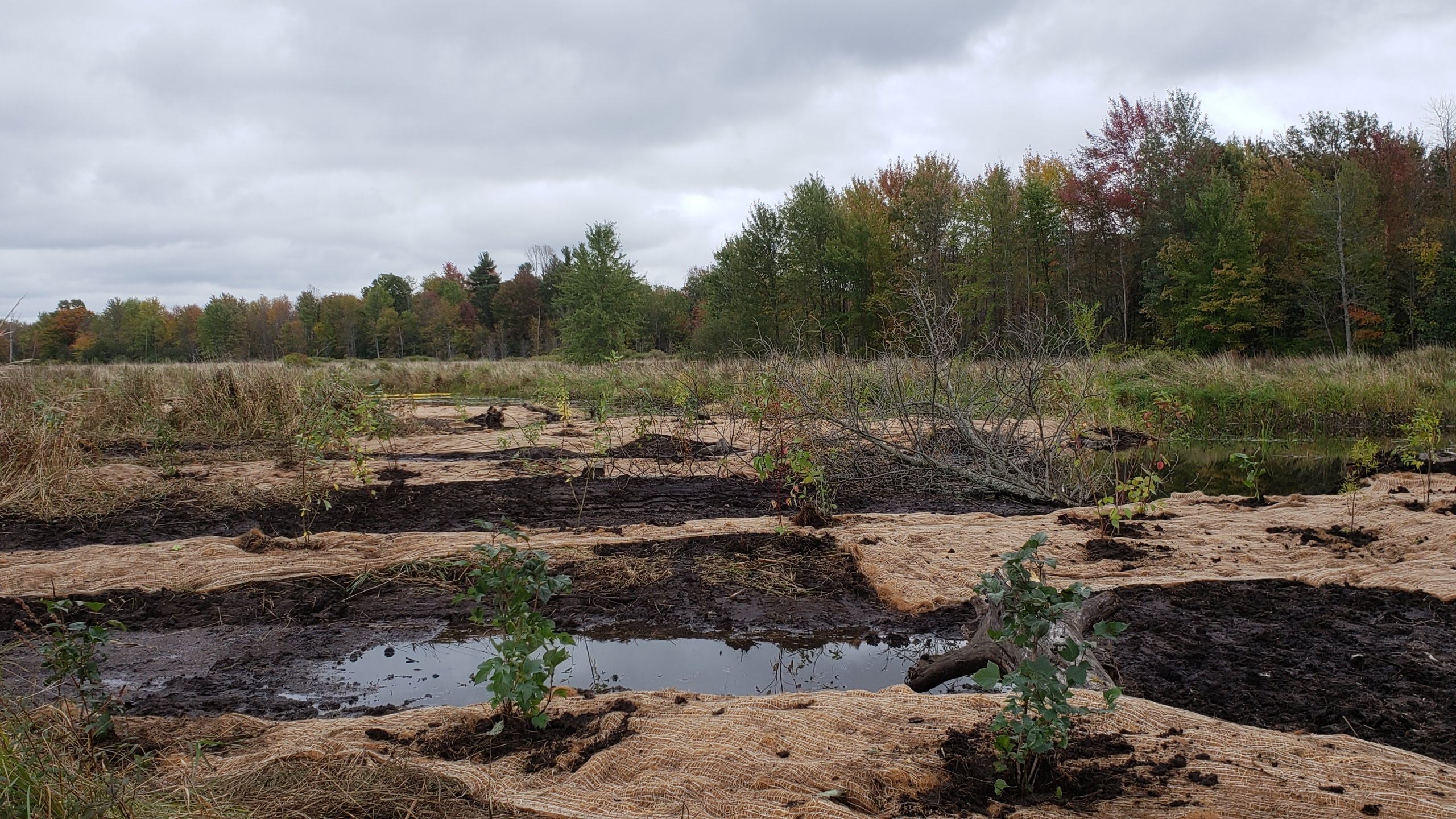
Project implementation was carried out by the RVCA and partners. A variety of techniques/applications were carried out, including:
- The removal of fill from the existing shoreline to create a series of small embayment’s with a variety of slope conditions
- In-water planting of aquatic sedges and grasses known to be favorable for northern pike spawning
- Installation of wood structure to further enhance nursery habitat
- Re-vegetation of the riparian area by planting native trees, shrubs and wetland vegetation
- Maintain the pathway system adjacent to the embayment feature to continue access for recreational use
- Deposit the excess fill in specified areas in the adjacent field outside of the regulatory area and seed these areas with a pollinator seed mix to support pollinator habitat
- The installation of an interpretive sign along the adjacent existing pathway, with partner logos, describing the project benefits from a watershed management perspective
Project Timeline
- (2015-2018) background data collection to inform the detailed design process
- December/January 2017/18 Refine and further develop the wetland embayment proposal
- February/March/April 2018 prepare Detailed Design (contour plan, cross section plan, landscape plan, structures plan)
- April 2018 site visit with RVCA/MNRF staff
- June 2018 review of plans for permits and tender package for potential contractors
- July/August 2018 Around the Rideau announcing the project and partners prior to construction
- September 2018 Construction of the wetland feature
- November/December 2018 Around the Rideau announcing completion of the project and showing construction and volunteer photos
- Post effectiveness monitoring 2019, 2021, 2023 (year 1,3,5)