
Super User
Flood Watch Termination — Lower Ottawa River / Fin de la veille de crue — Cours inférieur de la rivière des Outaouais
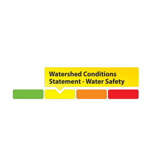
Water Safety Statement Remains in Effect
April 20, 2020 — The Flood Watch issued on April 9, 2020 is being TERMINATED. A Water Safety Statement is in effect as all areas are experiencing high spring flows which are typical for this time of year.
The Ottawa River Regulation Committee has indicated that levels are decreasing along the main stem of the Ottawa River from Pembroke down to the Montreal region as runoff from melting snow in tributaries decreases. It is expected that levels will continue decreasing to normal spring freshet levels as no major precipitation is forecasted over the next few days.
Residents are advised to stay away from watercourses where flows are high and where banks might be unstable. Parents are encouraged to explain dangers to children.
The Mississippi Valley, Rideau Valley, and South Nation Conservation Authorities monitor
water levels and weather forecasts with the Ministry of Natural Resources and Forestry as part
of the Flood Forecasting and Warning Program. Updates are provided as conditions change.
The Ottawa River Regulating Committee will be reassessing forecast conditions and providing hydrological condition updates on its website daily at ottawariver.ca/forecasts/.
To view current flood warnings across Ontario, visit:
www.ontario.ca/law-and-safety/flood-forecasting-and-warning-program.
This WATER SAFETY STATEMENT is in effect until May 4, 2020 at 5:00 PM. No further updates will be issued unless forecasted levels or conditions change.
- end -
Definitions:
- Water Conditions Statement - Water Safety: indicates that high flows, melting ice or other factors could be dangerous for such users as boaters, anglers and swimmers but flooding is
not expected. - Water Conditions Statement - Flood Outlook: gives early notice of the potential for flooding based on weather forecasts calling for heavy rain, snow melt, high winds or other conditions.
- Flood Watch: potential for flooding exists within specific watercourses and municipalities.
- Flood Warning: flooding is imminent or occurring within specific watercourses and municipalities.
Une déclaration sur la sécurité aquatique est en vigueur
20 avril 2020 - La déclaration de veille de crue publié le 9 avril 2020 EST LEVÉE. Une déclaration sur la sécurité aquatique est en vigueur car toutes les régions connaissent des débits de printemps élevés qui sont typiques pour cette période de l'année.
Le Comité de régularisation de la rivière des Outaouais a indiqué que les niveaux sont à la baisse dans le tronçon principal de la rivière des Outaouais, de Pembroke à la région de Montréal, en raison des eaux de fonte des affluents de la rivière qui diminuent. On s'attend à ce que les niveaux continuent à baisser pour atteindre les niveaux normaux de la crue printanière, car aucune précipitation majeure n'est prévue au cours des prochains jours.
Il est conseillé aux résidents de se tenir à l'écart des cours d'eau dont le débit est élevé et dont les berges pourraient être instables. On recommande aux parents d’expliquer ces dangers aux enfants.
Les offices de protection de la nature des rivières Mississippi, Rideau et Nation Sud surveillent les niveaux d'eau et les prévisions météorologiques avec le ministère des Richesses naturelles et des Forêts dans le cadre du Programme de prévision et d'alerte des crues. Des mises à jour sont émises en fonction de l'évolution des conditions.
Le Comité de régularisation de la rivière des Outaouais réévaluera les prévisions et publiera quotidiennement des mises à jour des conditions hydrologiques sur son site Web à ottawariver.ca/forecasts/.
Pour consulter les alertes de crue actuelles en Ontario, visitez le site : www.ontario.ca/law-and-safety/flood-forecasting-and-warning-program.
Ce message sur la SÉCURITÉ AQUATIQUE est en vigueur jusqu'au 4 mai 2020 à 17h00. Aucune autre mise à jour ne sera émise à moins que les niveaux ou les conditions prévus ne changent.
- fin -
Définitions :
- Communiqué sur les conditions des bassins versants – Sécurité aquatique : indique que des débits forts, de la glace fondante ou d’autres facteurs peuvent être dangereux pour des utilisateurs comme les plaisanciers, les pêcheurs à la ligne et les baigneurs, mais qu’une crue n’est pas prévue.
- Communiqué sur les conditions des bassins versants – Perspective de crue :préavis de crue possible basé sur des prévisions de pluies abondantes, de fonte des neiges, de forts vents ou autre.
- Veille de crue :possibilité de crue pour des cours d’eau et municipalités spécifiques.
- Avertissement de crue : crue immimente ou en cours pour des cours d’eau et
municipalités spécifiques.
Flood Watch — Lower Ottawa River / Veille de crue — Cours inférieur de la rivière des Outaouais
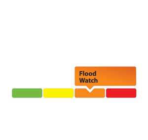
April 9, 2020 — A Flood Watch is being issued for areas along the Lower Ottawa River. Water levels and flows from Arnprior to Hawkesbury continue to rise gradually due to on-going snowmelt in the central and northern portions of the Ottawa River basin.
On Monday a spring storm is expected to bring above average temperatures and a significant amount of rainfall. Minor flood levels may be exceeded in low-lying, flood prone areas depending on the temperatures and precipitation received.
Levels and flows are expected to stabilize into the weekend and will continue to rise beginning on Monday.
Levels are currently expected to remain below major flood thresholds in all locations and are expected to be similar to levels reached in May 2018.
AREAS OF CONCERN ALONG LOWER OTTAWA RIVER:
Water levels are expected to be similar or below the peak levels reached in May 2018 for:
- Constance Bay and Britannia (Grandview Road, Britannia Village, Belltown Community)
Water levels are expected to be similar or slightly above the peak levels reached in May 2018 for:
- East of Cumberland Village (Boisé Village, Morin Road, Leo Lane)
- Clarence-Rockland (Voisine, Onesime Guilbord Roads)
- Alfred-Plantagenet (Presqu’ile (Miller Island), Presquile Road)
- L’Orignal (Montpetit and Dufour Streets)
Residents in flood-prone areas are encouraged to closely follow evolving conditions and to take necessary measures to protect their property. Residents are advised to stay away from watercourses where flows are high and where banks might be unstable. Parents are encouraged to explain dangers to children.
The Mississippi Valley, Rideau Valley, and South Nation Conservation Authorities monitor water levels and weather forecasts with the Ministry of Natural Resources and Forestry as part of the Flood Forecasting and Warning Program. Updates are provided as conditions change.
The Ottawa River Regulating Committee will be reassessing forecast conditions and providing hydrological condition updates on its website daily at ottawariver.ca/forecasts/.
To view current flood warnings across Ontario, visit: www.ontario.ca/law-and-safety/flood-forecasting-and-warning-program.
This FLOOD WATCH is in effect until April 23, 2020 at 5:00 PM.
- end -
Definitions:
- Water Conditions Statement: Water Safety: indicates that high flows, melting ice or other factors could be dangerous for such users as boaters, anglers and swimmers but flooding is
not expected. - Water Conditions Statement: Flood Outlook: gives early notice of the potential for flooding based on weather forecasts calling for heavy rain, snow melt, high winds or other conditions.
- Flood Watch: potential for flooding exists within specific watercourses and municipalities.
- Flood Warning: flooding is imminent or occurring within specific watercourses and municipalities.
9 avril 2020 - Une veille de crue est émise pour les secteurs situés le long du cours inférieur de la rivière des Outaouais. Les niveaux d'eau et les débits d'Arnprior à Hawkesbury continuent d'augmenter progressivement en raison de la fonte des neiges en cours dans les parties centrale et nord du bassin de la rivière des Outaouais.
Lundi, une tempête printanière devrait entraîner des températures supérieures à la moyenne et une quantité importante de précipitations. Les seuils d'inondation mineurs pourraient être dépassés dans les zones basses sujettes aux inondations, en fonction des températures et des précipitations reçues.
Les niveaux et les débits d'eau devraient se stabiliser au cours de la fin de semaine et continuer à augmenter à partir de lundi.
Les niveaux d'eau devraient se maintenir en dessous des seuils d'inondation majeurs dans tous les secteurs et devraient être similaires aux niveaux atteints en mai 2018.
ZONES PRÉOCCUPANTES LE LONG DU COURS INFÉRIEUR DE LA RIVIÈRE DES OUTAOUAIS :
Les niveaux d'eau devraient être similaires ou inférieurs aux niveaux maximums atteints en mai 2018 pour :
- Constance Bay et Britannia (Chemin Grandview, Village de Britannia, Collectivité de Belltown)
Les niveaux d'eau devraient être similaires ou légèrement supérieurs aux niveaux maximums atteints en mai 2018 pour les secteurs suivants :
- À l'est du village de Cumberland (Village de Boisé, Chemin Morin, Allée Leo)
- Clarence-Rockland (Chemins Voisine, Onesime Guilbord, Boileau, Lalonde et Ettyville)
- Alfred-Plantagenet (Presqu'ile (Île Miller), chemin Presqu'ile)
- L'Orignal (rues Montpetit et Dufour)
On encourage les résidents des zones inondables à suivre de près l'évolution des conditions et à prendre les mesures nécessaires pour protéger leurs biens. Il est conseillé aux résidents de se tenir à l'écart des cours d'eau où les débits sont élevés et où les berges pourraient être instables. On recommande aux parents d'expliquer les dangers aux enfants.
Les offices de protection de la nature des rivières Mississippi, Rideau et Nation Sud surveillent les niveaux d'eau et les prévisions météorologiques avec le ministère des Richesses naturelles et des Forêts dans le cadre du Programme de prévision et d'alerte des crues. Des mises à jour sont émises en fonction de l'évolution des conditions.
Le Comité de régularisation de la rivière des Outaouais réévaluera les prévisions et publiera quotidiennement des mises à jour des conditions hydrologiques sur son site Web à ottawariver.ca/forecasts/.
Pour consulter les alertes de crue actuelles en Ontario, visitez le site : www.ontario.ca/law-and-safety/flood-forecasting-and-warning-program.
Cette VEILLE DE CRUE est en vigueur jusqu'au 23 avril 2020 à 17 h.
- fin -
Définitions :
- Communiqué sur les conditions des bassins versants – Sécurité aquatique : indique que des débits forts, de la glace fondante ou d’autres facteurs peuvent être dangereux pour des utilisateurs comme les plaisanciers, les pêcheurs à la ligne et les baigneurs, mais qu’une crue n’est pas prévue.
- Communiqué sur les conditions des bassins versants – Perspective de crue :préavis de crue possible basé sur des prévisions de pluies abondantes, de fonte des neiges, de forts vents ou autre.
- Veille de crue :possibilité de crue pour des cours d’eau et municipalités spécifiques.
- Avertissement de crue : crue immimente ou en cours pour des cours d’eau et
municipalités spécifiques.
Announcement: Goulbourn Wetland Complex Regulated to 2017 MNRF Designated Boundary and 120 metre Adjacent Lands
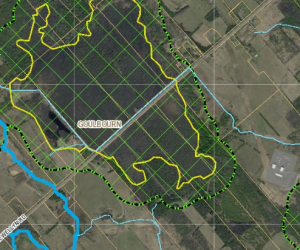
Effective February 18, 2020, the Rideau Valley Conservation Authority (RVCA) is regulating the entire Goulbourn Provincially Significant Wetland (PSW) boundary as approved by the Ministry of Natural Resources and Forestry (MNRF) in 2017. The RVCA will also be regulating 120 metres from the defined 2017 boundary, per Ontario Regulation 174/06.
Since 2006, the Province of Ontario has required Conservation Authorities to regulate development in wetlands and adjacent lands. The RVCA’s responsibilities in this regard are outlined in Ontario Regulation 174/06. Although the RVCA regulates all PSWs, the wetlands within the Flewellyn Special Study Area, which includes the Goulbourn Wetland Complex, were exempt while the City of Ottawa undertook various studies to better understand the hydrology of the area and a wetland boundary re-evaluation. However, in order to address the matter of ongoing interference with these wetlands, the RVCA Board of Directors, at their meeting on January 25, 2018, passed a motion to apply Ontario Regulation 174/06 to the Goulbourn Wetland Complex based on boundaries that were identified by MNRF in 2008.This was an interim approach until such time as:
- The City of Ottawa had concluded a re-evaluation of the boundaries for those wetlands within the Flewellyn Special Study Area
- The wetland boundaries identified through the re-evaluation were approved by MNRF
- Notification was provided to landowners
- The City of Ottawa adopted an official plan amendment to recognize the re-evaluated wetlands as Provincially Significant
These steps have been completed. The City of Ottawa adopted Official Plan Amendment 240 on February 12, 2020 to designate the re-evaluated wetlands within the Flewellyn Special Study Area as Provincially Significant. The RVCA now regulates the entire Goulbourn Wetland Complex PSW in accordance the MNRF approved boundaries, and the 120 adjacent lands. This includes PSWs that were identified through this process that extend beyond the Flewellyn Special Study Area boundary.
What Affect Does Ontario Regulation 174/06 Have?
Ontario Regulation 174/06 (Development, Interference with Wetlands and Alterations to Shorelines and Watercourses Regulation) under Section 28 of the Conservation Authorities Act, requires property owners to obtain the written permission of the RVCA prior to interfering in any way with the existing channel of a river, creek, stream or watercourse or for changing or interfering in any way (including hydrologic function) with a wetland. Therefore, property owners must receive approval from the RVCA prior to undertaking any development or site alteration within a Provincially Significant Wetland or within 120 metres of a Provincially Significant Wetland boundary. Development is defined as:
- The construction, reconstruction, erection or placing of a building or structure of any kind or changes to a building or structure that would result in an increase in size or the number of dwelling units,
- Site grading, and
- Temporary or permanent placing, dumping or removal of any material, originating on the site or elsewhere.
For More Information Please Contact Us
We encourage you to contact our office if you have any questions or would like additional information, including a site-specific map of your property showing regulated areas.
You can contact one of our Resource Specialists at:
You can also view maps, Ontario Regulation 174/06 and RVCA’s development policies at Regulations & Planning
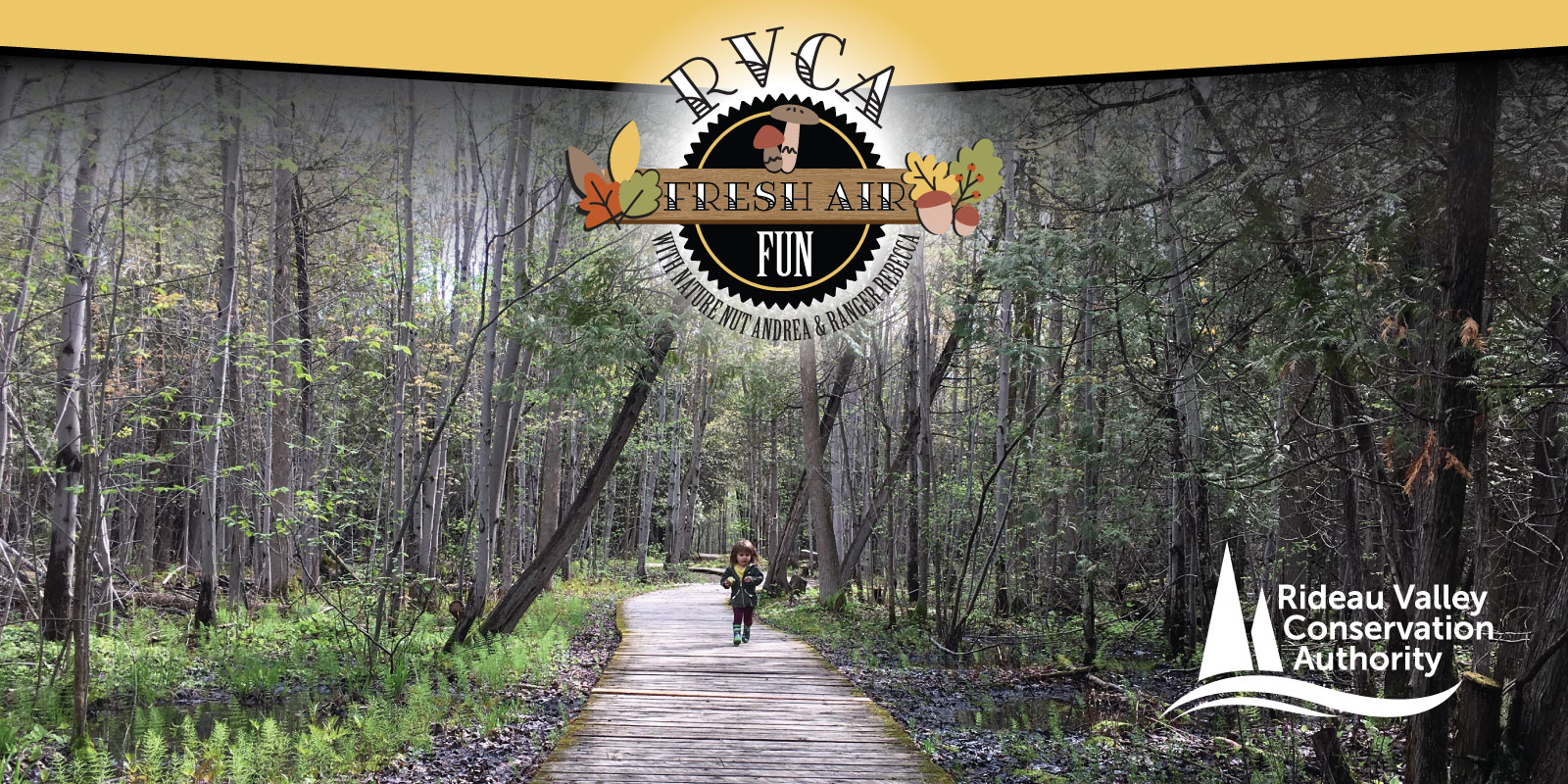
Fresh Air Fun!
Getting outside doesn't have to be complicated: there's tons of fun and learning just waiting to be discovered in your backyard, around your block or at your local conservation area. To get you started, RVCA's Outdoor Educators have compiled some awesome activities to help you maximize your outdoor adventures!
Spring Resources |
Winter Resources |
| Elementary School Activities: | |
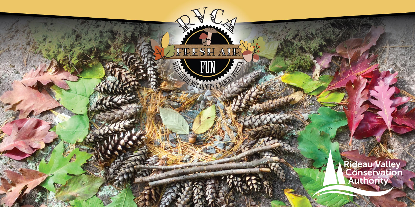 Natural Art — Hey kids! Why not get outside and collect little pieces of “nature” and create a work of art? What can you use from your backyard to make your own unique masterpiece? A few blades of grass? Maybe a few twigs will help? How about those pinecones? There are treasures to be found! Build your design outside, take a snap and leave it behind. Natural Art — Hey kids! Why not get outside and collect little pieces of “nature” and create a work of art? What can you use from your backyard to make your own unique masterpiece? A few blades of grass? Maybe a few twigs will help? How about those pinecones? There are treasures to be found! Build your design outside, take a snap and leave it behind. |
|
 Alphabet Walk — Hey parents, here’s today’s RVCA Fresh Air Fun tip! Take the little ones for an “alphabet walk.” Can you see letters in shapes around you? Or find objects for every letter of the alphabet. Access our ABC check list here (download PDF) Alphabet Walk — Hey parents, here’s today’s RVCA Fresh Air Fun tip! Take the little ones for an “alphabet walk.” Can you see letters in shapes around you? Or find objects for every letter of the alphabet. Access our ABC check list here (download PDF) |
|
 Scavenger Hunt — Hey kids! It’s a spring scavenger hunt! Get outside see what you can spy during your outdoor adventure. Get your scavenger hunt here (download PDF). Scavenger Hunt — Hey kids! It’s a spring scavenger hunt! Get outside see what you can spy during your outdoor adventure. Get your scavenger hunt here (download PDF). |
|
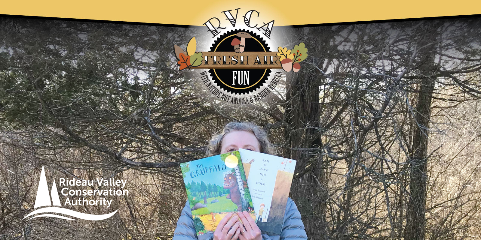 Booklist — Hey parents! Pair a fun children’s story with your next walk outside. Make connections from the book to nature while watching the squirrels, jumping in puddles or sitting under a magic tree! Check out Interpreter Andrea and Rebecca’s recommended reading list! Reading List (download PDF) Booklist — Hey parents! Pair a fun children’s story with your next walk outside. Make connections from the book to nature while watching the squirrels, jumping in puddles or sitting under a magic tree! Check out Interpreter Andrea and Rebecca’s recommended reading list! Reading List (download PDF) |
|
 Photography fun! What a better way to capture your backyard fresh air fun than with your camera! Whether spring is blooming or the snow is blowing, what beautiful outdoor image can you freeze in time? The flight of a feathered friend, the unique patterns of a frosty leaf, the buds about to burst? Photography fun! What a better way to capture your backyard fresh air fun than with your camera! Whether spring is blooming or the snow is blowing, what beautiful outdoor image can you freeze in time? The flight of a feathered friend, the unique patterns of a frosty leaf, the buds about to burst? |
|
 Ready to read — Weave literacy skills into your next bit of fresh air fun! Make a list of all the things you see on your walk while encouraging literacy skills. Younger children can guess the first letter based or draw pictures, while older kids can try to spell the words. You can help them fill in the blanks later! Ready to read — Weave literacy skills into your next bit of fresh air fun! Make a list of all the things you see on your walk while encouraging literacy skills. Younger children can guess the first letter based or draw pictures, while older kids can try to spell the words. You can help them fill in the blanks later! |
|
|
Why is this type of play beneficial for kids? Loose parts encourage kids to be physically active and creative. The learning is hands on, engaging, and encourages children to communicate and be cooperative along with developing great problem-solving skills. |
|
|
Rainy Day Play — Water is a wonderful in Parents, be sure to watch your kids near deep or fast flowing water! Dry off and pair your experience with a fun story. Check out “Over and Under the Pond" by Kate Messner or "In the Small, Small Pond" by Denise Fleming. If you have a library card, many books can be accessed through digital library connections like OverDrive Tumble Books for free. |
|
|
|
|
|
The messiness of play and learning can take its tole on your indoor space and patience! Try taking it outside for some fresh air fun. Grab some containers from your recycling, buckets, old kitchen utensils, bowls, pots, pans, etc. that you have lying around and set up a mud kitchen in your backyard. Find a spot where your children can dig in the soil or sand and collect ingredients from nature. Fill some containers with water and watch their imaginations go! Although you may see lots of fancy set-ups for mud kitchens online, we have found that children are more than happy to sit on the ground or work with their tools on a stump, bench, board, or picnic table. When the play is finished, you can throw everything in a plastic bin or sturdy reusable shopping bag. Washing things off is totally optional! How can this play support learning? Here are just a few examples:
Have fun! Don’t for get to check out our blog at https://www.rvca.ca/blog. |
|
|
|
|
|
How does this play support learning? Here are just a few examples:
|
|
|
How does this play support learning? Here are just a few examples:
Resources:
|
|
|
|
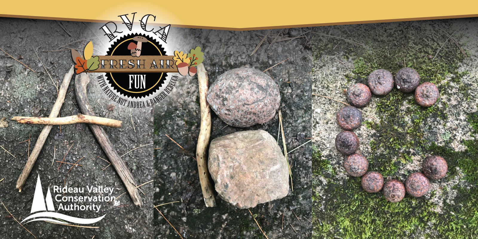
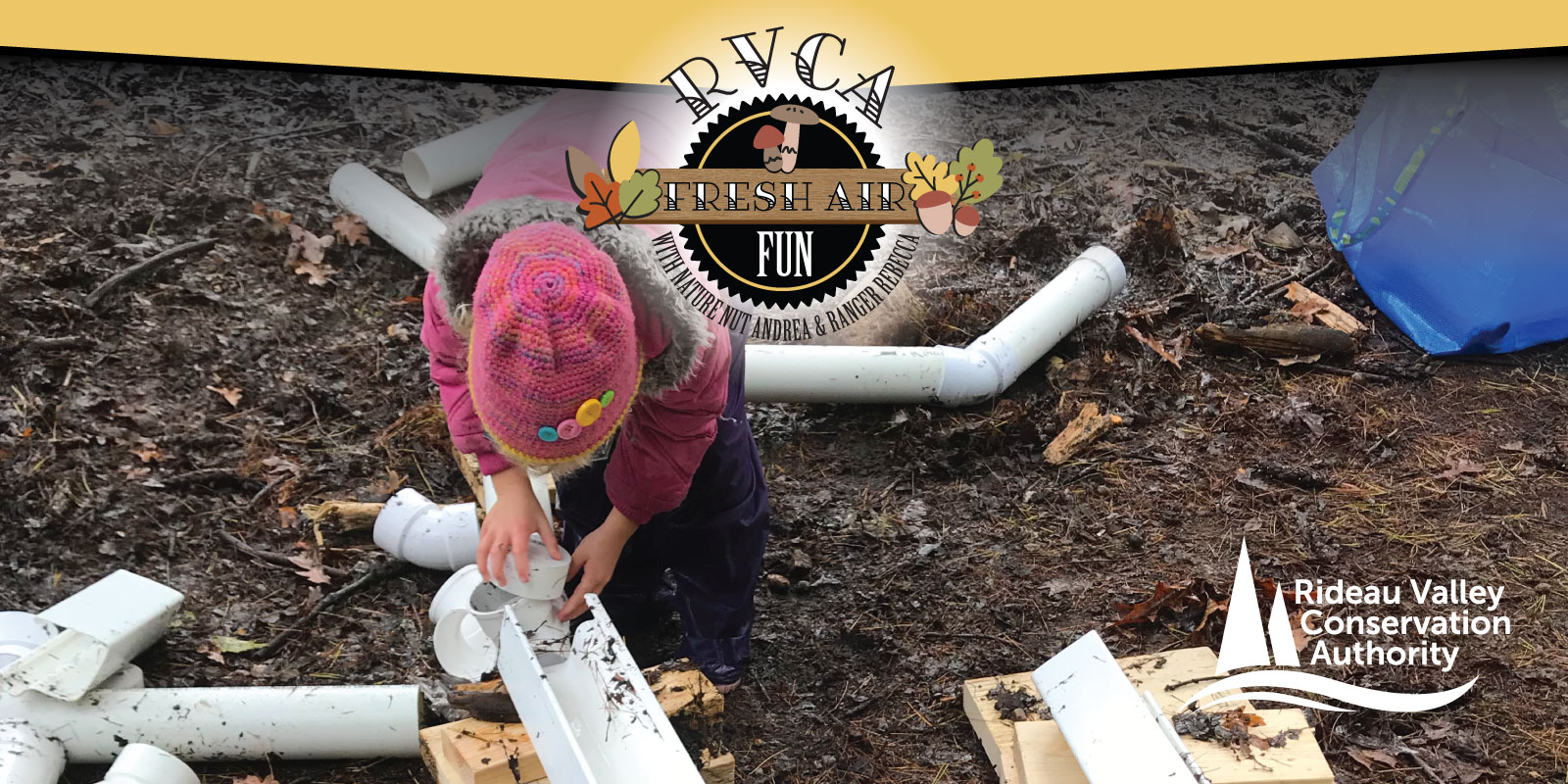 Loose Parts Play — Loose parts are random items that children use to build, play, create and more. Look through your home and think like a kid: boards, tires, fabric, boxes, old kitchen items, buckets, sticks, tubes, pipes, logs, rocks, recycling items and more can all become loose parts. And there is no better place to play with them than outside!
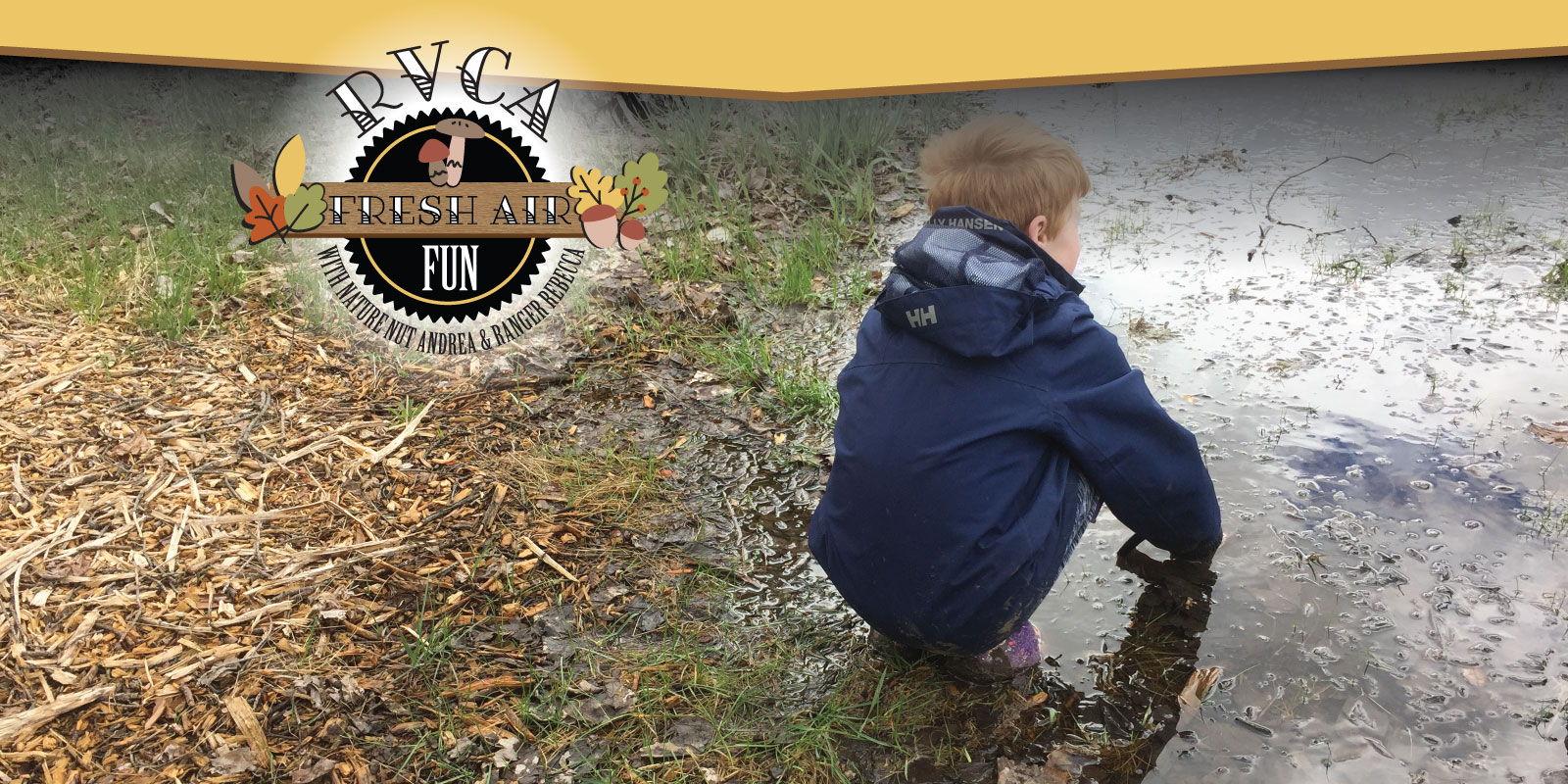 vitation for play and exploration! A puddle, a ditch, a stream, or a pond in your neighbourhood or backyard can all lead to some excellent fresh air fun. Raid your recycling bin for containers that you can use as scoops. Use an old kitchen strainer as a net. Find a pail, bowl, or basin to collect water and any creatures you might find. Don’t forget your rubber boots! Want to know what creatures you found? Make observations about sie, number of legs, antennae and how it swims. Then look it up later using our
 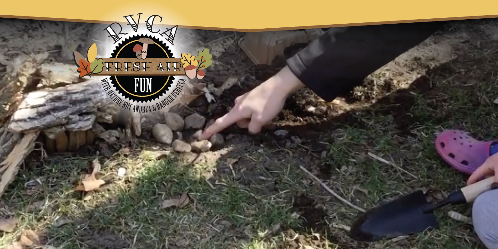 Toad House — Hop to it and try your hand at creating toad habitat in your own backyard! Toads are great neighbours because they love to eat bugs and slugs. Learn more from Ranger Rebecca as she gives tips on how to build a toad house with your little ones. Don’t forget to post and tag us in your creation!
 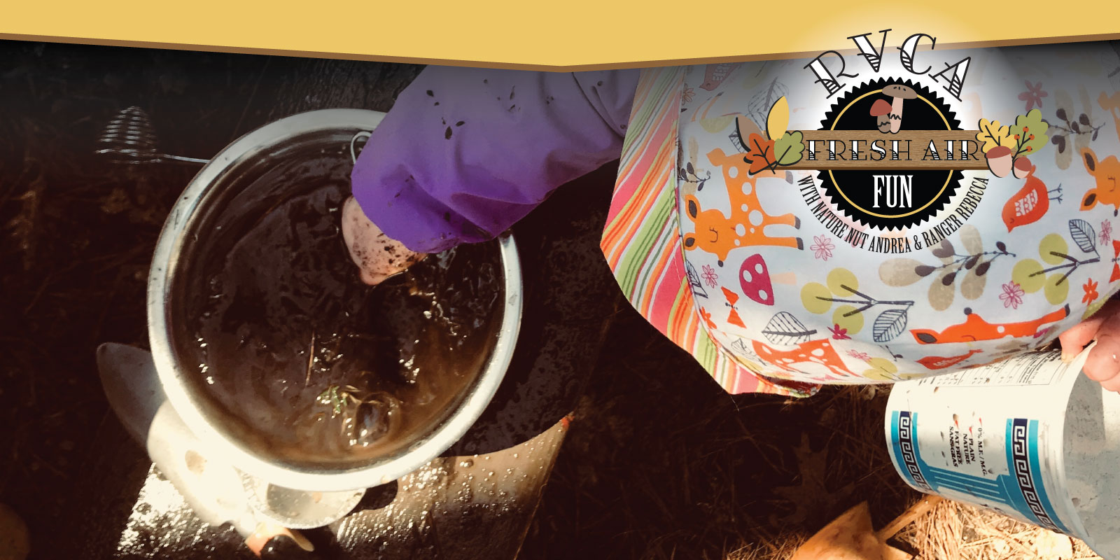 Mud Kitchen — How about building a mud kitchen?
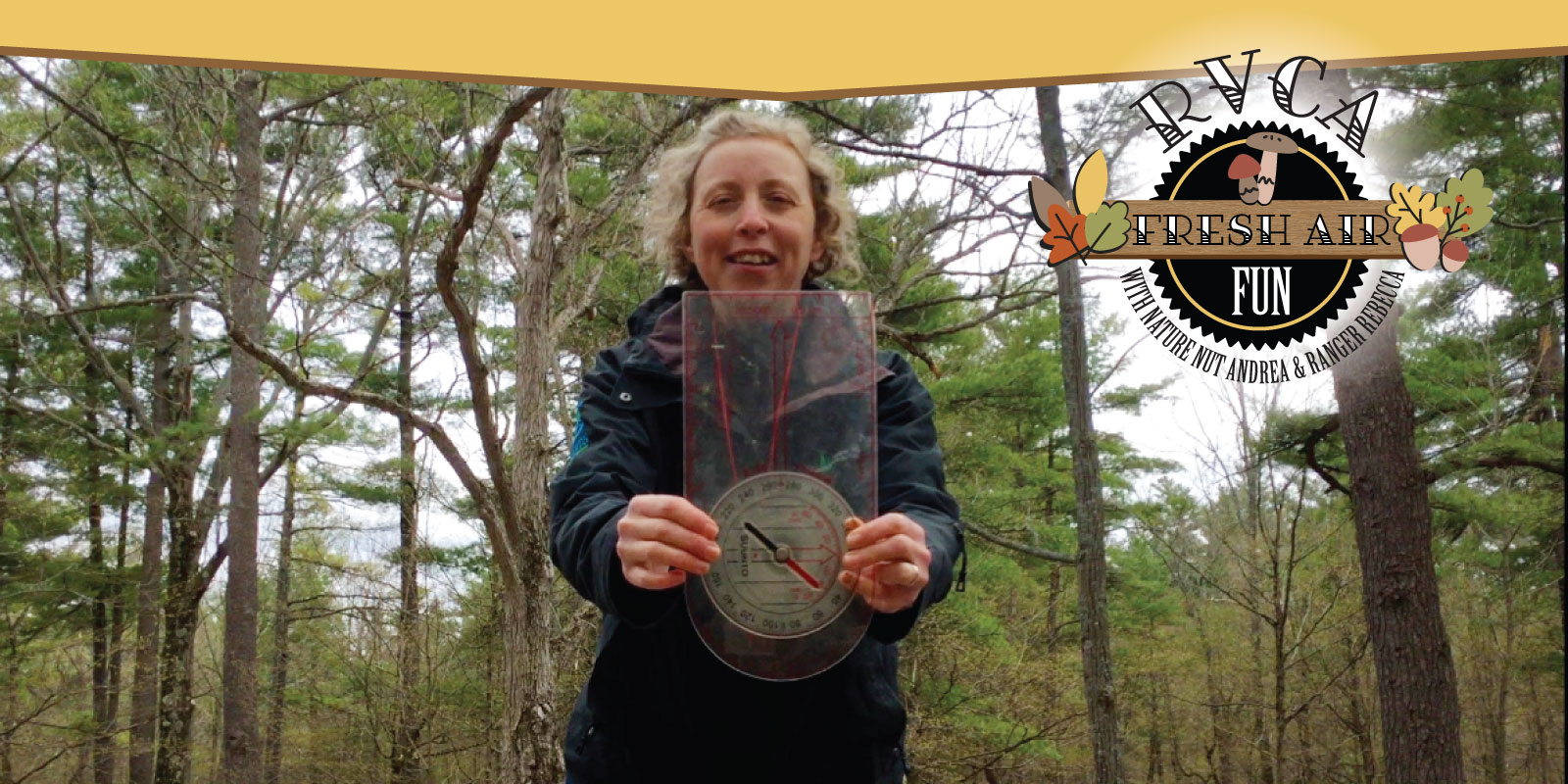 Map & Compass — Get back to basics with this edition of fresh air fun! GPS technology is amazing but it doesn’t always work the way we expect it. Traditional map and compass work is a great way to explore outside. Break out your old compass and see if you can figure out how to find north and the other cardinal directions. Grab some paper, pencils, and colouring tools to make a map of your backyard or neighbourhood. See if you can match north on your map to magnetic north and see how that can help you navigate on your adventure. Ranger Rebecca explains more at
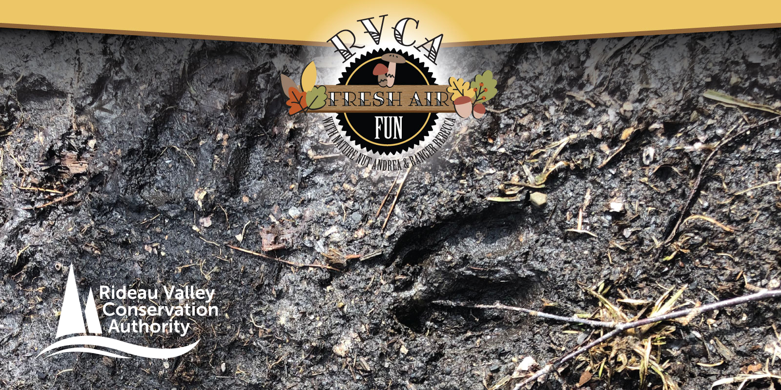
  Tiny Habitats — Did you know you might have some tiny habitats hiding right in your backyard? Do you have a rock sitting in your garden? How about a big stick or log sitting on the grass by your shed? Try lifting it up and looking underneath: you might be surprised what you find. When you're finished, be sure to put the rock or log back so the things living underneath stay safe.
 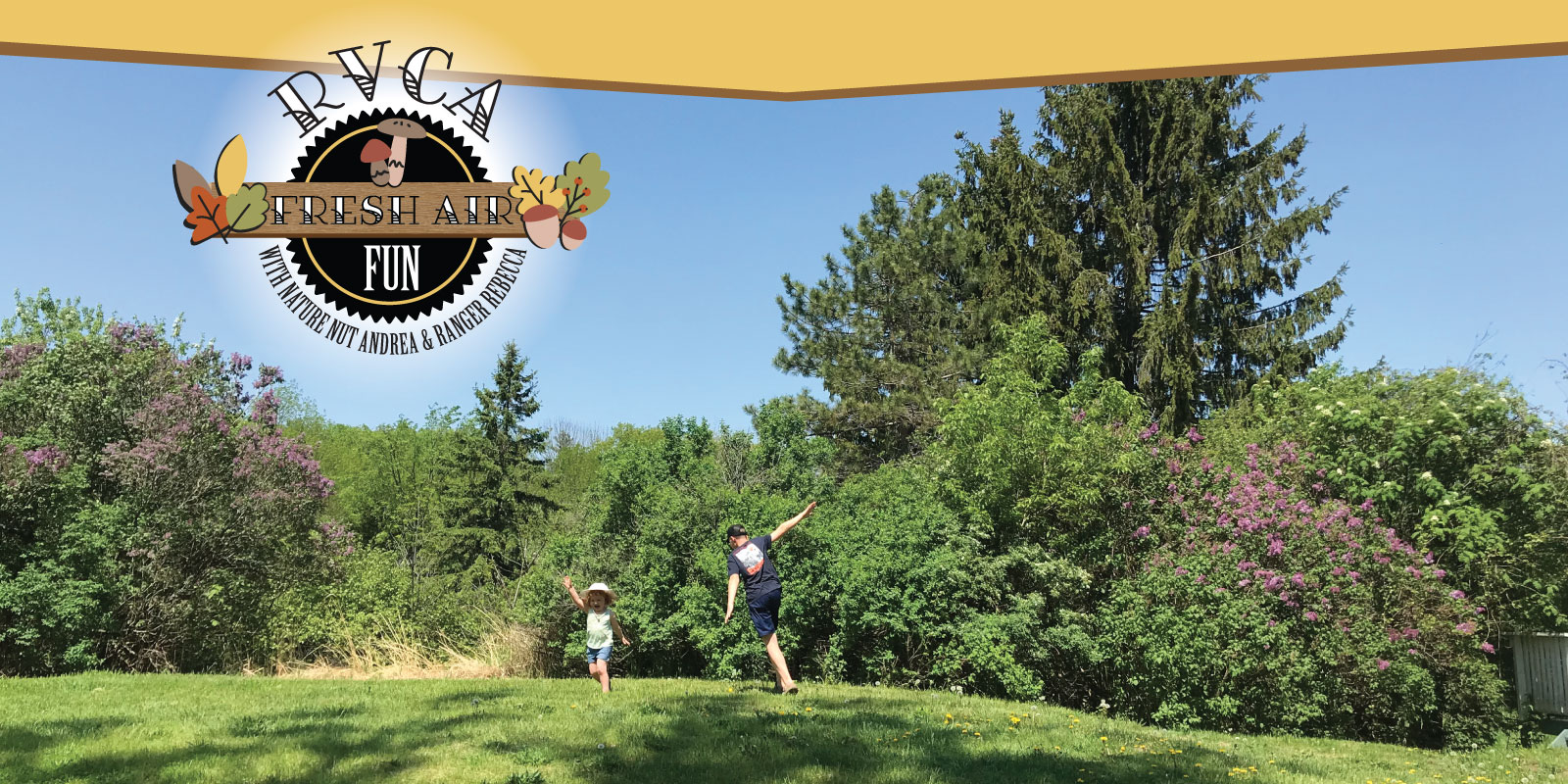 Pretend to be an animal — Classic fresh air fun: pretend to be an animal! Try hide and seek with a forest friend twist – the little owls fly out into the forest and hide from one of their owl friends. When everyone is ready, the owls start to hoot and their friend listens to try and find them.
 | Middle and High School Activities: |
Pond Study: Using bugs to test for pollutionSome bugs are more sensitive to poor water quality than others. In this hands-on science experiment, get up close and personal with the benthic invertebrates that live in your local pond or stream to determine whether or not its polluted. Instructions here! |
Join the world’s largest treasure hunt!Just you and your phone, chasing a secret — if you have to be outside, this is how to do it! The global geocaching movement is all around us, including at Baxter Conservation Area. Use your phone to track down the secret treasures tucked into our trees. Download the Geocaching app for iPhone or Android to get started. Bring a friend! |
Trail JournalingForest therapy is great for your mental health. Next time you're on a hike, at the cottage or even at a local park, tune into your wild side for a few minutes. Put away your phone, find a comfy spot to sit and just watch and listen. What do you see? What can you hear? Print your trail journal here! |
Five Senses in the ForestTake a nature break! Harness the restorative power of nature to help you stay grounded and able to cope with the stress all around us. Try our Five Senses in the Forest mindfulness activity here. |
Naturally Artistic ChallengeCreate your own outdoor masterpiece using nature’s gifts. Using rocks, twigs, leaves and any other natural materials you find, build your design outside, take a snap and leave it behind. Post it on your socials and tag us with #RVCAFreshAirFun! Find instructions here! |
Photo challengeForget the selfies! Put your phone to the test: What beautiful nature photo can you freeze in time? The flight of a feathered friend, the unique bend of a tree branch, the buds about to burst? Filters allowed! Be sure to post to your socials and tag us with #RVCAFreshAirFun. |

April 3, 2020 (WCS – R06/2020) –The Rideau Valley Conservation Authority is terminating the FLOOD WATCH that was previously in effect and issuing a HIGH WATER SAFETY message for all areas. Water levels and flows are still high for most, but not all, of the larger waterbodies in the Rideau Valley Watershed.
The short-term forecast does not indicate any significant precipitation and the snow is now melted across the Rideau Valley Watershed. As such, water levels and flows are expected to slowly decline in the days ahead.
Everyone needs to be cautious around lakes and streams with the fluctuating water levels. Children need to be educated about the hazards and kept away from all watercourses.
This watershed conditions statement is in effect until April 16, 2020 at 5 PM. No further updates will be issued unless the forecast or conditions change.
-end-
"Rideau Valley Conservation Authority is a partnership of municipalities within the Rideau Valley watershed created under the Conservation Authorities Act to deliver a range of programs in watershed management and natural resource conservation."
RVCA Watershed Conditions Statements:
- Water Safety – High flows, unstable banks, melting ice or other factors that could be dangerous for recreational users such as anglers, canoeists, hikers, children, pets, etc. Flooding is not expected.
- Flood Outlook – Early notice of the potential for flooding based on weather forecasts, calling for heavy rain, snow melt, high winds or other conditions that could lead to high runoff, cause ice jams and/or lakeshore flooding or erosion.
- Flood Watch – Flooding is possible in specific watercourses or municipalities. Municipalities, emergency services and individuals in flood prone areas should prepare.
- Flood Warning – Flooding is imminent or already occurring in specific watercourses or municipalities.
WATER SAFETY STATEMENT — Lower Ottawa River / SÉCURITÉ AQUATIQUE — Cours inférieur de la rivière des Outaouais
March 30, 2020 — A Water Safety Statement is being issued for areas along the Lower Ottawa River. Based on current snow cover and weather forecast, it’s anticipated that levels and flows from Arnprior to Hawkesbury will remain within the normal range of fluctuations associated with the spring freshet period.
The Ottawa River Regulating Committee indicates that with warming temperatures and forecasted precipitation, increases in flows and levels are expected to continue and may cause minor flooding in low-lying areas over the coming weeks depending on the temperatures and precipitation received. Levels are currently expected to remain below flood thresholds.
Throughout the freshet period, the combination of heavy rainfall and snowmelt may result in rapid increases in water levels and flows on the main stem of the Ottawa River from Mattawa down to the Montreal Region.
Residents in flood-prone areas are encouraged to closely follow evolving conditions and to take necessary measures. Residents are advised to stay away from watercourses where flows are high and where banks might be unstable. Parents are encouraged to explain dangers to children.
The Mississippi Valley, Rideau Valley, and South Nation Conservation Authorities monitor water levels and weather forecasts with the Ministry of Natural Resources and Forestry as part of the Flood Forecasting and Warning Program. Updates are provided as conditions change.
The Ottawa River Regulating Committee will be reassessing forecast conditions and providing hydrological condition updates on its website daily at ottawariver.ca/forecasts/.
To view current flood warnings across Ontario, visit: www.ontario.ca/law-and-safety/flood-forecasting-and-warning-program.
This WATER SAFETY STATEMENT is in effect until April 10, 2020 at 5:00 PM.
- end -
Definitions:
- Water Conditions Statement: Water Safety: indicates that high flows, melting ice or other factors could be dangerous for such users as boaters, anglers and swimmers but flooding is
not expected. - Water Conditions Statement: Flood Outlook: gives early notice of the potential for flooding based on weather forecasts calling for heavy rain, snow melt, high winds or other conditions.
- Flood Watch: potential for flooding exists within specific watercourses and municipalities.
- Flood Warning: flooding is imminent or occurring within specific watercourses and municipalities.
Le 30 mars 2020 — Une déclaration de sécurité aquatique est publiée pour les zones situées le long du cours inférieur de la rivière des Outaouais. Selon la couverture de neige actuelle et les prévisions météorologiques, on prévoit que les niveaux et les débits d'eau d'Arnprior à Hawkesbury resteront dans la fourchette normale des fluctuations associées à la période des crues printanières.
Le Comité de régularisation de la rivière des Outaouais indique qu'avec le réchauffement des températures et les précipitations prévues, l'augmentation des débits et des niveaux devrait se poursuivre et pourrait provoquer des inondations mineures dans les zones basses au cours des prochaines semaines, en fonction des températures et des précipitations reçues. Les niveaux devraient actuellement rester en dessous des seuils d'inondation.
Tout au long de la période de crue, la combinaison de fortes précipitations et de la fonte des neiges pourrait entraîner une augmentation rapide des niveaux et des débits sur le cours principal de la rivière des Outaouais, de Mattawa jusqu'à la région de Montréal.
On encourage les résidents des zones inondables à suivre de près l'évolution des conditions et à prendre les mesures nécessaires. Il est conseillé aux résidents de se tenir à l'écart des cours d'eau où les débits sont élevés et où les berges pourraient être instables. On recommande aux parents d'expliquer les dangers aux enfants.
Les offices de protection de la nature des rivières Mississippi, Rideau et Nation Sud surveillent les niveaux d'eau et les prévisions météorologiques avec le ministère des Richesses naturelles et des Forêts dans le cadre du Programme de prévision et d'alerte des crues.
Des mises à jour sont émises en fonction de l'évolution des conditions.
Le Comité de régularisation de la rivière des Outaouais réévaluera les prévisions et publiera quotidiennement des mises à jour des conditions hydrologiques sur son site Web à ottawariver.ca/forecasts/. Pour consulter les alertes de crue actuelles en Ontario, visitez le site : www.ontario.ca/law-and-safety/flood-forecasting-and-warning-program.
Cette DÉCLARATION DE SÉCURITÉ AQUATIQUE est en vigueur jusqu'au 10 avril 2020 à 17 h.
- fin -
Définitions :
- Communiqué sur les conditions des bassins versants – Sécurité aquatique : indique que des débits forts, de la glace fondante ou d’autres facteurs peuvent être dangereux pour des utilisateurs comme les plaisanciers, les pêcheurs à la ligne et les baigneurs, mais qu’une crue n’est pas prévue.
- Communiqué sur les conditions des bassins versants – Perspective de crue :préavis de crue possible basé sur des prévisions de pluies abondantes, de fonte des neiges, de forts vents ou autre.
- Veille de crue :possibilité de crue pour des cours d’eau et municipalités spécifiques.
- Avertissement de crue : crue immimente ou en cours pour des cours d’eau et
municipalités spécifiques.
Updated Flood Outlook & Flood Watch: Rideau Valley Watershed

(WCS – R05/2020) March 27, 2020 –The short-term forecast is calling for rainfall amounts of 35 millimetres or more on Sunday and into Monday with above zero temperatures. As such, water levels and flows across the Rideau Valley Watershed are expected to increase again.
A FLOOD WATCH is being issued for properties around Christie Lake and Wolfe Lake. In these areas, residents should expect freshet like water levels and flows. Parks Canada staff are closely monitoring the water levels in Bobs Lake and Christie Lake, and operations at the Bolingbroke Dam.
A FLOOD WATCH continues for the low-lying areas along Stevens Creek and Taylor Drain in the Village of North Gower; however, water levels are expected to be less than those that have already been seen this spring.
A FLOOD OUTLOOK is being maintained/issued for the following areas:
- Properties around Bob’s Lake and Tay River in the upper Rideau Valley Watershed. In these areas, residents should expect spring like water levels and flows. Parks Canada staff are closely monitoring the water levels in Bobs Lake and Christie Lake, and operations at the Bolingbroke Dam will take place as required, to balance the levels in Bobs Lake and Christie Lake.
- Properties around the Long Reach (Burritts Rapids to Kars) of the Rideau River.
- Properties around the smaller creeks and streams in the lower Rideau Valley Watershed, including the low-lying roads and waterfront properties adjacent to the Jock River (near Richmond).
- Any connected creeks or ditches.
Extreme caution should be exercised by everyone when near local waterbodies. Please note that riverbanks are very slippery at this time of year and it’s quite easy for a child or adult to inadvertently fall into the water. Parents should inform their children of the risks and provide appropriate supervision.
Residents in flood prone or low-lying areas, historically susceptible to flooding, should continue to take the necessary precautions to protect their property, such as:
- Ensuring sump pump is clear, in good working condition and has a backwater valve
- Ensuring easy access to a portable backup generator and pump
- Ensuring downspouts are clear and the outlet is at least 3 metres from the dwelling
- Securing items that might float away as flows increase
- Removing valuable items from basements or lower floors that could be subject to flooding
- Keeping emergency phone numbers handy
- Familiarizing yourself with your municipality’s Emergency Preparedness Plan
This watershed conditions statement is in effect until April 9, 2020, at 5 p.m. and will be updated at that time unless the forecast or conditions change.
"Rideau Valley Conservation Authority is a partnership of municipalities within the Rideau Valley watershed created under the Conservation Authorities Act to deliver a range of programs in watershed management and natural resource conservation."
RVCA Watershed Conditions Statements:
- Water Safety – High flows, unstable banks, melting ice or other factors that could be dangerous for recreational users such as anglers, canoeists, hikers, children, pets, etc. Flooding is not expected.
- Flood Outlook – Early notice of the potential for flooding based on weather forecasts, calling for heavy rain, snow melt, high winds or other conditions that could lead to high runoff, cause ice jams and/or lakeshore flooding or erosion.
- Flood Watch – Flooding is possible in specific watercourses or municipalities. Municipalities, emergency services and individuals in flood prone areas should prepare.
- Flood Warning – Flooding is imminent or already occurring in specific watercourses or municipalities.
Flood Outlook & Updated Flood Watch: Rideau Valley Watershed

(WCS – R04/2020)
March 19 ,2020 – The short-term forecast is calling for rainfall amounts of 10 to 15 mm and high temperatures near 15 degrees Celsius on Friday, followed by below zero temperatures on Saturday, and then milder temperatures in the days following. No significant rain is in the short-term forecast after Friday. With Friday’s rain and high temperatures, water levels and flows across the Rideau Valley Watershed are expected to increase everywhere and then decline again slowly with the cooler weather in the following days.
Some specific areas of concern are highlighted below:
A FLOOD OUTLOOK is being issued for the following areas:
- Properties around Bob’s Lake, Christie Lake and Tay River in the upper Rideau Valley Watershed. In these areas, local residents should expect spring like water levels and flows. Parks Canada staff are closely monitoring the water levels in Bobs Lake and Christie Lake, and operations at the Bolingbroke Dam will take place as required, to balance the levels in Bobs Lake and Christie Lake.
- Properties around Wolfe Lake in the upper Rideau Valley Watershed.
- Properties around the smaller creeks and streams in the lower Rideau Valley Watershed, including the low-lying roads and waterfront properties adjacent to the Jock River (near Richmond)
- and any connected creeks or ditches.
A FLOOD WATCH continues for the low-lying areas along Stevens Creek and Taylor Drain in the Village of North Gower; however, water levels are expected to be somewhat similar or possibly less than those that have already been seen this spring.
Extreme caution should be exercised by everyone when near local waterbodies. Parents should inform their children of the risks and provide appropriate supervision.
Residents in flood prone or low-lying areas, historically susceptible to flooding, should continue to take the necessary precautions to protect their property, such as:
- Ensuring sump pump is clear, in good working condition and has a backwater valve
- Ensuring easy access to a portable backup generator and pump
- Ensuring downspouts are clear and the outlet is at least 3 metres from the dwelling
- Securing items that might float away as flows increase
- Removing valuable items from basements or lower floors that could be subject to flooding
- Keeping emergency phone numbers handy
- Familiarizing yourself with your municipality’s Emergency Preparedness Plan
This watershed conditions statement is in effect until April 2, 2020, at 5 p.m. and will be updated at that time unless the forecast or conditions change.
"Rideau Valley Conservation Authority is a partnership of municipalities within the Rideau Valley watershed created under the Conservation Authorities Act to deliver a range of programs in watershed management and natural resource conservation."
RVCA Watershed Conditions Statements:
- Water Safety – High flows, unstable banks, melting ice or other factors that could be dangerous for recreational users such as anglers, canoeists, hikers, children, pets, etc. Flooding is not expected.
- Flood Outlook – Early notice of the potential for flooding based on weather forecasts, calling for heavy rain, snow melt, high winds or other conditions that could lead to high runoff, cause ice jams and/or lakeshore flooding or erosion.
- Flood Watch – Flooding is possible in specific watercourses or municipalities. Municipalities, emergency services and individuals in flood prone areas should prepare.
- Flood Warning – Flooding is imminent or already occurring in specific watercourses or municipalities.
RVCA Waiving Fees at Local Conservation Areas
Rideau Valley Watershed, March 17, 2020 — RVCA is waiving fees at its Conservation Areas as public health officials encourage people to get out and enjoy a walk during these stressful times. All trails and boardwalks owned and operated by the Rideau Valley Conservation Authority will be open to the public free of charge until April 6, 2020. Interpretive centres and other facilities including washrooms and outhouses will be closed however to protect the health and safety of visitors and staff.
“We recognize that this is a stressful time for people as everyone takes steps to help limit the spread of the Coronavirus” said Sommer Casgrain-Robertson, RVCA General Manager. “We hope that our 11 conservation areas can provide some comfort by offering local residents with a close-to-home outdoor escape where they can enjoy a relaxing walk in a beautiful natural setting”.
Many studies show that time spent in nature reduces stress levels, enhances mental attitude and of course improves physical health. While enjoying our conservation areas we ask that people maintain social distancing and avoid gathering in groups or touching common surfaces.
“We have more than 40 kilometres of trails through mixed hardwood forests, meadows and wetlands,” says Casgrain-Robertson. “We hope families will come and explore our many hiking trails and scenic lookouts especially while schools are closed.”
Conservation Areas in the Rideau watershed include:
- Chapman Mills Conservation Area – Barrhaven/Riverside South
- Baxter Conservation Area – Kars
- Meisel Woods Conservation Area — Crow Lake
- Mill Pond Conservation Area – Portland
- Perth Wildlife Reserve – Perth
- Rideau Ferry Yacht Club Conservation Area – Rideau Ferry
- Foley Mountain Conservation Area – Westport
Visit www.rvca.ca/consevation-areas for a complete listing of locations,
RVCA Offices Closed to Public

Rideau Watershed, March 17, 2020 — The health, safety and well-being of our visitors and staff is our top priority. RVCA is responding to the COVID-19 pandemic with the following changes in operations and programming effective immediately:
- The RVCA Administrative Centre (3889 Rideau Valley Drive, Manotick) is closed to the general public.
- Meetings and events scheduled at the RVCA Administrative Centre are cancelled.
- Education programming and rentals at Baxter and Foley Mountain Conservation Areas are cancelled.
- Interpretive centres and privies at RVCA Conservation Areas are closed to the general public. The trails remain open for physical and mental health benefits and will be available free of charge until April 6, 2020.
- All essential services including RVCA’s flood forecasting and warning operations and planning and permitting remain active.
Staff will continue to provide service over the phone and through email. Please call 613-692-3571 or 1-800-267-3504 or search online at www.rvca.ca/directory for a directory of services and contact information. Permits and other hard copy documents can be dropped off in our drop box at RVCA Administrative office or emailed to the appropriate staff member. Payment can be taken over the phone at 613-692-3571 ext. 1100.
Theses decisions are in response to recent measures implemented across the province. As of today, we plan to reopen on Monday, April 6, 2020. We will continue to monitor the situation and reassess as more information becomes available. Please check the RVCA website and social media platforms for updates. Your patience and cooperation are appreciated.
RVCA’s outdoor facilities at our developed Conservation Area will remain open for public use; only the interpretive centres and privies will be closed. The public are invited to use our outdoor trails and boardwalks free of charge until April 6, 2020. Visit www.rvca.ca/conservation-areas for a complete listing of locations and amenities.