Monitoring & Reporting (91)
Children categories
Flood Risk/Hazard Mapping Reports (61)
Learn More:
- Contact Tyler Bauman, Water Resources Engineer (Flood Management)
In cooperation with local municipalities and the province, the RVCA identifies, studies and maps natural hazard areas along local rivers, lakes, streams and wetlands. Natural hazard areas include floodplains, unstable slopes. Natural features such as wetlands are also mapped. In the past, these maps were called flood risk maps.
If not understood or dealt with effectively, these hazards can pose risks and problems to society, especially when considering development activities.
Hazard mapping is used by watershed municipalities when updating Official Plan and Zoning Schedules and in the review of development applications under the Planning Act. The RVCA uses the mapping for the administration and enforcement of regulations made under the Conservation Authorities Act (Section 28).
Kemptville Creek Flood Risk Mapping - Floodplain Delineation Revision 3 (June 3, 2011)
Kemptville Creek Flood Risk Mapping - Floodplain Delineation Revision 2 (June 3, 2011)
Kemptville Creek Flood Risk Mapping - Floodplain Delineation Revision 1 (June 3, 2011)
Access water chemistry results by searching your area of interest or zooming into an area and selecting a sampling site.
Learn More:
- Current Water Conditions Statements (flood or drought)
- Contact Brian Stratton, Manager Engineering Services
Streamflow and water level data are used to monitor flood and drought events. They are also used to monitor water supply for lake operation and navigation. This information is used to determine flood risk, support land use planning, assess fish habitat and for water quality analyses of contaminant loading.

DISCLAIMER: Users of the RVCA flow data and water level data are cautioned to consider the unverified nature of the information before using it for decisions that concern personal or public safety or the conduct of business. The Rideau Valley Conservation Authority assumes no responsibility for the correctness of the information contained in this website nor liability to any user of such information, regardless of the purpose. River Levels and flows can change rapidly.
Otter and Hutton Creeks - Flood Risk and Generic Regulation Limits Mapping Along Otter and Hutton Creeks, 2016

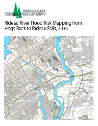
Rideau River Flood Risk Mapping from Hogs Back to Rideau Falls, 2016