Monitoring & Reporting (91)
Children categories
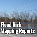
Flood Risk/Hazard Mapping Reports (61)
Learn More:
- Contact Tyler Bauman, Water Resources Engineer (Flood Management)
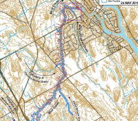
In cooperation with local municipalities and the province, the RVCA identifies, studies and maps natural hazard areas along local rivers, lakes, streams and wetlands. Natural hazard areas include floodplains, unstable slopes. Natural features such as wetlands are also mapped. In the past, these maps were called flood risk maps.
If not understood or dealt with effectively, these hazards can pose risks and problems to society, especially when considering development activities.
Hazard mapping is used by watershed municipalities when updating Official Plan and Zoning Schedules and in the review of development applications under the Planning Act. The RVCA uses the mapping for the administration and enforcement of regulations made under the Conservation Authorities Act (Section 28).
INSTRUCTIONS
1) A user-defined time frame can be selected via the "FROM DATE" and "TO DATE" tools above (Date Format: YYYY-M-D). An active 90-day window is loaded by default.
2) Chart and data export functionality is available via the [ ≡ ] icon at the top right of the chart area.
3) Series may be toggled on/off by clicking on the associated legend elements at the bottom of the chart.
4) Data values can be reviewed by hovering over the desired series.
DATA STATUS - PROVISIONAL
The RVCA cannot guarantee the accuracy of the provided data. Data accuracy can be affected by a number of factors including, but not limited to: Ice and/or sediment accumulation, backwater effects and equipment malfunction/maintenance.
Users of the RVCA's real-time data are cautioned to consider the unverified nature of the information before using it for decision that concern personal or public safety or the conduct of business.
STATION METADATA