


News
December 14, 2016
2016 Deadlines
RVCA Property Inquiry Service Deadline Friday, December 16 at 4 p.m. — if you require a property inquiry response before December 23, please submit on or before December 16. Anything received after December 16 will be processed starting on Tuesday, January 3, 2017. Ottawa Septic Office Service Deadlines Friday, December 16, 2016 at 4 p.m. – deadline for OSSO inspection requests Monday, December 19 at 4 p.m. — deadlines to submit: OSSO Part 8 Septic applications (new/replacement/alterations) OSSO Septic Record Searches ORWC OBC Part 8 registration
Published in
Other News
December 06, 2016
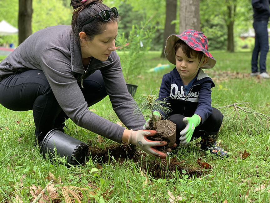
RVCA Celebrates 50 Years of Conservation
Special guests and dignitaries gathered to celebrate 50 years of conservation at the Rideau Valley Conservation Authority’s Anniversary Celebration on November 30. Surrounded by watershed representatives, politicians, past and present staff along with numerous friends and partners, RVCA Board of Director Members looked to acknowledge the many people, projects and partnerships behind a conservation movement that started in the early 1940s. “This was our opportunity to thank those who have helped us towards our goal of a thriving and sustainable watershed,” said Lyle Pederson, RVCA Chair and Elizabethtown-Kiltey representative. “Conservation of our land and water is not something you can…
Published in
Media Release
November 17, 2016
Otter-Hutton Hazard Mapping Public Open Houses
Rideau Lakes, November 14, 2016 — Members of the public are invited to an upcoming open house to review hazard maps. The RVCA has completed draft hazard mapping for Otter Creek (from Otter Lake outlet to the Rideau River) and Hutton Creek (from the Motts Mills Dam to its confluence with Otter Creek). These maps are typically known as “floodplain mapping,” but they also show areas that are prone to natural hazards such as flooding, erosion and natural environment features such as wetlands. The mapping will be used by the Township of Elizabethtown-Kitley, the Township of Rideau Lakes and the…
Published in
Media Release
October 17, 2016
Ottawa Hazard Mapping Public Open Houses
Members of the public are invited to an upcoming open house to review hazard maps. The RVCA has just completed a review and update of existing hazard maps (floodplain and steep slopes) along the Rideau River from Hogs Back to Rideau Falls. These maps are typically known as “floodplain mapping,” but they also show areas that are prone to natural hazards such as flooding, erosion and unstable slopes and natural environment features such as wetlands. The mapping takes these features into consideration and will be used by the City of Ottawa and the Conservation Authority when updating Official Plans and…
Published in
Media Release
October 05, 2016
Erratic Rains means “Severe” Drought Condition Continues
The drought status in the Rideau River watershed remains at “Severe” because sustained flows in the streams and rivers have not been restored. As has been the case all summer, rainfall has been very erratic with significant amounts recorded at some monitoring stations and very little at others. There has been enough rain in the last two weeks to make many watershed residents forget that there is still a drought. Lawns are green. Farm crops are close to being ready for harvest.
Published in
Watershed Conditions Statements
September 16, 2016
“Severe” Drought Condition Continued
Recent heavy but localized rain was not sufficient to change the drought status in the Rideau River watershed from “Severe.” Streamflows and lake levels continue to decline throughout the watershed. At the climate station at Kemptville, 44 millimetres of rain was recorded on September 10. Both Smiths Falls and Rideau Ferry received 26 but all of 2 mm was recorded at the station at Innisville east of Perth. Where the heavier rainfall occurred, levels increased but they quickly fell back to where they had been.
Published in
Watershed Conditions Statements

Media Release Archives
-
2024(1 article)
- February 2024 (1 article)
-
2023(19 articles)
- December 2023 (2 articles)
- October 2023 (3 articles)
- September 2023 (2 articles)
- August 2023 (1 article)
- July 2023 (2 articles)
- June 2023 (1 article)
- May 2023 (3 articles)
- April 2023 (2 articles)
- March 2023 (3 articles)
-
2022(21 articles)
- December 2022 (1 article)
- November 2022 (3 articles)
- October 2022 (2 articles)
- September 2022 (4 articles)
- July 2022 (1 article)
- June 2022 (3 articles)
- May 2022 (2 articles)
- April 2022 (2 articles)
- March 2022 (2 articles)
- February 2022 (1 article)
-
2021(28 articles)
- November 2021 (2 articles)
- October 2021 (1 article)
- September 2021 (3 articles)
- August 2021 (1 article)
- July 2021 (1 article)
- June 2021 (3 articles)
- May 2021 (3 articles)
- April 2021 (5 articles)
- March 2021 (4 articles)
- February 2021 (3 articles)
- January 2021 (2 articles)
-
2020(17 articles)
- November 2020 (2 articles)
- October 2020 (3 articles)
- September 2020 (1 article)
- August 2020 (1 article)
- July 2020 (2 articles)
- June 2020 (1 article)
- May 2020 (1 article)
- March 2020 (4 articles)
- February 2020 (1 article)
- January 2020 (1 article)
-
2019(70 articles)
- December 2019 (1 article)
- October 2019 (3 articles)
- September 2019 (5 articles)
- August 2019 (5 articles)
- July 2019 (2 articles)
- June 2019 (8 articles)
- May 2019 (19 articles)
- April 2019 (19 articles)
- March 2019 (5 articles)
- February 2019 (1 article)
- January 2019 (2 articles)
-
2018(46 articles)
- December 2018 (2 articles)
- November 2018 (3 articles)
- September 2018 (3 articles)
- August 2018 (6 articles)
- July 2018 (5 articles)
- June 2018 (3 articles)
- May 2018 (11 articles)
- April 2018 (6 articles)
- March 2018 (4 articles)
- February 2018 (1 article)
- January 2018 (2 articles)
-
2017(22 articles)
- November 2017 (2 articles)
- October 2017 (3 articles)
- September 2017 (1 article)
- August 2017 (3 articles)
- July 2017 (3 articles)
- June 2017 (5 articles)
- May 2017 (2 articles)
- March 2017 (2 articles)
- February 2017 (1 article)
-
2016(15 articles)
- December 2016 (1 article)
- November 2016 (1 article)
- October 2016 (1 article)
- August 2016 (2 articles)
- June 2016 (4 articles)
- May 2016 (2 articles)
- April 2016 (3 articles)
- February 2016 (1 article)