
Super User
New StoryMap takes deep dive into region's vulnerable drinking water
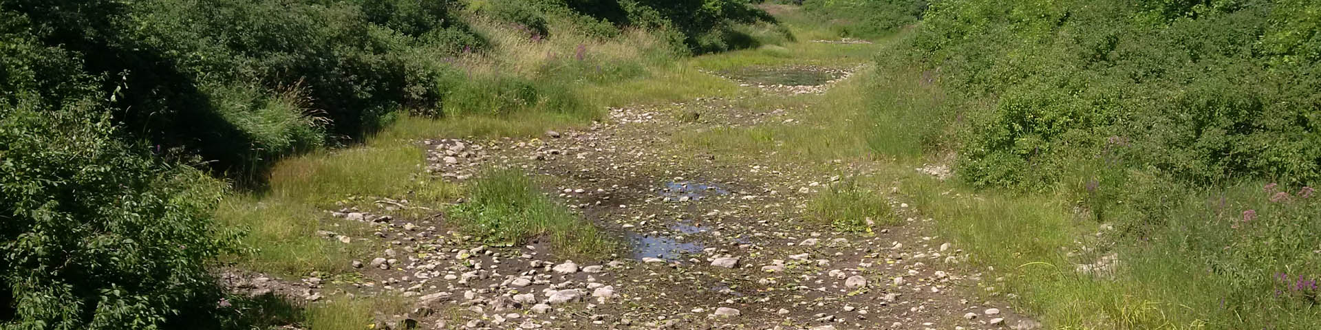
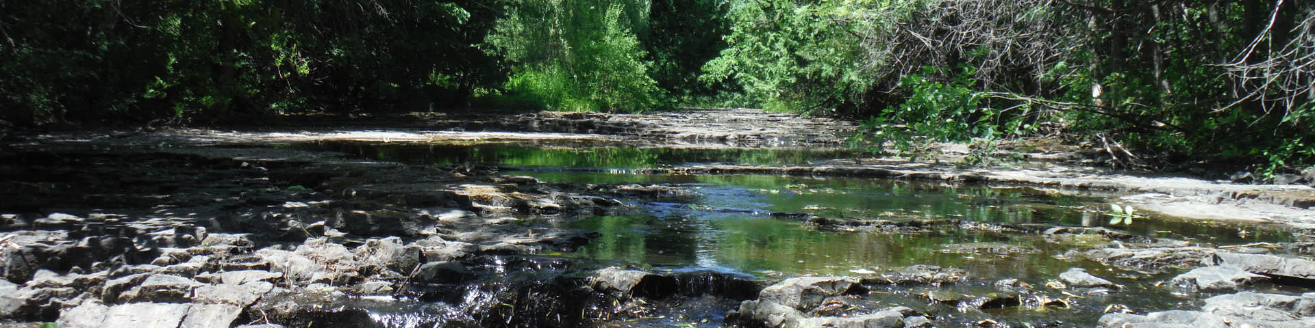
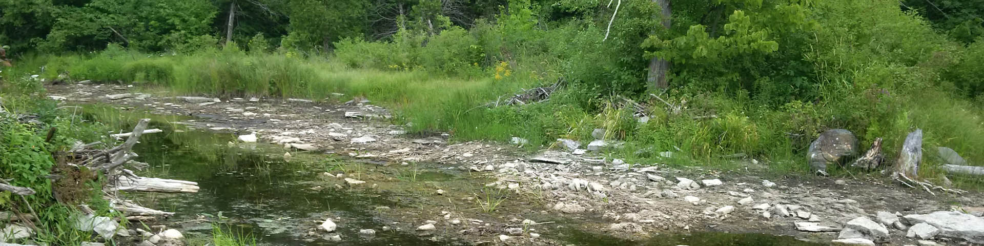
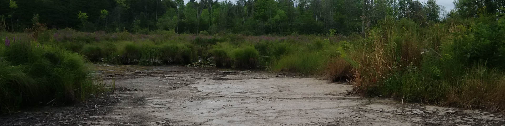
EASTERN ONTARIO, Oct. 17, 2022 – The Mississippi-Rideau Source Protection Region (MRSPR) has released an interactive StoryMap exploring threats to our region’s highly vulnerable aquifers – and what we can do about them.
Readers of all backgrounds and interest levels can use the new StoryMap to explore risks to groundwater through its digital maps, charts and photos.
“Whether you’re interested in the geology behind our groundwater system, the impacts of contamination on your family or what you can do about it, our new StoryMap offers a choose-your-own-adventure to explore a huge range of information,” said Rideau Valley Conservation Authority groundwater scientist Claire Milloy, who wrote and designed the digital product on behalf of the MRSPR.
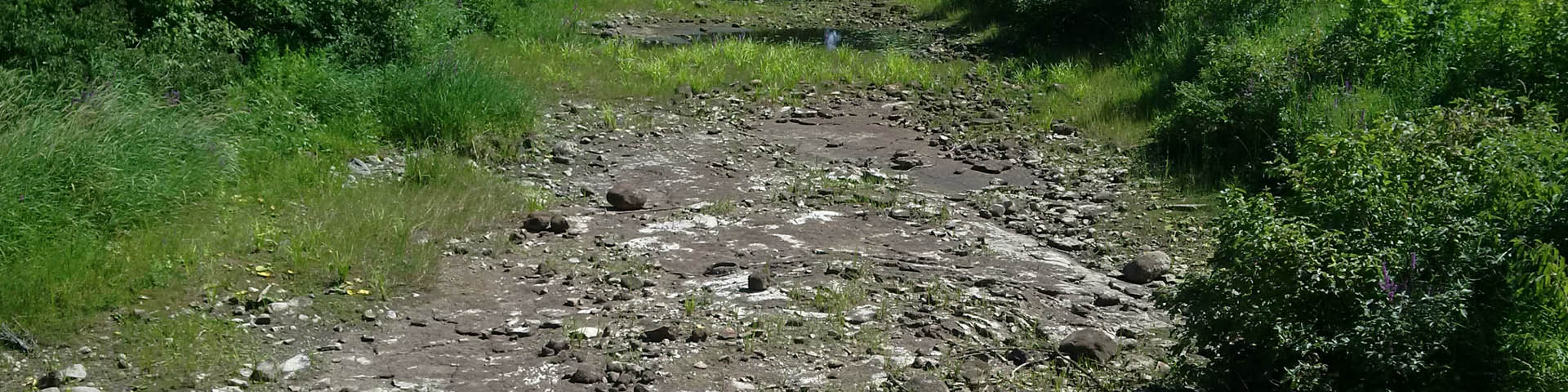
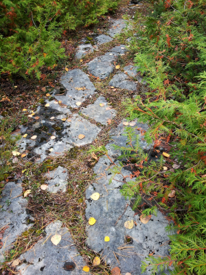
About 90% of drinking water aquifers across the Mississippi and Rideau watersheds are considered highly vulnerable to contamination. These aquifers have very little protection from surface soils, which are necessary to filter chemicals, nutrients and other pollutants out of surface runoff as it trickles down from above.
Cracks in the exposed bedrock can allow contaminants from industrial, agricultural and residential activities to easily enter the groundwater below - and they're sometimes impossible to clean up.
The StoryMap and its accompanying resources were developed in accordance with an MRSPR policy encouraging groundwater threat awareness.
The education package also includes a series of “action sheets” highlighting best practices for homes and businesses, a three-part animated video series developed by the Spring Ridge Training Institute, and an extensive scientific bibliography intended for scientists, researchers, planners and engineers.
“We sincerely hope these resources will help shed some much-needed light on the risks facing our local groundwater supplies,” said Milloy, P. Geo. “It only takes a few minutes to contaminate an aquifer, but it can take hundreds of years to undo the damage – if it can be undone at all.”
The 8,500 km2 MRSPR is one of 19 in Ontario created under the Clean Water Act of 2006, which now operate through local conservation authorities. The MRSPR encompasses the watersheds of the Mississippi and Rideau rivers, and is jointly administered by the Rideau Valley and Mississippi Valley conservation authorities as well as a multi-stakeholder Source Protection Committee.
To learn more about highly vulnerable aquifers visit www.mrsourcewater.ca.
-30-
Local Conservation Authorities expand septic approval services
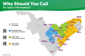
MISSISSIPPI and RIDEAU VALLEY WATERSHEDS, October 5, 2022 – Landowners in several Eastern Ontario municipalities will now receive septic approval services from their local conservation authority.
As of October 1, 2022, the Mississippi Valley and Rideau Valley Conservation Authorities have begun providing septic inspections, reviews and permits on behalf of the following municipalities:
- Township of Beckwith
- Town of Carleton Place
- Township of Lanark Highlands
- Town of Mississippi Mills
- Township of North Grenville
- Town of Smiths Falls
- Town of Westport
These municipalities were formerly serviced by the Leeds, Grenville and Lanark District Health Unit.
The Mississippi Valley and Rideau Valley Conservation Authorities have been providing septic review and approval services in the City of Ottawa and Tay Valley Township for more than 25 years and have knowledgeable and experienced staff to support this increased service area.
“We are pleased to support our local municipalities with septic review and approval services required under the Ontario Building Code,” said Terry Davidson, RVCA Director of Regulations and Chief Building Official for program delivery across the two watersheds. “We look forward to working with contractors and residents to ensure systems are properly installed and repaired with the goal of protecting homeowners and keeping communities healthy and safe.”
The Leeds, Grenville and Lanark District Health Unit will carry out all inspection work for permits received or extended on or before September 30, 2022. Property owners who have previously submitted a septic permit prior to September 30, will continue to have their application overseen by the Health Unit.
Visit www.rvca.ca/septic-approvals for a map of Eastern Ontario to guide you to your local septic approval agent as well as forms, fees, frequently asked questions, and other sewage system resources for landowners and contractors.
-end-
For more information:
Terry Davidson, P. Eng.
Director of Regulations and Chief Building Official
613-692-3571 or 1-800-267-3504 ext. 1107
Part of Chapman Mills trail to close for bridge replacement
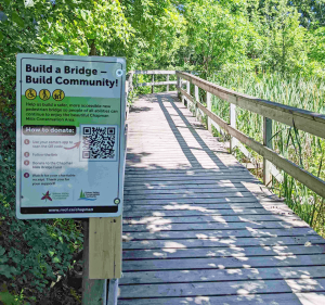
BARRHAVEN, Sept. 27, 2022 – A section of trail at Chapman Mills Conservation Area will close on Monday, Oct. 3 so crews can install a new, state-of-the-art accessible pedestrian bridge this fall.
The current wooden bridge near the northern trailhead of Barrhaven’s most beloved boardwalk has reached the end of its life cycle. Thanks to local donors, several significant grants and support from the Rideau Valley Conservation Foundation (RVCF), the Rideau Valley Conservation Authority has secured the funding to do the work.
The trail will be closed on either side of the bridge for about six weeks. Visitors can still access the docks and picnic shelter from Winding Way Ave. Most of the trail will remain accessible from the southern trail connection beside Vimy Memorial Bridge.
“This is a really exciting project that will improve accessibility and safety at one of our busiest properties,” said Chelsey Ellis, RVCA’s conservation lands manager. “We know the closure will be inconvenient in the short term, but it’ll be worth it.”
The current bridge has several accessibility issues: it’s not wide enough for two people with wheelchairs or strollers to pass, for example, leaving one person to back up beside the path’s steep shorelines. The narrow bridge also led to temporary park closures in the early days of the COVID-19 pandemic because adequate physical distancing couldn’t be maintained – leaving many local residents without their go-to nature escape just when they needed it most.
RVCA staff worked with the RVCF and local accessibility consultant Marnie Peters to ensure the new bridge is built to the gold standard of accessibility – not just the legislated minimums. This includes a wider deck, more gradual slopes, accessible sight lines and longer ramps.
“It’s critical that this urban oasis be as accessible as possible for the local community,” Ellis said. “It’s close to two large seniors’ residences and is located in the middle of a family-friendly suburb. It was time to get this done.”
Individuals can still donate to the bridge project directly at https://www.canadahelps.org/en/dn/73114.
To learn more visit www.rvcf.ca/ways-to-give/chapman-mills-accessible-bridge or contact Chelsey Ellis at .
-30-
Seeking new Chair for Mississippi-Rideau Source Protection Committee
MISSISSIPPI AND RIDEAU WATERSHEDS, September 22, 2022 — The Ministry of the Environment, Conservation and Parks is seeking a dedicated new Chairperson to lead the Mississippi-Rideau Source Protection Committee.
Under the Clean Water Act of 2006, 19 local watershed-based source protection committees have been established across the province. These committees include representatives from local watershed stakeholders such as municipalities, agricultural groups, landowners, industry, environmental organizations and the public at large. As outlined in the legislation, the Minister is responsible for appointing a Chair to each of these committees.
Each committee, under the leadership and guidance of their Chair, is responsible for upholding and implementing the source protection plans that have been developed to protect municipal drinking water systems across Ontario, as well as their terms of reference and assessment reports. Chairs play an important role in guiding their committees in reporting on implementation of these plans and ensuring they remain relevant through future updates.
“If you have leadership experience and an interest in protecting drinking water sources, we encourage you to apply,” said Marika Livingston, Mississippi-Rideau Source Water Protection Project Manager. “We are proud of the work that has been done to ensure our region has a strong safety net to protect our drinking water, but there is more work to be done. We need a leader willing to guide and support our committee as we work though some major program updates and changes.”
Among other qualifications, the Chair position requires a multi-year commitment, an ability to understand scientific and technical reports and attendance at the several Source Protection Committee meetings held each year. Applicants must also live or work in the Mississippi or Rideau watersheds.
Further details regarding this part-time position, including descriptions of roles and responsibilities and an application form, are available online at https://www.pas.gov.on.ca/Home/Advertisement/750. A small per diem as well as expenses (mileage and meals) will be paid while working on Source Protection business.
Applications will be accepted until October 3, 2022.
-30-
Mississippi Valley and Rideau Valley Source Protection Authorities
Marika Livingston, Project Manager
3889 Rideau Valley Drive, PO Box 599
Manotick ON K4M 1A5
613-692-3571 or 1-800-267-3504 ext. 1148
Fall in love with Fall at Foley Mountain

WESTPORT, Sept. 20, 2022 – Cooler nights and shorter days are once again painting our forests the vibrant reds and golds that can only mean one thing: Fall has arrived.
And what better place to embrace your autumnal awe than at Foley Mountain Conservation Area in Westport? With stunning views from Spy Rock Lookout as well as 10 kilometres of trails through forests and wetlands, visitors have endless opportunities to immerse themselves in the season’s wonder.
But as the park’s busiest season ramps up, visitors are wise to plan ahead. To avoid big crowds and make the most of your trip, consider:
- Choosing an off-peak time, like weekdays or early mornings
- Parking further down the park road and hiking back to Spy Rock. The colours are worth it!
- Bringing change for the parking machine, or purchasing ahead with code 5204 on paybyphone.com
- Planning to spend the day and explore the entire park – even some of the more remote trails.
“This is such a spectacular time of year to be outdoors, especially in a forest like ours,” said Foley Mountain site supervisor Rebecca Whitman. “We are thrilled to see a renewed interest in getting outside and embracing nature, but it does mean visitors need to be more prepared during busy times of the year.”
Whitman recommended trying trails beyond the Spy Rock lookout to get your fall colour fix. The Orange Maple Trail, for example, starts at the interpretive centre and offers a spectacular show in the fall with its many towering maple, ash and poplar trees along its 2.3 km loop. Hikers can even follow it back to Spy Rock for a peek at the views before they head home.
The White Pine Trail is a great option for hikers looking for more of a challenge. Parking at the group camping site, they can connect to White Pine using the Blue Trail. From there, they’ll find towering white pines and stunted oak trees high on the ridge, mixed with excellent fall foliage as they pick their way back down the mountain.
"It's a beautiful part of the park to go into," said Whitman.
Foley's colours usually peak around Thanksgiving, give or take a week. Please bring a mask for crowded areas and follow all directional signage on the trails. If you are feeling ill or have been told to isolate, please stay home.
For more information about visiting Foley Mountain in the fall visit www.rvca.ca/foley-fall-colours or email . You can also follow us on Facebook at @FoleyMountain or @RideauValleyConservationAuthority. You can also follow @RideauValleyCA on Twitter and Instagram.
-30-
Van Gaal Drain Hazard Land and Regulations Mapping Update - Public Consultation and Open House
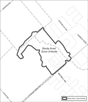
OTTAWA, September 14, 2022 – The RVCA is concluding work updating floodplain mapping along the realigned portion of the Van Gaal Drain in the Village of Richmond.
Members of the public are invited to review the draft regulation and hazard maps during the public consultation period between September 12 to October 14, 2022. Draft mapping is available online at www.rvca.ca/vangaal and members of the public can connect with an RVCA Resource Specialist to understand how the mapping may affect their property. RVCA Resource Specialists can be reached by email () or phone (613-692-3571 or 1-800-267-3504 ext. 1132 or 1193).
A public open house will also take place on October 5, 2022 from 4:30 to 8 p.m. at the Richmond Memorial Community Centre (6095 Perth Street, Richmond).
The new mapping shows areas that are subject to natural hazards such as flooding and unstable slopes. The mapping will be used by the City of Ottawa when updating its Official Plans and Zoning Schedules and in the review of development applications under the Planning Act. RVCA will also use the mapping to guide the review of development applications submitted under the RVCA’s Development, Interference with Wetlands and Alterations to Shorelines and Watercourses Regulation.
The goal of this mapping is to help ensure that sound planning decisions are made — keeping people and property safe.
— end —
Van Gaal Drain Hazard Mapping Update
Project Status: Active
Posted: September 12, 2022 The Rideau Valley Conservation Authority, in collaboration with the City of Ottawa, has recently embarked on a hazard mapping update for the realigned Van Gaal Drain in the Village of Richmond. This mapping identifies changes to flood prone areas and where new development is to be allowed, restricted or prohibited in accordance with provincial and municipal planning policies.
These maps have been traditionally known as “floodplain mapping” or “regulation mapping” and they show areas that are prone to natural hazards such as flooding, erosion and natural environment features such as wetlands.
Mapping and regulating natural hazard areas ensure safe and sustainable development. Development projects within these areas must obtain permission from the Conservation Authority before proceeding (Ontario Regulation 174/06, Development, Interference with Wetlands and Alteration to Shorelines and Watercourses). When completed, the mapping will also be used by the City of Ottawa when updating their Official Plan and Zoning Schedules and in the review of development applications under the Planning Act.
The Rideau Valley Conservation Authority (RVCA) invites you to participate in the public consultation process regarding this mapping update from September 12 to October 14, 2022.
You can participate by viewing draft maps online (see links below) and by contacting an RVCA Resource Specialist (phone 613-692-3571, toll-free at 1-800-267-3504 ext. 1132 or 1193, email . You can also join us at our public open house.
Van Gaal Drain Hazard Land and Regulations Mapping Open House
Richmond Memorial Community Centre (Seniors’ Room)
6095 Perth Street, Richmond
Wednesday, October 5, 2022
4:30 to 8 p.m.
This consultation period and open house offer the opportunity for RVCA staff to respond to any questions that you may have regarding the mapping and collect your input about local conditions.
Draft Map
Interactive Map - Click here to view the interactive map full screen
The interactive map allows you to zoom in to a specific property and get very specific digital informaiton. Need help? Have questions? Call a Resource Specialist at 613-692-3571 or 1-800-267-3504 ext. 1132 or 1193 or email us at .
Need help? Have questions? Call a Resource Specialist at 613-692-3571 or 1-800-267-3504 ext. 1132 or 1193 or email us at .
Technical Report
Download J.F. Sabourin and Associates Inc. report:
Richmond Village Development / Proposed Realignment of Van Gaal Drain
EOconservation
 Your Eastern Ontario conservation authorities were thrilled to be back at the Plowing Match to showcase the many ways we help communities protect their natural resources while steering clear of natural hazards. On this page you’ll find links to your local conservation authority, which will take you to information about stewardship grants, planning and regulations, conservation areas and more. Below, you’ll also find some key digital resources to help you implement best practices on your own property.
Cataraqui Region Conservation Authority
Cataraqui Region Conservation Authority

Visit our website to learn more at https://cataraquiconservation.ca/
Cataraqui Conservation has jurisdiction over 3,800 sq. km of land from Greater Napanee in the west to Brockville in the east. In all there are 11 watersheds in our jurisdiction. Cataraqui Conservation's core mandate is to work in partnership with local municipalities, provincial and federal government agencies, environmental organizations and the general public to monitor and protect water, natural habitats, shorelines, and promote sustainable living in the community.
Crowe Valley Conservation
Crowe Valley Conservation
![]()
Visit our website to learn more at https://www.crowevalley.com/
Crowe Valley Conservation Authority (CVCA) watershed covers an area of approximately 2,006 km2, and is comprised of three primary sub-watersheds: the Crowe River, North River and Beaver Creek. Numerous wetlands, natural riverbank corridors and forests are intertwined throughout the watershed, providing essential habitat to many species of fish, mammals, birds, reptiles, amphibians and insects that thrive in this region.
For over 60 years, Crowe Valley Conservation Authority has worked in partnerships with its member municipalities, the Ministry of Natural Resources and Forestry and the Ministry of Environment, Conservation and Parks. CVCA water management dates back to the late 1950s and has continued to evolve and adapt according to climate change conditions that have been observed and recorded.
Mississippi Valley Conservation Authority
Mississippi Valley Conservation Authority
![]()
Visit our website to learn more at https://mvc.on.ca/
The Mississippi River is 200 km in length. Draining over 250 lakes and wetlands, the watershed encompasses an area of 3,750 km². From its headwaters at Mazinaw Lake to its confluence at the Ottawa River near Fitzroy Harbour, the river drops 210 m in elevation.
The Mississippi River watershed is home to incredible natural heritage features such as wetlands, areas of natural and scientific interest (ANSIs), woodland and natural heritage systems.
Otonabee Region Conservation Authority
Otonabee Region Conservation Authority

Visit our website to learn more at https://www.otonabeeconservation.com/
Otonabee Conservation is a locally-focused, community-based environmental agency that protects, restores, and manages the natural resources within the Otonabee Region watershed. We work with our eight member municipalities to create a healthy, environmentally diverse watershed that improves the quality of life for residents, makes our area more appealing to visitors and new business, and helps to ensure a more vibrant regional economy.
Quinte Conservation Authority
Quinte Conservation Authority
![]()
Visit our website to learn more at https://www.quinteconservation.ca/
We are a local watershed based not-for-profit environmental protection agency. Our services are focused on protecting people and property from the dangers of natural hazards. One of our main roles is to provide flood forecasting and low water information to municipalities and residents within our jurisdiction. Our natural boundaries include the drainage basins of the Moira, Napanee, and Salmon Rivers and all of Prince Edward County.
Raisin Region Conservation Authority
Raisin Region Conservation Authority
Visit our website to lear more at https://rrca.on.ca/
The RRCA was established on October 10, 1963 and included the Raisin River watershed and its tributaries. It was enlarged on February 29, 1968 to include Hoople Creek, Riviere Delisle and Riviere au Beaudet. The most recent enlargement occurred in 2003, with the addition of the headwaters of the Rigaud River within the Township of North Glengarry.
The RRCA has five member municipalities: the Townships of North Glengarry, South Glengarry, North Stormont, South Stormont, and the City of Cornwall. There are eight members on the Board of Directors: two from the City of Cornwall, South Stormont and South Glengarry, and one from North Stormont and North Glengarry.
Rideau Valley Conservation Authority
Rideau Valley Conservaiton Authority![]()
Visit our website to learn more at https://www.rvca.ca/
The Rideau River drains an area of over 4,000 square kilometres of Eastern Ontario. The main stem of the river flows in a northerly direction from Upper Rideau Lake near Newboro to the City of Ottawa where it tumbles over Rideau Falls into the Ottawa River. Total length of the longest part of the watershed is about 180 kilometres. From the highest point in the valley (Carnahan Lake in the Tay sub-watershed) to the Ottawa River is a drop of 204 metres in elevation. About 620,000 people live in the watershed including a large part of the City of Ottawa, the fourth largest metropolitan area in Canada. There are 18 municipalities within the valley and most people, outside of Ottawa, draw their drinking water from the river or from groundwater.
South Nation Conservation
South Nation Conseration ![]()
Visit our website to learn more at https://www.nation.on.ca/
SNC protects, restores and manages 4,441 km2 of land in Eastern Ontario; employs more than 40 staff; and has lead hundreds of stewardship projects to success. regional ecosystems. It does this in partnership with its 16 watershed municipalities, comprising portions of: the United Counties of Prescott and Russell; United Counties of Stormont, Dundas and Glengarry; United Counties of Leeds and Grenville; and the City of Ottawa. The member municipalities appoint a 12-member, plus past chair, Board of Directors to govern all of our work. We carry out our mandate to manage the natural resources in the watershed, with the help of many forward-thinking individuals, groups, and agencies.
Not from Eastern Ontario? Click here to search with your postal code.
How to Submit Digital Paperwork
![]()
![]()
How to submit digital paperwork:
- Access all forms and fee information by clicking here.
- Be sure that the application is in PDF format (including photos).
- Consider using apps such as Turbo Scan that convert jpeg photos into PDF documents.
- Upgrading software on office desktop to Adobe Pro to be able to edit PDF documents.
2. Electronic files that accompany the email request/instruction must be applied as an ATTACHMENT.
3. Email your application to the intake email address identified by your municipality listed here.
4. Watch for payment details. Directions on how to make payment will be sent to your inbox. Please note, payments must be received to activate the permitting process.