

Super User
Flood Watch and Water Safety: Significant Rain Expected to Increase Water Levels Throughout the Rideau Valley
(WCS - 10/2023)
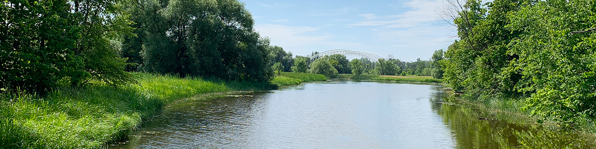
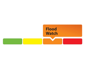
April 28, 2023 – The Rideau Valley Conservation Authority is maintaining a FLOOD WATCH for properties around Bobs Lake and Christie Lake and issuing a WATER SAFETY for the entire Rideau Valley Watershed.
Environment Canada is forecasting significant rainfall starting on Saturday April 29, and continuing through next Tuesday. This forecasted rainfall is expected to cause all water levels and flows to increase throughout the Rideau Valley Watershed. Except as noted below, most water levels and flows are currently at seasonal levels, so it is expected that this rain event will not cause any significant flooding, but it could cause localized flooding in small watercourses, urban areas and ditches.
The water levels on Bobs and Christie Lakes are near lake capacity and water levels are expected to increase with this rain event and may approach flood levels. Parks Canada staff are closely monitoring the water levels in these lakes, and operations at the Bolingbroke Dam will take place as required to balance the levels in Bobs Lake and Christie Lake.
The RVCA reminds the public to exercise extreme caution around all waterbodies and remind children about the dangers of playing near open water. Residents are reminded to make sure their sump pumps are in good working condition and to help reduce ponding by keeping ditches, culverts, and storm drains clear of obstructions.
This watershed conditions statement is in effect until Tuesday, May 9, 2023 at 5 PM and will be updated at that time unless the forecast or conditions change.
-end-
More Information:
Contact: Brian Stratton, RVCA Manager Engineering Services
Rideau Valley Conservation Authority
613-692-6804, 1-800-267-3504 ext. 1141
www.rvca.ca/watershed-conditions
"Rideau Valley Conservation Authority is a partnership of municipalities within the Rideau Valley watershed
created under the Conservation Authorities Act to deliver a range of programs in watershed management and
natural resource conservation."
RVCA Watershed Conditions Statements:
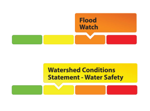
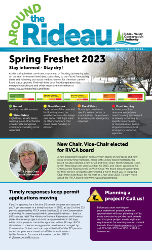
- Water Safety – High flows, unstable banks, melting ice or other factors that could be dangerous for recreational users such as anglers, canoeists, hikers, children, pets, etc. Flooding is not expected.
- Flood Outlook – Early notice of the potential for flooding based on weather forecasts, calling for heavy rain, snow melt, high winds or other conditions that could lead to high runoff, cause ice jams and/or lakeshore flooding or erosion.
- Flood Watch – Flooding is possible in specific watercourses or municipalities. Municipalities, emergency services and individuals in flood prone areas should prepare.
- Flood Warning – Flooding is imminent or already occurring in specific watercourses or municipalities.
Flood data collection begins on four Rideau Valley lakes
RIDEAU VALLEY WATERSHED, April 28, 2023 – Work is underway to collect flood hazard data on four upper watershed lakes.
Beginning this May, the Rideau Valley Conservation Authority (RVCA) will be collecting important data that will inform future flood mapping projects on Lower Rideau, Big Rideau, Bobs and Otty Lakes, in co-operation with local municipalities. RVCA has contracted Water’s Edge Environmental Solutions Team to be on the lakes throughout the Spring and Fall of 2023.
This data collection is the first phase of a larger initiative to complete natural hazard mapping around the lakes. Water’s Edge will survey topography surrounding the lakes to verify recent LiDAR analyses, lake bathymetry, bridges, culverts, and nearby channel cross-sections while also documenting and assessing land uses, precipitation, historic high water marks, and water levels and flows. They will also document water control structures, their operating policies and their operational history. The data will be analysed in future projects to develop robust hazard mapping reports.
The RVCA received $160,000 in funding from the federal Flood Hazard Identification and Mapping Program (FHIMP) to cover up to half of the project’s total cost. The funding program was announced in 2022 to increase the number and quality of publicly accessible flood maps across Canada as extreme weather drives more severe flooding in communities across the country.
Mapping the flood hazards in these lakes will reduce impacts on people and property by promoting responsible land use planning, directing development away from flood prone areas and enhancing the RVCA’s flood forecasting and warning program.
While the surveyors will likely not need to access private property to carry out their work, they will be visibly active on the lakes during shoulder seasons throughout 2023. Waterfront residents can expect to see their boat moving slowly along shorelines and sometimes weaving back and forth to collect lakebed data. They may also be spotted on roadsides as they document bridges, culverts and other man-made structures.
Conservation Authorities are responsible for mapping natural hazards including flooding under the Conservation Authorities Act. While many urban parts of the Rideau Valley watershed have been mapped over the past 60 years, this is the first time these lakes are being formally mapped for flood hazards.
The hazard maps will also help RVCA comment on municipal planning files with respect to their impact on flooding, erosion and other natural hazards, and will help direct development away from floodplains and hazard areas in our own permitting program for work near watercourses and wetlands.
To learn more about our hazard mapping program visit https://www.rvca.ca/watershed-monitoring-reporting/reporting/flood-risk-mapping-reports.
-30-
(WCS - 09/2023)
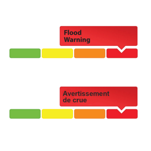
April 25, 2023 – The Rideau Valley Conservation Authority is terminating the FLOOD WARNING that was previously in effect and issuing a FLOOD WATCH for properties around Bobs Lake and Christie Lake.
The water levels on Bobs and Christie Lakes continue to decline but these lakes are near capacity and water levels may still increase with any significant rain. The current forecast indicates between 25 mm and 45 mm of rain could fall between Saturday and next Tuesday. Parks Canada staff are closely monitoring the water levels in these lakes, and operations at the Bolingbroke Dam will take place as required to balance the levels in Bobs Lake and Christie Lake.
Water levels are now near seasonal in the rest of the Rideau Valley Watershed.
Everyone should remain cautious around lakes and streams as water levels continue to fluctuate. Children should be reminded of the hazards and adequately supervised around all watercourses.
This watershed conditions statement is in effect until Tuesday, May 9, 2023 and will be updated at that time unless the forecast or conditions change.
-end-
More Information:
Contact: Brian Stratton, RVCA Manager Engineering Services
Rideau Valley Conservation Authority
613-692-6804, 1-800-267-3504 ext. 1141
www.rvca.ca/watershed-conditions
"Rideau Valley Conservation Authority is a partnership of municipalities within the Rideau Valley watershed
created under the Conservation Authorities Act to deliver a range of programs in watershed management and
natural resource conservation."
RVCA Watershed Conditions Statements:
- Water Safety – High flows, unstable banks, melting ice or other factors that could be dangerous for recreational users such as anglers, canoeists, hikers, children, pets, etc. Flooding is not expected.
- Flood Outlook – Early notice of the potential for flooding based on weather forecasts, calling for heavy rain, snow melt, high winds or other conditions that could lead to high runoff, cause ice jams and/or lakeshore flooding or erosion.
- Flood Watch – Flooding is possible in specific watercourses or municipalities. Municipalities, emergency services and individuals in flood prone areas should prepare.
- Flood Warning – Flooding is imminent or already occurring in specific watercourses or municipalities.
Chapman Mills trail reopens with new accessible bridge
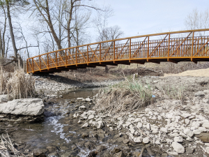
BARRHAVEN, April 21, 2023 – The trail at Chapman Mills Conservation Area has fully reopened just in time for spring – and it’s more accessible than ever.
A new pedestrian span was installed overnight on Sunday, March 19, replacing the old wooden bridge that had reached the end of its lifecycle. The new bridge is wider with more accessible slopes and railings. The ramps on either end are also longer and safer.
“We are thrilled to reopen with even more accessibility and safety features at one of our busiest properties,” said Chelsey Ellis, RVCA’s conservation lands manager. “We thank the community for their patience while we completed this critical project.”
The 23-acre conservation area on the shores of the Rideau River is in walking distance from two seniors’ residences and surrounded by family-friendly neighbourhoods. While the trail still includes some steep slopes, the new pedestrian bridge will allow people of all ages and abilities to more fully enjoy the site’s 1.5 kilometre boardwalk trail, which connects to multi-use pathways south of Vimy Memorial Bridge.
The Rideau Valley Conservation Foundation (RVCF) secured the funding to complete the project, including $150,000 from the Government of Canada through the Federal Economic Development Agency for Southern Ontario.
Local donations and community support were also key to bringing the project to life.
RVCA staff have been working with renowned accessibility consultant Marnie Peters to create a matrix of the world’s best outdoor accessibility solutions and apply them to all infrastructure projects going forward. Another accessible bridge project is also underway at Baxter Conservation Area south of Manotick.
To learn more about the Chapman Mills project visit www.rvcf.ca/ways-to-give/chapman-mills-accessible-bridge or contact Chelsey Ellis at .
To plan your visit to Chapman Mills visit https://www.rvca.ca/conservation-areas/no-fee-required/chapman-mills-ca.
About Chapman Mills Conservation Area:
Chapman Mills Conservation Area is located on the west bank of the Rideau River on Prince of Wales Drive between Winding Way and Lodge Road. It consists mainly of natural river shoreline, wetlands and flood plain areas that are unique in the City of Ottawa.
Visitors can enjoy a covered picnic shelter, scenic lookouts, walkways and boardwalks that lead pedestrians on a 1.5 km stroll through some sensitive and beautiful habitats. Interpretive signs along the way tell the site’s environmental story. At the trail’s north end visitors can also enjoy an accessible dock for launching canoes, kayaks and other paddlecrafts, as well as a viewing platform. The south end has a shoreline entrance for paddlecrafts. Parking is located off Winding Way.
The land for Chapman Mills Conservation Areas was a gift to the people of the Rideau Valley from the South Nepean Development Corporation, along with additional land ceded from Parks Canada. Minto Development Inc. provided the development funds necessary to carry out the improvements for public use of Chapman Mills Conservation Area.
-30-
UPDATE #1: Flood Warning — Lower Ottawa River | Mise à jour no 1 : Avertissement de crue – Cours inférieur de la rivière des Outaouais
Water Conditions Statement: Flood Warning — Lower Ottawa River
April 20, 2023 — This FLOOD WARNING statement is an update to the Flood Warning issued for areas along the Lower Ottawa River (Arnprior to Hawkesbury) on April 17th, 2023.
Water levels are expected to continue rising within the Ottawa River Basin due to snowmelt, combined with forecasted rainfall starting Friday and continuing over the weekend.
Most of the water currently entering the Ottawa River is originating in areas where there are no reservoirs or retention capacity. The Ottawa River Regulating Committee is managing principal reservoirs to reduce river flows to downstream areas.
The Ottawa River Regulating Committee anticipates that water levels along the main stem will continue increasing over the next few days before stabilizing near the major flood level, impacting several streets, lawns and houses in low-lying areas. Flood levels are expected to remain well below historic high flood levels.
Impacted locations include flood-prone areas at Chats Lake, Constance Bay area, Britannia / Lac Deschênes, Cumberland, City of Clarence-Rockland, Township of Alfred Plantagenet, and other vulnerable areas down to Montreal.
MVCA - Areas of Concern:
- Water levels in the Constance Bay area are expected to rise by about 0.15 m within the next day and remain high for over the next four to five days.
RVCA - Areas of Concern:
- Water levels in the Britannia area (Grandview Road and the Belltown Community) are expected to rise by about 0.20 m above the current elevation* over the next 2-3 days.
- Water levels east of Cumberland Village (Boise Village, Morin Road, Leo Lane) are expected to rise by about 0.25 m above the current elevation* over the next 2-3 days.
SNC - Areas of Concern:
Water levels in the Rockland area are expected to rise by about 0.45 m above the current elevation* over the next 2-3 days.
MNRF - Areas of Concern:
Water levels in the Hawkesbury area are expected to rise by about 0.40 m above the current elevation* over the next 2-3 days.
* Current elevation as of 6:00 a.m., Thursday, April 20, 2023.
Peak river conditions remain dependent on snowmelt and rainfall amounts. The rain event forecasted this weekend will add water to the river at a time when flows are near flood thresholds.
There is uncertainty on the rainfall amounts and the areas that could be affected. It should be noted that water level forecasts do not account for wind and wave impacts.
Residents in flood-prone areas are encouraged to closely follow changing conditions and to take necessary measures. Residents are advised to stay away from watercourses where flows are high and where banks might be unstable. Parents are encouraged to explain dangers to children and provide appropriate supervision around all waterbodies.
The Mississippi Valley, Rideau Valley, and South Nation Conservation Authorities monitor water levels and weather forecasts with the Ministry of Natural Resources and Forestry as part of the Flood Forecasting and Warning Program. Updates are provided as conditions change.
The Ottawa River Regulating Committee will be reassessing forecast conditions and providing hydrological condition updates on its website daily at www.ottawariver.ca/forecasts.
To view current flood warnings across Ontario, visit: www.ontario.ca/law-and-safety/flood-forecasting-and-warning-program.
This FLOOD WARNING STATEMENT is in effect until April 28, 2023 at 5:00 PM.
FOR MORE INFORMATION:
Brian Stratton
RVCA Manager Engineering Services
613-692-3571 or 1-800-267-3504 ext. 1141
Definitions:
- Water Conditions Statement: Water Safety: indicates that high flows, melting ice or other factors could be dangerous for such users as boaters, anglers and swimmers but flooding is not expected.
- Water Conditions Statement: Flood Outlook: gives early notice of the potential for flooding based on weather forecasts calling for heavy rain, snow melt, high winds or other conditions.
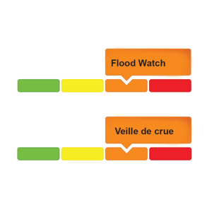
- Flood Watch: potential for flooding exists within specific watercourses and municipalities.
- Flood Warning: flooding is imminent or occurring within specific watercourses and municipalities.
-end-
Déclaration sur l’état de la rivière, mise à jour no 1 : Avertissement de crue: - Cours inférieur de la rivière des Outaouais
20 avril 2023 —
Cet déclaration de AVERTISSEMENT DE CRUE est une mise à jour de l'avertissement de crue émise pour les secteurs situés le long du cours inférieur de la rivière des Outaouais (d’Arnprior à Hawkesbury) le 17 avril 2023.
On s’attend à ce que les niveaux d'eau continuent d’augmenter dans le bassin de la rivière des Outaouais en raison de la fonte des neiges, combinée aux précipitations prévues à partir de vendredi et pendant la fin de semaine.
La majeure partie de l’eau qui pénètre actuellement dans la rivière des Outaouais provient de régions où il n’y a pas de réservoirs ou de capacité de rétention. Le Comité de régularisation de la rivière des Outaouais gère les principaux réservoirs afin de réduire le débit de la rivière vers les zones en aval.
Le Comité de régularisation de la rivière des Outaouais prévoit que les niveaux d’eau le long continuera à augmenter au cours des prochains jours avant de se stabiliser près des seuils d’inondation majeure, ce qui aura des répercussions sur plusieurs rues, pelouses et maisons dans les zones basses. On s’attend à ce que les niveaux d’inondation demeurent bien en deçà des niveaux d'inondation historiques les plus élevés.
Les endroits touchés comprennent les secteurs sujets aux inondations du lac des Chats, de la région de la baie Constance, de Britannia / Lac Deschênes, de Cumberland, de la Cité de Clarence-Rockland, du canton d’Alfred et Plantagenet et d’autres zones vulnérables jusqu’à Montreal.
Secteurs préoccupants – MVCA :
-
Les niveaux d’eau dans la région de la baie de Constance devraient augmenter d’environ 0,15 m au-dessus du niveau actuel* au cours de la journée suivante et rester élevés au cours des quatre ou cinq jours suivants.
Secteurs préoccupants - RVCA :
- Les niveaux d’eau dans le secteur de Britannia (chemin Grandview et communauté de Belltown) devraient augmenter d’environ 0,20 m au-dessus du niveau actuel* au cours des 2-3 prochains jours.
- Les niveaux d’eau à l’est du village de Cumberland (village de Boise, chemin Morin, ruelle Leo) devraient augmenter d’environ 0,25 m au-dessus du niveau actuel* au cours des 2-3 prochains jours.
Secteurs préoccupants – CNS :
- Les niveaux d’eau dans la région de Rockland devraient augmenter d’environ 0,45 m au-dessus du niveau actuel* au cours des 2-3 prochains jours.
Secteurs préoccupants - MNRF :
- Les niveaux d’eau dans la région de Hawkesbury devraient augmenter d’environ 0,40 m au-dessus du niveau actuel* au cours des 2-3 prochains jours.
* Niveau actuel à 6 h, le jeudi 20 avril 2023.
Les conditions de pointe de la rivière dépendent toujours de la fonte des neiges et des quantités de précipitations. Un épisode de pluie est prévu en fin de semaine, qui ajoutera de l'eau à la rivière à un moment où les débits sont proches des seuils d'inondation.
Les quantités de pluie et les zones susceptibles d'être touchées sont incertaines. Il convient de noter que les prévisions de niveau d'eau ne tiennent pas compte de l'impact du vent et des vagues.
Les résidents des zones sujettes aux inondations sont invités à suivre de près l’évolution des conditions et à prendre les mesures nécessaires. Il est conseillé aux résidents de rester à l’écart des cours d’eau où les débits sont élevés et où les berges pourraient être instables. On demande aux parents d'expliquer ces dangers à leurs enfants et d'assurer une surveillance appropriée autour de tous les cours d'eau.
Les offices de protection de la nature de la vallée de la Mississippi, de la vallée de la Rideau et de la Nation Sud surveillent les niveaux d'eau et les prévisions météorologiques avec le ministère des Richesses naturelles et des Forêts dans le cadre du programme de prévision et d'alerte des crues. Des mises à jour sont émises au fur et à mesure que les conditions changent.
Le Comité de régularisation de la rivière des Outaouais réévaluera les conditions prévues et publiera des mises à jour sur l’état de la rivière sur son site Web tous les jours à www.ottawariver.ca/forecasts.
Pour consulter les avertissements d’inondation actuels en Ontario, visitez : www.ontario.ca/law-and-safety/flood-forecasting-and-warning-program.
La présente DÉCLARATION D'AVERTISSEMENT DE CRUE est en vigueur jusqu’au 28 avril 2023 à 17 h 00.
POUR PLUS D’INFORMATIONS :
Brian Stratton
RVCA Manager Engineering Services
613-692-3571 or 1-800-267-3504 poste 1141
Définitions :
- Communiqué sur les conditions des bassins versants – Sécurité aquatique : indique que des débits forts, de la glace fondante ou d’autres facteurs peuvent être dangereux pour des utilisateurs comme les plaisanciers, les pêcheurs à la ligne et les baigneurs, mais qu’une crue n’est pas prévue.
- Communiqué sur les conditions des bassins versants – Perspective de crue :préavis de crue possible basé sur des prévisions de pluies abondantes, de fonte des neiges, de forts vents ou autre.
- Veille de crue :possibilité de crue pour des cours d’eau et municipalités spécifiques.
- Avertissement de crue : crue immimente ou en cours pour des cours d’eau et
municipalités spécifiques.
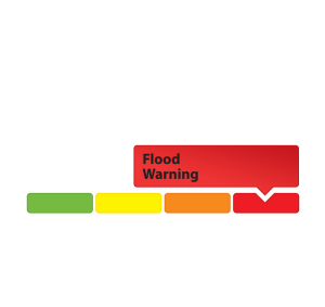
Flood Warning – Update #3: Water Levels Continue to Decline Across the Rideau Valley Except in Upper Watershed Lakes
(WCS - 08/2023)
April 18, 2023 – The previous Flood Warning and Flood Watch messages issued on April 6th, 8th and 11th 2023 are being updated to reflect current conditions. Unlike the Ottawa River Watershed which is currently experiencing high water conditions, the water levels and flows in the Rideau Valley Watershed are declining and approaching seasonal levels in all waterways except for Bobs Lake and Christie Lake.
These lakes are near capacity and although the water level increases are now almost stabilized, the water levels may still increase with any significant rain. The current forecast indicates between 25 mm and 35 mm of rain could fall next Sunday. As such, the water levels in Bobs Lake and Christie Lake will likely increase due to the forecasted rain. Parks Canada staff are closely monitoring the water levels in these lakes, and operations at the Bolingbroke Dam will take place as required, to balance the levels in Bobs Lake and Christie Lake.
At this time, a FLOOD WARNING is being maintained for properties around Bobs Lake and Christie Lake.
The FLOOD WATCH issued on April 6th, 2023 for the properties around Big Rideau Lake is now over.
Residents in flood-prone or low-lying areas that are historically susceptible to flooding should take the necessary precautions to protect their property, such as:
- Ensuring sump pump is clear, in good working condition and has a backwater valve
- Ensuring easy access to a portable backup generator and pump
- Ensuring downspouts are clear and the outlet is at least 3 metres from the dwelling
- Securing items that might float away as flows increase
- Removing valuable items from basements or lower floors that could be subject to flooding
- Keeping emergency phone numbers handy
- Familiarizing yourself with your municipality’s Emergency Preparedness Plan
This watershed conditions statement is in effect until Friday, April 28, 2023 and may be updated at that time unless the forecast or conditions change.
- end -
More Information:
Contact: Brian Stratton, RVCA Manager Engineering Services
Rideau Valley Conservation Authority
613-692-6804, 1-800-267-3504 ext. 1141
www.rvca.ca/watershed-conditions
"Rideau Valley Conservation Authority is a partnership of municipalities within the Rideau Valley watershed
created under the Conservation Authorities Act to deliver a range of programs in watershed management and
natural resource conservation."
RVCA Watershed Conditions Statements:
- Water Safety – High flows, unstable banks, melting ice or other factors that could be dangerous for recreational users such as anglers, canoeists, hikers, children, pets, etc. Flooding is not expected.
- Flood Outlook – Early notice of the potential for flooding based on weather forecasts, calling for heavy rain, snow melt, high winds or other conditions that could lead to high runoff, cause ice jams and/or lakeshore flooding or erosion.
- Flood Watch – Flooding is possible in specific watercourses or municipalities. Municipalities, emergency services and individuals in flood prone areas should prepare.
- Flood Warning – Flooding is imminent or already occurring in specific watercourses or municipalities.
Flood Warning — Lower Ottawa River | Avertissement de crue – Cours inférieur de la rivière des Outaouais

Water Conditions Statement: Flood Warning — Lower Ottawa River
April 17, 2023 —This FLOOD WARNING statement is an update to the Flood Watch issued for areas along the Lower Ottawa River (Arnprior to Hawkesbury) on April 14th, 2023.
Water levels are expected to continue rising within the Ottawa River Basin due to increased snowmelt associated with above normal snowpack and high temperatures over the weekend.
Most of the water currently entering the Ottawa River is originating in areas where there are no reservoirs or retention capacity. The Ottawa River Regulating Committee is managing principal reservoirs to reduce river flows to downstream areas.
The Ottawa River Regulating Committee anticipates that water levels along the main stemof the Ottawa River are expected to exceed major flood levels, impacting several streets, lawns and houses in low-lying areas. Flood levels are expected to remain well below historic high flood levels.
Impacted locations include flood-prone areas at Chats Lake, Constance Bay area, Britannia / Lac Deschênes, Cumberland, City of Clarence-Rockland, Township of Alfred Plantagenet and other vulnerable areas down to Montreal.
MVCA - Areas of Concern:
- Water levels in the Constance Bay area are expected to rise by about 0.7 m above the current elevation* over the next 2-3 days.
RVCA - Areas of Concern:
- Water levels in the Britannia area (Grandview Road and the Belltown Community) are expected to rise by about 0.65 m above the current elevation* over the next 2-3 days.
- Water levels east of Cumberland Village (Boise Village, Morin Road, Leo Lane) are expected to rise by about 1.0 m above the current elevation* over the next 2-3 days.
SNC - Areas of Concern:
Water levels in the Rockland area are expected to rise by about 1.0 m above the current elevation* over the next 2-3 days.
MNRF - Areas of Concern:
Water levels in the Hawkesbury area are expected to rise by about 0.50 m above the current elevation* over the next 2-3 days.
* Current elevation as of 9 a.m., Monday, April 17, 2023.
Peak river conditions remain dependent on snowmelt and rainfall amounts. A rainfall event is forecasted next weekend that will add water to the river at a time when flows are near flood thresholds. There is uncertainty on the rainfall amounts and the areas that could be affected.
Residents in flood-prone areas are encouraged to closely follow changing conditions and to take necessary measures. Residents are advised to stay away from watercourses where flows are high and where banks might be unstable. Parents are encouraged to explain dangers to children and provide appropriate supervision around all waterbodies.
The Mississippi Valley, Rideau Valley, and South Nation Conservation Authorities monitor water levels and weather forecasts with the Ministry of Natural Resources and Forestry as part of the Flood Forecasting and Warning Program. Updates are provided as conditions change.
The Ottawa River Regulating Committee will be reassessing forecast conditions and providing hydrological condition updates on its website daily at www.ottawariver.ca/forecasts.
To view current flood warnings across Ontario, visit: www.ontario.ca/law-and-safety/flood-forecasting-and-warning-program.
This FLOOD WARNING STATEMENT is in effect until April 28, 2023 at 5:00 PM.
FOR MORE INFORMATION:
Brian Stratton
RVCA Manager Engineering Services
613-692-3571 or 1-800-267-3504 ext. 1141
Definitions:
- Water Conditions Statement: Water Safety: indicates that high flows, melting ice or other factors could be dangerous for such users as boaters, anglers and swimmers but flooding is not expected.
- Water Conditions Statement: Flood Outlook: gives early notice of the potential for flooding based on weather forecasts calling for heavy rain, snow melt, high winds or other conditions.
- Flood Watch: potential for flooding exists within specific watercourses and municipalities.
- Flood Warning: flooding is imminent or occurring within specific watercourses and municipalities.
-end-
Déclaration sur l’état de la rivière : Avertissement de crue: - Cours inférieur de la rivière des Outaouais
17 avril 2023 — Cet déclaration d’AVERTISSEMENT DE CRUE fait suite à la veille de crue émise pour les secteurs situés le long du cours inférieur de la rivière des Outaouais (d’Arnprior à Hawkesbury) le 14 avril 2023.
On s’attend à ce que les niveaux d'eau continuent d’augmenter dans le bassin de la rivière des Outaouais en raison de l’augmentation de la fonte des neiges associée à une accumulation de neige supérieure à la normale et à aux températures élevées de la fin de semaine.
La majeure partie de l’eau qui pénètre actuellement dans la rivière des Outaouais provient de régions où il n’y a pas de réservoirs ou de capacité de rétention. Le Comité de régularisation de la rivière des Outaouais gère les principaux réservoirs afin de réduire le débit de la rivière vers les zones en aval.
Le Comité de régularisation de la rivière des Outaouais prévoit que les niveaux d’eau le long du tronçon principal de la rivière des Outaouais devraient dépasser les seuils d’inondation majeure, ce qui aura des répercussions sur plusieurs rues, pelouses et maisons dans les zones basses. On s’attend à ce que les niveaux d’inondation demeurent bien en deçà des niveaux d'inondation historiques les plus élevés.
Les endroits touchés comprennent les secteurs sujets aux inondations du lac des Chats, de la région de la baie Constance, de Britannia / Lac Deschênes, de Cumberland, de la Cité de Clarence-Rockland, du canton d’Alfred et Plantagenet et d’autres zones vulnérables jusqu’à Montreal.
Secteurs préoccupants – MVCA :
- Les niveaux d’eau dans la région de la baie de Constance devraient augmenter d’environ 0,7 m au-dessus du niveau actuel* au cours des 2-3 prochains jours.
Secteurs préoccupants - RVCA :
- Les niveaux d’eau dans le secteur de Britannia (chemin Grandview et communauté de Belltown) devraient augmenter d’environ 0,65 m au-dessus du niveau actuel* au cours des 2-3 prochains jours.
- Les niveaux d’eau à l’est du village de Cumberland (village de Boise, chemin Morin, ruelle Leo) devraient augmenter d’environ 1,0 m au-dessus du niveau actuel* au cours des 2-3 prochains jours.
Secteurs préoccupants – CNS :
- Les niveaux d’eau dans la région de Rockland devraient augmenter d’environ 1,0 m au-dessus du niveau actuel* au cours des 2-3 prochains jours.
Secteurs préoccupants - MNRF :
- Les niveaux d’eau dans la région de Hawkesbury devraient augmenter d’environ 0,50 m au-dessus du niveau actuel* au cours des 2-3 prochains jours.
* Niveau actuel à 9 h, le lundi 17 avril 2023.
Les conditions de pointe de la rivière dépendent toujours de la fonte des neiges et des quantités de précipitations. Un épisode pluvieux est prévu en fin de semaine, qui ajoutera de l'eau à la rivière à un moment où les débits sont proches des seuils d'inondation. Les quantités de pluie et les zones susceptibles d'être touchées sont incertaines.
Les résidents des zones sujettes aux inondations sont invités à suivre de près l’évolution des conditions et à prendre les mesures nécessaires. Il est conseillé aux résidents de rester à l’écart des cours d’eau où les débits sont élevés et où les berges pourraient être instables. On demande aux parents d'expliquer ces dangers à leurs enfants et d'assurer une surveillance appropriée autour de tous les cours d'eau.
Les offices de protection de la nature de la vallée de la Mississippi, de la vallée de la Rideau et de la Nation Sudsurveillent les niveaux d'eau et les prévisions météorologiques avec le ministère des Richesses naturelles et des Forêts dans le cadre du programme de prévision et d'alerte des crues. Des mises à jour sont émises au fur et à mesure que les conditions changent.
Le Comité de régularisation de la rivière des Outaouais réévaluera les conditions prévues et publiera des mises à jour sur l’état de la rivière sur son site Web tous les jours à www.ottawariver.ca/forecasts.
Pour consulter les avertissements d’inondation actuels en Ontario, visitez : www.ontario.ca/law-and-safety/flood-forecasting-and-warning-program.
La présente DÉCLARATION D'AVERTISSEMENT DE CRUE est en vigueur jusqu’au 28 avril 2023 à 17 h 00.
POUR PLUS D’INFORMATIONS :
Brian Stratton
RVCA Manager Engineering Services
613-692-3571 or 1-800-267-3504 poste 1141
Définitions :
- Communiqué sur les conditions des bassins versants – Sécurité aquatique : indique que des débits forts, de la glace fondante ou d’autres facteurs peuvent être dangereux pour des utilisateurs comme les plaisanciers, les pêcheurs à la ligne et les baigneurs, mais qu’une crue n’est pas prévue.
- Communiqué sur les conditions des bassins versants – Perspective de crue :préavis de crue possible basé sur des prévisions de pluies abondantes, de fonte des neiges, de forts vents ou autre.
- Veille de crue :possibilité de crue pour des cours d’eau et municipalités spécifiques.
- Avertissement de crue : crue immimente ou en cours pour des cours d’eau et
municipalités spécifiques.
Audit Committee
Audit Committee — 2024
| Meeting Date | Agendas | Minutes |
|---|---|---|
| April 8, 2024 | Agenda Package | Draft Minutes |
Audit Committee — 2023
| Meeting Date | Agendas | Minutes |
|---|---|---|
| April 19, 2023 | Agenda Package | Approved Minutes |
Audit Committee — 2022
| Meeting Date | Agendas | Minutes |
|---|---|---|
| March 11, 2022 | Agenda Package | Approved Minutes |
Flood Watch — Lower Ottawa River | Veille de crue – Cours inférieur de la rivière des Outaouais
Water Conditions Statement: Flood Watch — Lower Ottawa River
April 14, 2023 — This FLOOD WATCH statement is an update to the Flood Outlook Statement issued for areas along the Lower Ottawa River (Arnprior to Hawkesbury) on April 7th, 2023.
Due to signifiant snow melt and forecasted rainfall anticipated on Sunday and Monday, water levels are expected to continue rising within the Ottawa River Basin.
Most of the water currently entering the Ottawa River is located in areas where there are no reservoirs or retention capacity. The current strategy by the Ottawa River Regulating Committee is to reduce the amount of water released from the principal reservoirs to prevent water levels exceeding major flood levels.
The Ottawa River Regulating Committee anticipates that water levels along the main stem of the Ottawa River will exceed minor flood levels, impacting several streets and lawns in low-lying areas.
This includes flood-prone areas at Lake Coulonge, Chats Lake, Britannia / Lac Deschênes, Pointe-Gatineau, Cumberland, City of Clarence-Rockland, Thurso and other vulnerable areas down to Montreal. Areas at greatest risk are located in Cumberland and Rockland.
While there are currently no major flooding indicators of concern, it is still too early to forecast peak river conditions which remain dependent on snowmelt and rainfall amounts.
Residents in flood-prone areas are encouraged to closely follow changing conditions and to take necessary measures. Residents are advised to stay away from watercourses where flows are high and where banks might be unstable. Parents are encouraged to explain dangers to children and provide appropriate supervision around all waterbodies.
The Mississippi Valley, Rideau Valley, and South Nation Conservation Authorities monitor water levels and weather forecasts with the Ministry of Natural Resources and Forestry as part of the Flood Forecasting and Warning Program. Updates are provided as conditions change.
The Ottawa River Regulating Committee will be reassessing forecast conditions and providing hydrological condition updates on its website daily at www.ottawariver.ca/forecasts.
To view current flood warnings across Ontario, visit: www.ontario.ca/law-and-safety/flood-forecasting-and-warning-program.
This FLOOD WATCH STATEMENT is in effect until April 28, 2023 at 5:00 PM.
FOR MORE INFORMATION:
Brian Stratton
RVCA Manager Engineering Services
613-692-3571 or 1-800-267-3504 ext. 1141
Definitions:
- Water Conditions Statement: Water Safety: indicates that high flows, melting ice or other factors could be dangerous for such users as boaters, anglers and swimmers but flooding is not expected.
- Water Conditions Statement: Flood Outlook: gives early notice of the potential for flooding based on weather forecasts calling for heavy rain, snow melt, high winds or other conditions.
- Flood Watch: potential for flooding exists within specific watercourses and municipalities.
- Flood Warning: flooding is imminent or occurring within specific watercourses and municipalities.
-end-
Déclaration sur l’état de la rivière : Veille de crue: - Cours inférieur de la rivière des Outaouais
14 avril 2023 — Cet déclaration de VEILLE DE CRUE fait suite à la déclaration de PERSPECTIVE DE CRUE émise pour les régions situées le long du cours inférieur de la rivière des Outaouais (d'Arnprior à Hawkesbury) le 7 avril 2023.
En raison de l'importante fonte des neiges et des précipitations prévues dimanche et lundi, les niveaux d'eau devraient continuer à augmenter dans le bassin de la rivière des Outaouais.
La majeure partie de l'eau qui pénètre actuellement dans la rivière des Outaouais se trouve dans des zones dépourvues de réservoirs ou de capacité de rétention. La stratégie actuelle du Comité de régularisation de la rivière des Outaouais consiste à réduire la quantité d'eau libérée par les principaux réservoirs afin d'éviter que les niveaux d'eau ne dépassent les seuils d'inondation majeurs.
Le Comité de régularisation de la rivière des Outaouais prévoit que les niveaux d’eau le long du cours principal de la rivière des Outaouais dépasseront les seuils d’inondation mineure, ce qui aura des répercussions sur plusieurs rues et pelouses dans les zones basses.
Cela comprend les zones inondables du lac Coulonge, du lac des Chats, de Britannia / Lac Deschênes, de Pointe-Gatineau, de Cumberland, de la Cité de Clarence-Rockland, de Thurso et d’autres zones vulnérables jusqu’à Montréal. Les zones les plus menacées se situent dans les secteurs de Cumberland et de Rockland.
Bien qu’il n’y ait actuellement aucun indicateur majeur d’inondation préoccupant, il est encore trop tôt pour prévoir les conditions de pointe des rivières qui dépendent toujours de la fonte des neiges et des quantités de précipitations.
Les résidents des zones sujettes aux inondations sont invités à suivre de près l’évolution des conditions et à prendre les mesures nécessaires. Il est conseillé aux résidents de rester à l’écart des cours d’eau où les débits sont élevés et où les berges pourraient être instables. On demande aux parents d'expliquer ces dangers à leurs enfants et d'assurer une surveillance appropriée autour de tous les cours d'eau.
Les offices de protection de la nature de la vallée de la Mississippi, de la vallée de la Rideau et de la Nation Sudsurveillent les niveaux d'eau et les prévisions météorologiques avec le ministère des Richesses naturelles et des Forêts dans le cadre du programme de prévision et d'alerte des crues. Des mises à jour sont émises au fur et à mesure que les conditions changent.
Le Comité de régularisation de la rivière des Outaouais réévaluera les conditions prévues et publiera des mises à jour sur l’état de la rivière sur son site Web tous les jours à www.ottawariver.ca/forecasts.
Pour consulter les avertissements d’inondation actuels en Ontario, visitez : www.ontario.ca/law-and-safety/flood-forecasting-and-warning-program.
La présente DÉCLARATION DE VEILLE DE CRUE est en vigueur jusqu’au 28 avril 2023
à 17 h 00.
POUR PLUS D’INFORMATIONS :
Brian Stratton
RVCA Manager Engineering Services
613-692-3571 or 1-800-267-3504 poste 1141
Définitions :
- Communiqué sur les conditions des bassins versants – Sécurité aquatique : indique que des débits forts, de la glace fondante ou d’autres facteurs peuvent être dangereux pour des utilisateurs comme les plaisanciers, les pêcheurs à la ligne et les baigneurs, mais qu’une crue n’est pas prévue.
- Communiqué sur les conditions des bassins versants – Perspective de crue :préavis de crue possible basé sur des prévisions de pluies abondantes, de fonte des neiges, de forts vents ou autre.
- Veille de crue :possibilité de crue pour des cours d’eau et municipalités spécifiques.
- Avertissement de crue : crue immimente ou en cours pour des cours d’eau et
municipalités spécifiques.