
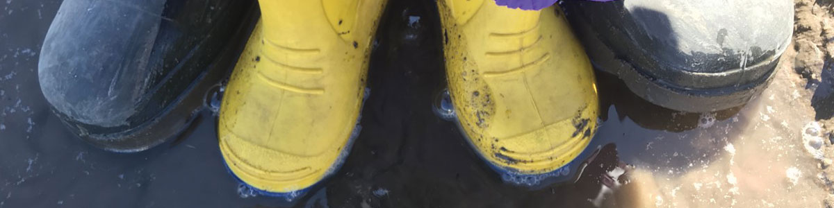
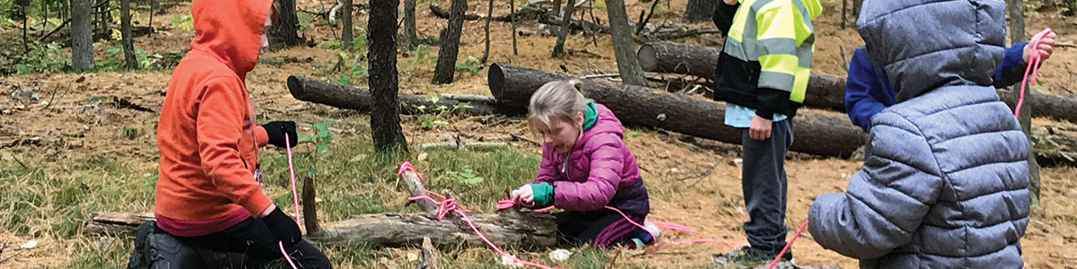
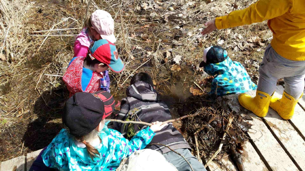
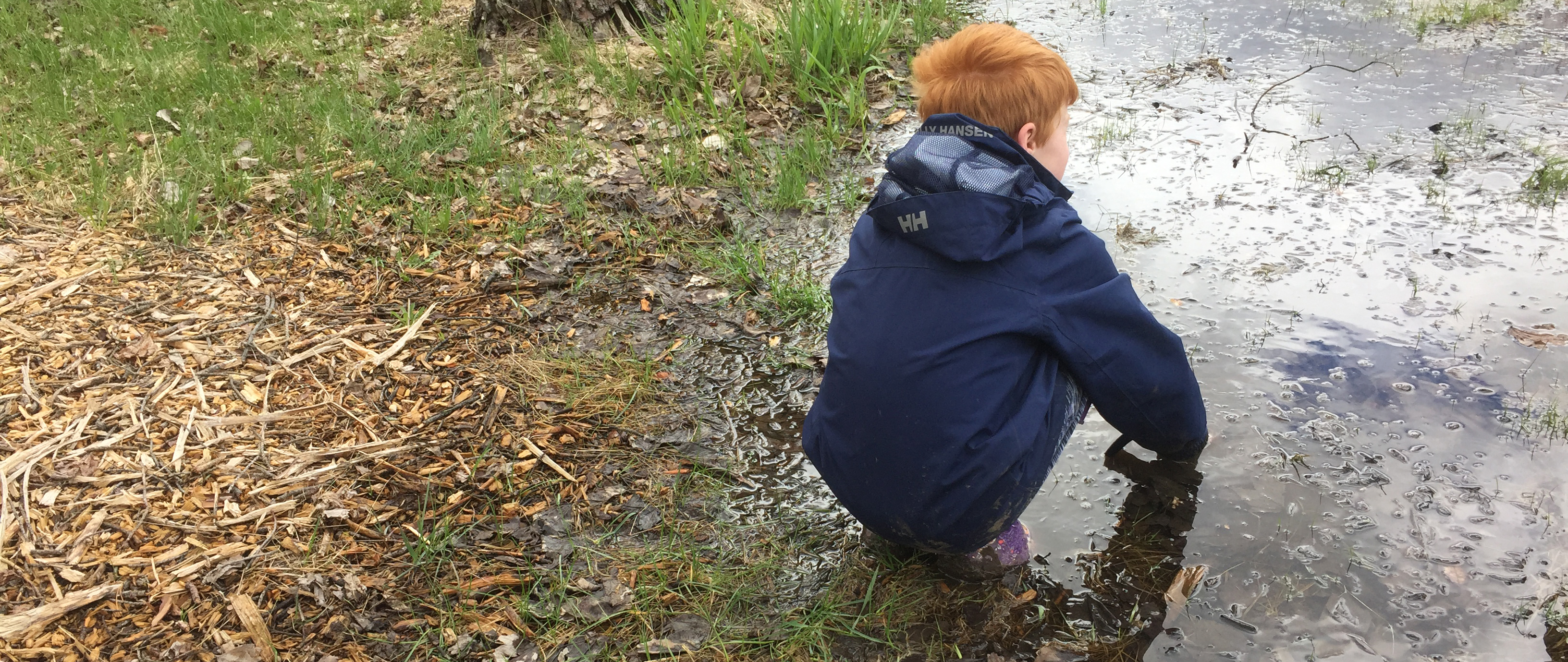
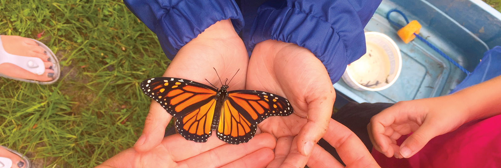
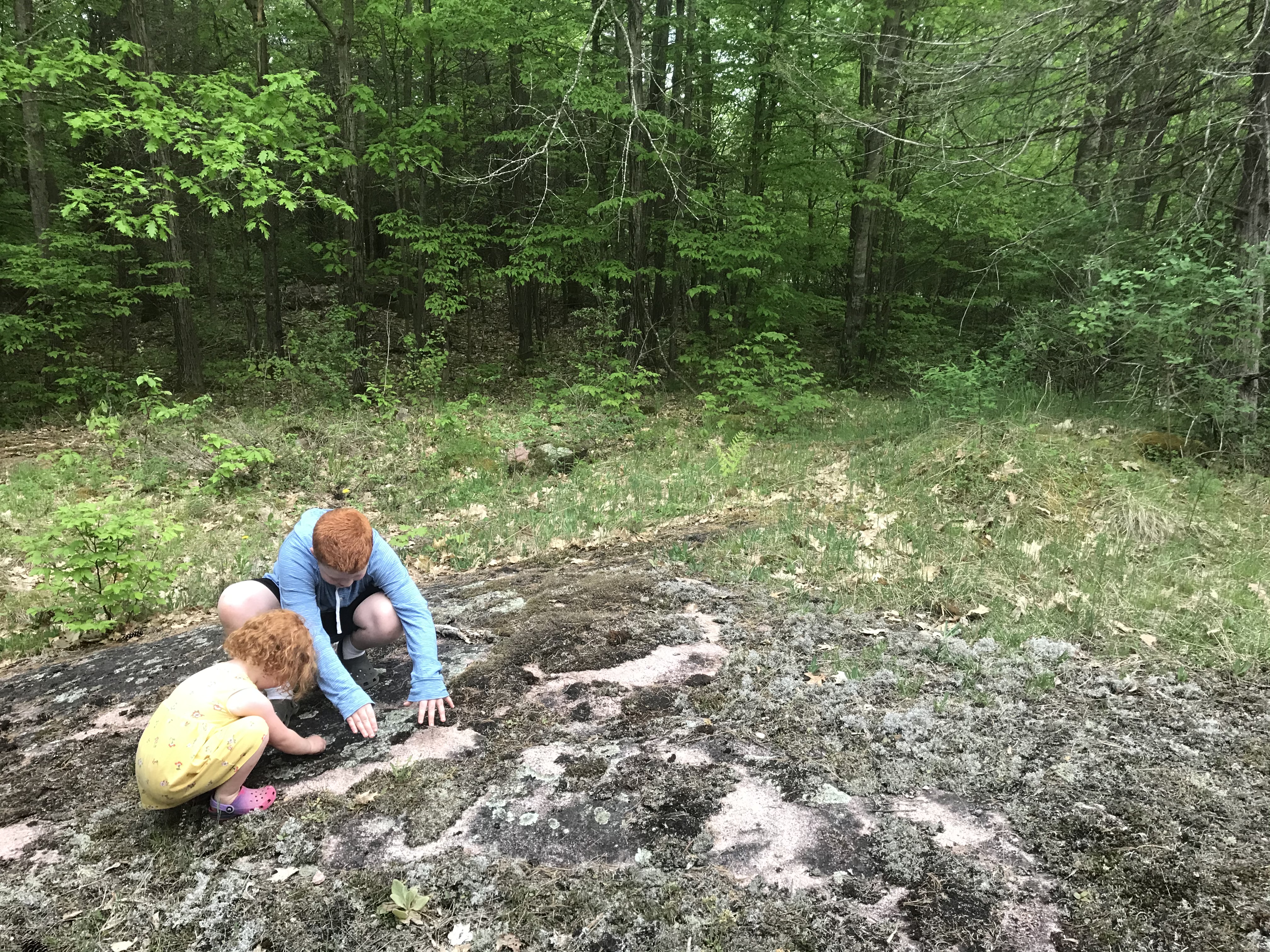
Foley Mountain Educational Programming
The outdoor environmental education program at Foley Mountain provides students with interactive, experiential, curriculum-based experiences that will help them to understand our natural world and their relationship with it. The Program can accommodate up to 60 students per day and all equipment is provided. All programs are approximately 1.5 hours in duration. Descriptions are offered as general guidelines — if there are specific objectives that you would like to accomplish, please let us know. Although grade levels are recommended for each program, these are only guidelines. Please select any desired fields to narrow your search.
| Half Day Program | $200 / group * | maximum 30 students, 90 minutes with an RVCA instructor |
| Full Day Program | $275 / group * | maximum 30 students, two 90 minutes with an RVCA instructor |
| Self-directed | $2.50/person * | Interested in just visiting the conservation area with your class but not booking a program? The cost is $2.50/person. This does not include the use of buildings other than access to public washrooms. To reserve facilities, contact staff. Staff must still be contacted to book a self-directed visit. |
| Overnight Tent Camping (accommodations only) | 1-15 people - $90/night * 16-30 people - $180/night * 30+ people - $7 for each additional person * Additional buildings also available for rent (link to facility rentals) |
Take you class on an overnight adventure to our group camping area! Plan your own activities or book our education staff to provide programming during your stay (see above for pricing). |
| Virtual Outdoor Education Program | $100 for a 45 minute program for up to 30 students * | Our outdoor education staff will guide you and your students through an adventure that focuses on bringing the outdoors to you. Our virtual programs are live, adapted for each grade level listed, curriculum connected, and include opportunities to interact directly with our outdoor educators! |
* plus applicable taxes
For information and to book a VIRTUAL program, click here.
Displaying items by tag: snow melt
Continued Snowmelt and Forecasted Rain Will Keep Water Levels Elevated Across Rideau Valley Watershed
(WCS – R05/2022)
March 23, 2022 – The current short-term weather forecast indicates mostly above zero temperatures until Sunday and possibly 30 – 50 mm of rain from Thursday to Saturday. Although much of the snow has already melted, some snow remains in the watershed, especially in the upper watershed areas.
The forecasted rain and on-going snowmelt are expected to keep water levels elevated and cause some flooding in all low-lying areas, especially those identified below. Parks Canada staff who manage the water levels for the Rideau Canal have indicated that water levels in upper watershed lakes will continue to rise as the snowpack melts.
Some specific areas of concern are highlighted below:
A FLOOD WATCH continues for all the low-lying areas along Stevens Creek and Taylor Drain in the Village of North Gower.
A FLOOD OUTLOOK continues for all the low-lying areas around the smaller creeks and streams in the Rideau Valley Watershed, including any connected creeks or ditches.
Extreme caution should be exercised by everyone when near local waterbodies. Parents should inform their children of the risks and provide appropriate supervision. Pets should be leashed near all bodies of water. Please contact your municipality if you see any ice jams that are causing localized flooding.
Residents in flood prone or low-lying areas, historically susceptible to flooding, should continue to take the necessary precautions to protect their property, such as:
- • Ensuring sump pump is clear, in good working condition and has a backwater valve
- • Ensuring easy access to a portable backup generator and pump
- • Ensuring downspouts are clear and the outlet is at least 3 metres from the dwelling
- • Securing items that might float away as flows increase
- • Removing valuable items from basements or lower floors that could be subject to flooding
- • Keeping emergency phone numbers handy
- • Familiarizing yourself with your municipality’s Emergency Preparedness Plan
This watershed conditions statement is in effect until March 31, 2022, at 5 p.m. and will be updated at that time unless the forecast or conditions change.
-end-
More Information:
Contact: Brian Stratton, RVCA Manager Engineering Services
Rideau Valley Conservation Authority
613-692-6804, 1-800-267-3504 ext. 1141
Rideau Valley Conservation Authority is a partnership of municipalities within the Rideau Valley watershed created under the Conservation Authorities Act to deliver a range of programs in watershed management and natural resource conservation.
RVCA Watershed Conditions Statements:
- Water Safety – High flows, unstable banks, melting ice or other factors that could be dangerous for recreational users such as anglers, canoeists, hikers, children, pets, etc. Flooding is not expected.
- Flood Outlook – Early notice of the potential for flooding based on weather forecasts, calling for heavy rain, snow melt, high winds or other conditions that could lead to high runoff, cause ice jams and/or lakeshore flooding or erosion.
- Flood Watch – Flooding is possible in specific watercourses or municipalities. Municipalities, emergency services and individuals in flood prone areas should prepare.
- Flood Warning – Flooding is imminent or already occurring in specific watercourses or municipalities.
(WCS – R06/2022)
March 25, 2022 – The Rideau Valley Conservation Authority is terminating the FLOOD WATCH for the Village of North Gower but a FLOOD OUTLOOK continues for all the low-lying areas around the smaller creeks and streams in the Rideau Valley Watershed, including any connected creeks or ditches.
The current short-term weather forecast indicates cooler, mostly below zero temperatures, for the next five days with limited precipitation. Although much of the snow has already melted, some snow remains in the watershed, especially in the upper watershed areas.
Parks Canada staff who manage the water levels for the Rideau Canal have indicated that the water levels in some of the upper watershed reservoir lakes are significantly increasing due to snowmelt and recent rainfall. More specifically, the water levels in the Upper Rideau and Big Rideau Lakes are increasing and measures are being taken to reduce the rate of increase. The releases from these lakes will be done to minimize downstream impacts. However, areas along the Rideau River between Smiths Falls and Merrickville should expect elevated water levels and flows for the next few days.
The current forecast along with Parks Canada operations indicate no significant flooding across the watershed at this time, although the areas between Smiths Falls and Merrickville will experience temporarily elevated water levels and flows.
Extreme caution should be exercised by everyone when near local waterbodies. Parents should inform their children of the risks and provide appropriate supervision. Pets should be leashed near all bodies of water. Please contact your municipality if you see any ice jams that are causing localized flooding.
Residents in flood prone or low-lying areas, historically susceptible to flooding, should continue to take the necessary precautions to protect their property, such as:
- • Ensuring sump pump is clear, in good working condition and has a backwater valve
- • Ensuring easy access to a portable backup generator and pump
- • Ensuring downspouts are clear and the outlet is at least 3 metres from the dwelling
- • Securing items that might float away as flows increase
- • Removing valuable items from basements or lower floors that could be subject to flooding
- • Keeping emergency phone numbers handy
- • Familiarizing yourself with your municipality’s Emergency Preparedness Plan
This watershed conditions statement is in effect until April 1, 2022, at 5 p.m. and will be updated at that time unless the forecast or conditions change.
-end-
More Information:
Contact: Brian Stratton, RVCA Manager Engineering Services
Rideau Valley Conservation Authority
613-692-6804, 1-800-267-3504 ext. 1141
Rideau Valley Conservation Authority is a partnership of municipalities within the Rideau Valley watershed created under the Conservation Authorities Act to deliver a range of programs in watershed management and natural resource conservation.
RVCA Watershed Conditions Statements:
- Water Safety – High flows, unstable banks, melting ice or other factors that could be dangerous for recreational users such as anglers, canoeists, hikers, children, pets, etc. Flooding is not expected.
- Flood Outlook – Early notice of the potential for flooding based on weather forecasts, calling for heavy rain, snow melt, high winds or other conditions that could lead to high runoff, cause ice jams and/or lakeshore flooding or erosion.
- Flood Watch – Flooding is possible in specific watercourses or municipalities. Municipalities, emergency services and individuals in flood prone areas should prepare.
- Flood Warning – Flooding is imminent or already occurring in specific watercourses or municipalities.
(WCS – R06/2022)
April 1, 2022 – The Rideau Valley Conservation Authority is issuing a HIGH WATER SAFETY message for all areas. Water levels and flows are declining for most areas of the Rideau Valley Watershed, except for the reservoir lakes which are discussed below.
The short-term forecast indicates mostly above zero temperatures and limited precipitation, although there is a possible rain event coming later next week. The snow has melted across the lower watershed, but some snow remains in the upper watershed, near Perth.
Parks Canada staff who manage the water levels for the Rideau Canal are carefully watching the water levels in the upper watershed lakes. The water levels in the Upper Rideau and Big Rideau Lakes are high but are no longer increasing. The water levels in Bobs and Christie lakes continue to rise due to on-going snowmelt and will be managed depending on the rain amounts next week and inflow responses in both watersheds.
Extreme caution should be exercised by everyone when near local waterbodies. Parents should inform their children of the risks and provide appropriate supervision. Pets should be leashed near all bodies of water. Please contact your municipality if you see any ice jams that are causing localized flooding.
This watershed conditions statement is in effect until April 15, 2022 at 5 PM. No further updates will be issued unless the forecast or conditions change.
-end-
More Information:
Contact: Brian Stratton, RVCA Manager Engineering Services
Rideau Valley Conservation Authority
613-692-6804, 1-800-267-3504 ext. 1141
www.rvca.ca/watershed-conditions
Rideau Valley Conservation Authority is a partnership of municipalities within the Rideau Valley watershed created under the Conservation Authorities Act to deliver a range of programs in watershed management and natural resource conservation.
RVCA Watershed Conditions Statements:
- Water Safety – High flows, unstable banks, melting ice or other factors that could be dangerous for recreational users such as anglers, canoeists, hikers, children, pets, etc. Flooding is not expected.
- Flood Outlook – Early notice of the potential for flooding based on weather forecasts, calling for heavy rain, snow melt, high winds or other conditions that could lead to high runoff, cause ice jams and/or lakeshore flooding or erosion.
- Flood Watch – Flooding is possible in specific watercourses or municipalities. Municipalities, emergency services and individuals in flood prone areas should prepare.
- Flood Warning – Flooding is imminent or already occurring in specific watercourses or municipalities.
(WCS – R08/2022)
April 6, 2022 – The Rideau Valley Conservation Authority is continuing with a HIGH WATER SAFETY message for all areas. Although water levels and flows are now declining for most areas of the Rideau Valley Watershed, except for the lakes which are discussed below, the forecasted rain will cause water levels and flows to increase in the coming days.
The short-term forecast indicates as much as 40 mm of rain may fall between Thursday, April 7 and Saturday, April 9. The snow has melted across the entire watershed. Although no significant flooding is anticipated, water levels and flows are expected to increase in all waterways in the Rideau Valley Watershed.
Parks Canada staff who manage the water levels for the Rideau Canal are carefully watching the water levels in the Upper Watershed lakes. The water levels in the Upper Rideau and Big Rideau Lakes are high and declining but expected to level off and increase due to the large rainfall event. The water levels in Bobs and Christie lakes will continue to rise due to the rain.
Extreme caution should be exercised by everyone when near local waterbodies. Parents should inform their children of the risks and provide appropriate supervision. Pets should be leashed near all bodies of water. Please contact your municipality if you see any ice jams that are causing localized flooding.
This watershed conditions statement is in effect until April 21, 2022 at 5 PM. No further updates will be issued unless the forecast or conditions change.
-end-
More Information:
Contact: Brian Stratton, RVCA Manager Engineering Services
Rideau Valley Conservation Authority
613-692-6804, 1-800-267-3504 ext. 1141
www.rvca.ca/watershed-conditions
Rideau Valley Conservation Authority is a partnership of municipalities within the Rideau Valley watershed created under the Conservation Authorities Act to deliver a range of programs in watershed management and natural resource conservation.
RVCA Watershed Conditions Statements:
- Water Safety – High flows, unstable banks, melting ice or other factors that could be dangerous for recreational users such as anglers, canoeists, hikers, children, pets, etc. Flooding is not expected.
- Flood Outlook – Early notice of the potential for flooding based on weather forecasts, calling for heavy rain, snow melt, high winds or other conditions that could lead to high runoff, cause ice jams and/or lakeshore flooding or erosion.
- Flood Watch – Flooding is possible in specific watercourses or municipalities. Municipalities, emergency services and individuals in flood prone areas should prepare.
- Flood Warning – Flooding is imminent or already occurring in specific watercourses or municipalities.