About
News
Governance
Contact
S
S
Conservation Areas
Explore all conservation areas
Conservation Areas
Baxter
Chapman Mills
Foley Mountain
Meisel Woods
Mill Pond
Motts Mills
Perth Wildlife Reserve
Portland Bay
Richmond
Rideau Ferry
W.A. Taylor
2026 Outdoor Adventure Challenge
Helpful Tips
Visiting a Conservation Area
Accessibility at RVCA Facilities
Parking & Passes
Beach Status
Things To Do
Trail Maps
Rent a Facility
Report An Issue
Outdoor Education
Explore all outdoor education programs
Baxter
School & Community Programs
Forest School
PD Day & Summer Camps
Foley Mountain
School & Community Programs
Forest School
Summer Programs
Permits & Planning
Explore all permit and planning programs
Section 28 Permits
About Section 28
Apply for a Section 28 Permit
Section 28 - FAQs
Report a Violation
Map a Property
Septic Permits
About Septic Permits
Apply for a Septic Permit
Inspections & Compliance
Septic Record Search
Report a Septic Complaint
Municipal Planning Review
About Municipal Planning Review
Property File Search
Stewardship & Grants
Explore all stewardship programs and opportunities
Landowner Grants
Tree Planting
Rural Clean Water Grants
Shoreline Naturalization
Other Opportunities
Butternut Recovery Program
Stewardship Resources
City Stream Watch
Watershed Management
Watershed Science
Understanding Our Watershed
Surface Water Quality
Groundwater Quality
Aquatic Conditions & Ecology
Resources & Publications
Flood Forecasting & Drought
Current Conditions
Streamflow and Water Levels
Be Prepared
After a Flood (Clean Up)
Low Water Response Program
Hazard Lands
What Are Natural Hazards?
Hazard Mapping Projects
RVCA GeoPortal
Conservation Areas
Explore all conservation areas
Conservation Areas
Helpful Tips
Baxter
Chapman Mills
Foley Mountain
Meisel Woods
Mill Pond
Motts Mills
Perth Wildlife Reserve
Portland Bay
Richmond
Rideau Ferry
W.A. Taylor
2026 Outdoor Adventure Challenge
Visiting a Conservation Area
Accessibility at RVCA Facilities
Beach Status
Parking & Passes
Things To Do
Trail Maps
Rent a Facility
Report An Issue
Outdoor Education
Explore all outdoor education programs
Baxter
School & Community Programs
Forest School
PD Day & Summer Camps
Foley Mountain
School & Community Programs
Forest School
Summer Programs
Permits & Planning
Explore all permit and planning programs
Section 28 Permits
About Section 28
Apply for a Section 28 Permit
Section 28 - FAQs
Report a Violation
Map a Property
Septic Permits
About Septic Permits
Apply for a Septic Permit
Inspections & Compliance
Septic Record Search
Report a Septic Complaint
Municipal Planning Review
About Municipal Planning Review
Property File Search
Stewardship & Grants
Explore all stewardship programs and opportunities
Landowner Grants
Tree Planting
Rural Clean Water Grants
Shoreline Naturalization
Other Opportunities
Butternut Recovery Program
Stewardship Resources
City Stream Watch
Watershed Management
Watershed Science
Understanding Our Watershed
Surface Water Quality
Groundwater Quality
Aquatic Conditions & Ecology
Resources & Publications
Flood Forecasting & Drought
Current Conditions
Streamflow and Water Levels
Be Prepared
After a Flood (Clean Up)
Low Water Response Program
Hazard Lands
What Are Natural Hazards?
Hazard Mapping Projects
RVCA GeoPortal
News & Stories
Flood Outlook - Lower Ottawa River | Risque de Crue - Cours inférieur de la rivière des Outaouais
Watershed Condition Statements
19 May 2026
Flood Watch — Lower Ottawa River May 4 || Veille de crue - Cours inférieur de la rivière des Outaouais 4 Mai
Watershed Condition Statements
04 May 2026
Update #1: Flood Warning — Lower Ottawa River | Avertissement de crue - Cours inférieur de la rivière des Outaouais
Watershed Condition Statements
27 April 2026
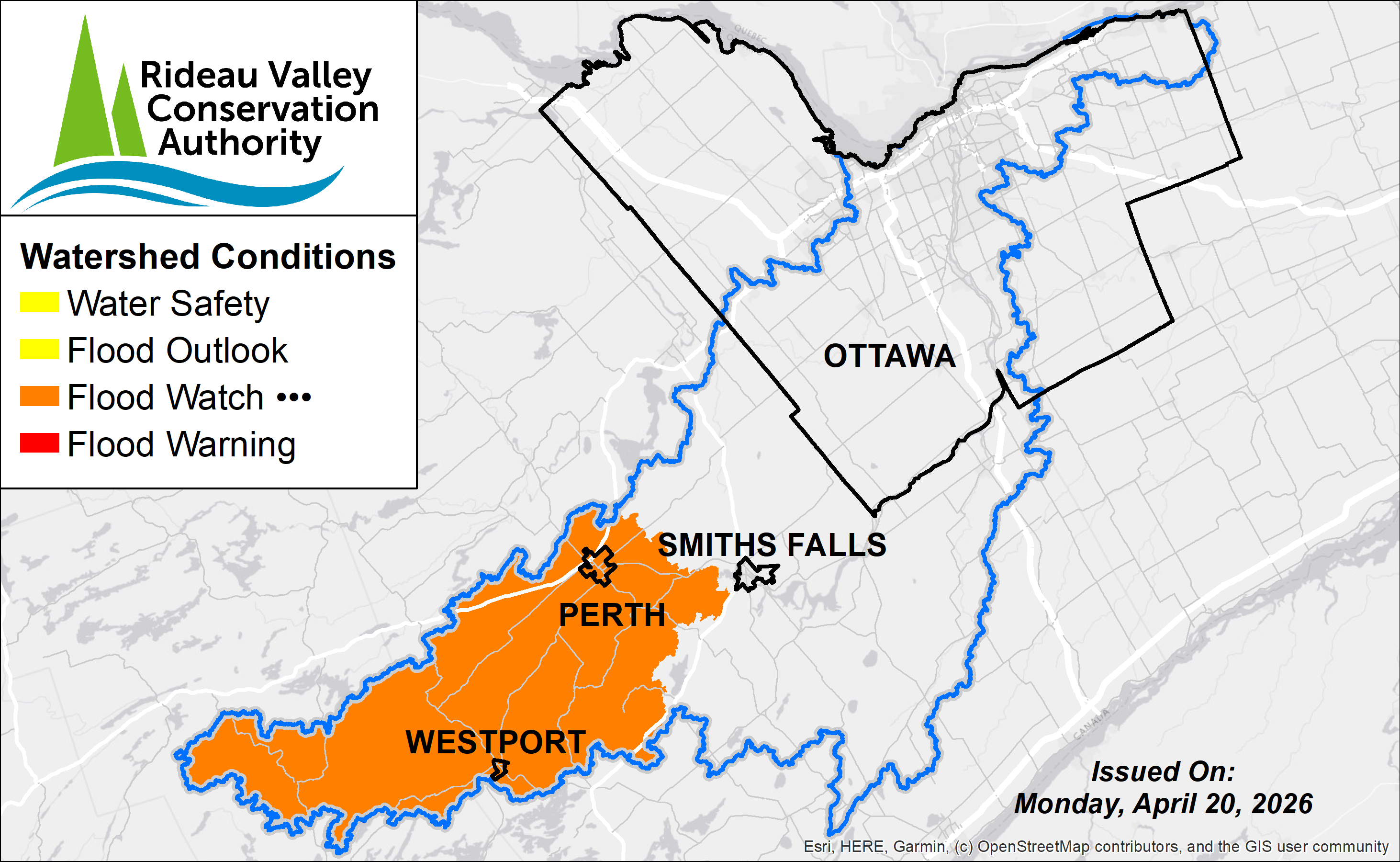
Update #1: Flood Watch – Upper Watershed Water Levels Receding but Remain Elevated
Watershed Condition Statements
20 April 2026
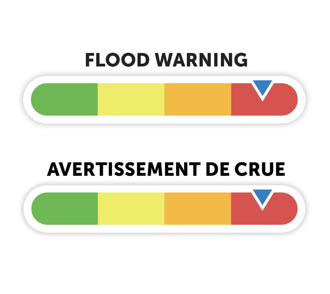
Flood Warning — Lower Ottawa River | Avertissement de crue — Cours inférieur de la rivière des Outaouais
Watershed Condition Statements
20 April 2026
Update #1: Flood Watch - Lower Ottawa River | Mise à jour n° 1 : Veille de crue - Cours inférieur de la rivière des Outaouais
Watershed Condition Statements
17 April 2026
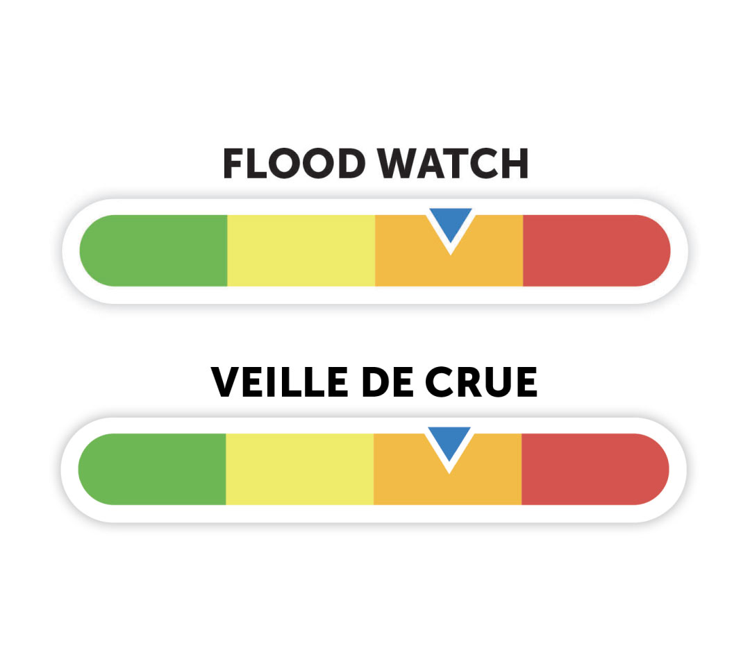
Flood Watch — Lower Ottawa River | Veille de crue - Cours inférieur de la rivière des Outaouais 2026
Watershed Condition Statements
16 April 2026
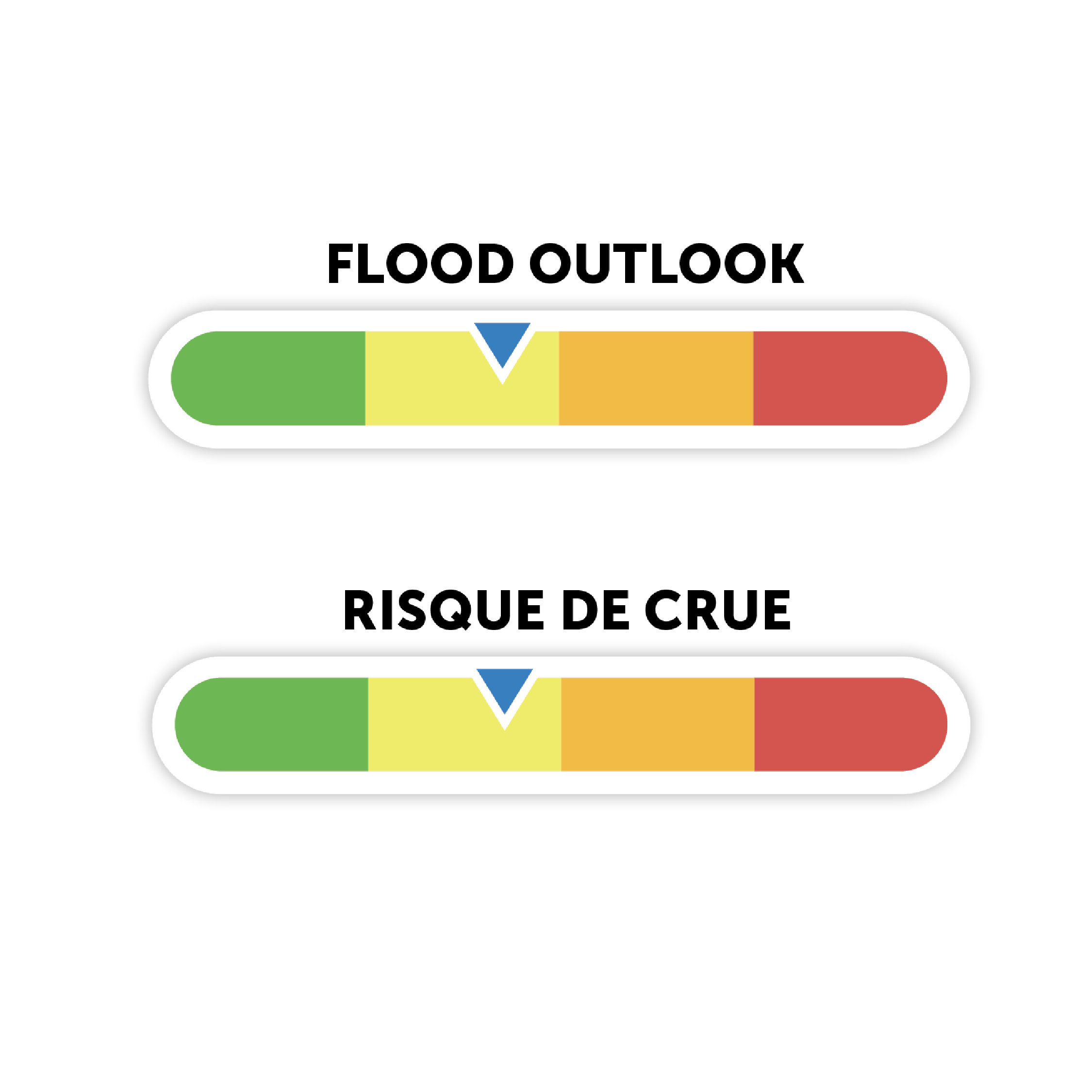
Flood Outlook — Lower Ottawa River | Risque de Crue - Cours inférieur de la rivière des Outaouais
Watershed Condition Statements
14 April 2026
Flood Watch Issued for Upper Watershed Lakes as Water Levels Continue to Rise
Watershed Condition Statements
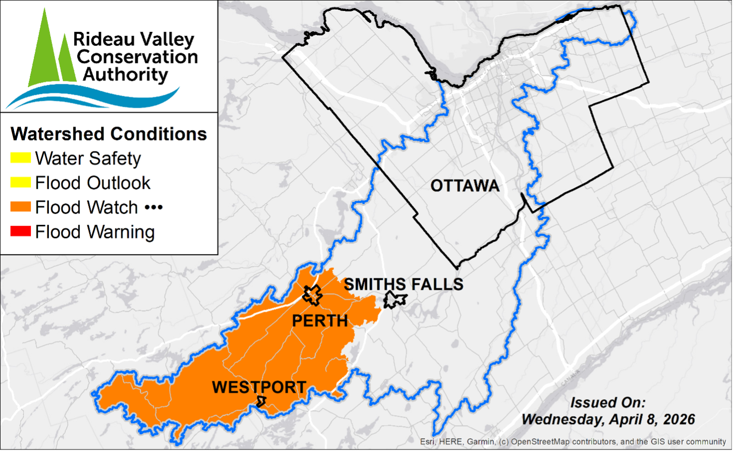
08 April 2026
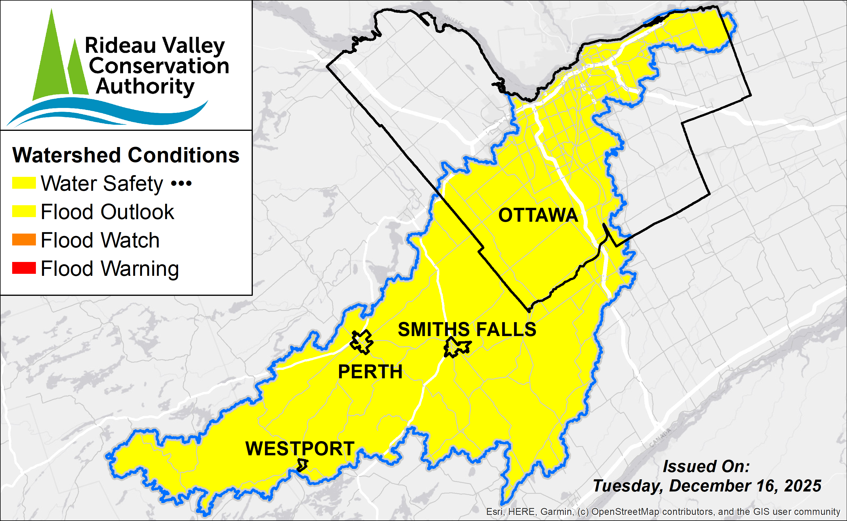
Water Safety Statement - Lower Ottawa River | Déclaration de sécurité aquatique - Cours inférieur de la rivière des Outaouais
Watershed Condition Statements
08 April 2026
Flood Outlook issued for Upper Watershed Ahead of Rainfall
Watershed Condition Statements
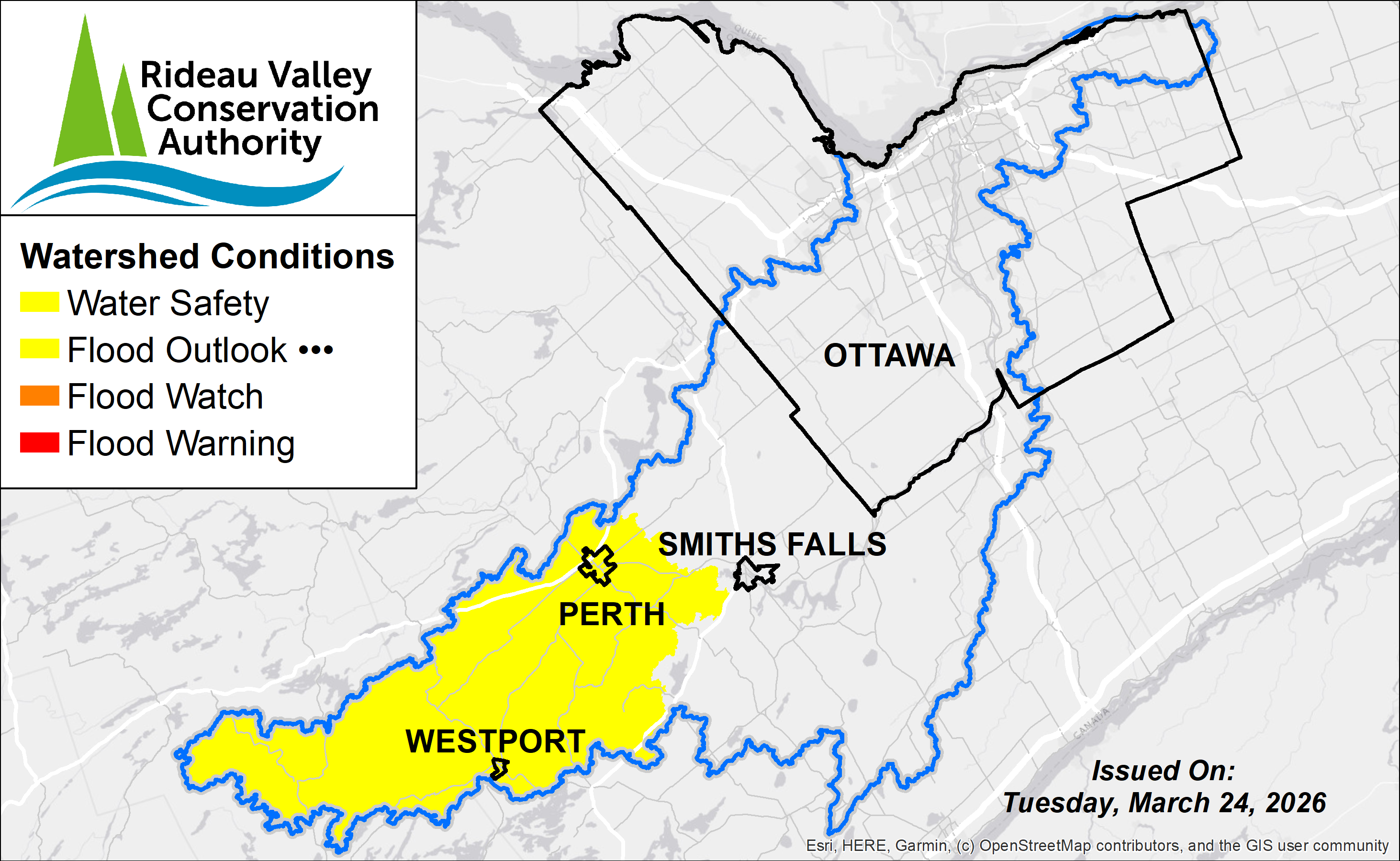
24 March 2026
Flood Watch Issued for Rideau River and North Gower; Elevated Flows May Lead to Localized Flooding
Watershed Condition Statements
10 March 2026
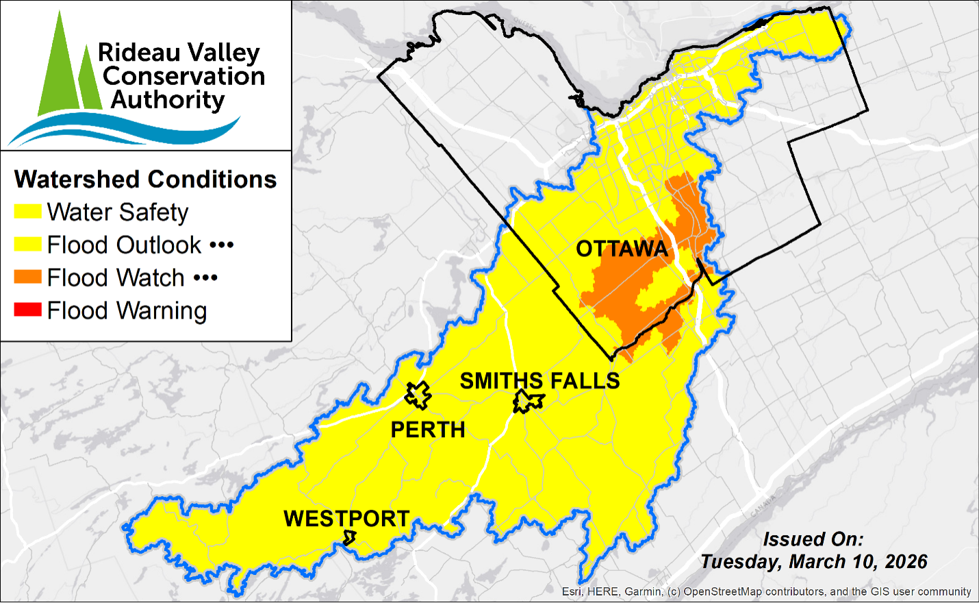
Flood Watch in Effect for North Gower; High Water Expected for Entire Watershed
Watershed Condition Statements
03 March 2026
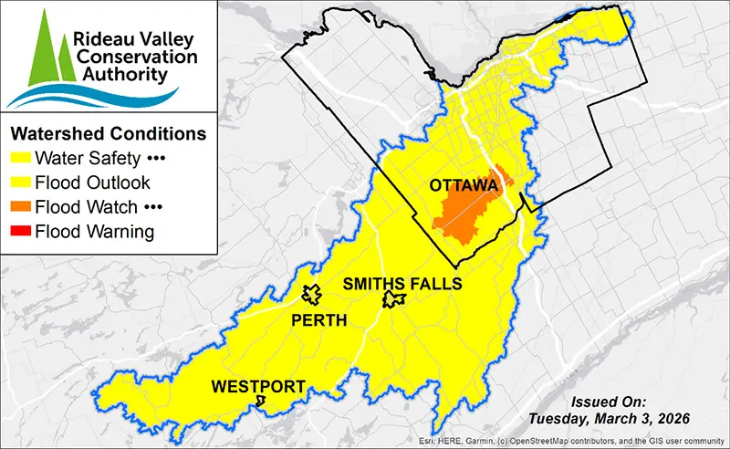
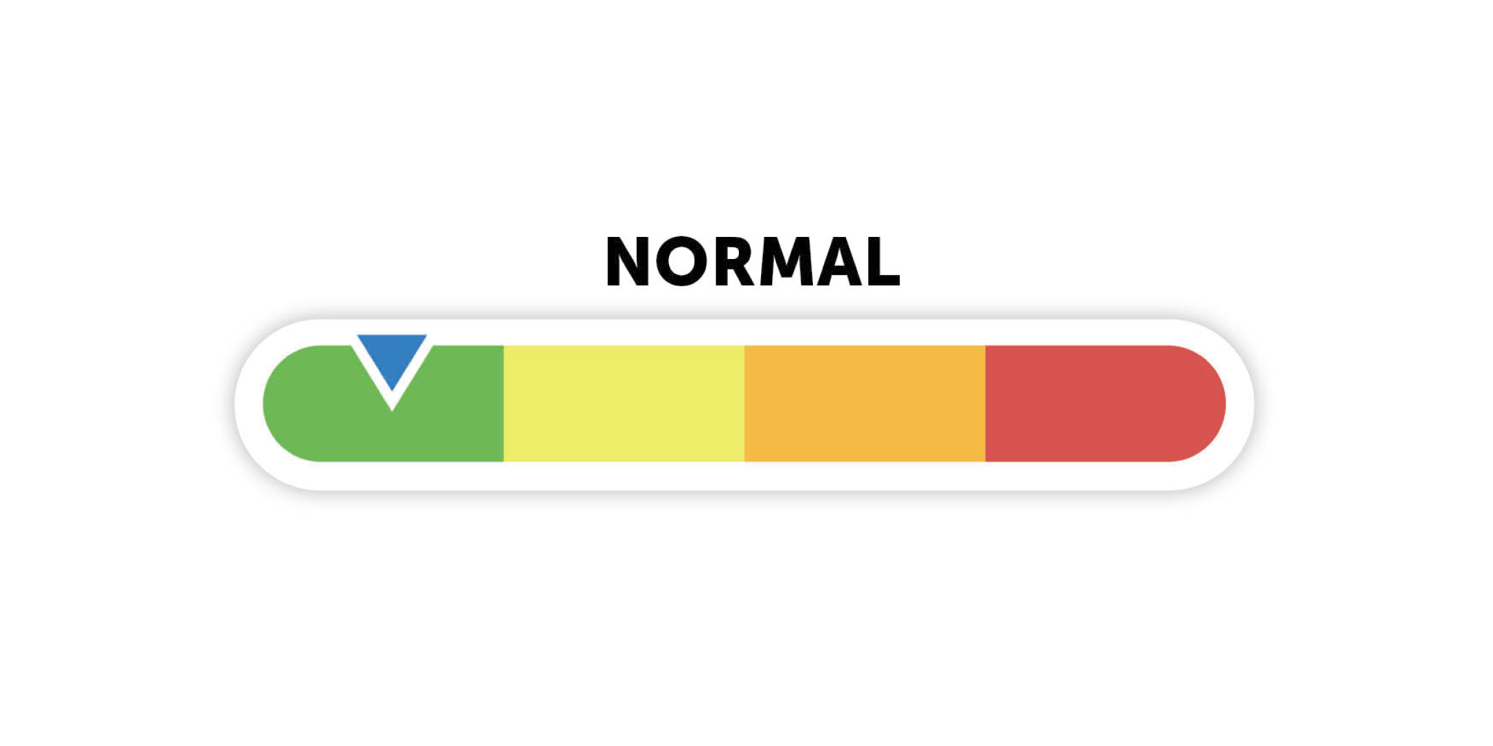
Notice of Return to Normal Watershed Conditions
Watershed Condition Statements
23 January 2026
WATER SAFETY STATEMENT – Rain and Mild Temperatures Expected to Increase Water Levels Across Rideau Valley Watershed
Watershed Condition Statements
16 December 2025
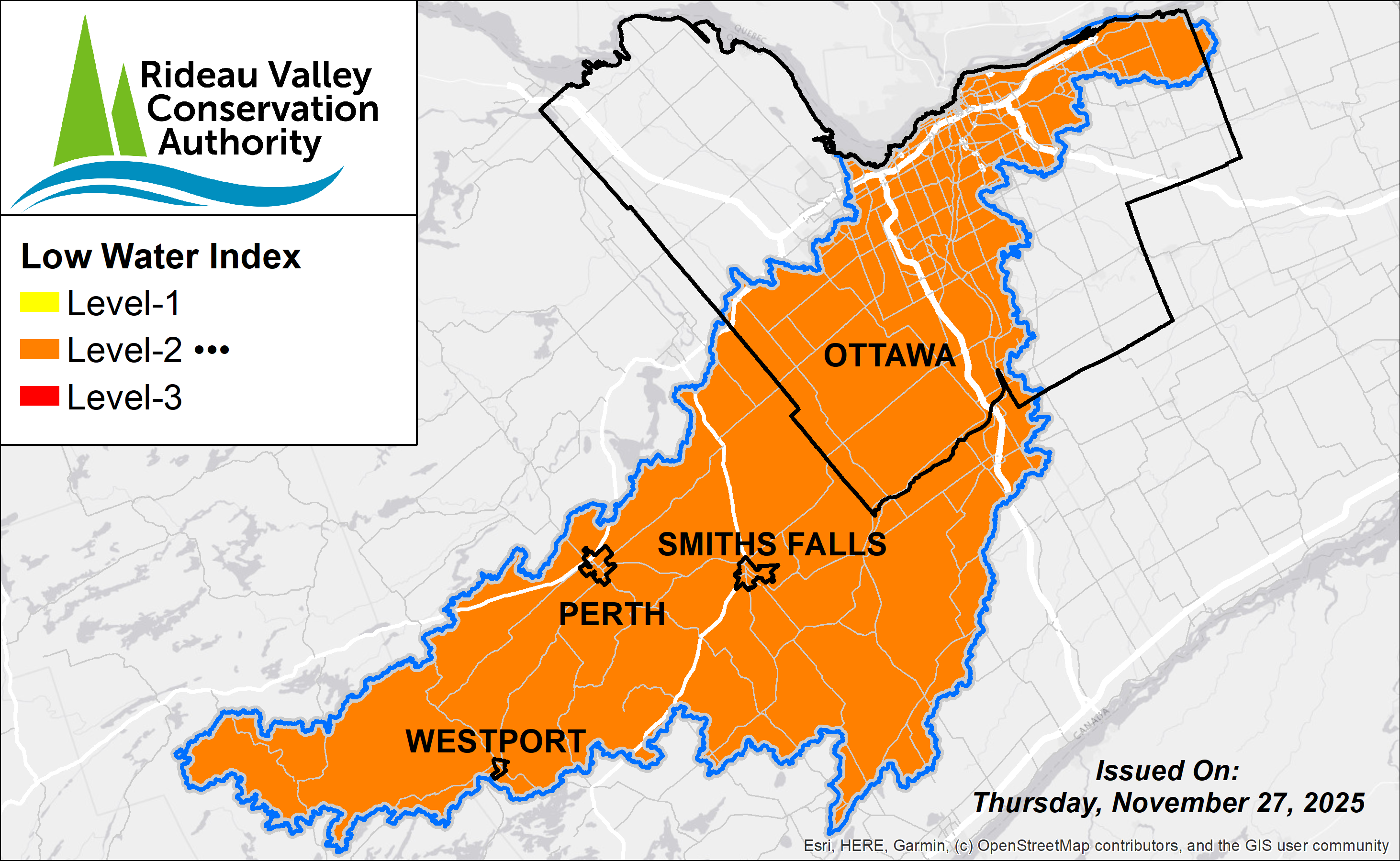
UPDATE: Low Water Advisory downgraded to Level 2 for Rideau Valley Watershed
Watershed Condition Statements
27 November 2025
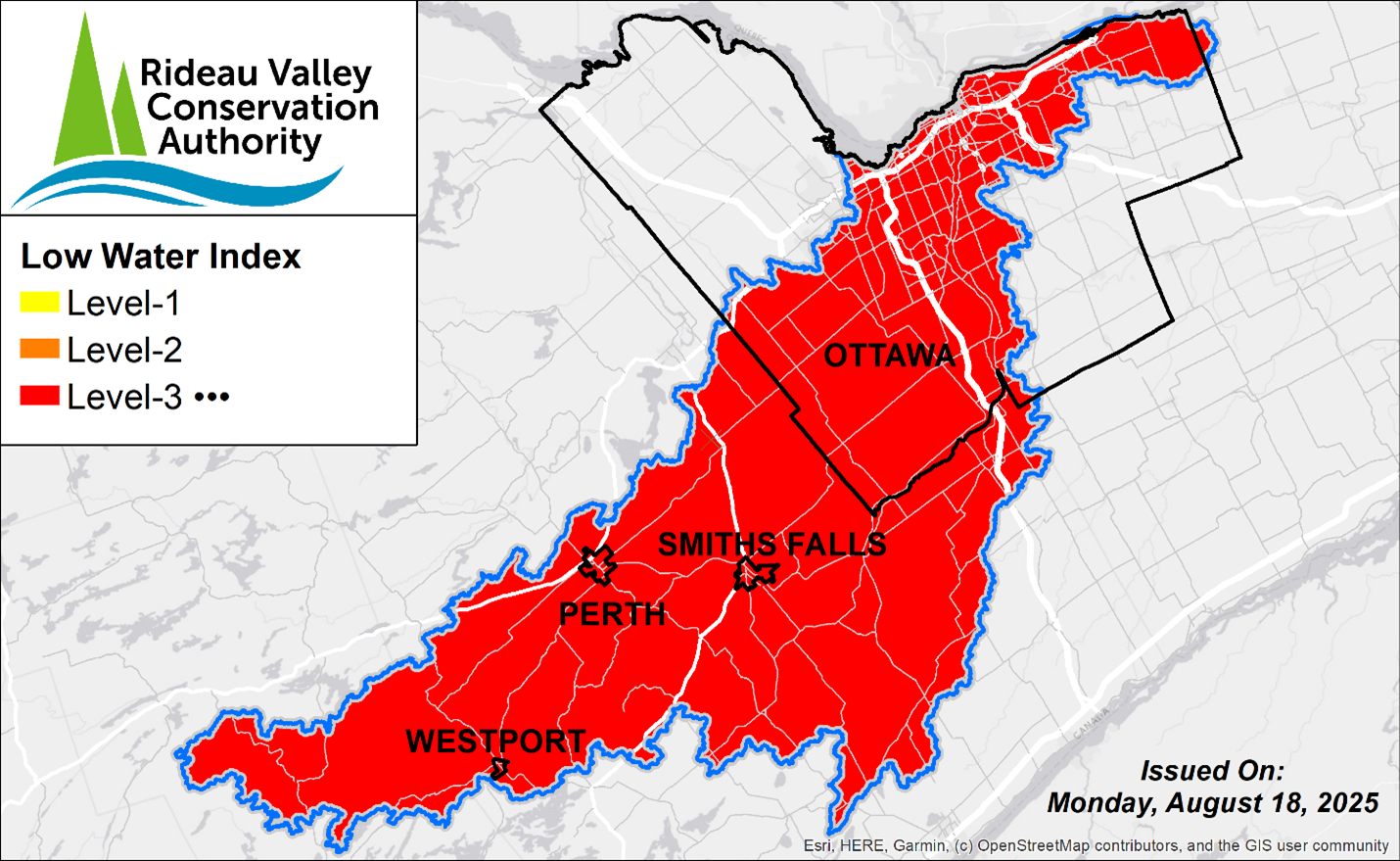
UPDATE: Level 3 Low Water Advisory for the Rideau Valley Watershed
Watershed Condition Statements
09 October 2025
Page 1 of 4
1
2
3
4
Publications Library
RVCA Open Data Portal
Join Our Mailing List
Careers
Tenders & RFPs
Report An Issue
Foundation
Drinking Water Source Protection
LandOwner Resource Centre
Accessibility
Website Translation Disclaimer
Connect With Us!
Conservation Areas
Explore all conservation areas
Conservation Areas
Baxter
Chapman Mills
Foley Mountain
Meisel Woods
Mill Pond
Motts Mills
Perth Wildlife Reserve
Portland Bay
Richmond
Rideau Ferry
W.A. Taylor
2026 Outdoor Adventure Challenge
Helpful Tips
Visiting a Conservation Area
Accessibility at RVCA Facilities
Parking & Passes
Beach Status
Things To Do
Trail Maps
Rent a Facility
Report An Issue
Outdoor Education
Explore all outdoor education programs
Baxter
School & Community Programs
Forest School
PD Day & Summer Camps
Foley Mountain
School & Community Programs
Forest School
Summer Programs
Permits & Planning
Explore all permit and planning programs
Section 28 Permits
About Section 28
Apply for a Section 28 Permit
Section 28 - FAQs
Report a Violation
Map a Property
Septic Permits
About Septic Permits
Apply for a Septic Permit
Inspections & Compliance
Septic Record Search
Report a Septic Complaint
Municipal Planning Review
About Municipal Planning Review
Property File Search
Stewardship & Grants
Explore all stewardship programs and opportunities
Landowner Grants
Tree Planting
Rural Clean Water Grants
Shoreline Naturalization
Other Opportunities
Butternut Recovery Program
Stewardship Resources
City Stream Watch
Watershed Management
Watershed Science
Understanding Our Watershed
Surface Water Quality
Groundwater Quality
Aquatic Conditions & Ecology
Resources & Publications
Flood Forecasting & Drought
Current Conditions
Streamflow and Water Levels
Be Prepared
After a Flood (Clean Up)
Low Water Response Program
Hazard Lands
What Are Natural Hazards?
Hazard Mapping Projects
RVCA GeoPortal
S
S
×
×
Low Water Impact Form
Full Name
*
Address
*
City
*
Province
*
Postal Code
*
ex. A9A 9A9
Phone Number
*
Email address
*
How is the drought impacting you?
*
Are you currently experiencing a dry well issue?
*
Yes
No
reCAPTCHA
*
Submit
Email