November 27, 2025 - Seasonal rainfall and cooler temperatures over the past month have resulted in measurable hydrologic recovery across the Rideau Valley watershed. Monitoring data indicates widespread increases in streamflows, baseflows, and groundwater levels.
Despite these improvements, notable residual deficits remain within the upper watershed region. Water levels within the upper reservoir lakes remain well below the long-term historic average, and some private wells may still be vulnerable to water-supply constraints.
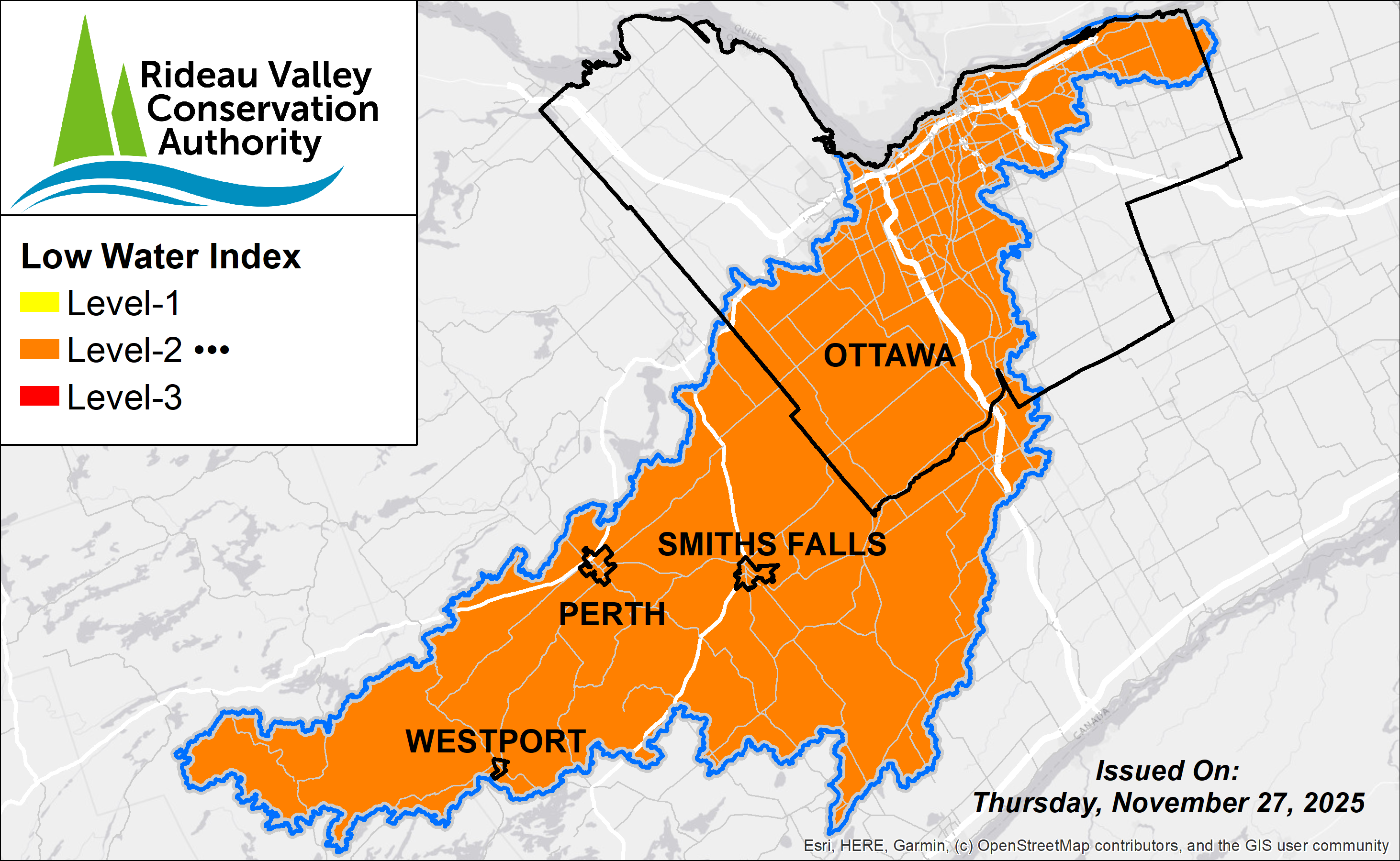
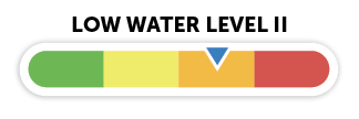
Based on the hydrologic recovery observed to date, the Rideau Valley Water Response Team has downgraded the watershed’s status to a Level-2 low water advisory, from the more severe Level-3 advisory in place since August 2025.
For more information, contact:
Isabelle Maltais
Director, Watershed Science & Engineering
1-800-267-3504 ext. 1165
A Level 2 advisory indicates that moderate water-supply concerns may persist, although conditions have improved relative to those observed earlier in the season. Under the Level 2 advisory, a 20% water-use reduction is recommended to support continued groundwater recharge and to reduce the risk of further impacts to private water-supply systems during the recovery period.
Residents who may still be experiencing water-supply issues are encouraged to report these impacts via the RVCA Report a Low Water Impact form. These reports assist staff and municipal members in evaluating the extent and current state of the water supply issues.
Level 3 low water conditions were initially declared in August 2025 in response to significant rainfall deficits, elevated temperatures, and high seasonal water demand. Numerous reports of dry or low-yielding private wells were received, in addition to observations of severely low water levels and zero-flow conditions in many local rivers and streams. Groundwater systems were particularly affected this season, with sustained declines observed across the monitoring network and several wells reaching new record lows within their 20- to 25-year periods of record.
The Rideau Valley Conservation Authority provides science-based advice and coordination during low water conditions but does not have the authority to enforce water use restrictions. Decisions related to restrictions or bylaws rest with individual municipalities and provincial agencies.
Current Conditions
Rainfall conditions over the past three months have generally returned to near-seasonal levels, with several widespread events contributing to a reduction in the cumulative rainfall deficit. The cool fall temperatures and sustained precipitation have promoted soil-water infiltration, with early indications of groundwater recovery observed.
Despite this improvement, the effects of the summer deficit remain evident, and precipitation has not yet fully offset these earlier shortfalls. The current 10-day Environment Canada forecast indicates near-seasonal temperatures and moderate mixed-precipitation.
Rainfall
- 90-day totals across the watershed range from 80%–100% of the long-term average for this time of year
- 30-day totals are slightly above average, ranging from 130%-160% of the seasonal normal
Streamflows & Baseflows
Streamflows and water levels across the major subwatersheds have shown substantial improvement but remain below long-term seasonal averages. Baseflows, representing the groundwater contribution to streamflow, have resumed in several reaches that were previously dry or exhibiting near zero-flow conditions.
Groundwater
Data from the Provincial Groundwater Monitoring Network show that levels in several shallow bedrock wells have returned to conditions comparable to those observed in May–June of this year. Broad recovery signals were evident across most wells from late October through mid-November, however, the recovery rate has slowed with the sub-zero temperatures.
Navigation & Reservoir Levels
Water levels within Bobs Lake, Big Rideau Lake & Wolfe Lake remain below the long term historic average. Outflows have been reduced to operational minimums to conserve upstream storage and mitigate further declines in lake and downstream river levels.
Parks Canada’s water management team continues to monitor conditions closely and will adjust operations as needed.
For further information, please contact:
Recommended Actions
Private Wells
Residents relying on groundwater wells are encouraged to use water efficiently to help protect the shared aquifer systems that supply both deep and shallow wells. Excessive or sustained withdrawals from deeper aquifers can lower groundwater levels and reduce the movement of water between deeper and shallower layers, which can increase the risk of local well shortages. Those experiencing well performance issues are encouraged to report these impacts via the RVCA Report a Low Water Impact form. These reports assist staff and municipal members in evaluating the extent and current state of the water supply issues.
Municipal Systems
Residents connected to municipal water supplies should monitor their municipality’s official channels for updates on water use restrictions.
Urban Ottawa
Residents served by the City of Ottawa’s central drinking water system are not subject to the same water supply pressures, as this system draws from the Ottawa River.
General Advisories
All residents are encouraged to follow municipal updates for guidance on water conservation, water source conditions, and information on fire bans.
Permit Holders
Holders of Permits to Take Water from surface or groundwater sources are strongly encouraged to continue to reduce withdrawals wherever possible. During low flow conditions, large surface & groundwater takings can significantly impact local water availability.
Conservation Authority staff continue to monitor conditions and communicate with water managers throughout the watershed. Updates to this message will be issued as conditions warrant.
More Resources:
RVCA Report A Low Water Impact Form: https://www.rvca.ca/watershed-management/low-water-response-program
Ministry of Environment, Conservation and Parks - Wells Help Desk: https://www.ontario.ca/page/wells-your-property#section-4
Ministry of Environment, Conservation and Parks – Find a Licensed Well Contractor: https://www.ontario.ca/page/find-licenced-well-contractors
Ministry of Environment, Conservation and Parks – Managing Your Water Well In Times Of Water Shortage: https://www.ontario.ca/page/managing-your-water-well-times-water-shortage
Ontario’s Low Water Response program: https://www.ontario.ca/page/low-water-response-program.
City of Ottawa Dry Conditions Webpage: https://www.ottawa.ca/en/health-and-public-safety/emergency-preparedness/current-and-ongoing-emergencies/dry-conditions
RVCA website: www.rvca.ca
Hourly and daily streamflows and water levels: https://www.rvca.ca/watershed-monitoring-reporting/reporting/streamflow-water-levels .
"Rideau Valley Conservation Authority is a partnership of municipalities within the Rideau Valley watershed created under the Conservation Authorities Act to deliver a range of programs in watershed management and natural resource conservation."
RVCA Watershed Conditions Statements:
Water Safety – High flows, unstable banks, melting ice or other factors that could be dangerous for recreational users such as anglers, canoeists, hikers, children, pets, etc. Flooding is not expected.
Flood Outlook – Early notice of the potential for flooding based on weather forecasts, calling for heavy rain, snow melt, high winds or other conditions that could lead to high runoff, cause ice jams and/or lakeshore flooding or erosion.
Flood Warning – Flooding is imminent or already occurring in specific watercourses or municipalities.
Flood Watch – Flooding is possible in specific watercourses or municipalities. Municipalities, emergency services and individuals in flood prone areas should prepare.