(WCS – R05/2026)
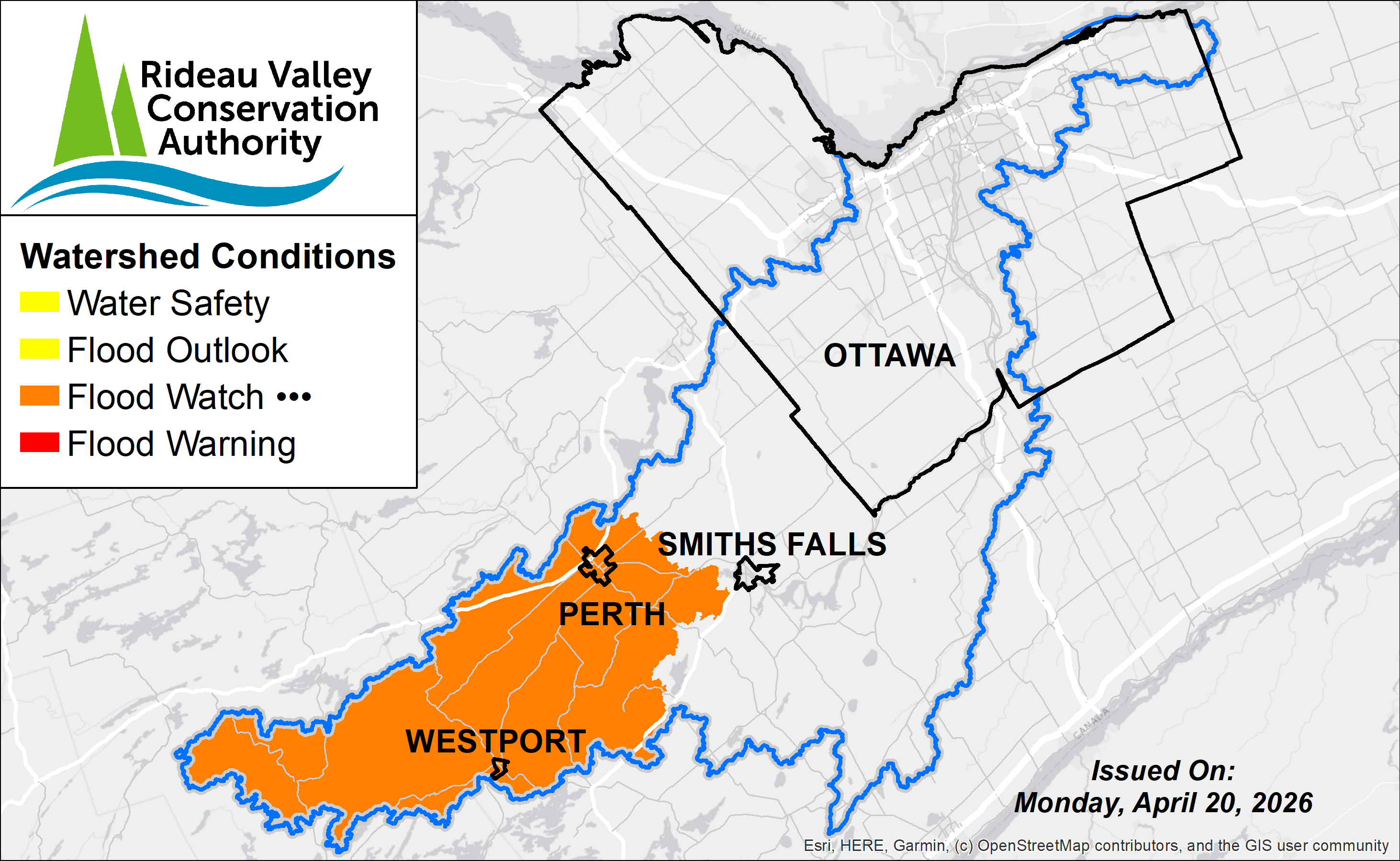
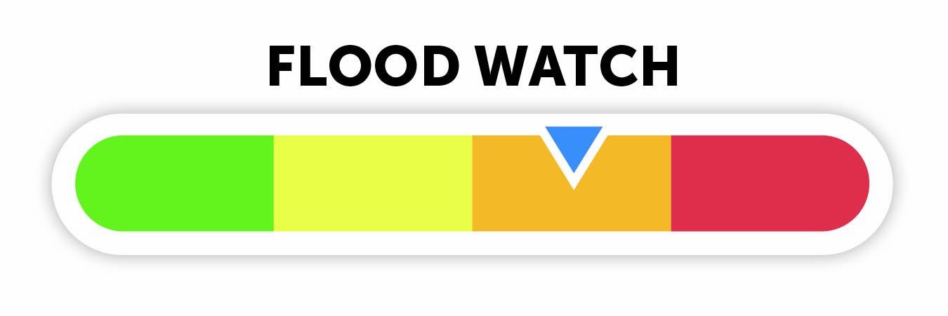
April 20, 2026 – A Flood Watch has been extended for the Tay Valley and Rideau Lakes regions in the Upper Rideau Watershed. Water levels across the upper watershed lakes remain elevated but are now stable or gradually declining following peak conditions. Flood risk has decreased, though flooding impacts may persist in low-lying areas until water levels recede further.
Residents are encouraged to continue monitoring local conditions and maintain appropriate precautions until water levels return to more typical seasonal levels.
MORE DETAILS:
Weather Forecast:
Environment Canada is forecasting daytime highs of approximately 4 to 6°C through April 21, increasing to 14 to 19°C across the region through late April. Minimal rainfall is expected over the short to mid-term range.
Environmental Conditions:
Water levels and flows across the Rideau Valley watershed remain elevated following the recent spring freshet. Peak water levels have occurred in the upper watershed lakes, and conditions are now generally in recession.
Snowpack across the watershed has been depleted, and runoff contributions have decreased significantly. While inflows have reduced, water levels within the reservoir system remain high due to the cumulative effects of earlier snowmelt and rainfall, as well as reduced available storage capacity.
Risks:
Flood risk has decreased from peak conditions, with the following risk factors remaining:
- Elevated water levels may continue to impact low-lying areas and locations historically prone to flooding
- Localized nuisance flooding may persist while water levels gradually decline
Location-Specific Considerations:
Tay River Subwatershed – Bobs Lake & Christie Lake
Water levels remain elevated within the upper Tay River system, including Bobs Lake and Christie Lake, but are generally trending downward. Flooding impacts in low-lying and historically flood-prone areas may persist in the near term. Residents should continue to monitor conditions and maintain protective measures as water levels recede. Parks Canada continues to actively manage conditions within the system.
Upper Rideau Subwatershed – Reservoir Lakes
Water levels across Wolfe Lake, Upper Rideau Lake, and Big Rideau Lake remain elevated but are stabilizing or gradually declining. Localized nuisance flooding may persist while water levels gradually recede.
Action & Safety Recommendations:
Residents in flood-prone areas are advised to remain vigilant and continue to take appropriate precautions, including:
- Ensuring sump pumps are clear, in good working condition, and have a backwater valve;
- Keeping a portable backup generator and pump easily accessible;
- Ensuring downspouts are clear and directing water at least 3 m away from the dwelling;
- Securing items that might float away as flows increase;
- Removing valuable items from basements or lower floors that could be subject to flooding;
- Keeping emergency phone numbers handy;
- Familiarizing yourself with your municipality’s Emergency Preparedness Plan.
Duration: This Flood Watch remains in effect until May 6 at 11:59 pm or until an update has been issued.
RVCA continues to monitor watershed conditions and will provide updates as required.
For more information, contact:
Justin Robert
Flood Duty Officer
1-800-267-3504 ext. 1194
RVCA Watershed Conditions Statements:
Water Safety – High flows, unstable banks, melting ice or other factors that could be dangerous for recreational users such as anglers, canoeists, hikers, children, pets, etc. Flooding is not expected.
Flood Outlook – Early notice of the potential for flooding based on weather forecasts, calling for heavy rain, snow melt, high winds or other conditions that could lead to high runoff, cause ice jams and/or lakeshore flooding or erosion.
Flood Watch – Flooding is possible in specific watercourses or municipalities. Municipalities, emergency services and individuals in flood prone areas should prepare.
Flood Warning – Flooding is imminent or already occurring in specific watercourses or municipalities.