


Displaying items by tag: water levels
Flood Outlook & Updated Flood Watch: Rideau Valley Watershed
(WCS – R04/2020)
March 19 ,2020 – The short-term forecast is calling for rainfall amounts of 10 to 15 mm and high temperatures near 15 degrees Celsius on Friday, followed by below zero temperatures on Saturday, and then milder temperatures in the days following. No significant rain is in the short-term forecast after Friday. With Friday’s rain and high temperatures, water levels and flows across the Rideau Valley Watershed are expected to increase everywhere and then decline again slowly with the cooler weather in the following days.
Some specific areas of concern are highlighted below:
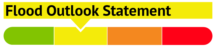
A FLOOD OUTLOOK is being issued for the following areas:
- Properties around Bob’s Lake, Christie Lake and Tay River in the upper Rideau Valley Watershed. In these areas, local residents should expect spring like water levels and flows. Parks Canada staff are closely monitoring the water levels in Bobs Lake and Christie Lake, and operations at the Bolingbroke Dam will take place as required, to balance the levels in Bobs Lake and Christie Lake.
- Properties around Wolfe Lake in the upper Rideau Valley Watershed.
- Properties around the smaller creeks and streams in the lower Rideau Valley Watershed, including the low-lying roads and waterfront properties adjacent to the Jock River (near Richmond)
- and any connected creeks or ditches.
A FLOOD WATCH continues for the low-lying areas along Stevens Creek and Taylor Drain in the Village of North Gower; however, water levels are expected to be somewhat similar or possibly less than those that have already been seen this spring.
Extreme caution should be exercised by everyone when near local waterbodies. Parents should inform their children of the risks and provide appropriate supervision.
Residents in flood prone or low-lying areas, historically susceptible to flooding, should continue to take the necessary precautions to protect their property, such as:
- Ensuring sump pump is clear, in good working condition and has a backwater valve
- Ensuring easy access to a portable backup generator and pump
- Ensuring downspouts are clear and the outlet is at least 3 metres from the dwelling
- Securing items that might float away as flows increase
- Removing valuable items from basements or lower floors that could be subject to flooding
- Keeping emergency phone numbers handy
- Familiarizing yourself with your municipality’s Emergency Preparedness Plan
This watershed conditions statement is in effect until April 2, 2020, at 5 p.m. and will be updated at that time unless the forecast or conditions change.
"Rideau Valley Conservation Authority is a partnership of municipalities within the Rideau Valley watershed created under the Conservation Authorities Act to deliver a range of programs in watershed management and natural resource conservation."
RVCA Watershed Conditions Statements:
- Water Safety – High flows, unstable banks, melting ice or other factors that could be dangerous for recreational users such as anglers, canoeists, hikers, children, pets, etc. Flooding is not expected.
- Flood Outlook – Early notice of the potential for flooding based on weather forecasts, calling for heavy rain, snow melt, high winds or other conditions that could lead to high runoff, cause ice jams and/or lakeshore flooding or erosion.
- Flood Watch – Flooding is possible in specific watercourses or municipalities. Municipalities, emergency services and individuals in flood prone areas should prepare.
- Flood Warning – Flooding is imminent or already occurring in specific watercourses or municipalities.
April 3, 2020 (WCS – R06/2020) –The Rideau Valley Conservation Authority is terminating the FLOOD WATCH that was previously in effect and issuing a HIGH WATER SAFETY message for all areas. Water levels and flows are still high for most, but not all, of the larger waterbodies in the Rideau Valley Watershed.
The short-term forecast does not indicate any significant precipitation and the snow is now melted across the Rideau Valley Watershed. As such, water levels and flows are expected to slowly decline in the days ahead.
Everyone needs to be cautious around lakes and streams with the fluctuating water levels. Children need to be educated about the hazards and kept away from all watercourses.
This watershed conditions statement is in effect until April 16, 2020 at 5 PM. No further updates will be issued unless the forecast or conditions change.
-end-
"Rideau Valley Conservation Authority is a partnership of municipalities within the Rideau Valley watershed created under the Conservation Authorities Act to deliver a range of programs in watershed management and natural resource conservation."
RVCA Watershed Conditions Statements:
- Water Safety – High flows, unstable banks, melting ice or other factors that could be dangerous for recreational users such as anglers, canoeists, hikers, children, pets, etc. Flooding is not expected.
- Flood Outlook – Early notice of the potential for flooding based on weather forecasts, calling for heavy rain, snow melt, high winds or other conditions that could lead to high runoff, cause ice jams and/or lakeshore flooding or erosion.
- Flood Watch – Flooding is possible in specific watercourses or municipalities. Municipalities, emergency services and individuals in flood prone areas should prepare.
- Flood Warning – Flooding is imminent or already occurring in specific watercourses or municipalities.
Minor Low Water Conditions in Rideau Valley Watershed
June 4, 2020 – Due to below average rainfall in April and May, conditions in the Rideau Valley Watershed now meet the threshold for Minor Low Water status under the Ontario Low Water Response Program. Watershed residents and businesses are encouraged to conserve water during dry conditions.
Although stream flow values are not currently below any of the low water thresholds, the stream flow values are lower than normal by as much as 30 to 50 percent and field observations indicate that ecological conditions are becoming stressed. The average 90-day rainfall measured at climate stations in and around the watershed is just shy of 80 per cent of normal for this time of year, which is a key indicator for Minor Low Water status. In the past 30 days, average rainfall is slightly below 50 per cent of normal. Looking ahead, the seven-day weather forecast suggests we will continue to receive minimal precipitation.
Following an early spring freshet this year, Parks Canada are closely monitoring the water levels throughout the Rideau Canal system inside the Rideau Valley watershed. Water levels in the reservoir lakes are currently close to normal but are expected to decline with little precipitation in the short-term forecast. Rideau River flows downstream of Big Rideau Lake have been reduced to minimum. Water levels in the Rideau River below Smiths Falls are within navigable ranges.
Conservation Authority staff continue to monitor conditions and communicate with water managers throughout the watershed. Updates to this message will be issued as conditions warrant.
-end-
"Rideau Valley Conservation Authority is a partnership of municipalities within the Rideau Valley watershed created under the Conservation Authorities Act to deliver a range of programs in watershed management and natural resource conservation."
June 25, 2020 – This statement is to advise that the low water status in the Rideau River watershed is now at MODERATE severity under the Ontario Low Water Responses Program.
Although some areas of the watershed have received more rain than others, the watershed has received very little rainfall over the past three months. The average 90-day rainfall measured at climate stations in and around the watershed is below 80 per cent of normal for this time of year. In the past 30 days, average rainfall is well below 50 per cent of normal. Looking ahead, the seven-day weather forecast suggests we will continue to receive minimal precipitation.
Stream flow values for all waterways are well below normal for this time of year. For example, the measured flows for the Rideau River at Carleton University and the Tay River in Perth are at about 40 percent normal for this time of year. Measured flows for the smaller tributaries such as the Jock River and Kemptville Creek are near 5 percent of normal for this time of year. Field observations around the watershed indicate that ecological conditions are poor with many fragmented streams and numerous reports of algae and/or weed growth.
Following an early spring freshet this year, Parks Canada are closely monitoring the water levels throughout the Rideau Canal system inside the Rideau Valley watershed. Water levels in the reservoir lakes, located in the upper reaches of the Rideau Valley watershed, are below normal and are expected to decline further with little precipitation in the forecast. Rideau River flows downstream of Big Rideau Lake have been reduced to minimum. Water levels in the Rideau River below Smiths Falls are within navigable ranges but some areas are below average for this time of year.
Water conservation is encouraged for all watershed residents and businesses, especially those who have permits for taking water from surface or groundwater sources and all residents on private, communal or municipal wells. There is less of a concern for residents of urban Ottawa because the City of Ottawa central drinking water system draws from the Ottawa River. Residents throughout the watershed should be aware of any bans or bylaws that may be in place in their municipalities regarding fires or watering bans.
Conditions are expected to decline with limited rain in the forecast. Conservation Authority staff continue to monitor conditions and communicate with water managers throughout the watershed. Updates to this message will be issued as conditions warrant.
More resources:
- Ministry of Environment, Conservation and Parks: https://www.ontario.ca/page/managing-your-water-well-times-water-shortage
- Ontario’s Low Water Response program: https://www.ontario.ca/page/surface-water-monitoring-centre#section-2
- RVCA website: www.rvca.ca
- Hourly and daily streamflows and water levels: https://www.rvca.ca/watershed-monitoring-reporting/reporting/streamflow-water-levels
"Rideau Valley Conservation Authority is a partnership of municipalities within the Rideau Valley watershed created under the Conservation Authorities Act to deliver a range of programs in watershed management and natural resource conservation."
(WCS-LW - 3/2020) July 15, 2020 – This statement is to advise that the low water status in the Rideau River watershed continues to be at MODERATE severity under the Ontario Low Water Responses Program.
Although varying amounts of rain fell across the watershed last weekend, the watershed has still received very little rainfall over the past three months. The average 90-day rainfall measured at climate stations in and around the watershed is below 60 per cent of normal for this time of year. In the past 30 days, average rainfall is below 45 per cent of normal. The recent hot weather has also increased the evaporation rates throughout the watershed. Looking ahead, the seven-day weather forecast suggests we may receive over 20 mm of rain.
Stream flow values for all waterways are well below normal for this time of year. For example, the measured flows for the Rideau River at Carleton University and the Tay River in Perth are at about 50 percent normal for this time of year. Measured flows for the smaller tributaries such as the Jock River and Kemptville Creek are at or below 3 percent of normal for this time of year. Field observations around the watershed indicate that ecological conditions are poor and declining with many fragmented streams, warm temperatures and numerous reports of extensive algae and/or weed growth.
Members of the Rideau Valley Water Response Team have indicated that municipal water supplies are not experiencing any issues as a result of low water and no issues with private wells have been reported. However, the Ontario Ministry of Agriculture and Food (OMAFRA) indicate numerous concerns including loss of crop yields and increase in wells being drilled to supply water for livestock.
Following an early spring freshet this year, Parks Canada are closely monitoring the water levels throughout the Rideau Canal system inside the Rideau Valley watershed. Water levels in the reservoir lakes, located in the upper reaches of the Rideau Valley watershed, are below normal and are expected to decline further with limited precipitation in the forecast. Rideau River flows downstream of Big Rideau Lake have been reduced to minimum. Water levels in the Rideau River below Smiths Falls are within navigable ranges but some areas are below average for this time of year.
Watershed residents and businesses are encouraged to voluntarily reduce their water usage by 20 percent and strongly encouraged to limit non-essential water usage. This is especially important for those who have permits for taking water from surface or groundwater sources and all residents on private, communal or municipal wells. There is less of a concern for residents of urban Ottawa because the City of Ottawa central drinking water system draws from the Ottawa River. Residents throughout the watershed should be aware of any bans or bylaws that may be in place in their municipalities regarding fires or watering bans.
In order that RVCA can track impacts of the low water conditions in the watershed, its is requested that any individuals or businesses in the Rideau Watershed who may be experiencing difficulties with their wells or other low water impacts please contact the Conservation Authority by email. Please send emails to .
Although there is some rain in the forecast, low water conditions are expected to intensify in the coming weeks. Conservation Authority staff continue to monitor conditions and communicate with water managers throughout the watershed. Updates to this message will be issued as conditions warrant.
More resources:
- Ministry of Environment, Conservation and Parks: https://www.ontario.ca/page/managing-your-water-well-times-water-shortage
- Ontario’s Low Water Response program: https://www.ontario.ca/page/low-water-response-program.
- RVCA website: www.rvca.ca
- Hourly and daily streamflows and water levels: https://www.rvca.ca/watershed-monitoring-reporting/reporting/streamflow-water-levels.
-end-
More Information:
Contact: Brian Stratton, RVCA Manager Engineering Services
Rideau Valley Conservation Authority
613-692-6804, 1-800-267-3504 ext. 1141
"Rideau Valley Conservation Authority is a partnership of municipalities within the Rideau Valley watershed created under the Conservation Authorities Act to deliver a range of programs in watershed management and natural resource conservation."
Watershed Conditions
Current Watershed Conditions
STAY
INFORMED
Worried about spring flooding? Have flood messages sent directly to your home email address. Subscribe to the RVCA Flood Forecasting and Warning mailing list.