


Displaying items by tag: water levels
Low Water Conditions Much Improved in Rideau Valley Watershed
(WCS-LW - 4/2020) August 5, 2020 — This statement is to advise that the low water status in the Rideau River watershed is being downgraded to “Minor” from “Moderate” severity under the Ontario Low Water Response Program because of recent precipitation.
Significant rain over the last week pushed 30-day rainfall totals above what is normal for the time of year at most climate monitoring sites in the region. However, the average 90-day rainfall measured at climate stations in and around the watershed is below 80 per cent of normal for this time of year which represents “Minor” low water severity. Looking ahead, the seven-day weather forecast suggests we may receive between 5 and 10 mm of rain across the watershed.
Stream flow values for all waterways are much closer to normal for this time of year compared to a few weeks ago. For example, the measured flows for the Rideau River at Carleton University and the Tay River in Perth are both slightly above 100 percent normal for this time of year. Measured flows for the smaller tributaries such as the Jock River and Kemptville Creek are still below normal for this time of year. Field observations around the watershed indicate that ecological conditions are much improved compared to a few weeks ago.
Following an early spring freshet this year, Parks Canada are closely monitoring the water levels throughout the Rideau Canal system inside the Rideau Valley watershed. 50-75% lower than normal amounts of precipitation in June and July resulted in below average level and flows conditions across the entire watershed. However, due to the recent significant rainfall received around the reservoir lakes (located in upper part of the watershed), the reservoir lake levels are near and/or above average. Due to the localized nature of the rain events, other nearby lakes located in the upper reaches of the Rideau Valley watershed, remain below normal. Rideau River flows downstream of Big Rideau Lake have been reduced to minimum. Water levels in the Rideau River below Smiths Falls are within navigable ranges but some areas are below average for this time of year.
Watershed residents and businesses are encouraged to voluntarily reduce their water usage by 10 percent. This is especially important for those who have permits for taking water from surface or groundwater sources and all residents on private, communal or municipal wells. There is less of a concern for residents of urban Ottawa because the City of Ottawa central drinking water system draws from the Ottawa River. Residents throughout the watershed should be aware of any bans or bylaws that may be in place in their municipalities regarding fires or watering bans.
Conservation Authority staff continue to monitor conditions and communicate with water managers throughout the watershed. Updates to this message will be issued as conditions warrant.
More resources:
- Ministry of Environment, Conservation and Parks: https://www.ontario.ca/page/managing-your-water-well-times-water-shortage
- Ontario’s Low Water Response program: https://www.ontario.ca/page/managing-your-water-well-times-water-shortage
- RVCA website: www.rvca.ca
- Hourly and daily streamflows and water levels: https://www.rvca.ca/watershed-monitoring-reporting/reporting/streamflow-water-levels
-end-
More Information:
Contact: Brian Stratton, RVCA Manager Engineering Services
Rideau Valley Conservation Authority
613-692-6804, 1-800-267-3504 ext. 1141
"Rideau Valley Conservation Authority is a partnership of municipalities within the Rideau Valley watershed created under the Conservation Authorities Act to deliver a range of programs in watershed management and natural resource conservation."
Low Water Status Returned to “Normal” in Rideau Valley Watershed
(WCS-LW - 52/2020) September 2, 2020 — Watershed conditions in the Rideau Valley Watershed have returned to “Normal’ under the Ontario Low Water Response Program.
With significant precipitation during the last month, the amount of rainfall received throughout the watershed is at or above average values for this time of year. As a result of this precipitation, stream flows and water levels are now at or above average values for this time of year. Looking ahead, the seven-day weather forecasts suggests we’ll continue to receive more rain.
Parks Canada continues to closely monitor the water levels throughout the Rideau Canal system inside the Rideau Valley watershed. Water levels in the reservoir lakes, located in the upper reaches of the Rideau Valley watershed, are either normal or above normal (i.e., Christie Lake) for this time of year and are expected to decline but this will depend on rainfall amounts received in the coming weeks. Rideau River flows downstream of Big Rideau Lake are now near normal. Water levels in the Rideau River below Smiths Falls are within navigable ranges for this time of year.
Conservation Authority staff continue to monitor conditions and communicate with water managers throughout the watershed. Updates to this message will be issued as conditions warrant.
More resources:
- Ministry of Environment and Climate Change: https://www.ontario.ca/page/managing-your-water-well-times-water-shortage
- Ontario’s Low Water Response program: https://www.ontario.ca/page/low-water-response-program
- RVCA website: www.rvca.ca
- Hourly and daily streamflows and water levels: https://www.rvca.ca/watershed-monitoring-reporting/reporting/streamflow-water-levels
"Rideau Valley Conservation Authority is a partnership of municipalities within the Rideau Valley watershed created under the Conservation Authorities Act to deliver a range of programs in watershed management and natural resource conservation."
Forecasted Precipitation May Increase Water Levels and Flows and Cause Unstable Ice Throughout Rideau Watershed
(WCS – R07/2020)
December 24, 2020 — Environment Canada is forecasting between 30 and 50 mm of rain starting today and continuing overnight throughout the Rideau Valley watershed.
Although no significant flooding is anticipated, water levels and flows are expected to increase in all waterways in the Rideau Valley Watershed. Depending on how much rain falls, residents who are adjacent to the smaller creeks and streams are advised to keep a close watch on water levels and flows and should take the necessary precautions to protect their property, such as:
- Ensuring sump pump is clear, in good working condition and has a backwater valve
- Ensuring easy access to a portable backup generator and pump
With the expected increase in water levels and flows in the coming days, ice cover on lakes, ditches, local streams and rivers will be unstable. Extreme caution should be exercised by everyone when near local waterbodies. Parents should inform their children of the risks and provide appropriate supervision.
This watershed conditions statement is in effect until Monday January 4, 2020 at 5 PM or until an update has been issued.
- end -
"Rideau Valley Conservation Authority is a partnership of municipalities within the Rideau Valley watershed created under the Conservation Authorities Act to deliver a range of programs in watershed management and natural resource conservation."
RVCA Watershed Conditions Statements:
- Water Safety – High flows, unstable banks, melting ice or other factors that could be dangerous for recreational users such as anglers, canoeists, hikers, children, pets, etc. Flooding is not expected.
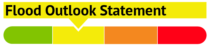
- Flood Outlook – Early notice of the potential for flooding based on weather forecasts, calling for heavy rain, snow melt, high winds or other conditions that could lead to high runoff, cause ice jams and/or lakeshore flooding or erosion.
- Flood Watch – Flooding is possible in specific watercourses or municipalities. Municipalities, emergency services and individuals in flood prone areas should prepare.
- Flood Warning – Flooding is imminent or already occurring in specific watercourses or municipalities.
Mild Winter Causing Unstable Ice Throughout Rideau Watershed
WCS – R01/2021)
January 13, 2021 – Environment Canada is forecasting mild temperatures for the remainder of this week, with daily temperatures above zero each day and some rain expected on Friday and Saturday. This follows a warmer than usual December and a mild January to date. As a result of a significant rain event on December 24 and 25, water levels are above normal for this time of year in the some of the lakes and rivers in the Rideau Lakes and Tay Valley sub-watersheds. Generally, water levels are at normal levels for the remainder of the watershed.
Although no significant flooding is anticipated at this time, it is expected that water levels and flows will continue to fluctuate across the watershed with the continued warmer-than-normal conditions and forecasted rain later this week. As a result, ice thickness can change drastically and be unpredictable. The shoreline adjacent to lakes, rivers and creeks is also very slippery and poses a serious hazard. Falling into open water can result in hypothermia or drowning.
The RVCA reminds the public to exercise extreme caution around all waterbodies by:
- Regularly testing ice thickness and staying off ice that may cover flowing water
- Reminding children about the dangers of playing on or near ice covered surfaces and open water
- Keeping pets on leash near frozen water bodies.

RVCA does not monitor or maintain ice conditions anywhere, including its 11 public conservation areas. This includes the Rideau River and its tributaries, as well as the ponds, lakes and other bodies of water within our parks.
This watershed conditions statement is in effect until Monday, February 1, 2021 at 5 PM or until an update has been issued.
"Rideau Valley Conservation Authority is a partnership of municipalities within the Rideau Valley watershed created under the Conservation Authorities Act to deliver a range of programs in watershed management and natural resource conservation."
RVCA Watershed Conditions Statements:
- Water Safety – High flows, unstable banks, melting ice or other factors that could be dangerous for recreational users such as anglers, canoeists, hikers, children, pets, etc. Flooding is not expected.
- Flood Outlook – Early notice of the potential for flooding based on weather forecasts, calling for heavy rain, snow melt, high winds or other conditions that could lead to high runoff, cause ice jams and/or lakeshore flooding or erosion.
- Flood Watch – Flooding is possible in specific watercourses or municipalities. Municipalities, emergency services and individuals in flood prone areas should prepare.
- Flood Warning – Flooding is imminent or already occurring in specific watercourses or municipalities.
Cold Weather this weekend could cause localized frazil ice formation and flooding in Rideau Valley Watershed
WCS - R02/2021
January 29, 2021 – Environment Canada is forecasting very cold weather beginning today and continuing into Sunday before returning to normal range on Monday. This includes night-time wind chill temperatures in the range of -20 to -30 degrees Celsius. In areas where there is a lack of ice cover along with turbulent flow, these cold temperatures can trigger the formation of frazil ice which can accumulate quickly on bridge abutments, piers and riverbanks resulting in increased water levels and flooding in low-lying areas. The small rivers and streams with open water, such as the Tay River, are considered the most vulnerable for frazil ice formation, resulting in localized flooding. Please notify RVCA if any localized flooding is observed to due frazil ice formation by sending an email to .
Residents are advised to stay away from all rivers and watercourses in the vicinity of any frazil ice and high-water areas. Parents are encouraged to explain these dangers to their children.
This watershed conditions statement is in effect until Monday February 1, 2021 at 5 PM or until an update has been issued.
"Rideau Valley Conservation Authority is a partnership of municipalities within the Rideau Valley watershed created under the Conservation Authorities Act to deliver a range of programs in watershed management and natural resource conservation."
RVCA Watershed Conditions Statements:
- Water Safety – High flows, unstable banks, melting ice or other factors that could be dangerous for recreational users such as anglers, canoeists, hikers, children, pets, etc. Flooding is not expected.
- Flood Outlook – Early notice of the potential for flooding based on weather forecasts, calling for heavy rain, snow melt, high winds or other conditions that could lead to high runoff, cause ice jams and/or lakeshore flooding or erosion.
- Flood Watch – Flooding is possible in specific watercourses or municipalities. Municipalities, emergency services and individuals in flood prone areas should prepare.
- Flood Warning – Flooding is imminent or already occurring in specific watercourses or municipalities.
Watershed Conditions
Current Watershed Conditions
STAY
INFORMED
Worried about spring flooding? Have flood messages sent directly to your home email address. Subscribe to the RVCA Flood Forecasting and Warning mailing list.