


Displaying items by tag: flood
Updated: Flood Outlook — Lower Ottawa River | Perspective de crue – Cours inférieur de la rivière des Outaouais 2022
Water Conditions Statement: Flood Outlook — Lower Ottawa River
April 27, 2022 —
The Flood Outlook Statement issued on April 14th is still in effect for areas along the Lower Ottawa River (Arnprior to Hawkesbury).
Water levels and flows on the main stem of the Ottawa River are expected to increase in most locations over the next few days in response to combined snowmelt from the northern part of the basin and recent rainfall. Levels are expected to be similar to those experienced about one week ago in most locations before starting to decline. Reservoirs throughout the basin are being used to partially store runoff from the northern areas.
Residents in flood-prone areas are encouraged to closely follow changing conditions and to take necessary measures. Residents are advised to stay away from watercourses where flows are high and where banks might be unstable. Parents are encouraged to explain dangers to children.
The Mississippi Valley, Rideau Valley, and South Nation Conservation Authorities, and the Ministry of Northern Development, Mines, Natural Resources and Forestry monitor water levels and weather forecasts as part of the Flood Forecasting and Warning Program. Updates are provided as conditions change.
The Ottawa River Regulating Committee will be reassessing forecast conditions and
providing hydrological condition updates on its website daily at www.ottawariver.ca/forecasts/.
To view current flood warnings across Ontario, visit: www.ontario.ca/law-and-safety/flood-forecasting-and-warning-program.
This FLOOD OUTLOOK STATEMENT is in effect until May 18, 2022 at 5:00 PM. No further updates will be issued unless the forecast or conditions change.
Definitions:
- Water Conditions Statement: Water Safety: indicates that high flows, melting ice or other factors could be dangerous for such users as boaters, anglers and swimmers but flooding is not expected.
- Water Conditions Statement: Flood Outlook: gives early notice of the potential for flooding based on weather forecasts calling for heavy rain, snow melt, high winds or other conditions.
- Flood Watch: potential for flooding exists within specific watercourses and municipalities.
- Flood Warning: flooding is imminent or occurring within specific watercourses and municipalities.
-- end --
Communiqué sur les conditions du bassin versant : Perspective de crue – Cours inférieur de la rivière des Outaouais
Le 27 avril 2022 —
Le bulletin de prévision des crues émis le 14 avril est toujours en vigueur pour les régions situées le long du cours inférieur de la rivière des Outaouais (d'Arnprior à Hawkesbury).
On s'attend à ce que les niveaux et les débits d'eau du cours principal de la rivière des Outaouais augmentent en de nombreux endroits au cours des prochains jours, en raison de la fonte de neige combinée aux récentes précipitations dans la partie nord du bassin. Les niveaux devraient être semblables à ceux d'il y a environ une semaine dans la plupart des endroits avant de commencer à baisser. On utilise les réservoirs du bassin pour stocker partiellement les eaux de ruissellement provenant des régions du nord.
Les résidents des zones sujettes aux inondations sont invités à suivre de près l'évolution des conditions et à prendre les mesures nécessaires. Il est conseillé aux résidents de ne pas s'approcher des cours d'eau dont le débit est élevé et dont les berges pourraient être instables.
On conseille aussi aux parents d'expliquer ces dangers aux enfants.
Les offices de protection de la nature des rivières Mississippi, Rideau et de la Nation Sud ainsi que le Ministère du Développement du Nord, des Mines, des Richesses naturelles et des Forêts surveillent les niveaux d'eau et les prévisions météorologiques dans le cadre du Programme de prévision des crues et d'avertissement du public. Des mises à jour sont communiquées au fur et à mesure que les conditions changent.
Le Comité de régularisation de la rivière des Outaouais réévaluera les conditions prévues et diffusera des mises à jour concernant les conditions hydrologiques sur son site Web tous les jours à www.ottawariver.ca/forecasts/. Pour consulter les avertissements de crues actuels à travers l'Ontario, visitez : www.ontario.ca/law-and-safety/flood-forecasting-and-warning-program.
Ce COMMUNIQUÉ DE PERSPECTIVE DE CRUE est en vigueur jusqu'au 18 mai 2022 à 17 h. Aucune autre mise à jour ne sera publiée, à moins que les prévisions ou les conditions ne changent.
Définitions :
- Communiqué sur les conditions des bassins versants – Sécurité aquatique : indique que des débits forts, de la glace fondante ou d’autres facteurs peuvent être dangereux pour des utilisateurs comme les plaisanciers, les pêcheurs à la ligne et les baigneurs, mais qu’une crue n’est pas prévue.
- Communiqué sur les conditions des bassins versants – Perspective de crue :préavis de crue possible basé sur des prévisions de pluies abondantes, de fonte des neiges, de forts vents ou autre.
- Veille de crue :possibilité de crue pour des cours d’eau et municipalités spécifiques.
- Avertissement de crue : crue immimente ou en cours pour des cours d’eau et
municipalités spécifiques.
-- fin --
WATER SAFETY STATEMENT - Significant Precipitation Event Will Cause Increased Water Levels Across Rideau Valley Watershed
(WCS – R09/2022)
December 21, 2022 – Caution is advised as a major winter storm makes its way to the Rideau Valley this week. Environment Canada’s short-term weather forecast indicates precipitation will begin as rain or snow late Thursday, Dec. 22 before transitioning to rain on Friday. Rainfall amounts of up to 40 mm are forecasted for Friday before the temperature drops below zero. Falling temperatures will be accompanied by strong winds along with more snow.
Water levels and flows are generally low to average for this time of year across the Rideau Valley Watershed. Although no significant flooding is anticipated, water levels and flows are expected to increase in all waterways in the Rideau Valley Watershed in the coming days. Residents adjacent to smaller creeks and streams are advised to keep a close watch on water levels and flows and should take the necessary precautions to protect their property, such as:
- Ensuring sump pump is clear, in good working condition and has a backwater valve
- Ensuring easy access to a portable backup generator and pump
- Ensuring downspouts are clear and the outlet is at least 3 metres from the dwelling
- Securing items that might float away as flows increase
- Removing valuable items from basements or lower floors that could be subject to flooding
- Keeping emergency phone numbers handy
- Familiarizing yourself with your municipality’s Emergency Preparedness Plan
Extreme caution should be exercised by everyone when near local waterbodies. Parents should inform their children of the risks and provide appropriate supervision. Pets should be leashed near all bodies of water.
This watershed conditions statement is in effect until Monday, Dec. 26, 2022 at 5 PM or until an update has been issued.
-end-
More Information:
Brian Stratton, RVCA Manager Engineering Services
Rideau Valley Conservation Authority
613-692-6804, 1-800-267-3504 ext. 1141
www.rvca.ca/watershed-conditions
"Rideau Valley Conservation Authority is a partnership of municipalities within the Rideau Valley watershed created under the Conservation Authorities Act to deliver a range of programs in watershed management and natural resource conservation."
RVCA Watershed Conditions Statements:
- Water Safety – High flows, unstable banks, melting ice or other factors that could be dangerous for recreational users such as anglers, canoeists, hikers, children, pets, etc. Flooding is not expected.
- Flood Outlook – Early notice of the potential for flooding based on weather forecasts, calling for heavy rain, snow melt, high winds or other conditions that could lead to high runoff, cause ice jams and/or lakeshore flooding or erosion.
- Flood Watch – Flooding is possible in specific watercourses or municipalities. Municipalities, emergency services and individuals in flood prone areas should prepare.
- Flood Warning – Flooding is imminent or already occurring in specific watercourses or municipalities.
WATER SAFETY STATEMENT - Water Safety Statement Extended Due To Prolonged Warming Trend and Forecasted Rainfall
(WCS – R10/2022)
December 30, 2022 – The Rideau Valley Conservation Authority is extending the Water Safety Statement issued on December 21, 2022 due to a prolonged warming trend and forecasted rainfall over the next few days.
Above zero temperatures are expected to continue late into next week, with forecasted rainfall of 20-30 mm through the weekend. These conditions will likely accelerate the release of the existing snowpack and will result in increased flows and water levels throughout the Rideau Valley watershed.
With rising water levels expected over the next few days, ice cover on lakes, ditches, local streams, and rivers will be unstable. Extreme caution should be exercised by everyone when near local waterbodies. Parents should inform their children of the risks and provide appropriate supervision. Keep pets leashed near waterbodies, as well.
At this time, no significant flooding is anticipated, however residents adjacent to smaller creeks and streams are advised to keep a close watch on water levels and flows and should take the necessary precautions to protect their property, such as:
- Ensuring sump pump is clear, in good working condition and has a backwater valve
- Ensuring easy access to a portable backup generator and pump
- Ensuring downspouts are clear and the outlet is at least 3 metres from the dwelling
- Securing items that might float away as flows increase
- Removing valuable items from basements or lower floors that could be subject to flooding
- Keeping emergency phone numbers handy
- Familiarizing yourself with your municipality’s Emergency Preparedness Plan
This watershed conditions statement is in effect until Friday, January 6, 2023 at 5 PM or until an update has been issued
-end-
"Rideau Valley Conservation Authority is a partnership of municipalities within the Rideau Valley watershed created under the Conservation Authorities Act to deliver a range of programs in watershed management and natural resource conservation."
RVCA Watershed Conditions Statements:
- Water Safety – High flows, unstable banks, melting ice or other factors that could be dangerous for recreational users such as anglers, canoeists, hikers, children, pets, etc. Flooding is not expected.
- Flood Outlook – Early notice of the potential for flooding based on weather forecasts, calling for heavy rain, snow melt, high winds or other conditions that could lead to high runoff, cause ice jams and/or lakeshore flooding or erosion.
- Flood Watch – Flooding is possible in specific watercourses or municipalities. Municipalities, emergency services and individuals in flood prone areas should prepare.
- Flood Warning – Flooding is imminent or already occurring in specific watercourses or municipalities.
FLOOD OUTLOOK - Elevated Water Levels Expected to Continue for Christie Lake and Tay River Region
(WCS – R01/2023)
January 12, 2023 – After gaining and losing a large amount of snow over the holiday season, the short-term forecast is calling for between 15 and 30 cm of snow starting Thursday, Jan. 12 through late Friday, Jan. 13.
Elevated water levels/flows are now declining across most of the watershed after above-average temperatures and precipitation caused a spike at the end of December and early January. But water levels in the upper watershed reservoir lakes, specifically Bobs and Christie Lake, are above average and continue to increase. The conditions are being monitored closely by Parks Canada staff.
A FLOOD OUTLOOK is now in effect for Christie Lake as the water levels are expected to remain high and may increase over the next month or so depending on the weather conditions. Residents on Christie Lake are advised to keep a close watch on water levels and should take the necessary precautions to protect their property, such as:
- Ensuring sump pump is clear, in good working condition and has a backwater valve
- Ensuring easy access to a portable backup generator and pump
- Ensuring downspouts are clear and the outlet is at least 3 metres from the dwelling
- Securing items that might float away as flows increase
- Removing valuable items from basements or lower floors that could be subject to flooding
- Keeping emergency phone numbers handy
- Familiarizing yourself with your municipality’s Emergency Preparedness Plan
Extreme caution should be exercised by everyone when near local waterbodies. Parents should inform their children of the risks and provide appropriate supervision. Pets should be leashed near all bodies of water.
Because of the above normal water level/flows across the watershed, localized ice jams and/or frazil ice formation may occur in areas of open water which can cause localized flooding.
This watershed conditions statement is in effect until Wednesday, February 1, 2023 at 5 PM or until an update has been issued.
-end-
"Rideau Valley Conservation Authority is a partnership of municipalities within the Rideau Valley watershed created under the Conservation Authorities Act to deliver a range of programs in watershed management and natural resource conservation."
RVCA Watershed Conditions Statements:
- Water Safety – High flows, unstable banks, melting ice or other factors that could be dangerous for recreational users such as anglers, canoeists, hikers, children, pets, etc. Flooding is not expected.
- Flood Outlook – Early notice of the potential for flooding based on weather forecasts, calling for heavy rain, snow melt, high winds or other conditions that could lead to high runoff, cause ice jams and/or lakeshore flooding or erosion.
- Flood Watch – Flooding is possible in specific watercourses or municipalities. Municipalities, emergency services and individuals in flood prone areas should prepare.
- Flood Warning – Flooding is imminent or already occurring in specific watercourses or municipalities.
SPRING OUTLOOK - With High Snowpack, Prepare for Spring Flooding Across the Rideau Valley
(WCS – R02/2023)
RIDEAU VALLEY, March 9, 2023 – The winter of 2022-23 is quickly coming to an end, and RVCA’s Flood Forecasting team is working closely with its municipal and agency partners to prepare for potential spring flooding. As discussed below, it is important to be prepared for possible flood conditions over the next few weeks as spring returns to the Rideau Valley watershed.
Current conditions:
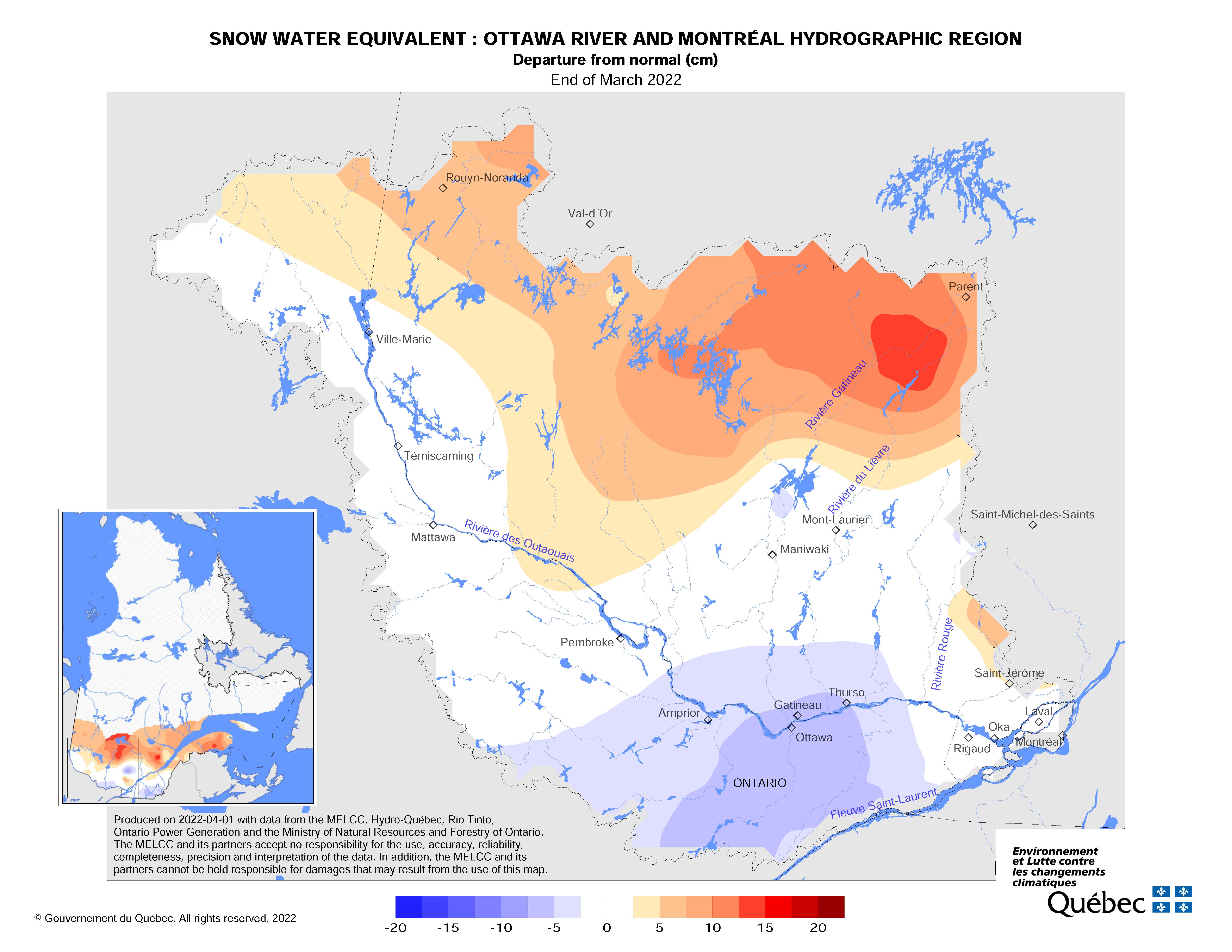
- This winter has been unusually mild with some rain events and approximately 300 cm of snow fallen to date in the Ottawa area. The snowpack varies throughout the Rideau Valley Watershed, but in general the water content in the snow is near average for the upper and middle parts of the watershed and above average for the lower part of the watershed (Ottawa area).
- Due to the mild weather and rain throughout the winter, water levels on some upper watershed lakes are presently above normal for this time of year (i.e., Wolfe & Christie Lakes). Parks Canada staff who manage water levels for the Rideau Canal will closely monitor these water levels and have indicated that the levels are expected to rise in the upper watershed lakes as the snowpack begins to melt.
- The current short-term forecast indicates limited precipitation and seasonal temperatures (slightly above zero temperatures during the day and below zero at night); however, we know the daily temperature will begin to increase and there will likely be some rain as we move through March.
- City of Ottawa crews have begun the annual ice removal program on the Rideau River between Rideau Falls and Bronson Avenue. Crews will work to keep the ice from reforming until the spring freshet occurs (for more information: City of Ottawa’s information line at 311).
What does this mean for flood potential?
- Based solely on the fact we have above-average snow water content and above-normal water levels in some upper watershed lakes, there is potential for above-average flooding this spring across the Rideau Valley Watershed, especially in low lying areas which have flooded in the past.
- Precipitation and temperature are two other key factors influencing actual flood conditions as we move through March and into April, which staff will monitor closely.
- The short-term forecast suggests a slow melt with little precipitation, which is favourable for limited flooding for at least the first half of March.
With changing levels expected over the coming weeks, ice cover on lakes, ditches, local streams and rivers will continue to be unstable. Extreme caution should be exercised by everyone when near local waterbodies. Parents should inform their children of the risks and provide appropriate supervision.
As the temperatures start to warm up, ice jams are possible in local streams and rivers, as flows could quickly increase before the ice can melt. Residents are advised to monitor their local waterbody closely for signs of ice jams as spring progresses. RVCA staff will be monitoring conditions, but we always welcome observations from watershed residents.
Potential flooding along roadways is also a concern due to current snow/ice buildup on roadside ditches and some roads.
Residents in flood-prone or low-lying areas historically susceptible to flooding should take the necessary precautions to protect their property, such as:
- Ensuring sump pump is clear, in good working condition and has a backwater valve
- Ensuring easy access to a portable backup generator and pump
- Ensuring downspouts are clear and the outlet is at least 3 metres from the dwelling
- Securing items that might float away as flows increase
- Removing valuable items from basements or lower floors that could be subject to flooding
- Keeping emergency phone numbers handy
- Familiarizing yourself with your municipality’s Emergency Preparedness Plan
More information including our Flood Contingency Plan and real-time water level and stream flow data can be found atwww.rvca.ca/watershed-conditions.
This watershed conditions statement is in effect until March 24, 2023 at 5 p.m. and may be updated at that time unless the forecast or conditions change.
-end-
More Information:
Contact: Brian Stratton, RVCA Manager Engineering Services
Rideau Valley Conservation Authority
613-692-6804, 1-800-267-3504 ext. 1141
www.rvca.ca/watershed-conditions
"Rideau Valley Conservation Authority is a partnership of municipalities within the Rideau Valley watershed
created under the Conservation Authorities Act to deliver a range of programs in watershed management and
natural resource conservation."
RVCA Watershed Conditions Statements:
- Water Safety – High flows, unstable banks, melting ice or other factors that could be dangerous for recreational users such as anglers, canoeists, hikers, children, pets, etc. Flooding is not expected.
- Flood Outlook – Early notice of the potential for flooding based on weather forecasts, calling for heavy rain, snow melt, high winds or other conditions that could lead to high runoff, cause ice jams and/or lakeshore flooding or erosion.
- Flood Watch – Flooding is possible in specific watercourses or municipalities. Municipalities, emergency services and individuals in flood prone areas should prepare.
- Flood Warning – Flooding is imminent or already occurring in specific watercourses or municipalities.