
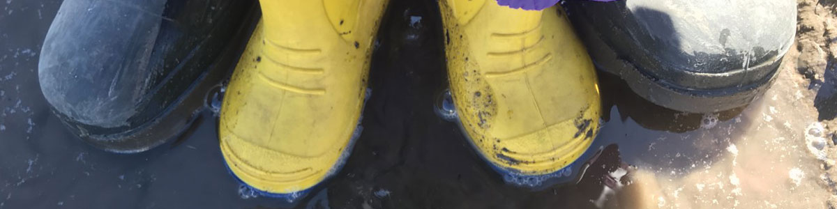
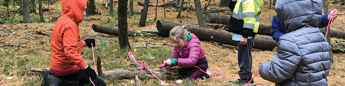
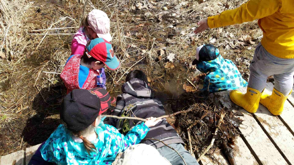
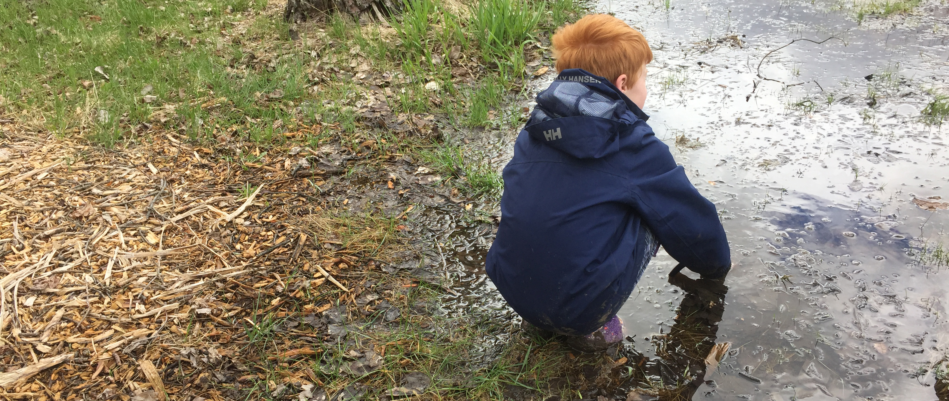

Foley Mountain Educational Programming
The outdoor environmental education program at Foley Mountain provides students with interactive, experiential, curriculum-based experiences that will help them to understand our natural world and their relationship with it. The Program can accommodate up to 60 students per day and all equipment is provided. All programs are approximately 1.5 hours in duration. Descriptions are offered as general guidelines — if there are specific objectives that you would like to accomplish, please let us know. Although grade levels are recommended for each program, these are only guidelines. Please select any desired fields to narrow your search.
| Half Day Program | $200 / group * | maximum 30 students, 90 minutes with an RVCA instructor |
| Full Day Program | $275 / group * | maximum 30 students, two 90 minutes with an RVCA instructor |
| Self-directed | $2.50/person * | Interested in just visiting the conservation area with your class but not booking a program? The cost is $2.50/person. This does not include the use of buildings other than access to public washrooms. To reserve facilities, contact staff. Staff must still be contacted to book a self-directed visit. |
| Overnight Tent Camping (accommodations only) | 1-15 people - $90/night * 16-30 people - $180/night * 30+ people - $7 for each additional person * Additional buildings also available for rent (link to facility rentals) |
Take you class on an overnight adventure to our group camping area! Plan your own activities or book our education staff to provide programming during your stay (see above for pricing). |
| Virtual Outdoor Education Program | $100 for a 45 minute program for up to 30 students * | Our outdoor education staff will guide you and your students through an adventure that focuses on bringing the outdoors to you. Our virtual programs are live, adapted for each grade level listed, curriculum connected, and include opportunities to interact directly with our outdoor educators! |
* plus applicable taxes
For information and to book a VIRTUAL program, click here.

Watershed Conditions (19)
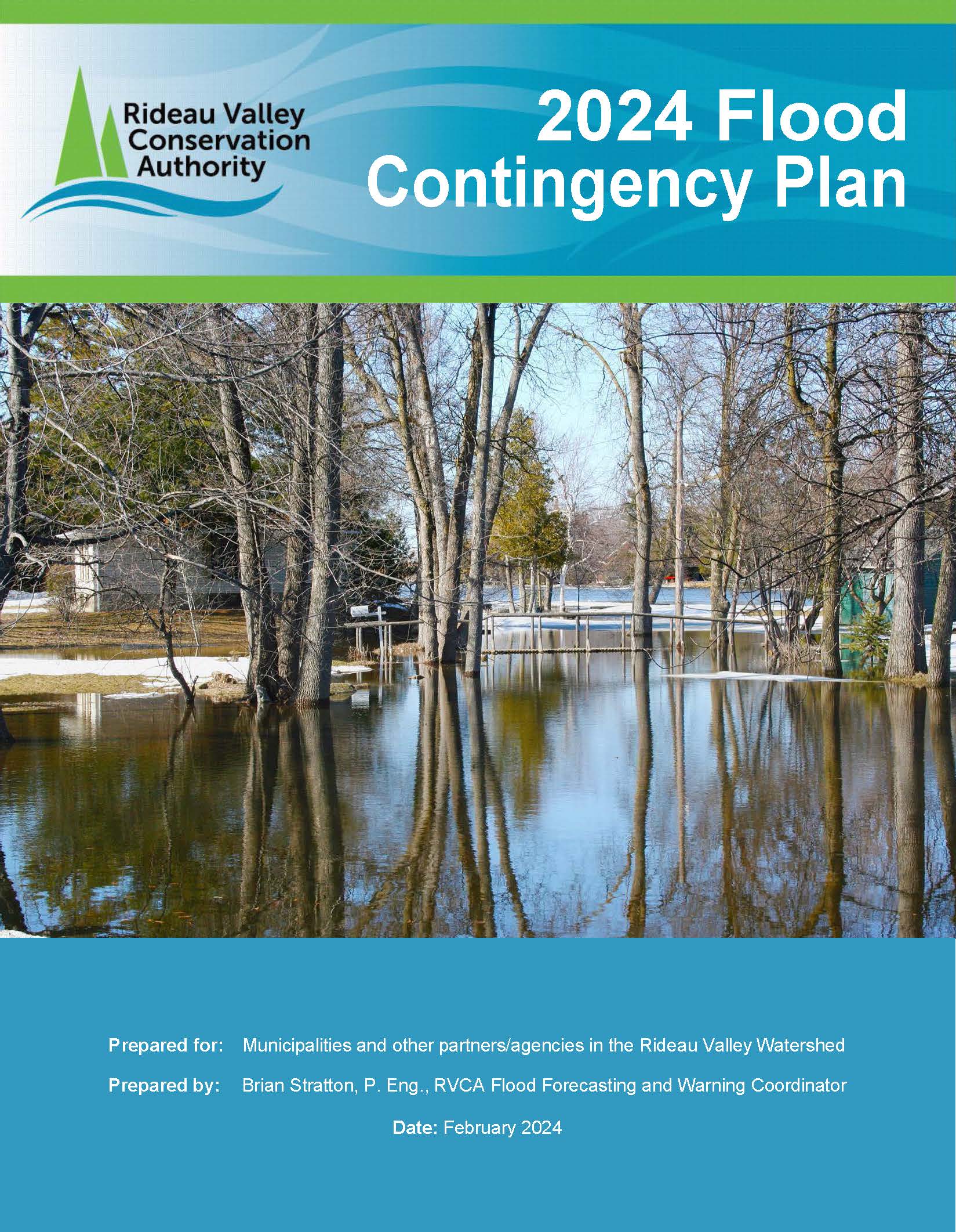
The responsibility for dealing with flood contingency planning in Ontario is shared by municipalities, Conservation Authorities (CAs) and the Ministry of Natural Resources and Forestry (MNRF), on behalf of the province. The Rideau Valley Conservation Authority (RVCA) 2023 Flood Contingency Plan was prepared in accordance with the provincial standards established in the Ontario Flood Forecasting and Warning: Implementation Guidelines for Conservation Authorities and Ministry of Natural Resources and Forestry’s document.
The purpose of this manual is to provide an overview of how RVCA Flood Forecasting and Warning System operates. Key information presented in this manual includes:
- roles and responsibilities throughout a flood event
- key background information about water management in the RVCA
- RVCA flood forecasting and warning operations
- the RVCA flood message system
This manual is not a municipal emergency preparedness plan and should not be used for that purpose.
The goal of the RVCA Flood Forecasting and Warning System is to provide an estimate of the potential for river and stream flooding in the Rideau Valley watershed and, based on that estimate, give sufficient advance warning to the designated municipal officials and members of the public in order that appropriate steps can be taken to reduce the risk of loss of life, injury, and property damage due to flooding.
-
Significant Rain in April Causing Elevated Water Levels
(WCS – R06/2024)
April 15, 2024 – A Flood Outlook Statement is being issued for the Upper Rideau Valley Watershed.Since early April, two large weather systems have brought between 60 to 90 mm of precipitation across the Rideau Valley Watershed. The highest precipitation amounts (90 mm) fell across the Upper Rideau Valley Watershed near Bob’s and Christie Lakes and the Tay River. The weather forecast indicates another 10 to 15 mm of precipitation for the next week.
The significant precipitation received since early April has resulted in increased water levels and flows in all waterways in the Rideau Valley Watershed.
Based on the above, a FLOOD OUTLOOK is being issued for the properties around Bobs and Christie Lakes in the Upper Rideau Valley Watershed. The water levels are expected to exceed full supply levels by this coming weekend and may result in flooding for low-lying areas. Parks Canada staff are closely monitoring the water levels in Bobs Lake and Christie Lake. Operations at the Bolingbroke Dam will take place as required to balance the levels in Bobs Lake and Christie Lake.
Residents in low-lying areas near Bobs and Christie Lakes that are historically susceptible to flooding should take the necessary precautions to protect their property, such as:
- Ensuring sump pump is clear, in good working condition and has a backwater valve
- Ensuring easy access to a portable backup generator and pump
- Ensuring downspouts are clear and the outlet is at least 3 metres from the dwelling
- Securing items that might float away as flows increase
- Removing valuable items from basements or lower floors that could be subject to flooding
- Keeping emergency phone numbers handy
- Familiarizing yourself with your municipality’s Emergency Preparedness Plan
With the elevated conditions, potential exists for further impacts if significant additional rain were to occur before the water levels and flows begin to recede.
Extreme caution should be exercised by everyone when near local waterbodies. Parents should inform their children of the risks and provide appropriate supervision. Pets should be leashed near all bodies of water.
This watershed conditions statement is in effect until Wednesday, April 24, 2024 at 5 PM unless the forecast or conditions change.
-end-
Contact: Brian Stratton, RVCA Manager Engineering Services
Rideau Valley Conservation Authority
613-692-6804, 1-800-267-3504 ext. 1141
www.rvca.ca/watershed-conditions"Rideau Valley Conservation Authority is a partnership of municipalities within the Rideau Valley watershed
created under the Conservation Authorities Act to deliver a range of programs in watershed management and
natural resource conservation."
RVCA Watershed Conditions Statements:
- Water Safety – High flows, unstable banks, melting ice or other factors that could be dangerous for recreational users such as anglers, canoeists, hikers, children, pets, etc. Flooding is not expected.
- Flood Outlook – Early notice of the potential for flooding based on weather forecasts, calling for heavy rain, snow melt, high winds or other conditions that could lead to high runoff, cause ice jams and/or lakeshore flooding or erosion.
- Flood Watch – Flooding is possible in specific watercourses or municipalities. Municipalities, emergency services and individuals in flood prone areas should prepare.
- Flood Warning – Flooding is imminent or already occurring in specific watercourses or municipalities.
Our low water index has four stages:The RVCA issues water conditions statements to inform residents, municipalities and other stakeholders of changing water levels across the watershed.

A green gauge means conditions are normal. No low flow or drought conditions exist.
This category reflects concern.
80% to 60% of long-term average precipitation for 540 day and/or 90 day precipitation totals and/or 7-day average streamflows less than the 5 year return period low flow.
This category suggests a potentially serious problem is pending.
60% to 40% of long-term average precipitation for 540, 90 and/or 30 day precipitation totals and/or 7-day average streamflows less than the 10 year return period low flow.
This category indicates a failure of the water supply to meet demand.
Less than 40% of long-term average precipitation for 540, 90 and/or 30 day precipitation totals and/or 7-day average streamflows less than the 10 year return period low flow.
Click here for the RVCA's Watershed Conditions Statements.
Know the warning system
The RVCA issues water conditions statements to inform residents, municipalities and other stakeholders of changing water levels across the watershed.

A green gauge means conditions are normal.
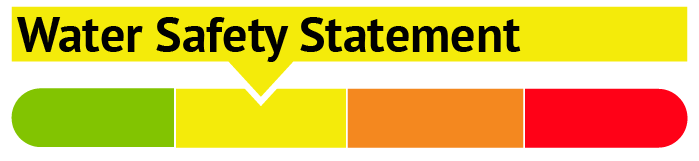
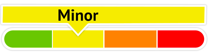
A yellow Water Safety Statement means rivers could have high flows, unsafe banks, melting ice or other factors that could be dangerous. However, flooding is not expected.
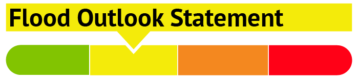
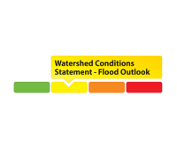
A yellow Flood Outlook Statement is an early notice of the potential for flooding based on weather forecasts calling for heavy rain, snow melt, high wind or other conditions that could lead to high runoff, cause ice jams, lakeshore flooding or erosion.

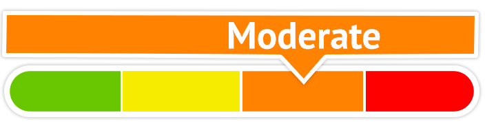
An orange Flood Watch means flooding is possible in specific watercourses or municipalities. Municipalities, emergency services and individual landowners in flood-prone areas should prepare.

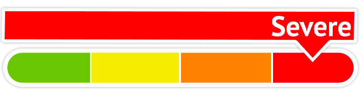
A red Flood Warning means flooding is imminent or already occurring in specific watercourses or municipalities.
Click here for the RVCA's Watershed Conditions Statements. Click here for RVCA real-time flows and water levels.
For water levels and flows on the Ottawa River visit the Ottawa River Regulation Planning Board
A flood is coming: What should you do?
If you live in a flood-prone area, the best thing you can do to keep your family and property safe is to make a plan and be prepared to follow it.
Each flood situation is unique, and your emergency plan should account for that – and be ready well in advance.
1. Know the warning system
The RVCA issues water conditions statements to inform residents, municipalities and other stakeholders of changing water levels across the watershed.
Click on a gauge for a larger image
GREEN: A green gauge means conditions are normal.
YELLOW: A yellow gauge can mean two things:
- A yellow Water Safety Statement means rivers could have high flows, unsafe banks, melting ice or other factors that could be dangerous. However, flooding is not expected.
- A yellow Flood Outlook Statement is an early notice of the potential for flooding based on weather forecasts calling for heavy rain, snow melt, high wind or other conditions that could lead to high runoff, cause ice jams, lakeshore flooding or erosion.
ORANGE: An orange Flood Watch means flooding is possible in specific watercourses or municipalities. Municipalities, emergency services and individual landowners in flood-prone areas should prepare.
RED: A red Flood Warning means flooding is imminent or already occurring in specific watercourses or municipalities.
2. Be prepared
- The first step to flood preparedness is knowing your risk level. Call an RVCA Resource Specialist to learn more about your property before flooding occurs.
- Subscribe to RVCA’s flood messages for regular updates and advanced warning of an impending flood. You can also stay informed through the RVCA website or our Facebook and Twitter pages.
- Learn about your municipality’s emergency plan: evacuation routes and locations for emergency shelters, as well as their sandbag program if they have one.
- Plan and practice an evacuation route with your family.
- Pack an emergency kit that can be accessed easily and carried quickly in case of evacuation; include any necessary medication, blankets, extra clothing and flashlights.
- Install a battery powered sump pump that can work in a blackout.
Learn more from Environment Canada's detailed flood preparation guide.
Managing flood risks in the Rideau Valley
Conservation authorities have a broad mandate to protect their watersheds, which can include everything from tree planting to regulating development in the floodplain. Not surprisingly, many residents have questions about the role of conservation authorities in their lives, especially when it comes to floods.
Flood Outlook - Ottawa River (Cumberland, Britannia Bay, Constance Bay) Ottawa River Levels Increase
Super User
May 4, 2018 – Water levels are expected to increase through the weekend on the Ottawa River.
As snowmelt runoff from the upper reaches of the Ottawa River watershed continues to work through the system, levels on the river in the Ottawa area are expected to rise. A weather system presently passing through the region will combine with the snowmelt to raise levels in low-lying shoreline areas that are typically flooded during spring freshet. More extensive flooding is not expected at this time.
Weather forecasts are presently indicating that next week will bring sun and warmer temperatures which will help cause levels to decline toward normal early summer levels.
Note that streambanks are slippery along the river, water is fast moving and still very cold. Children should be informed about the hazards and kept away from all watercourses as levels fluctuate with the spring weather.
This message in effect until May 7.
Ottawa River Regulation Planning Board http://ottawariver.ca/river-levels-flows.php#river-levels-flows-7-days for more information.

MAY 1, Ottawa River – Constance Bay Area — Further to the press release issued by the Ottawa River Planning Board, the Mississippi Valley Conservation Authority is issuing a Flood Outlook for the Lac Deschene (Constance Bay, Britannia Bay) area of the Ottawa River watershed.
Levels and flows along the Ottawa River have started to increase with the onset of the spring freshet period. Based on the current snowpack and the weather forecast, levels and flows from Arnprior to Deschenes Rapids are expected to remain within the normal range of fluctuations associated with this time of year; however the normal range may be slightly exceeded. Model outputs currently indicate that levels are expected to increase of 50 to 60 cm over the next week and peak on or about May 7th, 2018. Given the size of the Ottawa River basin and forecasted rain over the next week, these predictions could change quickly and significantly.
Levels and flows along the Ottawa River have started to increase with the onset of the spring freshet period. Based on the current snowpack and the weather forecast, levels and flows are expected to remain within the normal range of fluctuations associated with this period of the year.
Residents are strongly urged to remind children of the dangers of hypothermia from cold water and playing near fast flowing rivers and creeks.
Residents in low lying areas, historically susceptible to flooding, should take the necessary precautions to protect their property, such as:
• Ensuring sump pumps are clear and in good working condition
• Removing or securing items that might float away as flows increase
This Watershed Conditions Statement is valid through May 7, 2018. Additional statements will be issued when or if conditions are expected to change significantly from this outlook.
Daily water levels and flows are available on the MVCA website at http://mvc.on.ca/water-levels/
The Mississippi Valley Conservation Authority flood forecasting and warning program monitors weather conditions, snowpack water content, estimates expected river flows and water levels and issues flood advisories or warnings as required. MVCA provides early warning and continuous monitoring to municipal and provincial emergency response personnel through a flood event.
Water levels that were already high from rain on Sunday and Monday are expected to increase again if rain forecast for Thursday and Friday falls on the Rideau River watershed.
About 12 millimetres (mm) of rain fell overnight and as much as 40 mm more is expected. This could cause flows in the Rideau below Mooneys Bay to increase to about 320 cubic metres per second. While not an issue in the lower sections of the system, such flows typically mean flooding of low-lying areas on the Long Reach, the section of the river between Manotick and Burritts Rapids, with the access roads to the river side communities at risk.
High flows on the Tay River in Perth continue with most of the flow directed through the Little Tay which has caused flooding in Stewart Park. The construction site at Haggart Island Dam is being monitored closely.
The forecast rain can be expected to cause increased flows in the smaller streams such as Steven Creek. Residents in North Gower can once again expect to see the banks close to full through to next week.
Residents are advised to stay away from rivers as the forecasted weather may rapidly increase river flows, and cause slippery river banks. Parents are encouraged to explain these dangers to their children.
For water level and flow information in the Rideau system as well as the Ottawa River, visit the RVCA Streamflows and Water Levels webpage at: https://www.rvca.ca/watershed-monitoring-reporting/monitoring/surface-water-quantitiy
For more information about conditions on the Ottawa River, check the webpage of the Ottawa River Regulation Planning Board at http://ottawariver.ca/river-levels-flows.php#river-levels-flows-7-days .
(WCS - 41/2017)
The flood water may be gone, but it's left a lot of work in its wake. From sandbag and garbage disposal to septic inspection and well water testing, the RVCA is here to answer your questions and to help as much as possible.
1. What should I do with my sandbags?
DO NOT dump sandbags into the nearby waterway – it could make you and your neighbours sick. If sandbags have come in contact with flood water, they could be contaminated with all sorts of nasty materials, including raw sewage. They need to be disposed of properly – contact your local municipality for area-specific instructions.
Remember: Use gloves when handling used sandbags and take care not to let them spill onto roads, municipal drains or into waterways. For more information, check out this RVCA fact sheet: Cleaning Up After the Flood: Resources
2 . How do I know my well water is safe to drink?
Flooded wells need to be disinfected and tested before residents use them again. All residents on wells affected by the flood should disinfect their wells with a chlorine solution and then flush before testing. To learn more about disinfecting your well, sampling your well, and interpreting your sample results visit Ottawa Public Health’s well water information page.
3. What should I do if my septic system was flooded?
Do not use the system while the drain field or tanks are under water. Wait until the water level in the drain field is below the distribution pipes before using. If a system MUST be used, conserve water as much as possible to allow the system to restore itself.
Do not pump your septic tank during or immediately after the flood. This could cause the tank to “pop out” of the ground. Avoid using heavy machinery around the system when the ground is saturated to avoid further damage.
If you suspect damage, get a licensed inspection! If repairs are needed, contact the Ottawa Septic System Office or your local approval agency before undertaking any work.
Remember: flood waters may be contaminated with raw sewage. Wear protective gloves, eyewear, a face mask and rubber boots when in contact with the water.
For more information, check out: RVCA Factsheet: Frequently Asked Questions of the Conservation Authority and the Ottawa Septic System Office
4. I need to start repairing or rebuilding my home. What approvals do I need?
Check with your local municipality and conservation authority before beginning any repair work to see if a permit is required. Minor repairs like replacing flooring and drywall likely won’t require a permit, but larger projects like work on your foundation, outer walls or deck, or any other structural changes, will require approvals.
Landscaping work like grading, repairing shoreline retaining walls or docks will also need permits, as well as any work to secondary buildings.
For more permit information, visit: https://www.rvca.ca/regulations-planning/rvca-permits-section-28/do-i-need-a-permit
You can also contact an RVCA Resource Specialist at or 613-692-3571 ext. 1132 or ext. 1193.
Other things to consider:
-
- Have you suffered severe erosion on your shoreline? The Rural Clean Water Program (RCWP) is accepting applications for grants. Be sure to have all approvals for work in place (see above) and register with staff prior to starting work (613-692-3571 or 1-800-267-3504 ext. 1134). Permits may be required.
-
- Interested in creating a low-cost, natural shoreline along your waterfront to help fight erosion and future flooding? Learn about RVCA's Shoreline Naturalization Program.
More...
PLANS
RVCA 2020 Flood Contingency Plan
FACTSHEETS
What Should You Do If You Are At Risk Of Flooding?
Cleaning Up After the Flood Proper Handling and Disposal of Sandbags
LINKS
City of Ottawa: Flood Information
Environment Canada Flood Forecasting Centres Across Canada
Public Safety Canada — Floods in Canada
Government of Canada Self-help Brochure: Floods — What to do Before and After
Conservation Ontario — Flood Facts Fact Sheet
VIDEOS
A New Type of River Management is Coming!
Early Spring Water Safety (Source: Quinte Conservation)
Feeling the impact of a drought in the Rideau Valley? Any individuals or businesses experiencing problems due to low water are encouraged to contact the Water Response Team to help us track and understand local conditions.
Email us using the Subject: Drought Impacts.
Include the following details in your email:
- Your name
- Your address
- Your phone number and
- comments how the drought is impacting you.
Links
Tips on How To Manage your Water Well in Times of Water Shortage
Tips — How to Conserve Water
- Filling wells with surface water, or potable water is not recommended. Installing a holding tank that links to a household system, and filling that with potable water is a better option.
- Removing water from streams and lakes for watering lawns or gardens may cause problems for other users.
In the yard
- Brown grass is only dormant, not dead. Grass only needs 25 mm of water each week to do well, any more can weaken the roots.
- 20 L (5 gal) of water once a week will help trees survive dry conditions.
- Don't water lawns and gardens when a municipal water shortage warning is in effect.
- If you must water, only water gardens and lawns once a week, no more than one inch in total, including rain.
- Avoid watering on windy days and water your lawn and plants in the morning — evaporation occurs at a slower rate than if you watered in the hot sun.
- Cut grass less frequently and cut grass higher as it reduces evaporation and increases moisture.
- Collect and use rainwater for your lawn and gardens — it's free and better for your plants than municipally supplied water or well water. Consider buying a rain barrel.
- Plant drought resistant plants — convert your lawns to low-care perennials.
Your car
- Don't wash your car when a municipal water shortage warning is in effect.
- Use commercial car washes that recycle their water.
- If you do wash your car, do it on the lawn. Use a bucket of soapy water and the bare minimum to rinse it off.
In the kitchen
- Rinse fruits and vegetables by putting a little water in the sink or a bowl instead of running water.
- When hand washing dishes, plug the drain and do them all at once.
- Run the dishwasher with full loads only.
- Defrost frozen foods in the refrigerator or the microwave, not under running water.
- For cold water to drink, keep a jug in the fridge instead of running the tap.
In the bathroom
- Install a low-flush toilet or install a toilet dam in your toilet tank to reduce water use.
- Keep showers to five minutes or less.
- Consider buying a water efficient showerhead.
- If you must take a bath, fill the tub with only the amount of water really needed to clean yourself (1/4 full).
- When cleaning your teeth, don’t keep the tap running, use a glass to rinse. Rinsing a toothbrush under a tap wastes about 4,000 litres of water a year.
- Replace all leaky tap washers, they can waste more than 400 litres of water a day. Repair all leaks in pipes and toilets as well.
Laundry
- Wash clothes only when you have a full load.
Our low flow index has four stages:
- Normal
- No low flow or drought conditions exist.
- Minor
- This category reflects concern.
80% to 60% of long-term average precipitation for 540 day and/or 90 day precipitation totals and/or 7-day average streamflows less than the 5 year return period low flow. - Moderate
- This category suggests a potentially serious problem is pending.
60% to 40% of long-term average precipitation for 540, 90 and/or 30 day precipitation totals and/or 7-day average streamflows less than the 10 year return period low flow. - Severe
- This category indicates a failure of the water supply to meet demand.
Less than 40% of long-term average precipitation for 540, 90 and/or 30 day precipitation totals and/or 7-day average streamflows less than the 10 year return period low flow.
Click here for the RVCA's Watershed Conditions Statements.