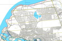
Identifying hazard lands is an important responsibility for Ontario’s Conservation Authorities.
During the last five years, the Rideau Valley Conservation Authority (RVCA) has been conducting several hazard mapping studies on watercourses within the City of Ottawa and the RVCA area of jurisdiction. For some watercourses, old mapping will be updated; and for others, hazards maps will be created for the first time.
Studies look at identifying two main types of hazards along the watercourses: flood risk and slope stability risk.
Flood risk studies make use of contemporary methods in hydrologic and hydraulic analysis,all the available historical records of streamflow and/or water level, and the most up-to-date topographical data to produce estimates of the 1:100 year flood discharge and corresponding water surface elevations and flood lines for the watercourses under consideration. The resulting flood risk maps identify areas along the river that are vulnerable to flooding, and where new development is to be restricted or prohibited in accordance with Provincial Planning Policies.
These studies are being done through a collaboration involving the City of Ottawa and the Rideau Valley, Mississippi Valley and South Nation Conservation Authorities. The City recognized a need to update its zoning schedules based on up-to-date flood risk mapping, and has provided contributions enabling the Conservation Authorities to move ahead with these studies sooner than would otherwise be possible.
Slope stability studies make use of new, highly detailed topographic data to identify toe and top of slope. This information is used to create an allowance area that serve as a flag of potentially unstable slope areas.
When completed, the new flood risk mapping will be used by the City of Ottawa when updating its Official Plan and Zoning Schedules and in the review of development applications under the Planning Act. Conservation Authorities will use the same mapping flood risk mapping as well as slope stability risk in the administration and enforcement of regulations made under the Conservation Authorities Act.
Currently, the RVCA is focusing its efforts on the following streams:
- Flowing Creek (Flewellyn Road to Jock River)
- Hobbs Drain (Fallowfield Road to Jock River)
- Kings Creek (Brunton Side Road to Jock River)
- Nichols Creek (Montague Boundary Road to Jock River)
- Becketts Creek (Sarsfield Road to Ottawa River)
- Bilberry Creek (Innes Road to Ottawa River)
- Rideau River (Hogs Back to Kars)
- Rideau River (Kars to Burritts Rapids)
Historical records, news clippings, photographs and local anecdotal stories and memories of past flood events can be useful in confirming the reasonableness of the calculations and resulting floodplain mapping. Local residents with this kind of information are encouraged to share their information and knowledge with RVCA’s Ferdous Ahmed (1-800-267-3504 or 613-692-3571 ext. 1170 or ).
Those interested in learning more about the project or being included on our contact list are also encouraged to contact the RVCA.
Once the technical work for individual study areas is complete and hazard mapping has been prepared, a public information session will be held to collect public feedback. Any new information or comments will be taken into consideration in further refinement of the mapped hazard limits.
