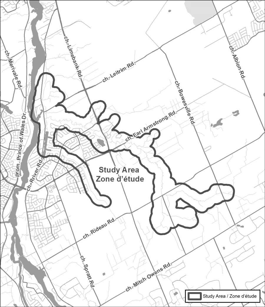
OTTAWA, June 7, 2022 — The Rideau Valley Conservation Authority (RVCA) has completed a hazard mapping study for Mosquito Creek from Mitch Owens Road to the Rideau River, in and around the community of Riverside South. Members of the public are invited to an upcoming open house to review regulation and hazard maps.
Much of the area has been regulated since 2017 when hazard mapping was completed for the Rideau River from Hogs Back to Kars (Rideau River Flood Risk Mapping Report from Hogs Back to Kars, July 2017). This 2017 mapping captured Mosquito Creek from the Rideau River to Limebank Road. This new study reviews past mapping and extends upstream from Limebank Road to Mitch Owens.
The new mapping shows areas that are subject to natural hazards such as flooding and unstable slopes and have natural environmental features such as wetlands. The mapping will be used by the City of Ottawa when updating Official Plans and Zoning Schedules and in the review of development applications under the Planning Act. RVCA will also use the mapping to guide the review of development applications submitted under the RVCA’s Development, Interference with Wetlands and Alterations to Shorelines and Watercourses Regulation.
The goal of this mapping is to help ensure that sound planning decisions are made — keeping people and property safe. Accurate engineered hazard mapping is the foundation of effective floodplain and resource management.
Members of the public are encouraged to attend the open house and/or provide comments on the mapping. The RVCA also welcomes every bit of information that we can obtain about the historical behaviour of local watercourses. Residents and landowners living along these features may have anecdotal or documented information such as photographs or journal entries of their observations during past high-water events or slope failures.
Mosquito Creek Hazard Land and Regulations Mapping Public Open House
Rideauview Community Centre
4310 Shoreline Drive, Ottawa
Tuesday, June 28, 2022
4:30 to 8:00 p.m.
For those unable to attend the open house, mapping can also be seen online at www.rvca.ca/mosquito-creek. Individual or small group meetings (on-line or in-person) can also be booked by contacting an RVCA Resource Specialist at or by completing an online property inquiry form at www.rvca.ca/regulations-planning/general-property-inquiries.
The public consultation period will run until July 29, 2022.
This study is being done through a collaboration involving the City of Ottawa and the Rideau Valley, Mississippi Valley and South Nation Conservation Authorities. The City recognized a need to update its zoning schedules based on up-to-date hazard mapping and has provided contributions enabling the Conservation Authorities to move ahead with these studies sooner than would otherwise be possible. The RVCA is currently working on several studies in the Ottawa area. For a complete list of ongoing work, please visit www.rvca.ca.
— end —