April 11, 2019 – The current weather forecast is calling for up to 30 mm of rain between Friday and Monday, and then more rain later next week. This anticipated rain, plus meltwater from the remaining snow pack, will increase the water levels in Bob’s Lake, Christie Lake, Tay River and Wolfe Lake. The water levels in the three lakes and the Tay River are currently above average and increasing because of snowmelt runoff. Waterfront property owners in these areas should be prepared for possible flooding in the upcoming days. Parks Canada staff are closely monitoring the water levels in Bobs Lake and Chrisite Lake, and operations at the Bolingbroke Dam will take place as required, to balance the levels in Bobs Lake and Christie Lake.
Water levels and flows in all other areas of the Rideau Valley Watershed are also expected to increase with the forecast rain, however, no significant flooding in expected.
City of Ottawa crews have now completed their annual ice removal program on the Rideau River between Rideau Falls and Bronson Avenue. However, City crews are continuing to monitor for possible ice jams due to shoreline ice that may break loose (for more information: City of Ottawa information at 311).
Extreme caution should be exercised by everyone when near local waterbodies. Parents should inform their children of the risks and provide appropriate supervision.
Residents in flood prone or low-lying areas, historically susceptible to flooding, should continue to take the necessary precautions to protect their property, such as:
- Ensuring sump pump is clear, in good working condition and has a backwater valve
- Ensuring easy access to a portable backup generator and pump
- Ensuring downspouts are clear and the outlet is at least 3 metres from the dwelling
- Securing items that might float away as flows increase
- Removing valuable items from basements or lower floors that could be subject to flooding
- Keeping emergency phone numbers handy
- Familiarizing yourself with your municipality’s Emergency Preparedness Plan
This watershed conditions statement is in effect until Thursday April 18, 2019 and will be updated at that time unless the forecast or conditions change.
-end-
"Rideau Valley Conservation Authority is a partnership of municipalities within the Rideau Valley watershed created under the Conservation Authorities Act to deliver a range of programs in watershed management and natural resource conservation."
RVCA Watershed Conditions Statements:
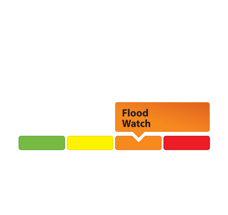
- Water Safety – High flows, unstable banks, melting ice or other factors that could be dangerous for recreational users such as anglers, canoeists, hikers, children, pets, etc. Flooding is not expected.
- Flood Outlook – Early notice of the potential for flooding based on weather forecasts, calling for heavy rain, snow melt, high winds or other conditions that could lead to high runoff, cause ice jams and/or lakeshore flooding or erosion.
- Flood Watch – Flooding is possible in specific watercourses or municipalities. Municipalities, emergency services and individuals in flood-prone areas should prepare.
- Flood Warning – Flooding is imminent or already occurring in area watercourses.