April 3, 2019 -- With limited precipitation and below seasonal temperatures so far this week, water levels and flows have somewhat stabilized across the Rideau Valley Watershed since last weekend. The flood warning issued over the weekend is now over for the areas listed below; however, a flood watch is still in effect for these areas. With snow still on the ground in some areas, combined with forecasted warmer temperatures and precipitation later this week, increased water levels and flows in all waterways in the Rideau Valley Watershed are still expected in the days to come.
Areas currently under a Flood Watch:
- The smaller creeks and streams in the lower Rideau Valley Watershed, including the low-lying roads and waterfront properties adjacent to the Jock River (near Richmond) and Stevens Creek (near North Gower), and any connected creeks or ditches.
- The Long Reach (Burritts Rapids to Manotick) of the Rideau River, including the communities of Hilly Lane, Cedar Beach, Rideau Glen and other neighourhoods on that reach of the river.
- The low-lying roads and waterfront properties adjacent to the Tay River between the outlet of Christie Lake and the Beveridge Locks near Port Elmsley.
City of Ottawa crews are continuing with their annual ice removal program on the Rideau River between Rideau Falls and Bronson Avenue. City crews are busy with ice breaking activities and are making good progress despite thicker than normal ice (for more information: City of Ottawa information at 311).
Ice cover on lakes, ditches, local streams and rivers remains unstable. Extreme caution should be exercised by everyone when near local waterbodies. Parents should inform their children of the risks and provide appropriate supervision.
The potential for ice jams still remains high in some local streams and rivers, as flows could quickly increase before the ice can melt. Residents are advised to monitor the river closely as spring progresses for signs of ice jams. RVCA staff will be monitoring conditions, but we always welcome any unique observations from watershed residents.
Residents in flood prone or low-lying areas, historically susceptible to flooding, should take the necessary precautions to protect their property, such as:
- Ensuring sump pump is clear, in good working condition and has a backwater valve
- Ensuring easy access to a portable backup generator and pump
- Ensuring downspouts are clear and the outlet is at least 3 metres from the dwelling
- Securing items that might float away as flows increase
- Removing valuable items from basements or lower floors that could be subject to flooding
- Keeping emergency phone numbers handy
- Familiarizing yourself with your municipality’s Emergency Preparedness Plan
This watershed conditions statement is in effect until Monday April 8, 2019 and will be updated at that time unless the forecast or conditions change.
-end-
"Rideau Valley Conservation Authority is a partnership of municipalities within the Rideau Valley watershed created under the Conservation Authorities Act to deliver a range of programs in watershed management and natural resource conservation."
RVCA Watershed Conditions Statements:
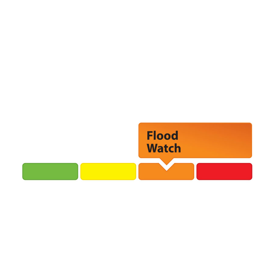
- Water Safety – High flows, unstable banks, melting ice or other factors that could be dangerous for recreational users such as anglers, canoeists, hikers, children, pets, etc. Flooding is not expected.
- Flood Outlook – Early notice of the potential for flooding based on weather forecasts, calling for heavy rain, snow melt, high winds or other conditions that could lead to high runoff, cause ice jams and/or lakeshore flooding or erosion.
- Flood Watch – Flooding is possible in specific watercourses or municipalities. Municipalities, emergency services and individuals in flood-prone areas should prepare.
- Flood Warning – Flooding is imminent or already occurring in area watercourses.