


News from: July 2019
Open House for Mud Creek Hazard Mapping study
August 28, 2019 — The Rideau Valley Conservation Authority (RVCA) has completed a hazard mapping study for Mud Creek in Manotick, from 3rd Line Road North to the Rideau River. Members of the public are invited to an upcoming open house to review hazard and regulations maps.
The new mapping shows areas that are subject to natural hazards such as flooding and unstable slopes. The mapping will be used by the City of Ottawa when updating its Official Plans and Zoning Schedules and in the review of development applications under the provincial Planning Act. RVCA will also use the mapping to guide the review of development applications submitted under the provincial Development, Interference with Wetlands and Alterations to Shorelines and Watercourses regulation.
The goal of this mapping is to help ensure that sound planning decisions are made — keeping people and property safe. Accurate engineered hazard mapping is the foundation of effective floodplain and resource management.
Members of the public are encouraged to attend the open house and/or provide comments on the mapping. Conservation Authority staff welcome historical records of past flood events, slope failures, erosion, news clippings, photographs and even anecdotal stories to help confirm the reasonableness of their calculations.
Mud Creek Hazard Land and Regulations Mapping Open House:
Rideau Valley Conservation Centre
3889 Rideau Valley Drive, Manotick
Tuesday, September 24, 2019
4:30 to 8 p.m.
For those unable to attend the open house, mapping can also be viewed online at www.rvca.ca/mud-creek. To understand how mapping may affect your property or to provide comments, please contact an RVCA Resource Specialist at or complete an online property inquiry form at www.rvca.ca/regulations-planning/general-property-inquiries.
This study is being done through a collaboration involving the City of Ottawa and the Rideau Valley, Mississippi Valley and South Nation Conservation authorities. The City recognized a need to update its zoning schedules based on up-to-date hazard mapping and has provided contributions enabling the Conservation Authorities to move ahead with these studies sooner than would otherwise be possible. The RVCA is currently working on several studies in the Ottawa area. For a complete list of ongoing work, please visit www.rvca.ca/ottawa-mapping-project.
— end —
Ottawa Greek Fest goes carbon neutral!
Aug. 15, 2019 – Ottawa Greek Fest is one of the capital’s hottest summer festivals, but this year it’s keeping it cool with a pledge to go carbon neutral through the Rideau Valley Conservation Foundation.
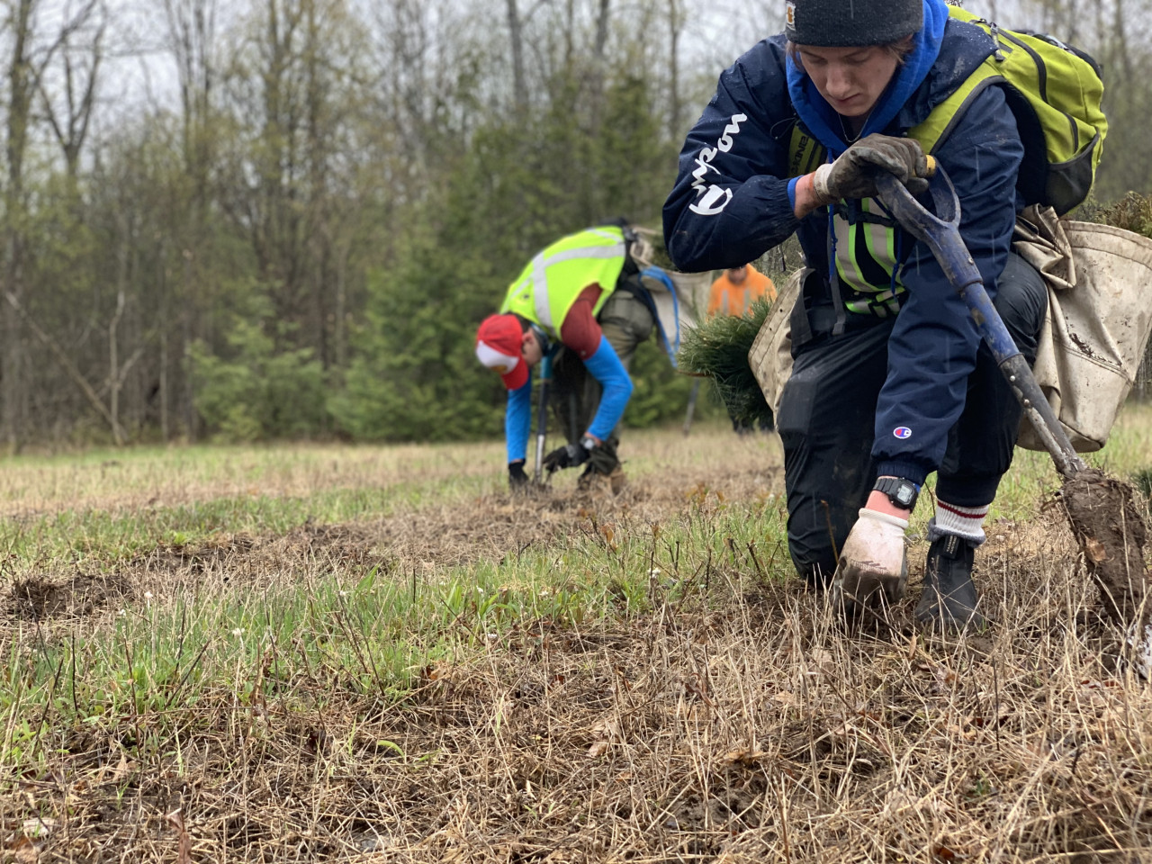
The charitable foundation helped the festival calculate its estimated carbon footprint from the gas, propane, diesel and electricity used over the course of its 11-day food, music and art extravaganza at the Hellenic Centre near Hog’s Back Falls. That calculation will translate into 120 trees planted locally across the Rideau Valley watershed, adding to Eastern Ontario’s forests and natural spaces and offsetting the event’s carbon footprint over the next 40 years.
So, how does planting trees make a festival like GreekFest carbon neutral? Trees absorb carbon dioxide from the air and capture it in their wood cells as part of their life cycle. Once we know how much carbon an event creates, we know how many trees are needed to offset it. It’s as easy as that!
The foundation supports the watershed protection work of the Rideau Valley Conservation Authority. Its staff plant and care for the trees over time to make sure they grow into a thriving forest that will not only capture carbon but also reduce runoff and flood risks, create vital wildlife habitat and improve soil quality.
Want to make your own home, business or event carbon neutral? Visit our website for more information: https://www.rvcf.ca/ways-to-give/carbon-neutral-program.
To support Ottawa’s latest carbon neutral event, visit www.ottawagreekfest.com.
-end-
Minor Low Water Conditions in Rideau Valley Watershed
August 15, 2019 — As the warm, dry weather continues, conditions in the Rideau Valley Watershed now meet the threshold for Minor Low Water status under the Ontario Low Water Response Program. Watershed residents and businesses are encouraged to conserve water during dry conditions.
After a cool and wet spring with very significant flooding in some areas, July and August have been mostly warm and dry across the Rideau Valley watershed, with some localized rainfall in early August. The average 90-day rainfall measured at climate stations in and around the watershed is just shy of 80 per cent of normal for this time of year, which is a key indicator for Minor Low Water status. In the past 30 days, average rainfall has been about 40 per cent of normal. Looking ahead, the seven-day weather forecasts suggests we’ll continue to experience above average temperatures and minimal precipitation, and conditions are expected to decline.
For the most part, water levels in lakes and rivers are close to normal for this time of year. However, we expect water levels will start to decline more noticeably in the near future. Outflows from the Rideau Canal’s reservoir lakes have recently been increased to compensate for the water level declines in river reaches downstream, including the Tay River and Big Rideau Lake. However, there is still sufficient water for Parks Canada to state that draft and navigation are normal throughout the Rideau Canal system inside the Rideau Valley watershed.
Conservation Authority staff continue to monitor conditions and communicate with water managers throughout the watershed. Updates to this message will be issued as conditions warrant.
More resources:
Ministry of Environment and Climate Change: https://www.ontario.ca/page/managing-your-water-well-times-water-shortage
Ontario’s Low Water Response program: https://www.ontario.ca/page/low-water-response-program.
RVCA website: www.rvca.ca
Hourly and daily streamflows and water levels: https://www.rvca.ca/watershed-monitoring-reporting/reporting/streamflow-water-levels
Fight the invaders! Free workshop taking aim at invasive species
Aug. 14, 2019 – Did you know? Your beautiful backyard garden could be harbouring dangerous enemy invaders: sneaky, ruthless agents of destruction, ready to launch a coup at any opportunity.
We’re talking, of course, about invasive species.
They can be hard to spot – sometimes distracting you with their gorgeous blooms or glittery shells – but a workshop this weekend can help you identify these interlopers and keep them under control.
From 9 a.m. to 12 p.m. on Saturday, Aug. 17, Rideau Valley staff will lead a free, public workshop at the conservation authority’s headquarters in Manotick. Participants can get up close and personal with several live displays while they learn about the types of invasive species found in Eastern Ontario, how they spread and how to identify them. Famous examples in Ottawa include the emerald ash borer, purple loosestrife and the round goby – to name just a few.
Invasive species aren’t native to the local ecosystem, so they have few natural predators and can out-compete their native counterparts for food and habitat. They spread quickly along walking trails by way of shoes and strollers, in the water by boats and other vehicles, and by gardeners who don’t realize the beautiful Himalayan Balsam they just planted could quickly hop the fence and take over a nearby shoreline.
On top of their environmental damage, invasive species can also cause problems for humans. Invasive wild parsnip and giant hogweed can cause severe burns and rashes, for example, while zebra mussels have clogged equipment all along the Rideau Canal.
To participate, RSVP to . Light refreshments will be served.
What: Invasive Species Identification Workshop
When: Sat. Aug. 17, 9 a.m. to 12 p.m.
Where: RVCA headquarters
3889 Rideau Valley Dr.
Manotick, ON
K4M 1A5
Parking: There is ample parking at the main office.
-end-
Wildlife reclaiming restored wetlands near DND campus
August 7, 2019 —You know what they say: "If you build it, they will come." But that old adage isn't just for haunted baseball fields – it also applies to wetland projects right in the heart of Ottawa's greenbelt.
Last fall, staff at the RVCA and the National Capital Commission created 10,000 square metres of new wetland habitat along Stillwater Creek, just south of the new DND headquarters off Moodie Drive and Highway 417.
Thanks to observations from the Ottawa-Carleton Wildlife Centre, which is located nearby, staff at the NCC and RVCA discovered the wetland had been suffering annually from extreme low water conditions. Most of the year the wetland was completely dry, dominated by long, reedy grasses that don't encourage much biodiversity.
Now, the restored wetland areas have been reconnected to the groundwater system and feature three large, permanent ponds of varying depths, with logs and branches for fish and wildlife habitat and a range of native wetland plants.
The transformation has been nothing short of miraculous: in just one season, RVCA biologists and field staff have witnessed a huge comeback for frogs, birds and fish.
Staff have spied a spotted sandpiper, nesting killdeer and a yellow warbler. Frogs have moved in and will likely stay the winter. And they've found a wide variety of fish in the new habitat, including pearl dace, brown bullhead and blacknose shiners.
"This project was about improving the hydrology and the function of the wetland, but when you do that the ecological functions inevitably improve, too," said RVCA aquatic biologist Jennifer Lamoureux, who designed the wetland features.
The work isn't quite finished. This fall, staff and volunteers will harvest cuttings from nearby dogwood and willow shrubs and will stake them around the wetlands to encourage growth of the plants, which will provide shade and important shoreline habitat.
Funding permitting, staff hope to continue monitoring the health of the new wetland over the next five years as plants take root and more wildlife begins to call it home.
Residents can watch the progress for themselves: walking trails are already present all around the wetland, connecting to the Watts Creek pathway off Corkstown Road.
Check it out this summer!

Media Release Archives
-
2024(1 article)
- February 2024 (1 article)
-
2023(19 articles)
- December 2023 (2 articles)
- October 2023 (3 articles)
- September 2023 (2 articles)
- August 2023 (1 article)
- July 2023 (2 articles)
- June 2023 (1 article)
- May 2023 (3 articles)
- April 2023 (2 articles)
- March 2023 (3 articles)
-
2022(21 articles)
- December 2022 (1 article)
- November 2022 (3 articles)
- October 2022 (2 articles)
- September 2022 (4 articles)
- July 2022 (1 article)
- June 2022 (3 articles)
- May 2022 (2 articles)
- April 2022 (2 articles)
- March 2022 (2 articles)
- February 2022 (1 article)
-
2021(28 articles)
- November 2021 (2 articles)
- October 2021 (1 article)
- September 2021 (3 articles)
- August 2021 (1 article)
- July 2021 (1 article)
- June 2021 (3 articles)
- May 2021 (3 articles)
- April 2021 (5 articles)
- March 2021 (4 articles)
- February 2021 (3 articles)
- January 2021 (2 articles)
-
2020(17 articles)
- November 2020 (2 articles)
- October 2020 (3 articles)
- September 2020 (1 article)
- August 2020 (1 article)
- July 2020 (2 articles)
- June 2020 (1 article)
- May 2020 (1 article)
- March 2020 (4 articles)
- February 2020 (1 article)
- January 2020 (1 article)
-
2019(70 articles)
- December 2019 (1 article)
- October 2019 (3 articles)
- September 2019 (5 articles)
- August 2019 (5 articles)
- July 2019 (2 articles)
- June 2019 (8 articles)
- May 2019 (19 articles)
- April 2019 (19 articles)
- March 2019 (5 articles)
- February 2019 (1 article)
- January 2019 (2 articles)
-
2018(46 articles)
- December 2018 (2 articles)
- November 2018 (3 articles)
- September 2018 (3 articles)
- August 2018 (6 articles)
- July 2018 (5 articles)
- June 2018 (3 articles)
- May 2018 (11 articles)
- April 2018 (6 articles)
- March 2018 (4 articles)
- February 2018 (1 article)
- January 2018 (2 articles)
-
2017(22 articles)
- November 2017 (2 articles)
- October 2017 (3 articles)
- September 2017 (1 article)
- August 2017 (3 articles)
- July 2017 (3 articles)
- June 2017 (5 articles)
- May 2017 (2 articles)
- March 2017 (2 articles)
- February 2017 (1 article)
-
2016(15 articles)
- December 2016 (1 article)
- November 2016 (1 article)
- October 2016 (1 article)
- August 2016 (2 articles)
- June 2016 (4 articles)
- May 2016 (2 articles)
- April 2016 (3 articles)
- February 2016 (1 article)