


News from: February 2018
Below Average Spring Freshet Expected
March 29, 2018 – Barring a rain event not presently in weather forecasts, it is appearing that the spring freshet of 2018 in the Rideau valley may have already occurred on March 2 as a result of the above normal temperatures in the latter half of February that removed all of the snow.
The snow that fell after the early March thaw, has gradually declined over the month with several sunny days and above freezing daily temperatures. With little snow and minor rainfall forecast, there is not expected to be enough runoff to cause significant increases in water levels in the Rideau valley. A flow in the order of 115 +/- cubic metres per second (cms) is possible at the monitoring station Rideau River at Ottawa if the weather that is forecast for the next four days arrives. That would be less than 50% of the long-term average spring flow.
Such a flow would cause flooding of only the lowest lying shoreline in the watershed but no residential flooding. Still, waterfront residents are advised to secure any of their possessions that could float away and ensure that sump pumps are operating properly.
Colder temperatures and snow are forecast for next week which will prolong the passing of the freshet but there is nothing indicated that would raise levels significantly.
Rideau Valley Conservation Authority (RVCA) reminds the public to exercise extreme caution around all water bodies. Banks adjacent to rivers and creeks are very slippery at this time and, when combined with current weather conditions, pose a serious hazard. Parents are encouraged to keep their children and pets away from all watercourses and off frozen water bodies, which have been weakened as a result of the warming conditions.
RVCA will continue to monitor conditions and will issue further statements when or if there is an indication that the situation can be expected to change significantly.
March 27, 2017, EASTERN ONTARIO — The Rideau Valley Conservation Authority (RVCA) Board of Directors celebrated World Water Day with release of their 2017 Annual Report. The report highlights the many achievements and on-the-ground projects that happened throughout the over 4,000 square kilometres of the Rideau watershed — activities that focus attention on the importance of water and supports World Water Day values.
“RVCA is committed to supporting watershed health and the principles promoted through World Water Day,” said Sommer Casgrain-Robertson, RVCA General Manager. “It is fitting that we release our 2017 Annual Report on this special day and share how RVCA and its many partners are working to support human health and well-being through sound management and protection of the natural systems around us.”
World Water Day 2017 looks to nature-based solutions to help solve many of our water challenges. The challenge is to do more with ‘green’ infrastructure wherever possible. Planting new forests, reconnecting rivers to floodplains, and restoring wetlands will rebalance the water cycle and improve human health and livelihoods. These globally endorsed concepts and principles are fully supported by the RVCA and guide its local conservation work.
RVCA and its many partners (municipalities, farmers, property owners, conservation groups, businesses and academia) recognize the value of water and the benefits of nature. RVCA looks to protect the health of the Rideau watershed and the people who live in it through environmental monitoring and reporting, on-the-ground restoration and stewardship, conservation lands and education, development review and approval and flood forecasting and warning.
“Without natural features like forests and wetlands, we wouldn’t have clear air to breathe, clean water to drink, rivers to boat, swim and fish in, water and soil to support agriculture and industry and green spaces to explore and relax in,” said Ms. Casgrain-Robertson. “Simply put, nature sustains life.”
Highlights for 2017 include:
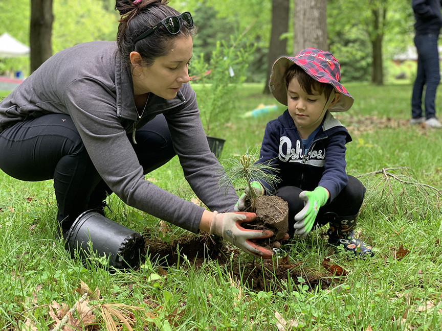
- $752,192+ in grants distributed to landowners who undertook stewardship projects
- 274,550 trees planted (5.97 million planted since 1984)
- 200,000 visitors to conservation areas annually
- 10,200+ students experienced RVCA Outdoor Education Programs
- 9,700 trees and shrubs planted along shorelines through RVCA’s Shoreline Naturalization Program
- 3,000 hectares of conservation land protected and managed
- 1,191 hours from 262 volunteers invested in Ottawa’s City Stream Watch program to research and clean up city streams
- 1,187 Planning Act applications received (minor variances, site plan control, subdivision applications, etc.)
- 628 applications for new or replacement septic systems received
- 380 hours donated by 25+ volunteers to help monitor and sample Watershed Watch lakes
- 348 septic re-inspections completed in participating municipalities
- 300 applications received for work along wetlands, shorelines and waterways (Section 28, Conservation Authorities Act)
- 42 kilometres of trails maintained for public use at local conservation areas
- 40 flood forecasting and warnings messages issued in 2017
- 39 lakes and 58 river and stream sides monitored for nutrients, E.coli and other parameters
- 16 wells monitored for ground water quantity and quality
- 6 invasive species removals and 5 stream clean ups on tributary streams in Ottawa
- release of the Jock River Subwatershed Report and 12 Jock catchment reports
- posting of 6 subwatershed reports and 66 catchment reports online at watersheds.rvca.ca
“Today’s investment in local water and watershed health will ensure a sustainable future — one that supports local communities, economies, tourism and recreation,” said Ms. Casgrain-Robertson. “Thanks to everyone who helped us achieve our 2017 goals and we look forward to continued support and success in 2018.”
For your copy of the RVCA 2017 Annual Report, visit www.rvca.ca or call 613-692-3571 or 1-800-267-3504 for a hard copy. To see what’s in store for 2018 take a look at our 2018 Budget and Work Plan which is also available online at our website.
EASTERN ONTARIO, March 12, 2018 — The Rideau Valley Conservation Authority (RVCA) has completed hazard mapping studies for Flowing Creek and Hobbs Drains — tributaries of the Jock River. Members of the public are invited to an upcoming open house to review regulations and hazard maps.
These studies provide new mapping that show areas that are prone to natural hazards such as flooding and erosion and have natural environmental features such as wetlands. The mapping will be used by the City of Ottawa when updating their Official Plan and Zoning Schedules and in the review of development applications under the Planning Act. RVCA will also use the mapping to guide the review of development applications submitted under the RVCA’s Development, Interference with Wetlands and Alterations to Shorelines and Watercourses Regulation.
The goal of this mapping is to help ensure that sound planning decisions are made — keeping people and property safe. Accurate engineered hazard mapping is the foundation of effective floodplain and resource management.
Members of the public are encouraged to attend the open house and/or provide comments on the mapping. Conservation Authority staff welcome historical records of past flood events, news clippings, photographs and even anecdotal stories to help confirm the reasonableness of calculations and resulting hazard mapping.
Flowing Creek and Hobbs Drain Regulations and Hazard Mapping
Public Open House
Tuesday, April 10, 2018
4:30 to 8:00 p.m.
Johnny Leroux Stittsville Community Arena Hall
10 Warner-Colpitts Lane, Stittsville
For those unable to attend the open house, mapping can also be seen online at www.rvca.ca/flowing-creek-and-hobbs-drain-hazard-mapping-studies. To understand how mapping may affect your property or to provide comments, please contact an RVCA Resource Specialist at or complete an online property inquiry form at www.rvca.ca/regulations-planning/general-property-inquiries.
This study is being done through a collaboration involving the City of Ottawa and the Rideau Valley, Mississippi Valley and South Nation Conservation Authorities. The City recognized a need to update its zoning schedules based on up-to-date flood risk mapping, and has provided contributions enabling the Conservation Authorities to move ahead with these studies sooner than would otherwise be possible. The RVCA is currently working on several studies in the Ottawa area. For a complete list on ongoing work, please visit www.rvca.ca.
Spring Outlook
March 9, 2018 –The winter of 2017-18 has been one of wide variations and periods of record cold.
First snow on the ground to start this winter was relatively early at the beginning of November but little more fell until after December 28 followed by the onset of the record cold temperatures including -30 degrees on January 1. After ten days of frigid temperatures, a few days of warm temperatures reduced the snow cover significantly. That warm spell ended with a flash freeze. Precipitation in all its forms and widely varying temperatures continued through January into mid-February. Since February 19, maple syrup weather (above freezing during the day, freezing temperatures at night) gradually eliminated the snow cover so that, when Conservation Authority staff did the March 1 snow survey, there was no snow to measure.
As was the case this year, the snow was gone from a thaw in late February for the March 1 snow survey in 2000. Some snow fell afterward but the amount measured on March 15 was a fraction of normal. The maximum flow that year was relatively minor at 245 cubic metres per second (30 year average is 320 cms as measured at the monitoring station Rideau River at Ottawa).
Snow forecast for the next few days will restore the cover to some extent but Meteorological Service of Canada (MSC) are forecasting precipitation around normal for the rest of March. If the weather happens as forecast, a flow similar to that in 2000 can be expected which will cause minor inundation of the lowest lying areas along the Rideau system.
City of Ottawa crews began the annual ice removal program on the Rideau River between Rideau Falls and Bronson Avenue several weeks early in response to the February thaw and related increased flows. Crews will work to keep the ice from reforming until the spring freshet occurs (for more information: City of Ottawa information at 311).
Levels and flows on the Ottawa River are close to normal for the time of year. Flooding in 2017 was caused by a major weather system that produced significant rainfall over a large area in western Quebec and eastern Ontario. Such an event is not indicated in present MSC forecasts.
Water levels on lakes and flows in the streams are presently at or slightly above normal for the time of year as a result of the February weather. With the changing levels that can be expected over the next weeks, ice cover on lakes, ditches, local streams and rivers will continue to be unstable. Caution should be exercised by everyone when near local waterbodies. Parents should inform their children of the risks and provide appropriate supervision.
RVCA will continue to monitor conditions and will issue further statements when or if there is an indication that the situation can be expected to change significantly.

Media Release Archives
-
2024(1 article)
- February 2024 (1 article)
-
2023(19 articles)
- December 2023 (2 articles)
- October 2023 (3 articles)
- September 2023 (2 articles)
- August 2023 (1 article)
- July 2023 (2 articles)
- June 2023 (1 article)
- May 2023 (3 articles)
- April 2023 (2 articles)
- March 2023 (3 articles)
-
2022(21 articles)
- December 2022 (1 article)
- November 2022 (3 articles)
- October 2022 (2 articles)
- September 2022 (4 articles)
- July 2022 (1 article)
- June 2022 (3 articles)
- May 2022 (2 articles)
- April 2022 (2 articles)
- March 2022 (2 articles)
- February 2022 (1 article)
-
2021(28 articles)
- November 2021 (2 articles)
- October 2021 (1 article)
- September 2021 (3 articles)
- August 2021 (1 article)
- July 2021 (1 article)
- June 2021 (3 articles)
- May 2021 (3 articles)
- April 2021 (5 articles)
- March 2021 (4 articles)
- February 2021 (3 articles)
- January 2021 (2 articles)
-
2020(17 articles)
- November 2020 (2 articles)
- October 2020 (3 articles)
- September 2020 (1 article)
- August 2020 (1 article)
- July 2020 (2 articles)
- June 2020 (1 article)
- May 2020 (1 article)
- March 2020 (4 articles)
- February 2020 (1 article)
- January 2020 (1 article)
-
2019(70 articles)
- December 2019 (1 article)
- October 2019 (3 articles)
- September 2019 (5 articles)
- August 2019 (5 articles)
- July 2019 (2 articles)
- June 2019 (8 articles)
- May 2019 (19 articles)
- April 2019 (19 articles)
- March 2019 (5 articles)
- February 2019 (1 article)
- January 2019 (2 articles)
-
2018(46 articles)
- December 2018 (2 articles)
- November 2018 (3 articles)
- September 2018 (3 articles)
- August 2018 (6 articles)
- July 2018 (5 articles)
- June 2018 (3 articles)
- May 2018 (11 articles)
- April 2018 (6 articles)
- March 2018 (4 articles)
- February 2018 (1 article)
- January 2018 (2 articles)
-
2017(22 articles)
- November 2017 (2 articles)
- October 2017 (3 articles)
- September 2017 (1 article)
- August 2017 (3 articles)
- July 2017 (3 articles)
- June 2017 (5 articles)
- May 2017 (2 articles)
- March 2017 (2 articles)
- February 2017 (1 article)
-
2016(15 articles)
- December 2016 (1 article)
- November 2016 (1 article)
- October 2016 (1 article)
- August 2016 (2 articles)
- June 2016 (4 articles)
- May 2016 (2 articles)
- April 2016 (3 articles)
- February 2016 (1 article)