


News from: July 2017
CITY OF OTTAWA AND MUNICIPALITY OF NORTH GRENVILLE, August 21, 2017 — Members of the public are invited to an upcoming open house to review hazard maps. The Rideau Valley Conservation Authority (RVCA) has completed two hazard mapping studies for the Rideau River: Hogs Back to Kars and Kars to Burritts Rapids. These studies update existing mapping in some areas and new mapping in others. Both Rideau River studies look at identifying two main types of hazards along these stretches of the watercourse: flooding and slope stability.
The mapping will be used by the City of Ottawa and the Municipality of North Grenville when updating their Official Plan and Zoning Schedules and in the review of development applications under the Planning Act. RVCA will also use the mapping to guide the review of development applications submitted under the RVCA’s Development, Interference with Wetlands and Alterations to Shorelines and Watercourses Regulation.
The goal of this mapping is to help ensure that sound planning decisions are made — keeping people and property safe. Accurate engineered hazard mapping is the foundation of effective floodplain and resource management.
Members of the public are encouraged to attend the open house and/or provide comments on the mapping. Conservation Authority staff welcome historical records of past flood events, news clippings, photographs and even anecdotal stories to help confirm the reasonableness of calculations and resulting hazard mapping. For those unable to attend the open house, mapping can also be seen online at www.rvca.ca and comments sent to Ferdous Ahmed, RVCA Senior Water Resources Engineer at .
Rideau River Mapping Public Open House
Wednesday, September 27, 2017
4:30 to 7:30 p.m.
Rideau Valley Conservation Centre
3889 Rideau Valley Drive
Manotick, ON
These studies are being done through a collaboration involving the City of Ottawa and the Rideau Valley, Mississippi Valley and South Nation Conservation Authorities. The City recognized a need to update its zoning schedules based on up-to-date flood risk mapping, and has provided contributions enabling the Conservation Authorities to move ahead with these studies sooner than would otherwise be possible. The RVCA is currently working on several studies in the Ottawa area. For a complete list on ongoing work, please visit www.rvca.ca.
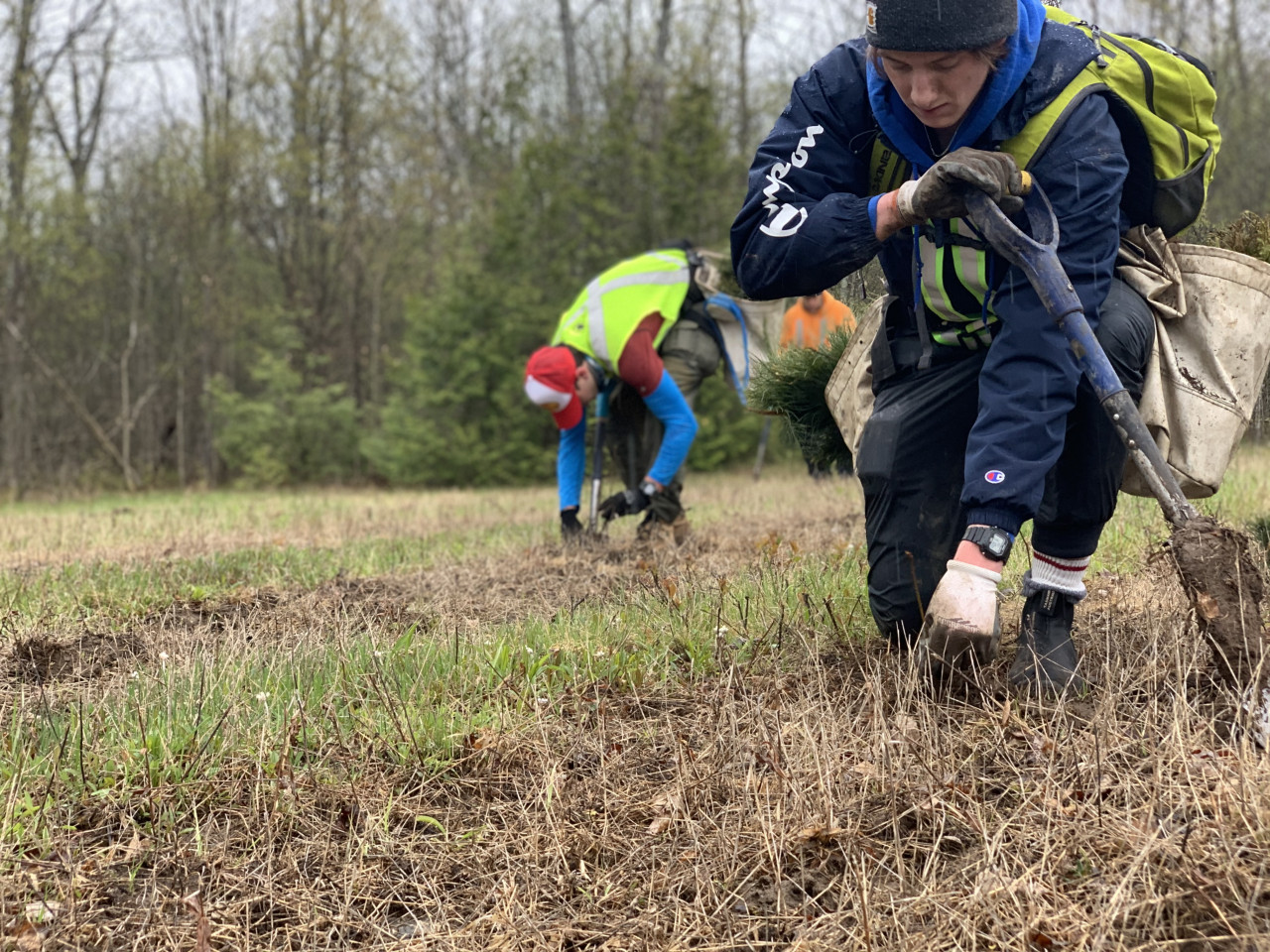
Dollars Available to Plant Trees — Free Site Visits
Money is available to landowners interested in planting trees. The Rideau Valley Conservation Authority offers private landowners tree planting programs that help them get technical advice, planting plans and funding for trees.
“We have numerous community-minded partners providing funding to projects to help reduce landowner costs,” says Scott Danford, RVCA Forestry Program Manager. “We offer planting programs that make it easy and affordable for landowners.”
To be eligible, landowners need at least one acre of land and are willing to plant a minimum of 500 trees. If you have the space, RVCA can help get trees growing on your land for 15 cents a tree. Since 1983, RVCA has planted over 5.25 million trees on private property for landowners.
“The RVCA provides professional reforestation services including the site preparation, planning and planting,” says Danford. “We also ensure success, with post planting visits and follow-up operations. It is a great deal at 15 cents a tree.”
Now is the time to book a free site visit where RVCA staff will meet to discuss the landowner’s objectives and to evaluate the best way to reforest the land. Planting could take place in spring 2018.
Tree planting is one the most practical ways to take care of our watershed and the wider environment. Trees improve local biodiversity by providing shelter for birds and wildlife, while at the same time providing us with windbreaks, screening and shade. Forests act as a major filter and cleansing system for water that soaks into the ground and feeds our wells and underground water systems. The newly planted trees take a little tender loving care in their early years, but once they are “free-growing”, they provide all of these advantages for up to 80 years or more. Trees are vital for a healthy and sustainable future; start planning now for planting next spring.
The program is made possible thanks to the RVCA’s 18 member municipalities, the City of Ottawa’s Green Acre Program, the Province of Ontario’s 50 Million Tree Program, Forest Ontario and numerous private businesses and watershed residents who donate to the tree planting program.
To get more information or to book a free site visit, contact Scott Danford, RVCA Forestry Program Manager at 613-692-3571 or 1-800-387-5304, ext. 1175. Now is the time to take root and grow a green legacy.
Wet Weather in Most of the Rideau Watershed but Record Rain and Flooding in North Gower
On January 17, 2017 the Rideau Valley Conservation Authority downgraded the Drought status in the watershed from “Moderate,” which had been carried over from a dry year in 2016, to “Minor.” The “Minor” status was kept in place because of uncertainty about groundwater conditions that couldn’t be checked until spring. The “Minor” status was removed on April 19 after three months of above normal precipitation that went a long way to recharging groundwater aquifers.
Since February, rainfall totals each month have been an average of 1.65 times normal. It is not unusual for there to be above normal amounts of rain a few times each year. What has been experienced in 2017, though, is not rainfall 10 or 20 millimetres (mm) above normal for a few months but well above normal for six consecutive months such that close to a normal year of rain has fallen in half the year at each of the climate stations in and around the Rideau watershed.
An early thaw in March looked like it could be the spring freshet and a minor one at that. However, rain over the first week of April of 70 to 80 mm and warm enough temperatures to melt the remaining snow brought on the spring freshet peak for most of the Rideau system reaching a 1:4 year frequency flow of 456 cubic metres per second (cms) as measured at the Rideau River monitoring station in Ottawa.
Basically, a tumultuous spring followed that didn’t quit. Cooler than normal temperatures persisted along with frequent rainfall. Rain over two weeks in early May caused second, slightly lower, peaks on the Rideau and Jock Rivers and Kemptville Creek. The Tay River reached its highest in 2017 on May 7 as the rain, combined with flood waters from Bobs and Christie Lakes, passed through the system.
On average about 40 percent of days in a year have some rain recorded. In 2017 since April 1, the average is about 55 percent with the Ottawa airport having rain on 62 percent of days. As a result water levels throughout the watershed have continued to be above normal.
The rain that fell in early May over the Rideau watershed was in the order of 135 mm recorded over 10 days. On July 24, rain started to fall in the early morning. By the time the rain stopped on the evening of the 24th, 79 mm had been recorded at the Ottawa Airport, 64 mm at Franktown near the headwaters of Stevens Creek, 71 mm at Kemptville. At Smiths Falls, 100 mm was recorded. These rains caused flows to increase throughout the Rideau watershed.
Of greater significance were the rains that fell in the North Gower area recorded by local gauge readers and City of Ottawa staff — 135 and 127 mm to the west, 120 on the north side, 108 to the south of the village and 131 to the east, all on the 24th. Of the greatest impact, after a thunderstorm cell passed through around 7:00 p.m., was the 190 total mm recorded for the day near the village centre.
The combination of soils that were already saturated from previous rains and had no capacity to absorb the rain and the higher ground around North Gower caused rapid runoff that would have begun shortly after the rain began in the early morning of the 24th. As the rain continued through the day, flows reached flood stage and over topped the banks. The heavy rain in the village core toward the end of the storm combined with the flow passing through to cause the flooding that exceeded the 100-year flood level by as much as 62 centimetres (cm). The rainfall also exceeded the 100-year precipitation amount (123 mm).
The erratic nature of the system that brought the heavy rains to eastern Ontario on July 24 made it difficult for forecasters to predict where the rain would fall. It appeared through the preceding weekend that southwestern Ontario was threatened with a significant storm. Forecasts for eastern Ontario indicated only showers and the possibility of thunderstorms. However, it came clear later on Sunday that the system track would be through eastern Ontario and at 3:30 a.m. the Meteorological Service of Canada (MSC) issued a Severe Rainfall Warning for eastern Ontario as the rain was starting. The Warning stated that 30 to 40 mm could be expected with up to 100 mm in thunderstorms. The Stevens Creek watershed got 35 percent more than that and North Gower almost twice that causing unprecedented flooding of homes and businesses and agricultural fields in the area.

Media Release Archives
-
2024(1 article)
- February 2024 (1 article)
-
2023(19 articles)
- December 2023 (2 articles)
- October 2023 (3 articles)
- September 2023 (2 articles)
- August 2023 (1 article)
- July 2023 (2 articles)
- June 2023 (1 article)
- May 2023 (3 articles)
- April 2023 (2 articles)
- March 2023 (3 articles)
-
2022(21 articles)
- December 2022 (1 article)
- November 2022 (3 articles)
- October 2022 (2 articles)
- September 2022 (4 articles)
- July 2022 (1 article)
- June 2022 (3 articles)
- May 2022 (2 articles)
- April 2022 (2 articles)
- March 2022 (2 articles)
- February 2022 (1 article)
-
2021(28 articles)
- November 2021 (2 articles)
- October 2021 (1 article)
- September 2021 (3 articles)
- August 2021 (1 article)
- July 2021 (1 article)
- June 2021 (3 articles)
- May 2021 (3 articles)
- April 2021 (5 articles)
- March 2021 (4 articles)
- February 2021 (3 articles)
- January 2021 (2 articles)
-
2020(17 articles)
- November 2020 (2 articles)
- October 2020 (3 articles)
- September 2020 (1 article)
- August 2020 (1 article)
- July 2020 (2 articles)
- June 2020 (1 article)
- May 2020 (1 article)
- March 2020 (4 articles)
- February 2020 (1 article)
- January 2020 (1 article)
-
2019(70 articles)
- December 2019 (1 article)
- October 2019 (3 articles)
- September 2019 (5 articles)
- August 2019 (5 articles)
- July 2019 (2 articles)
- June 2019 (8 articles)
- May 2019 (19 articles)
- April 2019 (19 articles)
- March 2019 (5 articles)
- February 2019 (1 article)
- January 2019 (2 articles)
-
2018(46 articles)
- December 2018 (2 articles)
- November 2018 (3 articles)
- September 2018 (3 articles)
- August 2018 (6 articles)
- July 2018 (5 articles)
- June 2018 (3 articles)
- May 2018 (11 articles)
- April 2018 (6 articles)
- March 2018 (4 articles)
- February 2018 (1 article)
- January 2018 (2 articles)
-
2017(22 articles)
- November 2017 (2 articles)
- October 2017 (3 articles)
- September 2017 (1 article)
- August 2017 (3 articles)
- July 2017 (3 articles)
- June 2017 (5 articles)
- May 2017 (2 articles)
- March 2017 (2 articles)
- February 2017 (1 article)
-
2016(15 articles)
- December 2016 (1 article)
- November 2016 (1 article)
- October 2016 (1 article)
- August 2016 (2 articles)
- June 2016 (4 articles)
- May 2016 (2 articles)
- April 2016 (3 articles)
- February 2016 (1 article)