
Super User
How Do We Do It?
Our work in regulating lands has several major components.
1. Regulation Permits
We ensure that development proposals have regard for natural hazard features and the natural environment while conforming with our watershed development policies. We are authorized under Section 28 of the Conservation Authorities Act. Learn more >>
2. Municipal Plan Review
We are responsible for representing the provincial interests with respect to natural hazards (examples include flooding, erosion and unstable ground) and natural features on applications circulated under the Planning Act. We are responsible for providing advice on the interpretation of the Provincial Policy Statement. We also have agreements with the City of Ottawa and Counties in the watershed to provide comments on natural heritage features, which include significant woodlands, wetlands, environmentally sensitive areas, fish habitat, as well as rare, threatened and endangered species and their habitats. Learn more >>
3. Board Approved Development Policies
The goal is to foster and consistently apply the development policies and guidelines that protect the environmental integrity of our watershed. Recognizing that development and changes occur within some limits and is ultimately limited by the capacity of the watershed environment is key.
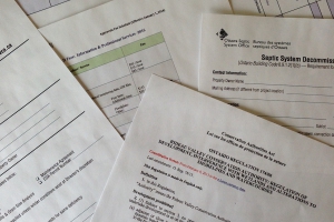
4. Septic System Approvals and Re-inspections
We provide septic system approvals and re-inspection program in interested municipalities. Our role is to ensure septic systems are built property for the benefit of the homeowner and the environment. We enforce the rules and regulations defined by the Ontario Building Code. Learn more >> Ottawa Septic System Office
Learn more >> Mississippi Valley Septic System Office
5. Technical Assistance
RVCA engineering and technical staff may also provide comments on water management and natural hazard aspects of planning and regulatory applications depending on the complexity of the application.
They are also involved in preparing subwatershed reports, remedial strategies and stormwater management strategies and the design of capital work projects and major floodplain engineering studies.
Key areas of expertise include: hydraulics and hydrology, plan input and review, environmental regulations, data collection and computer modeling, remediation and restoration techniques for the natural environment, project design, tendering and supervision.
6. Stewardship
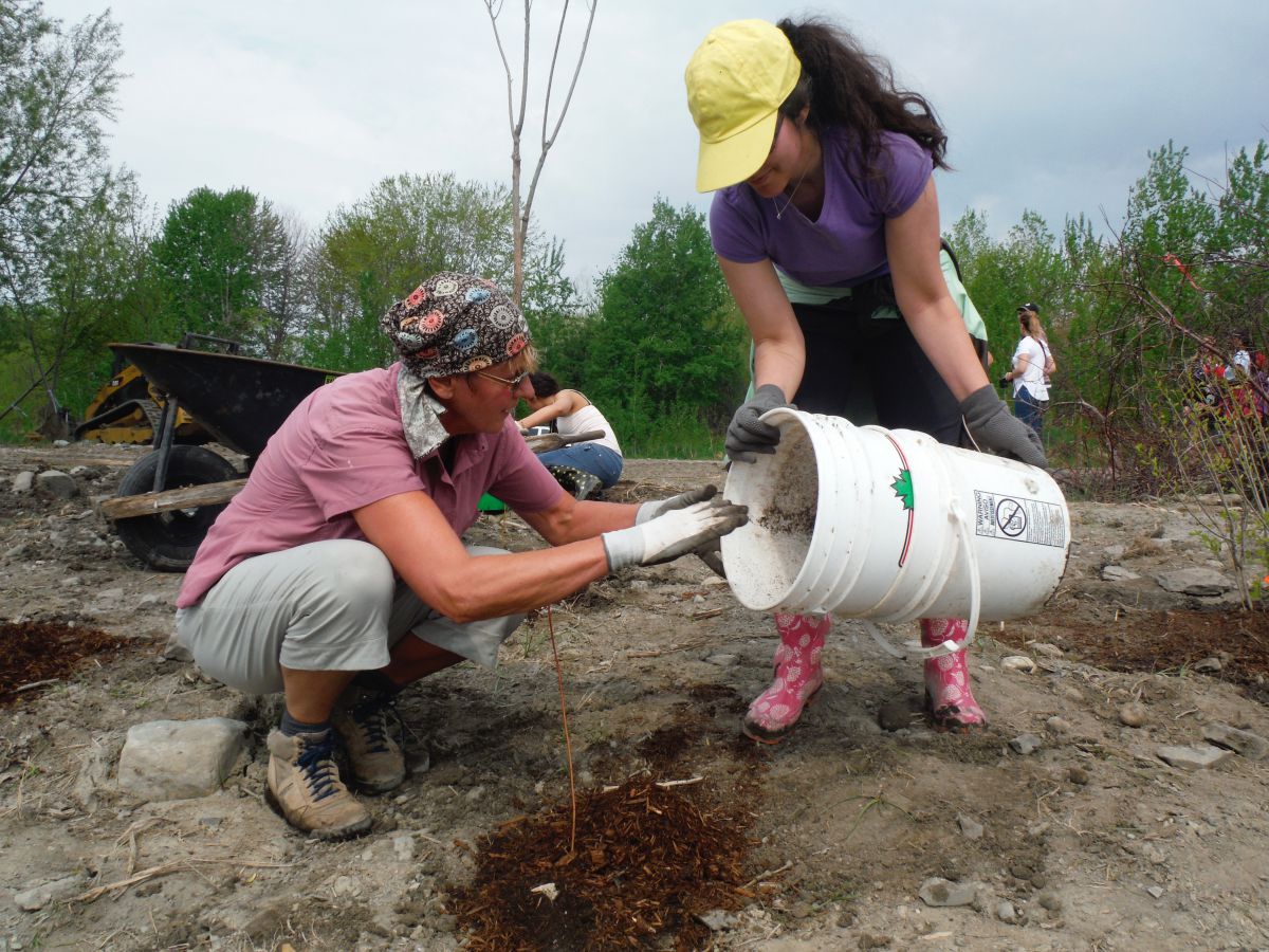
Our stewardship programs provide technical and financial assistance to support private landowners who undertake environmental projects that are designed to improve surface and groundwater quality, reduce soil erosion, enhance wildlife and more. Learn more >>
7. Flood Forecasting and Flood Control
RVCA is responsible for issuing flood warnings to help reduce flood damages. We do this by monitoring weather conditions and river flows issuing flood messages (advisories and warnings) to a variety of public service agencies through the media and this website controlling development in flood-prone areas to reduce potential property damages. Learn more >>
Do I Need A Permit?
If you are planning to do any work near a lake, river, stream, floodplain, steep slope or wetland, you may require approval from the RVCA.
The following projects require RVCA review and approval:
- the construction, reconstruction, erection or placing of a building or structure of any kind,
- changes that would alter the use or potential use of a building or structure
- increasing the size of the building or structure or increasing the number of dwelling units in the building or structure,
- site grading,
- the temporary or permanent placing, dumping or removal of any material, originating in the site or elsewhere,
- the straightening, changing or diverting or interfering with an existing channel of a river, creek, stream or watercourse, or changing or interfering with a wetland.
- All shorelines and watercourses, regardless of whether or not they appear on mapping, are subject to the alteration to waterways component of Ontario Regulation 174/06.
Note: As of April 1, 2024, Ontario Regulation 41/24: Prohibited Activities, Exemptions and Permits will replace the RVCA's existing Ontario Regulation 174/06 under Section 28 of the Conservation Authorities Act. Moving forward, O. Reg. 41/24 will be used by all Conservation Authorities.
If you are not within an identified floodplain, wetland, adjacent to a steep slope or working on the waterfront, then a permit may not be required from the RVCA. You should still contact your municipality to ensure your project meets municipal requirements. Please contact us for information.
RVCA Regulation - Section 28
All regions of Ontario experience flooding, erosion and slope failures. These are naturally occurring processes that have been continuously shaping and reshaping the earth for thousands of years. These processes represent a "hazard" when people and structures are located within areas directly impacted by these naturally occurring processes.
The RVCA administers a regulation made under Section 28 of the Conservation Authorities Act known as Development, Interference with Wetlands and Alterations to Shorelines and Watercourses Regulation.
Note: as of April 1, 2024, Ontario Regulation 41/24: Prohibited Activities, Exemptions and Permits will replace the RVCA's existing Ontario Regulation 174/06 under Section 28 of the Conservation Authorities Act.
This regulation allows RVCA to ensure that proposed developments have regard for natural features in order to:
- prevent loss of life;
- minimize property damage and social disruptions;
- reduce public and private expenditures related to emergency operations, evacuations and restoration;
- minimize the hazards associated with development in floodplains and areas which are susceptible to erosion, which in future years may require expensive protective measures.
General Property Inquiries
Looking to understand some basics about a property?
Option 1 — Map A Property
Visit our online mapping tool to search your property and explore the regulated areas in our watershed.
Option 2 — General Property Inquiry
Complete our General Property Inquiry Form to receive a map showing the mapped natural hazard (floodplain, unstable slope, wetland) or natural feature, 1:100 year flood elevations if applicable and available, links to general information, regulators and policies. Please allow for 48 to 72 hour response time for General Property Inquiries. More complex requests may take longer.
If you require formal written response to legal, real estate and related financial inquiries or require a review of historical files for specific project/proposals or technical review, please learn about our Property File Search Service.
Drought Condition Downgraded to Minor
The drought status in the Rideau River watershed is being downgraded to “Minor” because the recent warm temperatures and precipitation have caused flows to increase significantly in watershed streams.
Rain and snowmelt have caused flows in some streams to approach and, in some cases, exceed the long-term historical average flows. Kemptville Creek had low flows of .028 cubic metres per second (cms), 1.5% of average, in mid-October. Occasional thaws with rain since then have caused flows to increase in all streams and fluctuate around the average. Kemptville Creek flows have been consistently elevated since December 27 and reached three times the average on January 9th with a flow of 15.6 cms.
This is a significant contrast to the Tay River as measured in Perth, which had flows close to the average through July and August but declined through the fall as outflows from Bobs Lake fell and is presently about 60% of average. The flow measured at the outlet of Bobs Lake at Bolingbroke presently is about 35% of average for the time of year.
It remains to be seen if the present flows will be sustained. The Tay has continued to have low flows despite the weather. Also, it is unknown how much recharge of groundwater is occurring. In some areas of the watershed, there is minimal frost in the soil and recharge should be ongoing. In other areas, there has been greater freezing that has restricted recharge and, therefore, there is the possibility that the supply of water in wells may still be precarious.
For these reasons, the drought designation of “Minor” will be held through the winter. RVCA staff will continue to monitor conditions and the status will be re-evaluated after the spring freshet.
Levels in the Rideau Canal reservoir lakes, Bobs, Wolfe, Upper Rideau and Big Rideau, are presently above the long-term averages and the rule curve targets. Measurements on other lakes are not routinely available so we are unable to say what the water levels are. However, snowmobilers who use the lakes should assume that those rocks and shoals that were exposed with the low water levels could still be hazards and they should travel with caution.
All watershed residents are encouraged to continue to conserve water.
Relevant information sources are as follows:
- Ministry of Environment and Climate Change
- Ontario’s Low Water Response program
- RVCA website
- Hourly and daily streamflows and water levels
In order that we can track impacts of the drought conditions in the watershed, we request that any individuals or businesses in the Rideau Watershed who may be experiencing difficulties with their wells please contact the Conservation Authority by calling 613-692-3571 or 1-800-267-3504, ext. 1128 or by email (instructions at http://www.rvca.ca/low_water/index.html ). There is also the Drought Impacts Map application on the RVCA website under Watershed Conditions.
Conservation Authority staff continue to monitor conditions and communicate with water managers throughout the watershed through the Rideau Valley Low Water Response Team. An update to this message will be issued as conditions warrant.
Streamflow, Water Levels & Weather Stations
Learn More:
- Current Water Conditions Statements (flood or drought)
- Contact Brian Stratton, Manager Engineering Services
Streamflow and water level data are used to monitor flood and drought events. They are also used to monitor water supply for lake operation and navigation. This information is used to determine flood risk, support land use planning, assess fish habitat and for water quality analyses of contaminant loading.

DISCLAIMER: Users of the RVCA flow data and water level data are cautioned to consider the unverified nature of the information before using it for decisions that concern personal or public safety or the conduct of business. The Rideau Valley Conservation Authority assumes no responsibility for the correctness of the information contained in this website nor liability to any user of such information, regardless of the purpose. River Levels and flows can change rapidly.
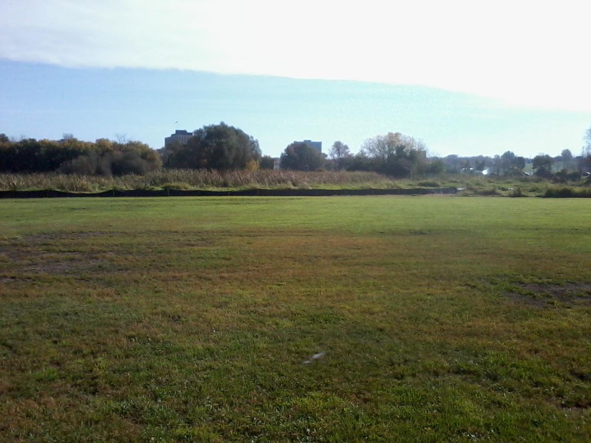
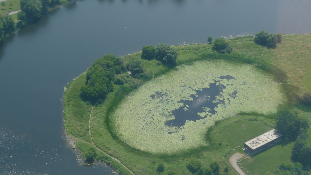
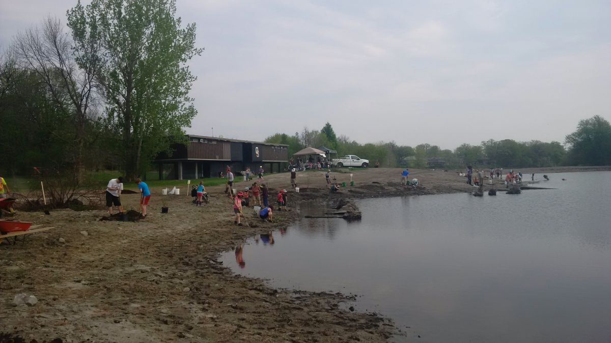
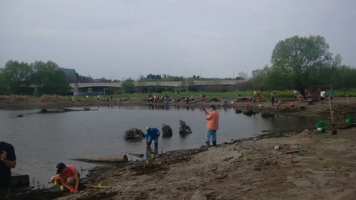
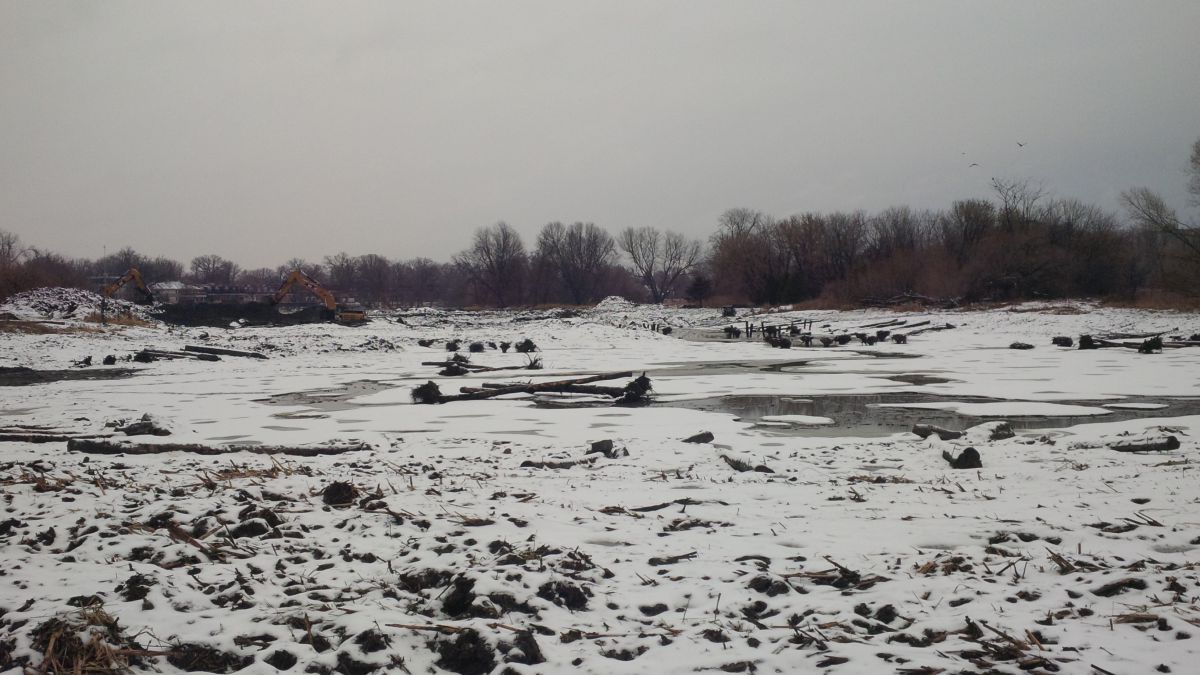
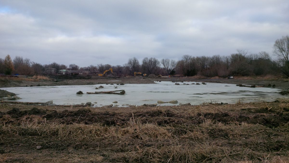
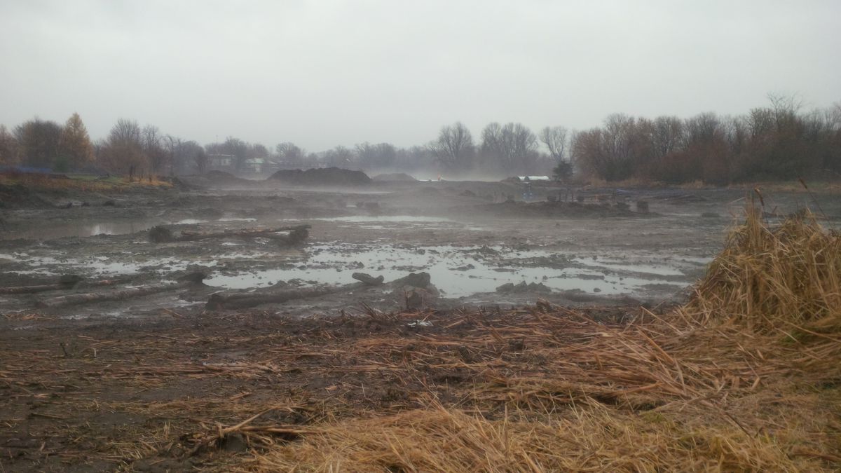
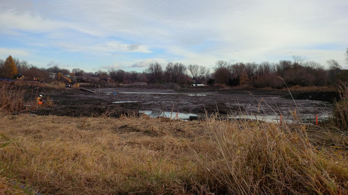
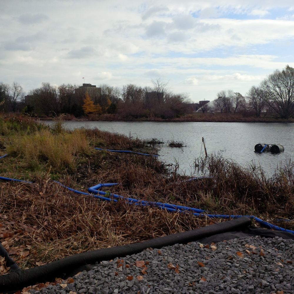
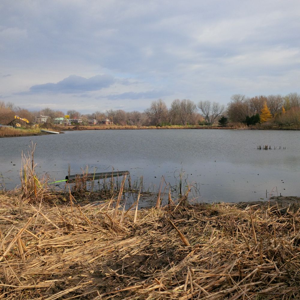
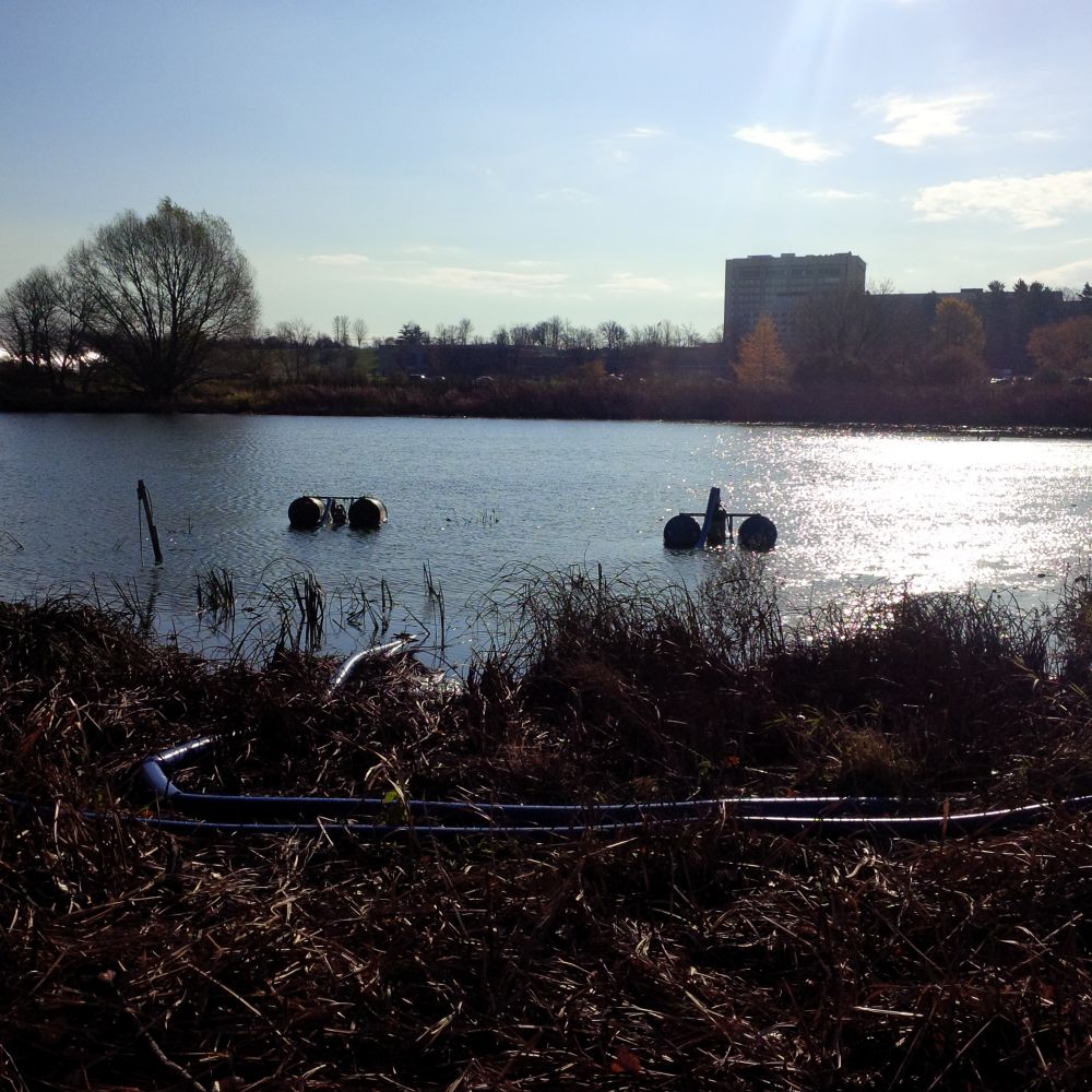
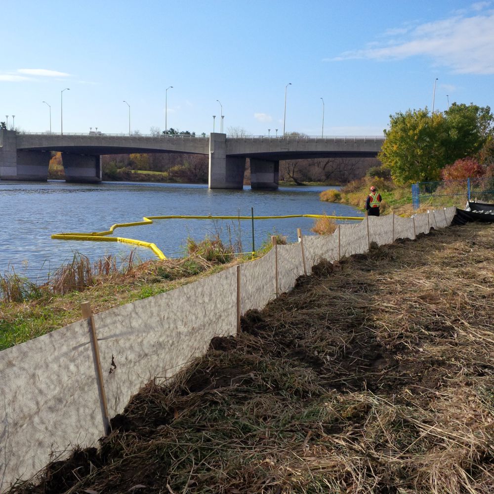
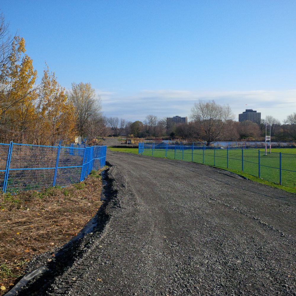
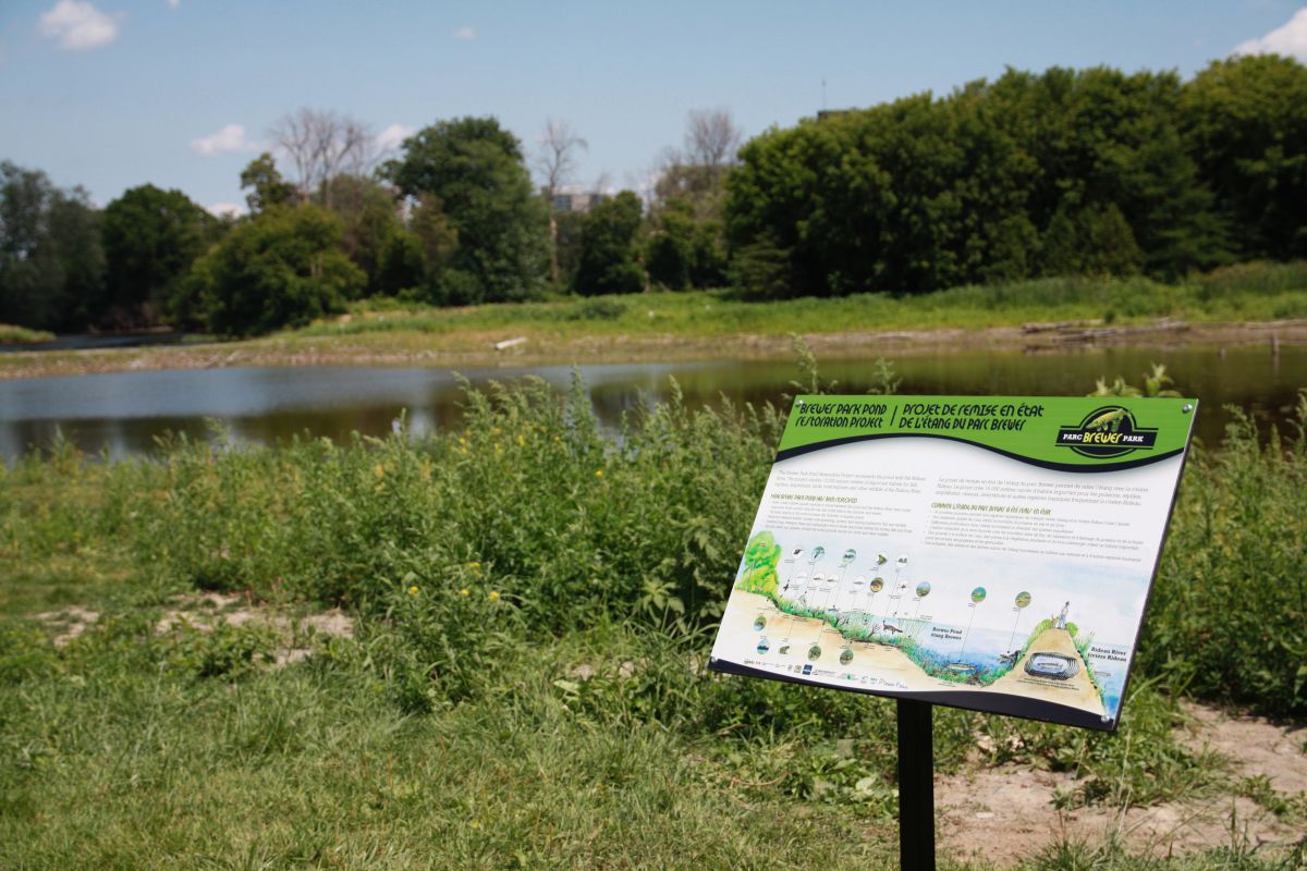
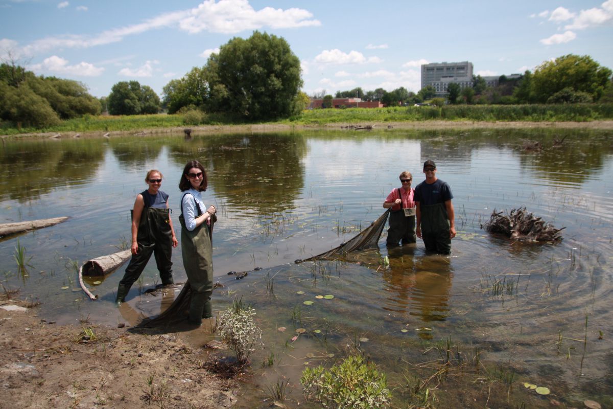
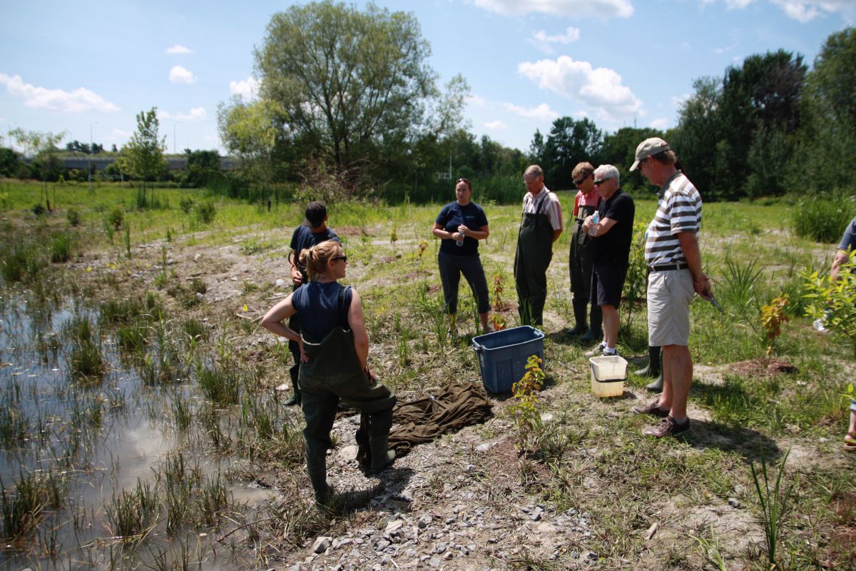
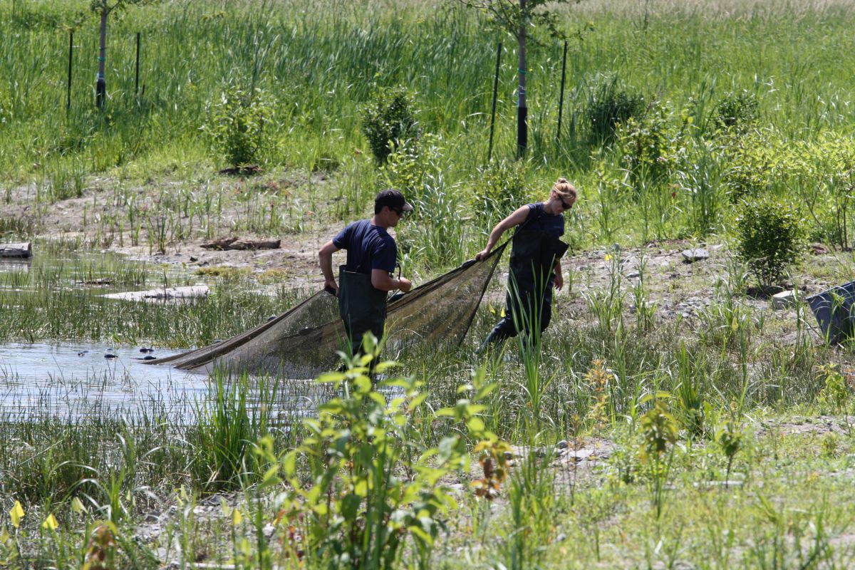
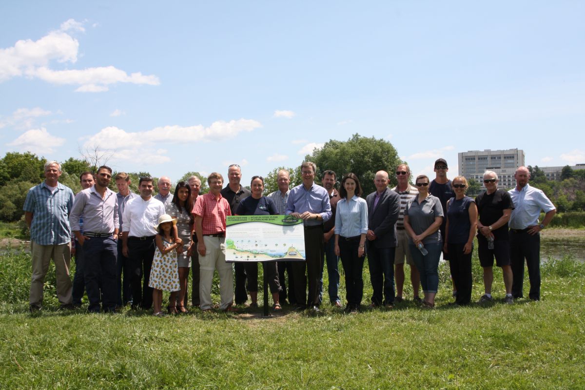
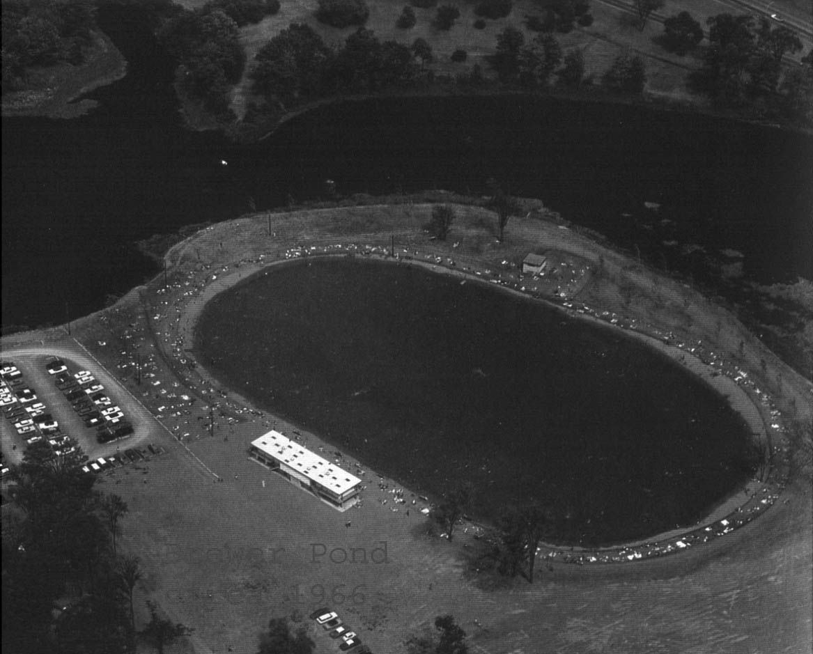
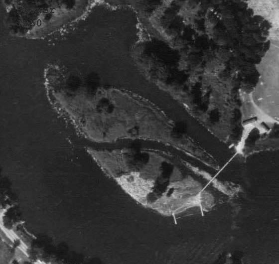
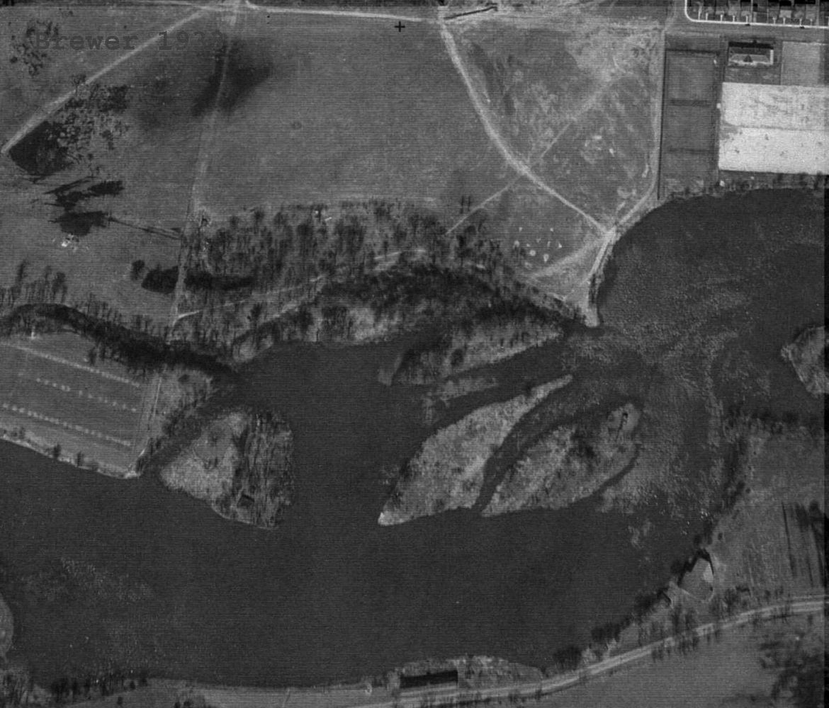
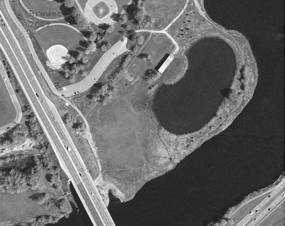
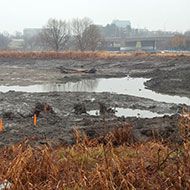
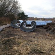
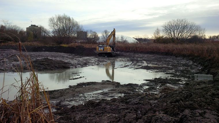
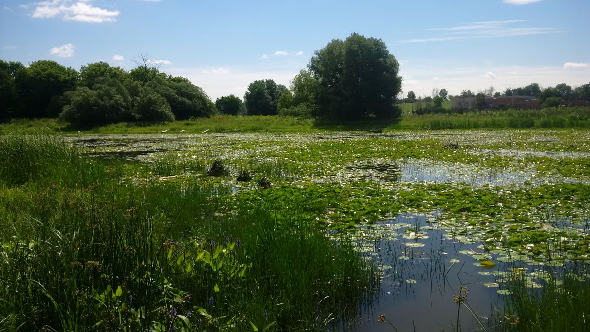
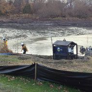
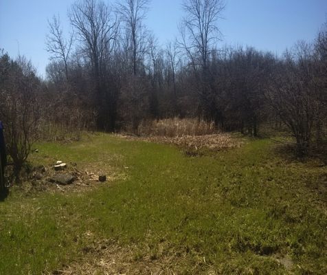
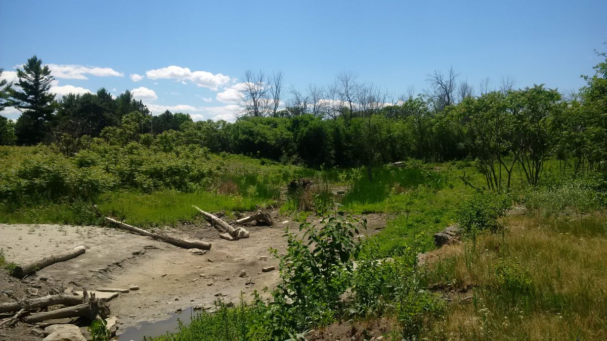
Brewer Park Pond Restoration Project
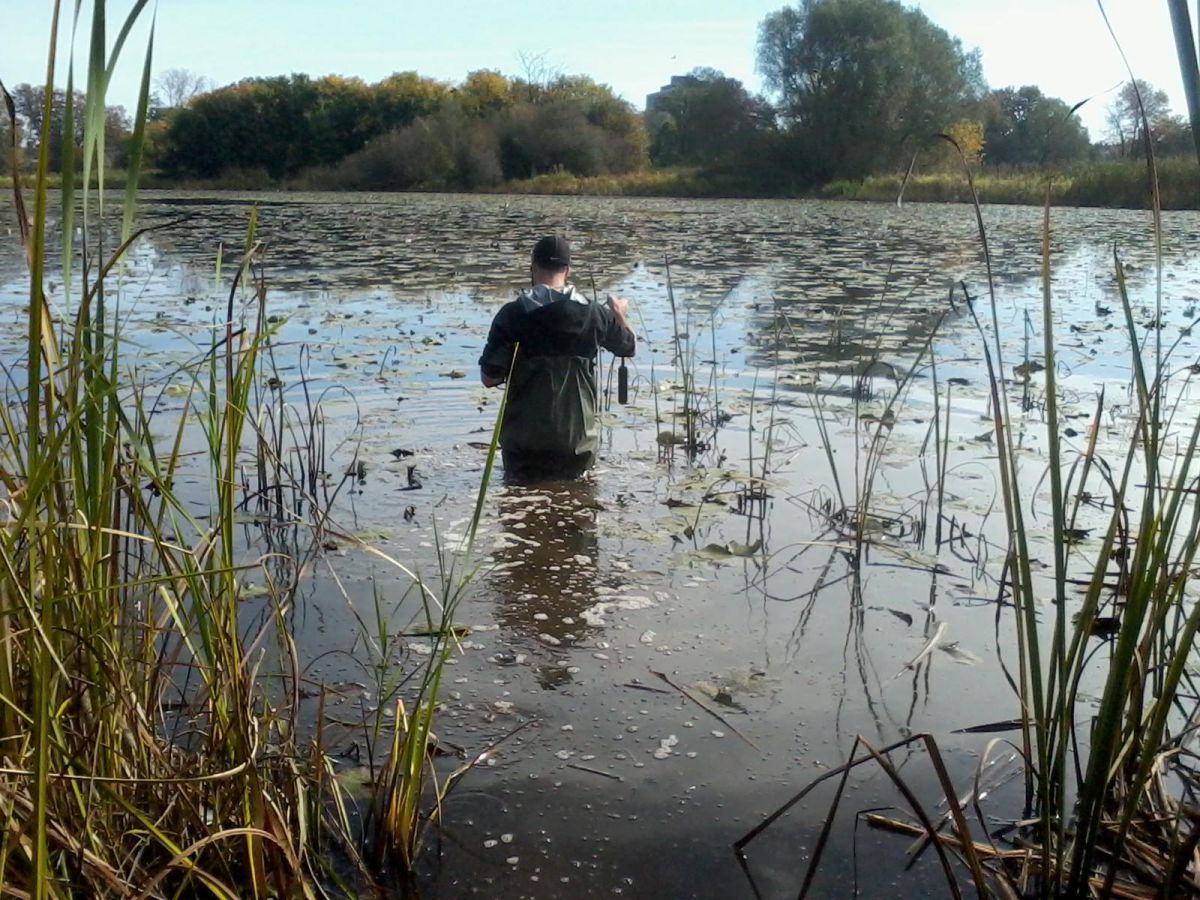
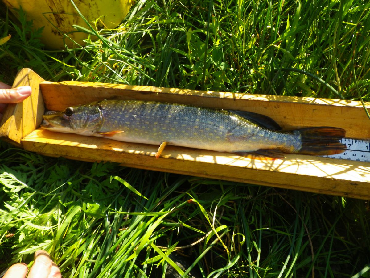
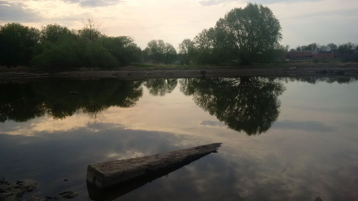
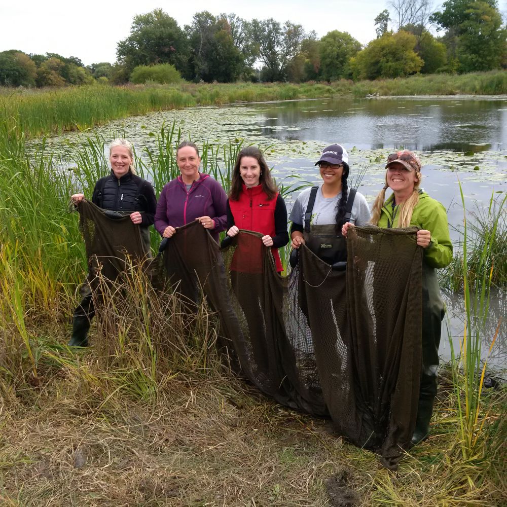
From October to December 2014 the landlocked Brewer Park Pond and former artificial swimming hole was reconnected to the main channel of the Rideau River. The newly connected pond boasts increased biodiversity with the creation of a new, vibrant wetland and pond with shoreline plantings, breeding bird habitat, amphibian habitat, turtle nesting beds and basking logs. The pond will provide improved spawning, nursery, rearing and feeding habitat for the local fish community in the Rideau all year round. This part of the Rideau River is home smallmouth bass, largemouth bass, yellow perch, northern pike, walleye and muskellunge.
Project Highlights:
- 16,000 square metres of new, functioning wetland and fish habitat in the heart of the City of Ottawa
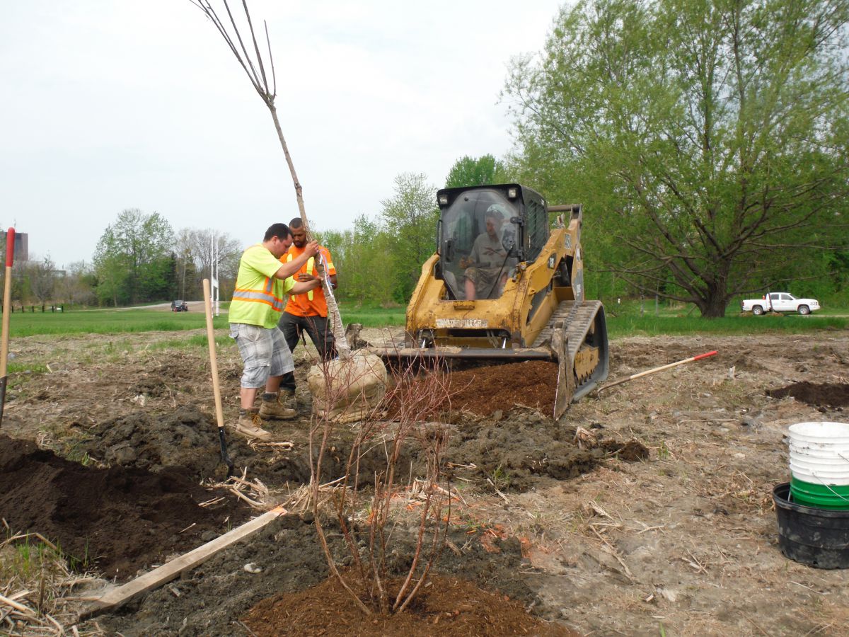
- 1,000 truckloads of soil removed to contour pond into more productive habitat
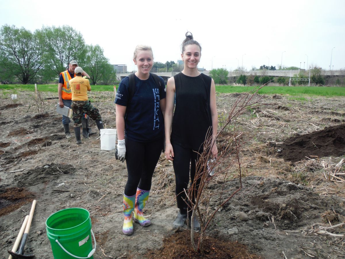
- 120 community volunteers helped plant over 1,600 trees, shrubs and aquatic plants in and around the pond
- 8 weeks of construction from October to December 2014
- Numerous basking logs, root wads and log piles installed as habitat for turtles, fish, amphibians
Ecological benefits:
- Reconnected pond allows fish species year-round access in and out of the pond into the main river
- Eliminates the potential for fish kills as a result of low oxygen conditions in the pond over winter and summer months
- Altered elevations creates conditions suitable for more diverse aquatic vegetation
- New functional spawning, nursery, rearing and food supply habitat created in the restored wetland for fish in the adjacent reach of the Rideau River
- Provides new and enhanced winter and summer refuge areas for fish
- Increased biodiversity.
- Enhanced wetland improves water quality in the Rideau River
Project Partners
- Fisheries and Oceans Canada
- Fish Biology & Conservation Physiology Lab
- Carleton University
- Minto
- Muskies Canada
- MNRF
- City of Ottawa
- Ottawa South Community Association
- Richcraft


Information
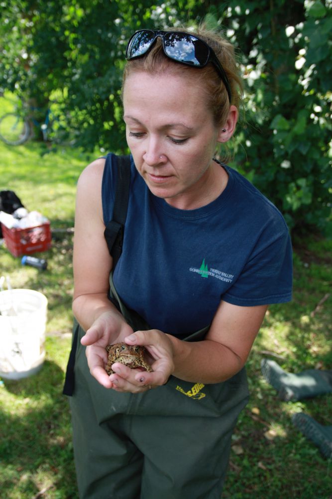
Jennifer Lamoureux
Aquatic and Fish Habitat Biologist,
Rideau Valley Conservation Authority
613-692-3571 ext. 1108
Lake Level Monitoring
If you live on a lake and are interested in recording water levels (weekly or every two weeks) and feel you have a good location for a staff gauge to be placed (permanent dock, flat rock etc..) then we would appreciate your help in our monitoring levels on watershed lakes.
For more information, please contact:
Justin Robert
Hydrometric Data Coordinator
Department of Engineering and Regulation
Ext. 1194
2016 Deadlines
RVCA Property Inquiry Service Deadline
Friday, December 16 at 4 p.m. — if you require a property inquiry response before December 23, please submit on or before December 16.
Anything received after December 16 will be processed starting on Tuesday, January 3, 2017.
Ottawa Septic Office Service Deadlines
Friday, December 16, 2016 at 4 p.m. – deadline for OSSO inspection requests
Monday, December 19 at 4 p.m. — deadlines to submit:
- OSSO Part 8 Septic applications (new/replacement/alterations)
- OSSO Septic Record Searches
- ORWC OBC Part 8 registration
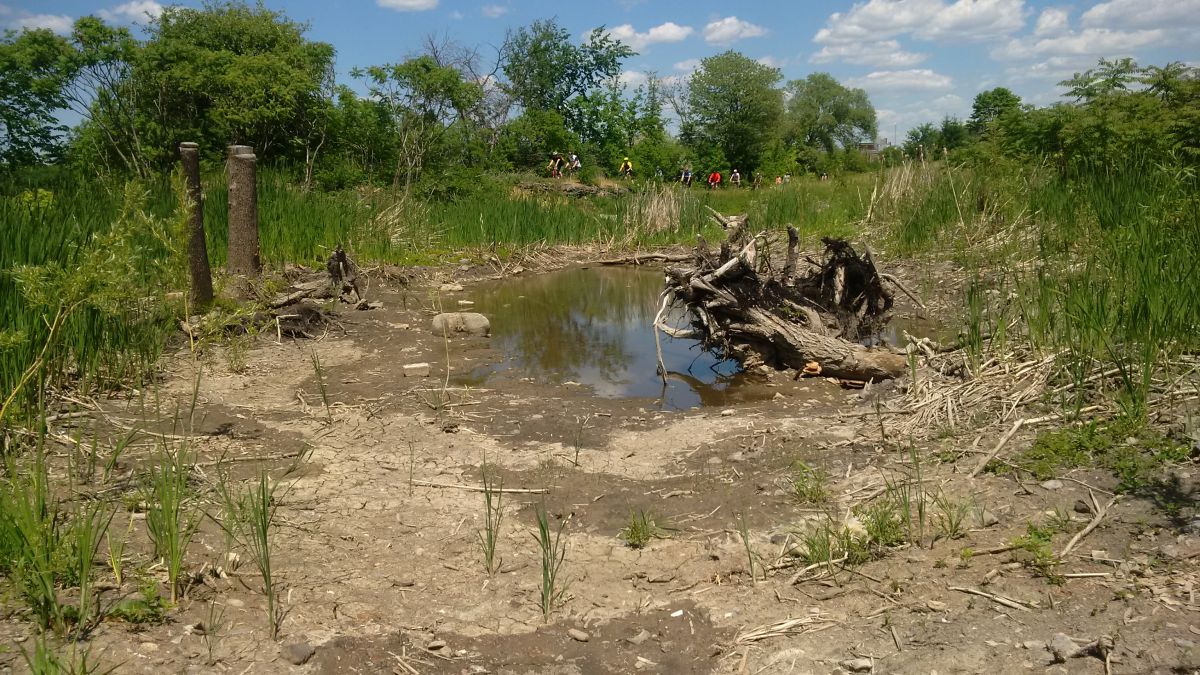
Remic Rapids Wetland Creation Project — Ottawa River
The Rideau Valley Conservation Authority (RVCA) partnered with the National Capital Commission (NCC) to design and construct a small wetland adjacent to the Ottawa River. This new wetland is located close to Remic Rapids along the Sir John A. Macdonald Parkway. The feature is 0.15 hectares and consists of a shallow basin that is a water supply for wildlife as well as amphibian breeding and bird foraging area. Volunteers and NGO community groups provided clean up and planting assistance. The wetland provides a unique and highly visible habitat feature along the National Capital Commission Ottawa River Pathway.
Benefits of the Project
- Altered elevations creates areas for more diverse aquatic and terrestrial plant life
- Provides new and enhanced habitat for wetland wildlife
- Provides quiet area for water fowl and shorebird nesting, rearing and feeding
- Installed woody structures creates more diverse habitat
- Installed sand and pea stone creates turtle nesting and basking areas
- Common buckthorn (invasive species) removal allowed for more native plant growth
Project Partners
![]()

Information
Jennifer Lamoureux
Aquatic and Fish Habitat Biologist,
Rideau Valley Conservation Authority
613-692-3571 ext. 1108