
Super User
ALUS Lanark

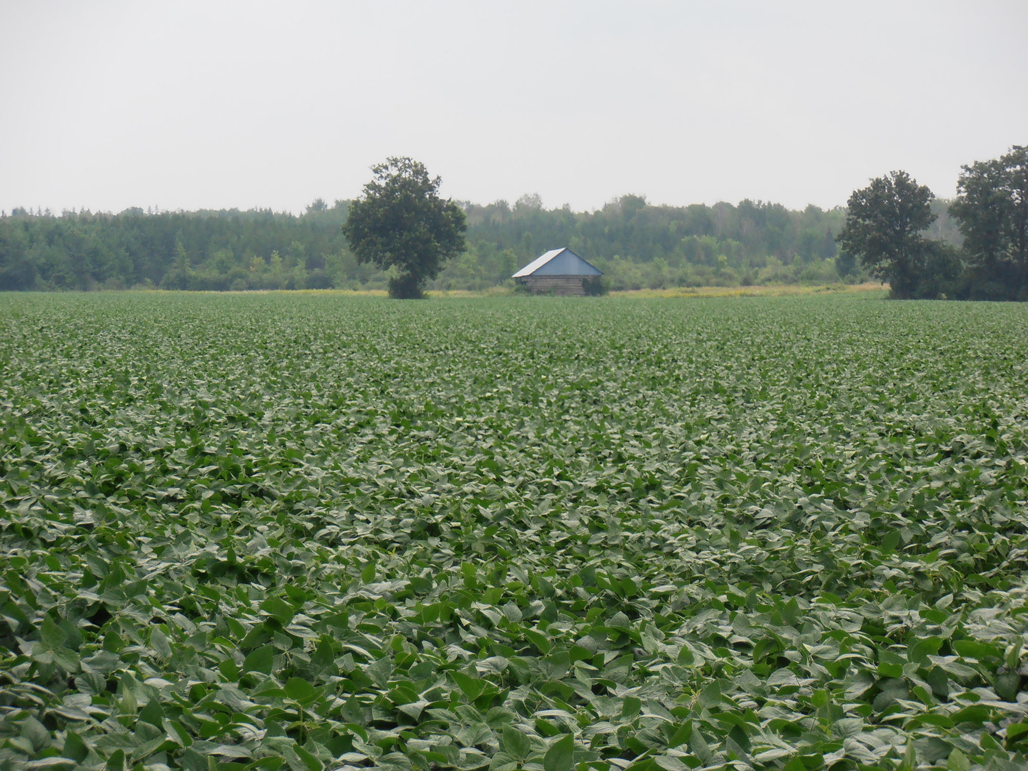
The Rideau Valley Conservation Authority and the Mississippi Valley Conservation Authority are partnering to deliver the ALUS Lanark program, an agricultural stewardship program aimed at creating, restoring, enhancing, managing, and maintaining ecosystem services on agricultural land. Delivered within the boundary of Lanark County, ALUS Lanark is made possible with the financial support of ALUS Canada and Environment and Climate Change Canada.
ALUS Lanark is a community-based and farmer-delivered program that provides technical and financial support to farmers, as well as annual payments to ensure the ongoing stewardship of ecosystem services on their land.
Projects supported will depend on available funding each year. Projects should be on marginal, ecologically sensitive, or inaccessible land, and may include:
- Wetland creation, enhancement, or restoration
- Reforestation, windbreaks, shelterbelts, and buffers
- Grassland restoration
- Pollinator habitat and wildlife food plots
- Delayed cut and delayed grazing
- Erosion control and livestock exclusion
- Habitat structures
- Other ecologically beneficial projects
To be eligible:
- Projects must be within Lanark County.
- Landowners must have a valid Farm Business Registration Number.
- Projects will not replace existing habitat with a new habitat type.
- Projects will not remove more than 20% of land from a farming operation.
If you have any questions, contact the Rural Clean Water Program at 613-692-3571 ext. 1136 or via email at .
Ready to apply? Click here for instructions or download your application form here. Please note you will need Adobe Acrobat Reader to e-sign your form.
How to apply for Rural Clean Water Grants
Thank you for your interest in protecting the land and water we all rely on! We look forward to working with you.
Please note: Funding is limited and provided on a first-come, first-served basis. Projects completed prior to contacting RVCA will not be eligible for funding.
Eligibility and approval:
Eligible Landowners:
- Farmers who have completed a 3rd edition or newer Environmental Farm Plan (EFP)
- Rural non-farmers who have completed a Healthy Home Guide may be eligible for funding (the Healthy Home Guide will be provided during site visits)
Applicants must:
- Apply prior to starting work on your project
- Obtain all necessary permits, approvals, and meet all legal requirements
- Complete a 3rd or 4th Edition Environmental Farm Plan (farm projects), or Healthy Home Guidebook (non-farm projects).
What is generally eligible for funding?
- Permit / approval costs
- Purchased materials and supplies
- Contract labour and professional fees
BEFORE you start your project, please contact the RVCA at 613-692-3571 ext. 1136 to register your information, confirm eligibility and apply.
Submitting your application:
Download your application form here. Please note you will need Adobe Acrobat Reader to e-sign your form.
Submit completed application with all estimates, quotes and necessary permits to:
Rural Clean Water Program
Box 599, 3889 Rideau Valley Dr.
Manotick, ON K4M 1A5
Or email your application package to
Approval process:
- A site representative will visit your property
- Project is assessed by our Review Committee
- Project grant proceeds if approved
- Payment issued upon completion of work, inspection by site representative and submission of all permits, approvals and proof of payment
More questions? Click here to view our FAQs (frequently asked questions).
About Rural Clean Water Grants
Rural Clean Water Grants for farmers and rural landowners
Rural Clean Water Grants help to improve water quality in our local rivers, streams and creeks by reducing pollution and the volume of water running off the land. Teaming up with farmers and rural residents, we provide financial support and technical assistance for on-the-ground projects that improve and protect water quality.

Rural Clean Water Grants up to $15,000 per project are available through three programs, based on location and project type:
- Ottawa Rural Clean Water Program for properties within the City of Ottawa (Rideau Valley, Mississippi and South Nation watersheds)
- Rideau Valley Rural Clean Water Program for properties outside the City of Ottawa, but in the remainder of the Rideau Valley
- ALUS Lanark for agricultural properties in Lanark County (RVCA and MVCA watersheds)
Eligible Projects:
Eligible projects for farmers include, but are not limited to:
- livestock fencing
- chemical and fuel storage
- manure storage and treatment
- nutrient management and precision farming
- controlled tile drainage
- cover crops
- annual payments for ecosystem services
- wastewater treatment
- wetland creation or enhancement
- windbreakers, buffers, and grasslands
Eligible projects for all rural residents include, but are not limited to:
- erosion control
- buffers
- well replacements, upgrades or decommissioning
- septic repair
- forest and wetland management plans
Grants:
Grant amounts and eligibility may vary by grant program, available funding and project type. Always contact us before starting your project, as we cannot offer grants for completed projects.
Deadline for grant applications is May 1 of each year, but depending on funding we may approve project proposals received after this date.
Ready to apply? Click here for instructions or download your application form here. Please note you will need Adobe Acrobat Reader to e-sign your form.
Ontario Approves Mississippi-Rideau Source Protection Plan and Assessment Report Amendments for additional well to existing Municipal Well System in Kemptville
MISSISSIPPI AND RIDEAU WATERSHEDS, May 2, 2022 — On April 20, 2022 the Ministry of Environment, Conservation and Parks (MECP) approved an amendment to the Mississippi-Rideau Source Protection Plan and the Rideau Valley Assessment Report. The approved amendment took effect on April 28, 2022.
This amendment reflects a new well to an existing municipal well system in the community of Kemptville which is owned and operated by the Municipality of North Grenville. The Kemptville well system serves approximately 5,000 people residing in the community.
The well system affects two existing Wellhead Protection Areas in the Source Protection Plan and Assessment Report, the Merrickville Wellhead Protection Area in the United Counties of Leeds and Grenville and the existing Kemptville Wellhead Protection Area. An amendment to the Mississippi-Rideau Source Protection Plan (including the Rideau Valley Assessment Report) is necessary to meet the requirements of the Clean Water Act.
“These amendments ensure municipal drinking water systems continue to be protected through the drinking water source protection program,” said Laura Cummings, Project Manager for the Mississippi-Rideau Source Protection Region.
Drinking water sources in the Mississippi-Rideau Source Protection Region include groundwater, drawn from aquifers underground, and water drawn from rivers. The Source Protection Plan sets out policies that use a variety of tools to protect municipal drinking water sources from contamination. These tools include education, risk management planning, prohibition and land use planning. Policies in the Mississippi-Rideau Source Protection Plan first came into effect on January 1, 2015. Visit the Region’s local website at https://www.mrsourcewater.ca to find out more.
The Notice of Approval of the amended Assessment Report and Source Protection Plan for the Mississippi-Rideau Source Protection Region is also posted on Ontario’s Environmental Registry at https://ero.ontario.ca/.
If you have questions about the approved changes, please contact Laura Cummings at 613-692-3571 ext. 1148 or .
- 30 -
Mississippi Valley and Rideau Valley Source Protection Authorities
Laura Cummings
3889 Rideau Valley Drive, PO Box 599
Manotick ON K4M 1A5
613-692-3571 or 1-800-267-3504 ext. 1148
City Stream Watch welcoming volunteers after two-year break
OTTAWA, April 29, 2022 – Ready to make a splash as you help your local environment? You’re in luck: after a two-year pause, the City Stream Watch program is finally back – with a lot of catching up to do.
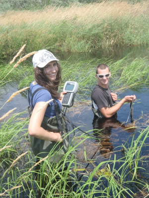
The RVCA-led program has monitored Ottawa’s 25 urban and rural creeks and streams since 2003, relying on enthusiastic volunteers to help with annual garbage clean-ups, invasive species removals, fish and water sampling, habitat assessments and shoreline naturalization projects.
But all of that came to a grinding halt in the spring of 2020, when the COVID-19 pandemic limited RVCA’s ability to welcome volunteers to help conduct this crucial work.
Two years is a long time to go without any maintenance (remember your pandemic haircut!) and now RVCA is keen to catch up with as many volunteer clean-ups and monitoring sessions as possible throughout the warmer months.
Garbage clean-ups will be plentiful this season, according to RVCA aquatic biologist Jennifer Lamoureux. She said the city’s creeks are suffering from two years’ worth of trash that has blown in from nearby neighbourhoods and roads.
“These urban waterways need special attention to remain clean and healthy habitats for the many fish and other aquatic species that live there,” Lamoureux said. “Some of these areas are highly built up, so we need to ensure the habitat that exists is actually liveable for all of the fish, frogs, turtles and waterfowl that rely on it.”
Volunteer groups will be needed on a variety of weekends to help clean up their neighbourhood streams, from Nepean to Orleans to Barrhaven and everywhere in between.
As well, the program is seeking a team of dedicated citizen scientists who can help staff measure water temperatures, assess shoreline and instream habitat characteristics and monitor local fish populations. This work will be limited to four waterways across the city this year: Sawmill Creek in South Keys, Black Rapids Creek in Nepean, Cardinal Creek in Orleans and Barrhaven Creek in Barrhaven. Monitoring efforts rotate annually between the 25 urban and rural streams, and this set hasn’t been monitored for more than six years. Volunteers will help staff collect this crucial data on dozens of sections of each stream between May and October.
Interested volunteers can sign up at www.rvca.ca/volunteer/city-stream-watch or email . An orientation will take place May 28. RSVPs are required for all events.
About City Stream Watch:
The City Stream Watch Program is a community-based partnership which includes the Rideau Valley Conservation Authority, Heron Park Community Association, Ottawa Flyfishers Society, Rideau Roundtable, Canadian Forces Fish and Game Club, Ottawa Stewardship Council, City of Ottawa and the National Capital Commission.
To read past monitoring reports visit www.rvca.ca/watershed-monitoring-reporting/reporting.
-30-
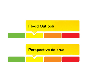
Updated: Flood Outlook — Lower Ottawa River | Perspective de crue – Cours inférieur de la rivière des Outaouais 2022
Water Conditions Statement: Flood Outlook — Lower Ottawa River
April 27, 2022 —
The Flood Outlook Statement issued on April 14th is still in effect for areas along the Lower Ottawa River (Arnprior to Hawkesbury).
Water levels and flows on the main stem of the Ottawa River are expected to increase in most locations over the next few days in response to combined snowmelt from the northern part of the basin and recent rainfall. Levels are expected to be similar to those experienced about one week ago in most locations before starting to decline. Reservoirs throughout the basin are being used to partially store runoff from the northern areas.
Residents in flood-prone areas are encouraged to closely follow changing conditions and to take necessary measures. Residents are advised to stay away from watercourses where flows are high and where banks might be unstable. Parents are encouraged to explain dangers to children.
The Mississippi Valley, Rideau Valley, and South Nation Conservation Authorities, and the Ministry of Northern Development, Mines, Natural Resources and Forestry monitor water levels and weather forecasts as part of the Flood Forecasting and Warning Program. Updates are provided as conditions change.
The Ottawa River Regulating Committee will be reassessing forecast conditions and
providing hydrological condition updates on its website daily at www.ottawariver.ca/forecasts/.
To view current flood warnings across Ontario, visit: www.ontario.ca/law-and-safety/flood-forecasting-and-warning-program.
This FLOOD OUTLOOK STATEMENT is in effect until May 18, 2022 at 5:00 PM. No further updates will be issued unless the forecast or conditions change.
Definitions:
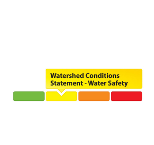
- Water Conditions Statement: Water Safety: indicates that high flows, melting ice or other factors could be dangerous for such users as boaters, anglers and swimmers but flooding is not expected.
- Water Conditions Statement: Flood Outlook: gives early notice of the potential for flooding based on weather forecasts calling for heavy rain, snow melt, high winds or other conditions.
- Flood Watch: potential for flooding exists within specific watercourses and municipalities.
- Flood Warning: flooding is imminent or occurring within specific watercourses and municipalities.
-- end --
Communiqué sur les conditions du bassin versant : Perspective de crue – Cours inférieur de la rivière des Outaouais
Le 27 avril 2022 —
Le bulletin de prévision des crues émis le 14 avril est toujours en vigueur pour les régions situées le long du cours inférieur de la rivière des Outaouais (d'Arnprior à Hawkesbury).
On s'attend à ce que les niveaux et les débits d'eau du cours principal de la rivière des Outaouais augmentent en de nombreux endroits au cours des prochains jours, en raison de la fonte de neige combinée aux récentes précipitations dans la partie nord du bassin. Les niveaux devraient être semblables à ceux d'il y a environ une semaine dans la plupart des endroits avant de commencer à baisser. On utilise les réservoirs du bassin pour stocker partiellement les eaux de ruissellement provenant des régions du nord.
Les résidents des zones sujettes aux inondations sont invités à suivre de près l'évolution des conditions et à prendre les mesures nécessaires. Il est conseillé aux résidents de ne pas s'approcher des cours d'eau dont le débit est élevé et dont les berges pourraient être instables.
On conseille aussi aux parents d'expliquer ces dangers aux enfants.
Les offices de protection de la nature des rivières Mississippi, Rideau et de la Nation Sud ainsi que le Ministère du Développement du Nord, des Mines, des Richesses naturelles et des Forêts surveillent les niveaux d'eau et les prévisions météorologiques dans le cadre du Programme de prévision des crues et d'avertissement du public. Des mises à jour sont communiquées au fur et à mesure que les conditions changent.
Le Comité de régularisation de la rivière des Outaouais réévaluera les conditions prévues et diffusera des mises à jour concernant les conditions hydrologiques sur son site Web tous les jours à www.ottawariver.ca/forecasts/. Pour consulter les avertissements de crues actuels à travers l'Ontario, visitez : www.ontario.ca/law-and-safety/flood-forecasting-and-warning-program.
Ce COMMUNIQUÉ DE PERSPECTIVE DE CRUE est en vigueur jusqu'au 18 mai 2022 à 17 h. Aucune autre mise à jour ne sera publiée, à moins que les prévisions ou les conditions ne changent.
Définitions :
- Communiqué sur les conditions des bassins versants – Sécurité aquatique : indique que des débits forts, de la glace fondante ou d’autres facteurs peuvent être dangereux pour des utilisateurs comme les plaisanciers, les pêcheurs à la ligne et les baigneurs, mais qu’une crue n’est pas prévue.
- Communiqué sur les conditions des bassins versants – Perspective de crue :préavis de crue possible basé sur des prévisions de pluies abondantes, de fonte des neiges, de forts vents ou autre.
- Veille de crue :possibilité de crue pour des cours d’eau et municipalités spécifiques.
- Avertissement de crue : crue immimente ou en cours pour des cours d’eau et
municipalités spécifiques.
-- fin --
Flood Outlook — Lower Ottawa River | Perspective de crue – Cours inférieur de la rivière des Outaouais 2022

Water Conditions Statement: Flood Outlook — Lower Ottawa River
April 14, 2022 — A Flood Outlook Statement is being issued for areas along the Lower Ottawa River (Arnprior to Hawkesbury). Based on forecasted precipitation and anticipated snow melt, levels and flows along the Ottawa River are expected to increase over the next few days as a result of the onset of the spring freshet in the Ottawa River basin.
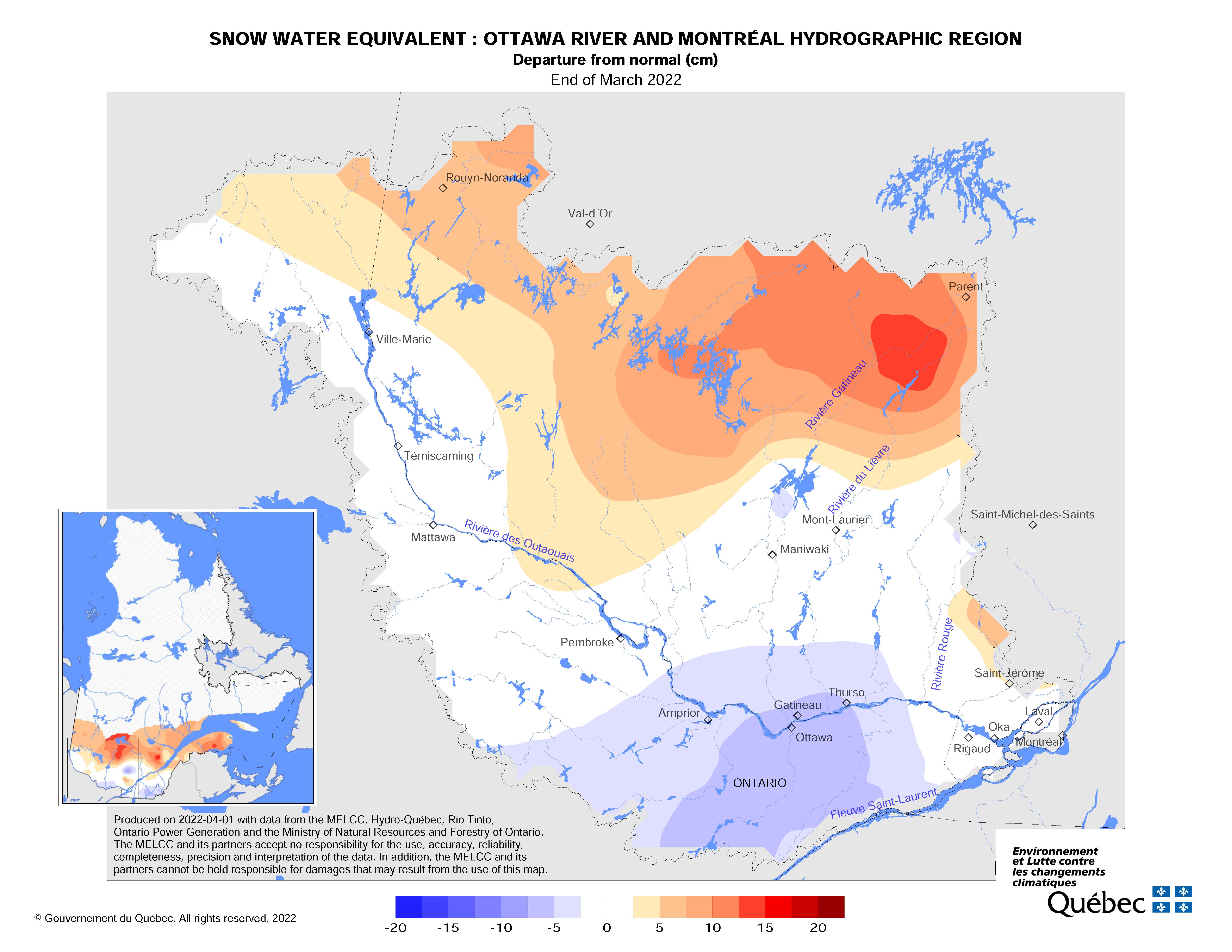
Snow cover varies significantly across the 146,300 km2 Ottawa River basin, with most southern areas having no snow cover at all. A large portion of snow cover in the northern regions had
near-average water content at the end of March.
Based on current weather forecasts, minor flooding may occur in low-lying areas generally susceptible to flooding along the Lower Ottawa River starting this weekend. Levels are not expected to exceed the peak levels observed in 2020, and little to no impact to houses and buildings is expected. Water levels are currently expected to remain below major flood thresholds in all locations.
While there are currently no flooding indicators of concern, it is still too early to forecast peak river conditions which remain dependent on rainfall amounts received and snowmelt.
Residents in flood-prone areas are encouraged to closely follow changing conditions and to take necessary measures. Residents are advised to stay away from watercourses where flows are high and where banks might be unstable. Parents are encouraged to explain dangers to children.
The Mississippi Valley, Rideau Valley, and South Nation Conservation Authorities monitor water levels and weather forecasts with the Ministry of Northern Development, Mines, Natural Resources and Forestry as part of the Flood Forecasting and Warning Program. Updates are provided as conditions change.
The Ottawa River Regulating Committee will be reassessing forecast conditions and providing hydrological condition updates on its website daily at www.ottawariver.ca/forecasts/.
To view current flood warnings across Ontario, visit: www.ontario.ca/law-and-safety/flood-forecasting-and-warning-program. A reference map from the ORRC with snowpack measurements from March 2022 is attached.
This FLOOD OUTLOOK STATEMENT is in effect until April 27, 2022 at 5:00 PM.
- end -
Definitions:
- Water Conditions Statement: Water Safety: indicates that high flows, melting ice or other factors could be dangerous for such users as boaters, anglers and swimmers but flooding is not expected.
- Water Conditions Statement: Flood Outlook: gives early notice of the potential for flooding based on weather forecasts calling for heavy rain, snow melt, high winds or other conditions.
- Flood Watch: potential for flooding exists within specific watercourses and municipalities.
- Flood Warning: flooding is imminent or occurring within specific watercourses and municipalities.
Communiqué sur les conditions du bassin versant : Perspective de crue – Cours inférieur de la rivière des Outaouais
Le 14 avril 2022 — Un communiqué de perspective de crue est émis pour les régions situées le long du cours inférieur de la rivière des Outaouais (d'Arnprior à Hawkesbury). Selon les précipitations prévues et la fonte des neiges anticipée, les niveaux et les débits d’eau le long de la rivière des Outaouais devraient augmenter au cours des prochains jours en raison du début de la crue printanière dans le bassin de la rivière des Outaouais.
La couverture de neige varie considérablement à travers les 146 300 km2 du bassin de la rivière des Outaouais, la plupart des régions du sud n'ayant aucune couverture de neige. Une grande partie de la couverture de neige dans les régions du nord avait une teneur en eau proche de la moyenne à la fin du mois de mars.
Selon les prévisions météorologiques actuelles, des inondations mineures pourraient se produire dans les basses terres généralement sujettes aux inondations le long du cours inférieur de la rivière des Outaouais à partir de cette fin de semaine. On ne s'attend pas à ce que les niveaux d’eau dépassent les niveaux de pointe observés en 2020, et on prévoit peu ou pas d'impact sur les maisons et les bâtiments. On s'attend actuellement à ce que les niveaux d'eau restent sous les seuils d'inondation majeurs dans tous les secteurs.
Bien qu'il n'y ait actuellement aucun indicateur d'inondation préoccupant, il est encore trop tôt pour prévoir les conditions de pointe de la rivière qui restent dépendantes des quantités de pluie reçues et de la fonte des neiges.
Les résidents des zones sujettes aux inondations sont invités à suivre de près l'évolution des conditions et à prendre les mesures nécessaires. Il est conseillé aux résidents de ne pas s'approcher des cours d'eau dont le débit est élevé et dont les berges pourraient être instables.
On conseille aussi aux parents d'expliquer ces dangers aux enfants.
Les offices de protection de la nature des rivières Mississippi, Rideau et de la Nation Sud surveillent les niveaux d'eau et les prévisions météorologiques avec le Ministère du Développement du Nord, des Mines, des Ressources naturelles et des Forêts dans le cadre du Programme de prévision des crues et d'avertissement du public. Des mises à jour sont communiquées au fur et à mesure que les conditions changent.
Le Comité de régularisation de la rivière des Outaouais réévaluera les conditions prévues et diffusera des mises à jour concernant les conditions hydrologiques sur son site Web tous les jours à www.ottawariver.ca/forecasts/.
Pour consulter les avertissements de crues actuels à travers l'Ontario, visitez : www.ontario.ca/law-and-safety/flood-forecasting-and-warning-program. Une carte de référence du CRRO avec les mesures de l'accumulation de neige de mars 2022 est incluse.
Ce COMMUNIQUÉ DE PERSPECTIVE DE CRUE est en vigueur jusqu'au 27 avril 2022 à 17 h.
- fin -
Définitions :
- Communiqué sur les conditions des bassins versants – Sécurité aquatique : indique que des débits forts, de la glace fondante ou d’autres facteurs peuvent être dangereux pour des utilisateurs comme les plaisanciers, les pêcheurs à la ligne et les baigneurs, mais qu’une crue n’est pas prévue.
- Communiqué sur les conditions des bassins versants – Perspective de crue :préavis de crue possible basé sur des prévisions de pluies abondantes, de fonte des neiges, de forts vents ou autre.
- Veille de crue :possibilité de crue pour des cours d’eau et municipalités spécifiques.
- Avertissement de crue : crue immimente ou en cours pour des cours d’eau et
municipalités spécifiques.
(WCS – R08/2022)
April 6, 2022 – The Rideau Valley Conservation Authority is continuing with a HIGH WATER SAFETY message for all areas. Although water levels and flows are now declining for most areas of the Rideau Valley Watershed, except for the lakes which are discussed below, the forecasted rain will cause water levels and flows to increase in the coming days.
The short-term forecast indicates as much as 40 mm of rain may fall between Thursday, April 7 and Saturday, April 9. The snow has melted across the entire watershed. Although no significant flooding is anticipated, water levels and flows are expected to increase in all waterways in the Rideau Valley Watershed.
Parks Canada staff who manage the water levels for the Rideau Canal are carefully watching the water levels in the Upper Watershed lakes. The water levels in the Upper Rideau and Big Rideau Lakes are high and declining but expected to level off and increase due to the large rainfall event. The water levels in Bobs and Christie lakes will continue to rise due to the rain.
Extreme caution should be exercised by everyone when near local waterbodies. Parents should inform their children of the risks and provide appropriate supervision. Pets should be leashed near all bodies of water. Please contact your municipality if you see any ice jams that are causing localized flooding.
This watershed conditions statement is in effect until April 21, 2022 at 5 PM. No further updates will be issued unless the forecast or conditions change.
-end-
More Information:
Contact: Brian Stratton, RVCA Manager Engineering Services
Rideau Valley Conservation Authority
613-692-6804, 1-800-267-3504 ext. 1141
www.rvca.ca/watershed-conditions
Rideau Valley Conservation Authority is a partnership of municipalities within the Rideau Valley watershed created under the Conservation Authorities Act to deliver a range of programs in watershed management and natural resource conservation.
RVCA Watershed Conditions Statements:
- Water Safety – High flows, unstable banks, melting ice or other factors that could be dangerous for recreational users such as anglers, canoeists, hikers, children, pets, etc. Flooding is not expected.
- Flood Outlook – Early notice of the potential for flooding based on weather forecasts, calling for heavy rain, snow melt, high winds or other conditions that could lead to high runoff, cause ice jams and/or lakeshore flooding or erosion.
- Flood Watch – Flooding is possible in specific watercourses or municipalities. Municipalities, emergency services and individuals in flood prone areas should prepare.
- Flood Warning – Flooding is imminent or already occurring in specific watercourses or municipalities.

(WCS – R06/2022)
April 1, 2022 – The Rideau Valley Conservation Authority is issuing a HIGH WATER SAFETY message for all areas. Water levels and flows are declining for most areas of the Rideau Valley Watershed, except for the reservoir lakes which are discussed below.
The short-term forecast indicates mostly above zero temperatures and limited precipitation, although there is a possible rain event coming later next week. The snow has melted across the lower watershed, but some snow remains in the upper watershed, near Perth.
Parks Canada staff who manage the water levels for the Rideau Canal are carefully watching the water levels in the upper watershed lakes. The water levels in the Upper Rideau and Big Rideau Lakes are high but are no longer increasing. The water levels in Bobs and Christie lakes continue to rise due to on-going snowmelt and will be managed depending on the rain amounts next week and inflow responses in both watersheds.
Extreme caution should be exercised by everyone when near local waterbodies. Parents should inform their children of the risks and provide appropriate supervision. Pets should be leashed near all bodies of water. Please contact your municipality if you see any ice jams that are causing localized flooding.
This watershed conditions statement is in effect until April 15, 2022 at 5 PM. No further updates will be issued unless the forecast or conditions change.
-end-
More Information:
Contact: Brian Stratton, RVCA Manager Engineering Services
Rideau Valley Conservation Authority
613-692-6804, 1-800-267-3504 ext. 1141
www.rvca.ca/watershed-conditions
Rideau Valley Conservation Authority is a partnership of municipalities within the Rideau Valley watershed created under the Conservation Authorities Act to deliver a range of programs in watershed management and natural resource conservation.
RVCA Watershed Conditions Statements:
- Water Safety – High flows, unstable banks, melting ice or other factors that could be dangerous for recreational users such as anglers, canoeists, hikers, children, pets, etc. Flooding is not expected.
- Flood Outlook – Early notice of the potential for flooding based on weather forecasts, calling for heavy rain, snow melt, high winds or other conditions that could lead to high runoff, cause ice jams and/or lakeshore flooding or erosion.
- Flood Watch – Flooding is possible in specific watercourses or municipalities. Municipalities, emergency services and individuals in flood prone areas should prepare.
- Flood Warning – Flooding is imminent or already occurring in specific watercourses or municipalities.